Haelen
Hale (
Limburgish) | |
|---|---|
Village | |
 Aldeghoor castle | |
 Haelen Location in the Netherlands  Haelen Location in the province of Limburg in the Netherlands | |
| Coordinates: 51°14′N 5°57′E / 51.233°N 5.950°E | |
| Country | Netherlands |
| Province | Limburg |
| Municipality | Leudal |
| Area | |
| • Total | 11.31 km2 (4.37 sq mi) |
| Elevation | 28 m (92 ft) |
| Population (2021)
[1] | |
| • Total | 4,395 |
| • Density | 390/km2 (1,000/sq mi) |
| Time zone | UTC+1 ( CET) |
| • Summer ( DST) | UTC+2 ( CEST) |
| Postal code | 6080-6081
[1] |
| Dialing code | 0475 |
| Major roads | N273, N279 |
Haelen (Dutch: [ˈɦaːlə(n)] ; Limburgish: Hale) is a town in the south-eastern Netherlands.
The village was first mentioned in 1224 as "Gregorio (de) Haele", and means "bend of the highland". [3] Haelen developed along the Haelense Beek. It used to belong to the County of Horne, and later became part of the Prince-Bishopric of Liège. In 1679, it became an independent heerlijkheid. [4]
Aldengoor Castle was first mentioned in 1212. One tower from 15th century remains, the other three towers were destroyed during a siege in 1598 by the Dutch Republic. During the 17th and 18th century, it was enlarged with two wings. In 1903, it was used as a monastery. In 1977, a museum was housed in the castle, and it has become private property since 1996. In 2006, a bed and breakfast opened in the castle. [4] [5]
The Catholic St Lambertus Church is a three aisled church built between 1953 and 1955 to replace the church which was destroyed in 1944. [4]
Haelen was home to 374 people in 1840. Until it became a part of Leudal on 1 January 2007 Haelen was a separate municipality, and included the villages of Buggenum, Horn, and Nunhem. [5]
-
 St Lambertus Church
 -
 House in Haelen
 -
 Groot Buggenum
 -
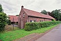 Farm in Haelen
.jpg)


- ^ a b c "Kerncijfers wijken en buurten 2021". Central Bureau of Statistics. Retrieved 25 April 2022.
- ^ "Postcodetool for 6081AA". Actueel Hoogtebestand Nederland (in Dutch). Het Waterschapshuis. Retrieved 25 April 2022.
- ^ "Haelen - (geografische naam)". Etymologiebank (in Dutch). Retrieved 25 April 2022.
- ^ a b c Sabine Broekhoven, & Ronald Stenvert (2003). Haelen (in Dutch). Zwolle: Waanders. ISBN 90 400 9623 6. Retrieved 25 April 2022.
- ^ a b "Haelen". Plaatsengids (in Dutch). Retrieved 25 April 2022.
| International | |
|---|---|
| National | |
Haelen
Hale (
Limburgish) | |
|---|---|
Village | |
|
Aldeghoor castle | |
Haelen Location in the Netherlands Haelen Location in the province of Limburg in the Netherlands | |
| Coordinates: 51°14′N 5°57′E / 51.233°N 5.950°E | |
| Country | Netherlands |
| Province | Limburg |
| Municipality | Leudal |
| Area | |
| • Total | 11.31 km2 (4.37 sq mi) |
| Elevation | 28 m (92 ft) |
| Population (2021)
[1] | |
| • Total | 4,395 |
| • Density | 390/km2 (1,000/sq mi) |
| Time zone | UTC+1 ( CET) |
| • Summer ( DST) | UTC+2 ( CEST) |
| Postal code | 6080-6081
[1] |
| Dialing code | 0475 |
| Major roads | N273, N279 |
Haelen (Dutch: [ˈɦaːlə(n)] ; Limburgish: Hale) is a town in the south-eastern Netherlands.
The village was first mentioned in 1224 as "Gregorio (de) Haele", and means "bend of the highland". [3] Haelen developed along the Haelense Beek. It used to belong to the County of Horne, and later became part of the Prince-Bishopric of Liège. In 1679, it became an independent heerlijkheid. [4]
Aldengoor Castle was first mentioned in 1212. One tower from 15th century remains, the other three towers were destroyed during a siege in 1598 by the Dutch Republic. During the 17th and 18th century, it was enlarged with two wings. In 1903, it was used as a monastery. In 1977, a museum was housed in the castle, and it has become private property since 1996. In 2006, a bed and breakfast opened in the castle. [4] [5]
The Catholic St Lambertus Church is a three aisled church built between 1953 and 1955 to replace the church which was destroyed in 1944. [4]
Haelen was home to 374 people in 1840. Until it became a part of Leudal on 1 January 2007 Haelen was a separate municipality, and included the villages of Buggenum, Horn, and Nunhem. [5]
-
St Lambertus Church
-
House in Haelen
-
Groot Buggenum
-
Farm in Haelen
- ^ a b c "Kerncijfers wijken en buurten 2021". Central Bureau of Statistics. Retrieved 25 April 2022.
- ^ "Postcodetool for 6081AA". Actueel Hoogtebestand Nederland (in Dutch). Het Waterschapshuis. Retrieved 25 April 2022.
- ^ "Haelen - (geografische naam)". Etymologiebank (in Dutch). Retrieved 25 April 2022.
- ^ a b c Sabine Broekhoven, & Ronald Stenvert (2003). Haelen (in Dutch). Zwolle: Waanders. ISBN 90 400 9623 6. Retrieved 25 April 2022.
- ^ a b "Haelen". Plaatsengids (in Dutch). Retrieved 25 April 2022.
| International | |
|---|---|
| National | |