Gelnai | |
|---|---|
Village | |
 | |
 Gelnai Location in Lithuania  Gelnai Gelnai (Lithuania) | |
| Coordinates: 55°08′31″N 23°58′41″E / 55.14194°N 23.97806°E | |
| Country | |
| County |
|
| Municipality | Kėdainiai district municipality |
| Eldership | Pelėdnagiai Eldership |
| Population (2011) | |
| • Total | 47 |
| Time zone | UTC+2 ( EET) |
| • Summer ( DST) | UTC+3 ( EEST) |
Gelnai (formerly Russian: Гельны, Polish: Giełny) [1] is a village in Kėdainiai district municipality, in Kaunas County, in central Lithuania. According to the 2011 census, the village had a population of 47 people. [2] It is located 3 kilometres (1.9 mi) from Vandžiogala, by the Mėkla river and its tributary the Klampis, next to the A8 highway, nearby the Labūnava Forest.
There is an agroservice, a wayside chapel (cultural heritage object), [3] a cemetery and many wooden sculptures made by local wood carver.
History
In the beginning of the 20th century, there was Gelnai village and zaścianek in Babtai volost. [1]
Demography
|
| ||||||||||||||||||||||||||||||
| Source: 1902, 1923, 1959 & 1970, 1979, 1989, 2001, 2011 | |||||||||||||||||||||||||||||||
Notable people
- Bronius Vyšniauskas (1923–2015), Lithuanian sculptor.
Images
-
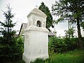 Gelnai chapel
 -
 Wooden sculptures
 -
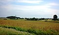 Gelnai from A8 road
 -
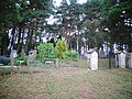 Cemetery


References
- ^ a b " Giełny". Geographical Dictionary of the Kingdom of Poland (in Polish). 15 pt. 1. Warszawa: Kasa im. Józefa Mianowskiego. 1900. p. 496.
- ^ "2011 census". Statistikos Departamentas (Lithuania). Retrieved August 21, 2017.
- ^ "Gelnų koplytėlė". Lietuvos Respublikos kultūros vertybių registras. Retrieved 2020-12-31.
Gelnai | |
|---|---|
Village | |
|
| |
Gelnai Location in Lithuania Gelnai Gelnai (Lithuania) | |
| Coordinates: 55°08′31″N 23°58′41″E / 55.14194°N 23.97806°E | |
| Country | |
| County |
|
| Municipality | Kėdainiai district municipality |
| Eldership | Pelėdnagiai Eldership |
| Population (2011) | |
| • Total | 47 |
| Time zone | UTC+2 ( EET) |
| • Summer ( DST) | UTC+3 ( EEST) |
Gelnai (formerly Russian: Гельны, Polish: Giełny) [1] is a village in Kėdainiai district municipality, in Kaunas County, in central Lithuania. According to the 2011 census, the village had a population of 47 people. [2] It is located 3 kilometres (1.9 mi) from Vandžiogala, by the Mėkla river and its tributary the Klampis, next to the A8 highway, nearby the Labūnava Forest.
There is an agroservice, a wayside chapel (cultural heritage object), [3] a cemetery and many wooden sculptures made by local wood carver.
History
In the beginning of the 20th century, there was Gelnai village and zaścianek in Babtai volost. [1]
Demography
|
| ||||||||||||||||||||||||||||||
| Source: 1902, 1923, 1959 & 1970, 1979, 1989, 2001, 2011 | |||||||||||||||||||||||||||||||
Notable people
- Bronius Vyšniauskas (1923–2015), Lithuanian sculptor.
Images
-
Gelnai chapel
-
Wooden sculptures
-
Gelnai from A8 road
-
Cemetery
References
- ^ a b " Giełny". Geographical Dictionary of the Kingdom of Poland (in Polish). 15 pt. 1. Warszawa: Kasa im. Józefa Mianowskiego. 1900. p. 496.
- ^ "2011 census". Statistikos Departamentas (Lithuania). Retrieved August 21, 2017.
- ^ "Gelnų koplytėlė". Lietuvos Respublikos kultūros vertybių registras. Retrieved 2020-12-31.