
Size of this PNG preview of this SVG file:
749 × 600 pixels. Other resolutions:
300 × 240 pixels |
600 × 480 pixels |
959 × 768 pixels |
1,279 × 1,024 pixels |
2,558 × 2,048 pixels |
1,214 × 972 pixels.
Original file (SVG file, nominally 1,214 × 972 pixels, file size: 1.98 MB)
| This is a file from the
Wikimedia Commons. Information from its
description page there is shown below. Commons is a freely licensed media file repository. You can help. |
| Description |
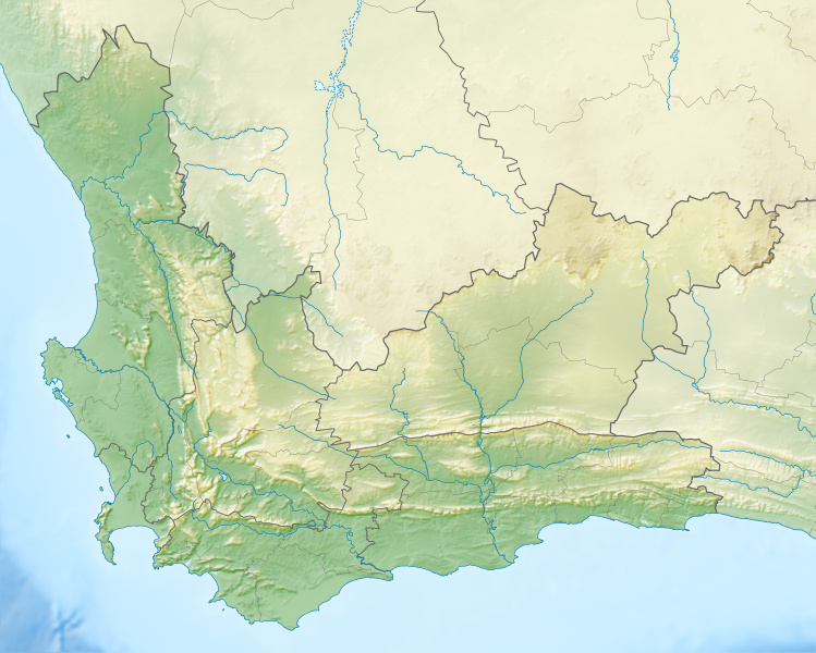
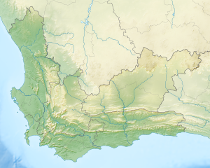
English: Relief location map of the
Western Cape
Equirectangular projection, N/S stretching 118%. Geographic limits of the map:
|
| Date | |
| Source |
|
| Author | Htonl |
| Permission ( Reusing this file) |
I, the copyright holder of this work, hereby publish it under the following license: This file is licensed under the
Creative Commons
Attribution-Share Alike 3.0 Unported license.
|
| Other versions | File:South Africa Western Cape location map.svg |
File history
Click on a date/time to view the file as it appeared at that time.
| Date/Time | Thumbnail | Dimensions | User | Comment | |
|---|---|---|---|---|---|
| current | 19:44, 4 January 2013 |
| 1,214 × 972 (1.98 MB) | Htonl | {{Information |Description ={{en|1=Relief location map of the Western Cape Equirectangular projection, N/S stretching 118%. Geographic limits of the map: * N: 30.25° S * S: 35.0° S * W: 17.5° E * E: 24.5° E}} |Source ... |
File usage
The following pages on the English Wikipedia use this file (pages on other projects are not listed):
- 1996 World Cup of Golf
- 2006 Eisenhower Trophy
- 2006 Espirito Santo Trophy
- Akkedisberg Pass
- Arniston (East Indiaman)
- Assegaaibosch Nature Reserve
- Attakwaskloof Pass
- BOS 400
- Bainskloof Pass
- Bird Island Nature Reserve (South Africa)
- Blaauwberg Conservation Area
- Blombos Cave
- Boomplaas Cave
- Boosmansbos Wilderness Area
- Bracken Nature Reserve
- Cape Town Ladies Open
- Cape Town Open
- Cederberg
- Chapman's Peak
- Clanwilliam Dam
- Coca-Cola Charity Championship
- Dasklip Pass
- Dassen Island
- De Hoop Nature Reserve
- Dimension Data Ladies Pro-Am
- Dimension Data Pro-Am
- Duiker Island
- Durbanville Nature Reserve
- False Bay
- Gamkaberg Nature Reserve
- Garcia's Pass
- Gouritz Cluster Biosphere Reserve
- Grootrivier Pass
- Harmony Flats Nature Reserve
- Helderberg Nature Reserve
- Hex River Mountains
- Johanna (East Indiaman)
- Karoo National Park
- Klein Berg River
- Knersvlakte Nature Reserve
- Koeberg Nature Reserve
- Kogelberg Nature Reserve
- List of South African military bases
- Lombard Insurance Classic
- Marloth Nature Reserve
- Matjiesrivier Nature Reserve
- Michell's Pass
- Miller's Point, Western Cape
- Molteno Pass
- Montagu Pass
- Mother City SkyDiving - Cape Town
- Nelson Bay Cave
- Oswego-Guardian–Texanita collision
- Outeniqua Pass
- Rockview Dam
- Rondevlei Nature Reserve
- SS Wafra oil spill
- Salmonsdam Nature Reserve
- Salt River (Nature's Valley)
- Seal Island, South Africa
- Seweweekspoort
- Soetendalsvlei
- Stellenbosch
- Stettynskloof Dam
- Stilbaai Tidal Fish Traps
- Swartberg Nature Reserve
- Theewaterskloof Dam
- Tradouw Pass
- Uitkamp Wetlands
- Versfeld Pass
- Vodacom Players Championship
- Walker Bay Nature Reserve
- Witzands Aquifer Conservation Area
- User:Tadpolefarm/sandbox
- Module:Location map/data/South Africa Western Cape
- Module:Location map/data/South Africa Western Cape/doc
- Module:Location map/data/Western Cape
Global file usage
The following other wikis use this file:
- Usage on ar.wikipedia.org
- Usage on ban.wikipedia.org
- Usage on be.wikipedia.org
- Usage on bg.wikipedia.org
- Usage on ceb.wikipedia.org
- Usage on de.wikipedia.org
- Tafelbucht
- Boulders Beach
- Saldanha Bay
- Montagu-Pass
- Wikipedia:Kartenwerkstatt/Positionskarten/Afrika
- Dyer Island (Südafrika)
- False Bay
- Vorlage:Positionskarte Südafrika Westkap
- Duiker Island
- Dassen Island
- Benutzer:Olga Ernst/Walker Bay (Südafrika)
- Walker Bay (Südafrika)
- Matroosberg
- Still Bay
- Sankt-Helena-Bucht
- Bergwerk Steenkampskraal
- Usage on eo.wikipedia.org
- Usage on es.wikipedia.org
- Usage on fa.wikipedia.org
- Usage on frr.wikipedia.org
- Usage on fr.wikipedia.org
View more global usage of this file.
Metadata
Size of this PNG preview of this SVG file:
749 × 600 pixels. Other resolutions:
300 × 240 pixels |
600 × 480 pixels |
959 × 768 pixels |
1,279 × 1,024 pixels |
2,558 × 2,048 pixels |
1,214 × 972 pixels.
Original file (SVG file, nominally 1,214 × 972 pixels, file size: 1.98 MB)
| This is a file from the
Wikimedia Commons. Information from its
description page there is shown below. Commons is a freely licensed media file repository. You can help. |
| Description |
English: Relief location map of the
Western Cape
Equirectangular projection, N/S stretching 118%. Geographic limits of the map:
|
| Date | |
| Source |
|
| Author | Htonl |
| Permission ( Reusing this file) |
I, the copyright holder of this work, hereby publish it under the following license: This file is licensed under the
Creative Commons
Attribution-Share Alike 3.0 Unported license.
|
| Other versions | File:South Africa Western Cape location map.svg |
File history
Click on a date/time to view the file as it appeared at that time.
| Date/Time | Thumbnail | Dimensions | User | Comment | |
|---|---|---|---|---|---|
| current | 19:44, 4 January 2013 |
| 1,214 × 972 (1.98 MB) | Htonl | {{Information |Description ={{en|1=Relief location map of the Western Cape Equirectangular projection, N/S stretching 118%. Geographic limits of the map: * N: 30.25° S * S: 35.0° S * W: 17.5° E * E: 24.5° E}} |Source ... |
File usage
The following pages on the English Wikipedia use this file (pages on other projects are not listed):
- 1996 World Cup of Golf
- 2006 Eisenhower Trophy
- 2006 Espirito Santo Trophy
- Akkedisberg Pass
- Arniston (East Indiaman)
- Assegaaibosch Nature Reserve
- Attakwaskloof Pass
- BOS 400
- Bainskloof Pass
- Bird Island Nature Reserve (South Africa)
- Blaauwberg Conservation Area
- Blombos Cave
- Boomplaas Cave
- Boosmansbos Wilderness Area
- Bracken Nature Reserve
- Cape Town Ladies Open
- Cape Town Open
- Cederberg
- Chapman's Peak
- Clanwilliam Dam
- Coca-Cola Charity Championship
- Dasklip Pass
- Dassen Island
- De Hoop Nature Reserve
- Dimension Data Ladies Pro-Am
- Dimension Data Pro-Am
- Duiker Island
- Durbanville Nature Reserve
- False Bay
- Gamkaberg Nature Reserve
- Garcia's Pass
- Gouritz Cluster Biosphere Reserve
- Grootrivier Pass
- Harmony Flats Nature Reserve
- Helderberg Nature Reserve
- Hex River Mountains
- Johanna (East Indiaman)
- Karoo National Park
- Klein Berg River
- Knersvlakte Nature Reserve
- Koeberg Nature Reserve
- Kogelberg Nature Reserve
- List of South African military bases
- Lombard Insurance Classic
- Marloth Nature Reserve
- Matjiesrivier Nature Reserve
- Michell's Pass
- Miller's Point, Western Cape
- Molteno Pass
- Montagu Pass
- Mother City SkyDiving - Cape Town
- Nelson Bay Cave
- Oswego-Guardian–Texanita collision
- Outeniqua Pass
- Rockview Dam
- Rondevlei Nature Reserve
- SS Wafra oil spill
- Salmonsdam Nature Reserve
- Salt River (Nature's Valley)
- Seal Island, South Africa
- Seweweekspoort
- Soetendalsvlei
- Stellenbosch
- Stettynskloof Dam
- Stilbaai Tidal Fish Traps
- Swartberg Nature Reserve
- Theewaterskloof Dam
- Tradouw Pass
- Uitkamp Wetlands
- Versfeld Pass
- Vodacom Players Championship
- Walker Bay Nature Reserve
- Witzands Aquifer Conservation Area
- User:Tadpolefarm/sandbox
- Module:Location map/data/South Africa Western Cape
- Module:Location map/data/South Africa Western Cape/doc
- Module:Location map/data/Western Cape
Global file usage
The following other wikis use this file:
- Usage on ar.wikipedia.org
- Usage on ban.wikipedia.org
- Usage on be.wikipedia.org
- Usage on bg.wikipedia.org
- Usage on ceb.wikipedia.org
- Usage on de.wikipedia.org
- Tafelbucht
- Boulders Beach
- Saldanha Bay
- Montagu-Pass
- Wikipedia:Kartenwerkstatt/Positionskarten/Afrika
- Dyer Island (Südafrika)
- False Bay
- Vorlage:Positionskarte Südafrika Westkap
- Duiker Island
- Dassen Island
- Benutzer:Olga Ernst/Walker Bay (Südafrika)
- Walker Bay (Südafrika)
- Matroosberg
- Still Bay
- Sankt-Helena-Bucht
- Bergwerk Steenkampskraal
- Usage on eo.wikipedia.org
- Usage on es.wikipedia.org
- Usage on fa.wikipedia.org
- Usage on frr.wikipedia.org
- Usage on fr.wikipedia.org
View more global usage of this file.