Photos • Location

Döhlau | |
|---|---|
 Döhlau Castle | |
 Coat of arms | |
Location of Döhlau within Hof district 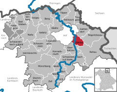 | |
 Döhlau  Döhlau | |
| Coordinates: 50°16′N 11°56′E / 50.267°N 11.933°E | |
| Country | Germany |
| State | Bavaria |
| Admin. region | Oberfranken |
| District | Hof |
| Subdivisions | 8 Ortsteile |
| Government | |
| • Mayor (2020–26) | Marc Ultsch [1] ( SPD) |
| Area | |
| • Total | 15.25 km2 (5.89 sq mi) |
| Elevation | 500 m (1,600 ft) |
| Population (2022-12-31)
[2] | |
| • Total | 3,783 |
| • Density | 250/km2 (640/sq mi) |
| Time zone | UTC+01:00 ( CET) |
| • Summer ( DST) | UTC+02:00 ( CEST) |
| Postal codes | 95182 |
| Dialling codes | 09286 (in Teilen: 09281 u. 09283) |
| Vehicle registration | HO |
| Website | www.doehlau.de |
Döhlau is a municipality in Upper Franconia in the district of Hof in Bavaria in Germany. It lies on the Saale River.
References
- ^ Liste der ersten Bürgermeister/Oberbürgermeister in kreisangehörigen Gemeinden, Bayerisches Landesamt für Statistik, 15 July 2021.
- ^ Genesis Online-Datenbank des Bayerischen Landesamtes für Statistik Tabelle 12411-003r Fortschreibung des Bevölkerungsstandes: Gemeinden, Stichtag (Einwohnerzahlen auf Grundlage des Zensus 2011).
Towns and municipalities in
Hof (district) | ||
|---|---|---|
|  | |
| International | |
|---|---|
| National | |
| Geographic | |
|
| This Hof district location article is a stub. You can help Wikipedia by expanding it. |
Döhlau | |
|---|---|
|
Döhlau Castle | |
|
Coat of arms | |
Location of Döhlau within Hof district | |
Döhlau Döhlau | |
| Coordinates: 50°16′N 11°56′E / 50.267°N 11.933°E | |
| Country | Germany |
| State | Bavaria |
| Admin. region | Oberfranken |
| District | Hof |
| Subdivisions | 8 Ortsteile |
| Government | |
| • Mayor (2020–26) | Marc Ultsch [1] ( SPD) |
| Area | |
| • Total | 15.25 km2 (5.89 sq mi) |
| Elevation | 500 m (1,600 ft) |
| Population (2022-12-31)
[2] | |
| • Total | 3,783 |
| • Density | 250/km2 (640/sq mi) |
| Time zone | UTC+01:00 ( CET) |
| • Summer ( DST) | UTC+02:00 ( CEST) |
| Postal codes | 95182 |
| Dialling codes | 09286 (in Teilen: 09281 u. 09283) |
| Vehicle registration | HO |
| Website | www.doehlau.de |
Döhlau is a municipality in Upper Franconia in the district of Hof in Bavaria in Germany. It lies on the Saale River.
References
- ^ Liste der ersten Bürgermeister/Oberbürgermeister in kreisangehörigen Gemeinden, Bayerisches Landesamt für Statistik, 15 July 2021.
- ^ Genesis Online-Datenbank des Bayerischen Landesamtes für Statistik Tabelle 12411-003r Fortschreibung des Bevölkerungsstandes: Gemeinden, Stichtag (Einwohnerzahlen auf Grundlage des Zensus 2011).
Towns and municipalities in
Hof (district) | ||
|---|---|---|
| | |
| International | |
|---|---|
| National | |
| Geographic | |
|
| This Hof district location article is a stub. You can help Wikipedia by expanding it. |