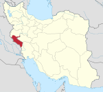
Cham Kabud Rural District
Kurdish: چەم کێو | |
|---|---|
| Coordinates: 32°51′48″N 47°30′11″E / 32.86333°N 47.50306°E [1] | |
| Country | Iran |
| Province | Ilam |
| County | Abdanan |
| District | Sarab Bagh |
| Capital | Cham Kabud |
| Population (2011)
[2] | |
| • Total | 5,539 |
| Time zone | UTC+3:30 ( IRST) |
Cham Kabud Rural District ( Kurdish: چەم کێو) is a former administrative division of Sarab Bagh District of Abdanan County, Ilam province, Iran. [3] Its capital was the village of Cham Kabud. [4]
Demographics
Population
At the time of the 2006 National Census, the rural district's population was 5,424 in 1,108 households. [5] There were 5,539 inhabitants in 1,397 households at the following census of 2011. [2]
After the census, some villages were transferred to Jaber-e Ansar Rural District in the Central District and some to the newly established Vach Kabud Rural District of Sarab Bagh District. [4]
See also
References
- ^ OpenStreetMap contributors (2 June 2023). "Cham Kabud Rural District (Abdanan County)" (Map). OpenStreetMap (in Persian). Retrieved 2 June 2023.
- ^ a b "Census of the Islamic Republic of Iran, 1390 (2011)". Syracuse University (in Persian). The Statistical Center of Iran. p. 16. Archived from the original (Excel) on 17 January 2023. Retrieved 19 December 2022.
- ^ Aref, Mohammad Reza (27 November 1381). "Number: 63630 T27988 K". Lamtakam (in Persian). Ministry of Interior, Political-Defense Commission of the Government Board. Archived from the original on 9 February 2024. Retrieved 9 February 2024.
- ^ a b Jahangiri, Ishaq (16 November 2013). "Cham Kabud separated from Sarab Bagh and joined the Central District of Abdanan". Islamic Republic News Agency (in Persian). Ministry of Interior, Cabinet of Ministers. Archived from the original on 2 June 2023. Retrieved 2 June 2023.
- ^ "Census of the Islamic Republic of Iran, 1385 (2006)". AMAR (in Persian). The Statistical Center of Iran. p. 16. Archived from the original (Excel) on 20 September 2011. Retrieved 25 September 2022.


