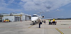
Castres - Mazamet Airport AĂ©roport de Castres - Mazamet | |||||||||||
|---|---|---|---|---|---|---|---|---|---|---|---|
 | |||||||||||
| Summary | |||||||||||
| Airport type | Public | ||||||||||
| Operator | CCI Castres-Mazamet | ||||||||||
| Serves | Castres / Mazamet | ||||||||||
| Location | LabruguiĂšre, Tarn, France | ||||||||||
| Elevation AMSL | 785 ft / 239 m | ||||||||||
| Coordinates | 43°33âČ18âłN 002°17âČ26âłE / 43.55500°N 2.29056°E | ||||||||||
| Map | |||||||||||
| Runways | |||||||||||
| |||||||||||
Castres â Mazamet Airport ( French: AĂ©roport de Castres - Mazamet) ( IATA: DCM, ICAO: LFCK) is an airport serving Castres and Mazamet [1] and the east of Midi-PyrĂ©nĂ©es. The airport is located 7 km (4 mi) southeast of Castres [1] and northwest of Mazamet, near the commune of LabruguiĂšre, in the Tarn department.
Facilities
The airport resides at an elevation of 239 metres (784 ft) above mean sea level. It has one paved runway designated 14/32 which measures 1,825 by 30 metres (5,988 ft Ă 98 ft). [1] The airport is VFR and IFR compliant.
Airlines and destinations
The following airlines operate regular scheduled and charter flights at CastresâMazamet Airport:
| Airlines | Destinations |
|---|---|
| Chalair Aviation | ParisâOrly [5] |
Statistics
Graphs are unavailable due to technical issues. There is more info on
Phabricator and on
MediaWiki.org. |
References
- ^ a b c d LFCK â CASTRES MAZAMET. AIP from French Service d'information aĂ©ronautique, effective 18 April 2024.
- ^ (in French) Aéroport de Castres - Mazamet Archived 2007-01-10 at the Wayback Machine at Union des Aéroports Français
- ^ Airport information for LFCK [usurped] from DAFIF (effective October 2006)
- ^ Airport information for DCM at Great Circle Mapper. Source: DAFIF (effective October 2006).
- ^ "Tarn. Une compagnie aérienne reprend la liaison Castres-Paris-Orly : Voici ce qui change". 17 May 2023.
External links
Castres - Mazamet Airport AĂ©roport de Castres - Mazamet | |||||||||||
|---|---|---|---|---|---|---|---|---|---|---|---|
 | |||||||||||
| Summary | |||||||||||
| Airport type | Public | ||||||||||
| Operator | CCI Castres-Mazamet | ||||||||||
| Serves | Castres / Mazamet | ||||||||||
| Location | LabruguiĂšre, Tarn, France | ||||||||||
| Elevation AMSL | 785 ft / 239 m | ||||||||||
| Coordinates | 43°33âČ18âłN 002°17âČ26âłE / 43.55500°N 2.29056°E | ||||||||||
| Map | |||||||||||
| Runways | |||||||||||
| |||||||||||
Castres â Mazamet Airport ( French: AĂ©roport de Castres - Mazamet) ( IATA: DCM, ICAO: LFCK) is an airport serving Castres and Mazamet [1] and the east of Midi-PyrĂ©nĂ©es. The airport is located 7 km (4 mi) southeast of Castres [1] and northwest of Mazamet, near the commune of LabruguiĂšre, in the Tarn department.
Facilities
The airport resides at an elevation of 239 metres (784 ft) above mean sea level. It has one paved runway designated 14/32 which measures 1,825 by 30 metres (5,988 ft Ă 98 ft). [1] The airport is VFR and IFR compliant.
Airlines and destinations
The following airlines operate regular scheduled and charter flights at CastresâMazamet Airport:
| Airlines | Destinations |
|---|---|
| Chalair Aviation | ParisâOrly [5] |
Statistics
Graphs are unavailable due to technical issues. There is more info on
Phabricator and on
MediaWiki.org. |
References
- ^ a b c d LFCK â CASTRES MAZAMET. AIP from French Service d'information aĂ©ronautique, effective 18 April 2024.
- ^ (in French) Aéroport de Castres - Mazamet Archived 2007-01-10 at the Wayback Machine at Union des Aéroports Français
- ^ Airport information for LFCK [usurped] from DAFIF (effective October 2006)
- ^ Airport information for DCM at Great Circle Mapper. Source: DAFIF (effective October 2006).
- ^ "Tarn. Une compagnie aérienne reprend la liaison Castres-Paris-Orly : Voici ce qui change". 17 May 2023.
External links
