Ballywilliam
Baile Liam | |
|---|---|
Village | |
 Pub in Ballywilliam | |
| Coordinates: 52°26′55″N 6°51′54″W / 52.4486°N 6.8650°W | |
| Country | Ireland |
| Province | Leinster |
| County | Wexford |
| Elevation | 88 m (289 ft) |
| Time zone | UTC+0 ( WET) |
| • Summer ( DST) | UTC-1 ( IST ( WEST)) |
| Area code | 051 |
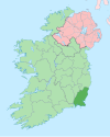
Ballywilliam (historically also Ballyliam, from Irish: Baile Liam, meaning "Liam's settlement") [1] is a village in the west of County Wexford, Ireland. The nearest town is New Ross, 8 kilometres (5 mi) to the south west. The village sits on the R731 road.
History
The village once had its own railway station, which was closed in 1963. Ballywilliam Railway Station was the first railway station in County Wexford. It opened in 1862. [2]
Ballywilliam R.I.C. Barracks was burned during the Irish War of Independence, on 5 April 1920.[ citation needed]
Amenities
Today, the village contains an agricultural cooperative, two pubs, and a Garda Station. [3] [4] Ballywilliam also contains a shop/ petrol station.
Sport
Ballywilliam is home to Shelburne United AFC, [5] a local soccer club that competes in the Wexford and District League, the Wexford and District Schoolboys' League and Wexford and District Women's and Schoolgirls' League.[ citation needed]
See also
References
- ^ Placenames Database of Ireland (see archival records)
- ^ "Irish Railway Stations" (PDF). www.railbrit.co.uk.
- ^ Garda Station telephone numbers Wexford/Wicklow Division
- ^ Dáil Debate - 2 April 2003
- ^ Shelburne United. "Shelburne United AFC Official Website". Archived from the original on 11 June 2013. Retrieved 25 October 2012.
Ballywilliam
Baile Liam | |
|---|---|
Village | |
 Pub in Ballywilliam | |
| Coordinates: 52°26′55″N 6°51′54″W / 52.4486°N 6.8650°W | |
| Country | Ireland |
| Province | Leinster |
| County | Wexford |
| Elevation | 88 m (289 ft) |
| Time zone | UTC+0 ( WET) |
| • Summer ( DST) | UTC-1 ( IST ( WEST)) |
| Area code | 051 |
Ballywilliam (historically also Ballyliam, from Irish: Baile Liam, meaning "Liam's settlement") [1] is a village in the west of County Wexford, Ireland. The nearest town is New Ross, 8 kilometres (5 mi) to the south west. The village sits on the R731 road.
History
The village once had its own railway station, which was closed in 1963. Ballywilliam Railway Station was the first railway station in County Wexford. It opened in 1862. [2]
Ballywilliam R.I.C. Barracks was burned during the Irish War of Independence, on 5 April 1920.[ citation needed]
Amenities
Today, the village contains an agricultural cooperative, two pubs, and a Garda Station. [3] [4] Ballywilliam also contains a shop/ petrol station.
Sport
Ballywilliam is home to Shelburne United AFC, [5] a local soccer club that competes in the Wexford and District League, the Wexford and District Schoolboys' League and Wexford and District Women's and Schoolgirls' League.[ citation needed]
See also
References
- ^ Placenames Database of Ireland (see archival records)
- ^ "Irish Railway Stations" (PDF). www.railbrit.co.uk.
- ^ Garda Station telephone numbers Wexford/Wicklow Division
- ^ Dáil Debate - 2 April 2003
- ^ Shelburne United. "Shelburne United AFC Official Website". Archived from the original on 11 June 2013. Retrieved 25 October 2012.

