| Reading's Bar Clear Creek Diggings Horsetown | |
|---|---|
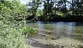
 Clear Creek near Horsetown | |
| Location | Clear Creek Road, Reading, California |
| Coordinates | 40°29′37″N 122°29′36″W / 40.4937°N 122.4933°W |
| Built | May 1848 |
| Architect | Gold Find then 49 mining town |
| Designated | August 1, 1932 |
| Reference no. | 32 |
 Location of Reading's Bar Clear Creek Diggings Horsetown in California  Reading's Bar (the United States) | |
Reading's Bar is a historical site in Redding, California in Shasta County. Reading's Bar is a California Historical Landmark No. 32 listed on August 1, 1932. [1] Reading's Bar was named after Major Pierson Barton Reading, who discovered gold on the Clear Creek bar in May 1848, starting a California Gold Rush in the surrounding area. Later he found gold on a sandbar on the Trinity River that started the Trinity Alps Gold Rush. [2] [3] Reading's gold discovery was a major part of the California Gold Rush and news of the find created a rush of gold prospecting in Northern California, well north of the better-known gold fields of the Sierra Nevada foothills.
Following the Reading's Bar gold discovery, a number of small mining towns grew up on and north of the Clear Creek including: Horsetown, Briggsville, Muletown, Lower Springs, Texas Springs, Middletown, Piety Hill, Igo, Larkin, Jackass Flat, Ono, Bald Hills, Janesville, and to the north Whiskeytown, Shasta, Tower House, and French Gulch.
Reading's Bar Historical markers
The California historical marker is at Clear Creek Bridge, on Clear Creek Road, 6.9 miles West of old Hwy 99 West of Redding. Marker was placed there by the
California Department of Parks and Recreation working with the Shasta Historical Society, Darrell Moss Historical Fund and Trinitarianus Chapter 62,
E Clampus Vitus.
[4]
A second Reading's Bar marker is at
Douglas City, California, in
Trinity County near Readings Trinity River find. The marker was placed there by E Clampus Vitus, Trinitarianus Chapter 62/Trinity County Sesquicentennial Committee in 1968.
[5]
Pierson Barton Reading
California pioneer Pierson Barton Reading (1816-1868) came to California in a wagon train in 1843. In 1844 he was given a Mexican land grant, Rancho Buena Ventura. [6] Reading was a member of John C. Frémont's California Battalion in the Mexican-American War and participated in the Bear Flag Revolt. Reading was one of the signers of the Treaty of Cahuenga on January 13, 1847, which ended the war in Alta California. Following the war, Reading became known for his discovery of gold at Clear Creek, near Redding, California. [5]
Horsetown
Just west of Reading's Bar on Clear Creek the mining town of Clear Creek Diggings was formed in 1851 at the site of Clear Creek Road and Clear Creek. [7] [8] The town served the many miners in the valley. As the town grew it was given the name One Horse Town and then changed to Horsetown. [9] [10] In 1855, Horsetown covered 36 acres with a population of 1,000, by 1856 it was 2,000. Lots of water is needed for mining gold, so the miners built a small dam on Clear Creek. By October 1849 about 250 men were mining on Clear Creek. The 49er miner, Alexander Andrews at Clear Creek diggings built the Horsetown Bridge near Reading's bar to cross Clear Creek safely. Duffy built Duffy’s Ditch that brought water into Horsetown. A stagecoach road was built from Stockton & Andrews’ Bridge to Horsetown. A second large water system was built in 1855, the Clear Creek Ditch, with 49 miles of flumes. [11] [12] The site of the former Horsetown is now the Horsetown Clear-Creek Preserve, a nonprofit preserve. [13] [10] [7]
Briggsville
Briggsville, California was a major mining Camp 1 mile east from Horsetown on Clear Creek at 40°29′42″N 122°28′40″W / 40.49511°N 122.47772°W. [9] [14] The camp was started by Benjamin F. Briggs. The camp was also called Breechesburg in its early days. Briggs wife Mrs. Briggs make it know she did not like the miners messy and dirty ways and the town was clean up some what. Landrum and Briggs built a toll bridge over Clear Creek at Briggsville in 1852 by Joel T. Landrum and Briggs. In 1853 the Briggsville Hotel and general store was built. A stagecoach road was built from Shasta to Red Bluffs that passed through Briggsville. [15] A Lime kiln and Limestone Quarry was built in Briggsville in 1855. [16] In 1861 the Briggsville toll bridge changed owners to Landrum & Ralston, now called the Ralston's bridge. The Briggsville water came from the Clear Creek Ditch and reservoir project opened in 1855. [17] The only remains of the town are two wood burning stone kilns in Bulgin Gulch, that were used to make plaster and mortar first run by Samuel R. Clough and his wife, Debora Clough. [18] By 1866 Briggsville had become a major Chinatown. There are no remains of the town. The closest city to the old Briggsville is Igo, California in Shasta County. [14] [19] [20]
Muletown
Muletown, California was small mining camp north of Horsetown on Muletown road, founded in 1849. Like Horsetown the camp was first called One Mule Town. The location of the center of the town has been lost in time, the town was on the north bank of Clear Creek about 2 miles northwest of Horsetown, at about 40°31′04″N 122°31′22″W / 40.517639°N 122.522694°W. [9] Clear Creek Ditch supplied water to Muletown opened in 1855. The Clear Creek Ditch was four feet wide at the bottom, and six feet wide at the top, with water three feet deep. Clear Creek Ditch ran from the Tower House, (now in the Whiskeytown National Recreation Area) then headed south along Clear Creek to Horsetown and the mining towns of Middletown, Muletown, Texas Springs, and Jackass Flat. The Clear Creek Ditch dropped seven feet per mile on it path. A branch ditch feed Horsetown. The Muletown road is a 5.5 mile road that run north–south, the southern end is the form site of Muletown. By mid to late 1860s the easy gold had run out and many town miners moved on. There was some hydraulic mining but this was outlawed in 1884. Dredging the creek also started as easy gold ran out. Drift mining also was used. The town no longer exists. [21] [22] [23]
Lower Springs
Lower Springs, California was small mining camp on Salt Creek about 4 miles north of Horsetown at 40°33′15″N 122°28′31″W / 40.55423°N 122.4753°W, now the Swasey Recreational Area off Swasey Drive. Clear Creek Ditch supplied water to Lower Springs and opened on November 24, 1855. [9] The largest buildings in the town was the Swasey's Hotel & casino and the Swasey mercantile store, built by Benjamin Swasey from New Hampshire and make is money at the Gold Gulch claim. Benjamin Swasey was born on January 31, 1822, in New Hampshire and he died in Oakland, California on September 19, 1912. The town was built after the gold find at the Lower Springs mining district near Reading Springs (now Shasta). The first wood house was built in 1850. A second hotel opened the Virginia House. A second general store opened in 1854, by the J.D. Dunlap & Company. The town was very anti-Chinese. The town had a general store, a pottery shop, Henry Jones Blacksmith Shop and two hotels, the Virginian House and Swasey Hotel. The Swasey Hotel & casino had two large palm trees in front, new site for Northern California. Swasey Hotel also had a garden, plant nursery and Orchards. Swasey sold his plants and crops in the county. From China the one of the first orange crops was from Lower Springs. [24] The town had a stage stop for some years. On April 17, 1851, Merady Swan, from Missouri, was killed in native tribe attack, one of many raids. Henry Jones & Company had hard rock mine nearby, also the Old Spanish Mine. Bert Wiser opened the Wiser & Terry vineyard. In 1851 Munroe & Felt of Sacramento hired McCummings to drive a simple Stagecoach to take passengers from Red Bluffs to Shasta, with stops at Lower Springs, Bells Bridge, Canon House (Canyon House), the main office was at the St. Charles hotel. The town no longer exists, but there is a Lower Springs Road. [25] [26] [27]
Texas Springs
Texas Springs, California is Gold Rush Mining town founded in the 1849. [28] Texas Springs was northeast of Horsetown on Texas Springs Road at 40°30′38″N 122°26′52″W / 40.510694°N 122.447667°W. [9] A miner nicknamed Texas found gold here in 1948 and started the dry digging gold rush in the valley. The mining nearby was in Dutch Gulche, Jackass Hill and Spring Flats. In 1857 a dam was built at Texas Springs and some dry digging were able to now used water. In 1958 Texas Springs was given the right to vote and run for offices. Texas Springs had a mixed Chinatown, which had farming, Texas Springs did not have anti-China conflicts. Wm. Weil & Co. general mercantile store and B. F. Koontz Store were the main stores in Texas Springs. Another store open later the Wright-Bedford Store that opened in 1858. In 1859 Wright-Bedford started a daily covered wagon train service for goods and passengers from Texas Springs to Middletown (now Grant) a 5-mile trip north. On November 17, 1958, a fire burned some of the town, including the blacksmith shop, a hotel and some homes. The town repaired after the fire. In 1860 Texas Springs opened two one-room schoolhouses, one was lost to fire. The Texas Springs Rock Quarry was founded in 1894 and stopped in 1903. The Texas Springs Rock Quarry supplied the stones for the Shasta County Courthouse and the rock wall in fornt of the Courthouse. The Texas Springs Rock Quarry rocks were also used for railroad culverts, tombstones, and the trimmings on buildings. [29] The only remains of the town is the Texas Springs Road, the Texas Springs Rock Quarry, a few stone foundations and small Texas Springs Pioneer Cementy, upper and lower Cementies. [30] [9]
Jackass Flat
Jackass Flat, California was a small mining town between Horsetown and Larkin (now Centerville). Jackass Flat was founded north of Horsetown after gold was found at Reading's Bar. The Clear creek Ditch Company provided water for the town of Jackass Flat and the surrounding mines, as the water ditch passed by on its way to Horsetown. A road was built from Jackass Flat to Bald Hills, which crossed the Stockton & Andrew's Bridge. A Stagecoach line also used the road opened in 1858. Jackass Flat supplied the nearby tent mining camps in Buljon Gulch-Jackass Hill. Jackass Hill large claim were the Johnson, Lull and Company and G.M. Roach mining. [31] [9]
Bald Hills
Bald Hills, California was a small mining town that started with about 25 miners. It was named Bald Hills, as the hills had no trees, unlike the other nearby hills. Bald Hills was west of Horsetown and Piety Hill, these towns are where Bald Hills wagon trains supplied Butler & Webb's Store in Bald Hills. Bald Hills was 6 miles south of
Ono, California, between North Fork and Middle Fork of
Cottonwood Creek at
40°22′56″N 122°34′47″W / 40.3822°N 122.5798°W.The 10-miles Bald Hills ditch supplied water to the town and mines, which opened in 1856. Cottonwood Ditch owned by Messrs. Abel and C. Barnum also supplied water to nearby mines. Active mines were: Thornton & Watson; Barnum, Love, White & Fowler; Mr. Jonathan Baker; John Abel, and W. Miller. In the 1860s Bald Hills has McDonald's Express wagon to ring goods and passengers. In the 1870s James S. Drew operated a blacksmith shop, Henry Gary opened a general store, Gary's Store and Bald Hills Lodge, No. 170 headed by Brother William S. Kidder, opened. In 1872 a school was opened. By 1880 with gold running out, only five homes were in Bald Hills, some raising
cattle. The largest cattle ranch was The 8,360 acres diamond stock range started by Hardin & Riley sold in 1899 to the Cosmos Land and Water Company. Booker Gill had a large
sheep ranch, lost in a large July 1901 fire. In 1902 Bald Hills put 25th a large
rodeo with 100s attending. In 1911, the Bald Hills Chinese Store closed. In 1917 the 5,000 acres James Miller ranch was sold to Trinity Land and Cattle Company. The town's Cemetery is called Bland Cemetery.
[32]
Bald Hills supported a nearby small mining towns of Kimball Plains, this became the 600 acres Kimball ranch, sold in 1922 from K. King sold to James Barry at
40°23′31″N 122°23′42″W / 40.392°N 122.395°W, now at Kimball Plains road. Bald Hills also supported a nearby small mining town of Antelope on Gas Point Road and Antelope Creek at
40°22′38″N 122°26′22″W / 40.3772°N 122.4394°W. In Antelope on August 2, 1881, a School was founded. Antelope's first teacher was May K. Giles then Carrie Hayden. The school's founding families were: Riggins, Shelton, Scovell, and Duggins, the school closed in 1940.
[32]
Roaring River
Roaring River, California was a company owned mining town on the Roaring River. The Roaring River Gold Dredging Company also worked the North and Middle Fork of the Cottonwood Creek that flowed in the Roaring River. Roaring River was south of Horsetown at 40°23′42″N 122°31′28″W / 40.395°N 122.52444°W. Roaring River Mine appears on a 1862 Shasta county town map, in 1862; it may have been a mining town or company town. Roaring River Mine was a small gold mine in Shasta county at an elevation of 623 feet, part of the Point-Backbone Mining District. The mine operated along 10,559 feet of the rivers, mostly dredging till 1941, ending with the start of World War II. [33] [34]

Gallery
-
 1862 map of mining towns in Shasta County California
 -
 Horsetown Clear-Creek Preserve Sign
 -
 Horsetown Clear-Creek Preserve Trail Head Sign
 -
 Clear Creek near Reading's Bar
 -
 Clear Creek Gorge BLM sign
 -
 Clear Creek Greenway Cloverdale Trails BLM Map
 -
 Benjamin Swasey in 1880 founder of Lower Springs, California


See also
- California Historical Landmarks in Shasta County
- Bell's Bridge (California) on Clear Creek
- Centerville, Shasta County, California just north of Reading's Bar
- Placer mining
References
- ^ "Reading's Bar #32". Office of Historic Preservation, California State Parks. Retrieved 2012-10-07.
- ^ "CHL # 32 Reading's Bar Shasta". www.californiahistoricallandmarks.com.
- ^ "Historical and Archaeological Investigations of the Horsetown Mining Complex, Shasta County, California." Gold and Lumber: Two Papers on Northern California History and Archaeology. BLM Redding Field Office, Bureau of Land Management, California, by Trudy Vaughan and Eric Ritter, 1992.
- ^ "Reading's Bar Historical Marker". www.hmdb.org.
- ^ a b "Reading's Bar Historical Marker". www.hmdb.org.
- ^ "CHL # 10 Reading Adobe Shasta". www.californiahistoricallandmarks.com.
- ^ a b Horsetown Clear-Creek Preserve greenway blm.gov
- ^ "HORSETOWN". CA State Parks.
- ^ a b c d e f g Shasta Valley mines, blm.gov
- ^ a b Horsetown Clear-Creek Preserve outings blm.gov
- ^ The Dictionary of Early Shasta County History, Smith, Dottie 1991, Redding
- ^ Historic Resource Study, Whiskeytown National Recreation Area, California. Report prepared for United States Department of Interior, National Park Service, Anna Coxe Toogood, 1978, Denver
- ^ "Horsetown-Clear Creek Preserve, located in Redding, CA". horsetownclearcreekpreserve.org.
- ^ a b "BRIGGSVILLE". CA State Parks.
- ^ "Mrs. Evoy Leaves Briggsville". August 4, 2021.
- ^ Tenth Annual Report of The State Mineralogist For The Year Ending December 1, 1890, California State Mining Bureau, Sacramento: State Printing Office, 1890, pp. 627
- ^ Tuggle, Jeremy M. (December 26, 2018). "Exploring Shasta County history by Jeremy M. Tuggle: LOWER SPRINGS".
- ^ Sole Trader, The Shasta Republican newspaper of Shasta, February 20, 1858
- ^ "History & Happenings - SHASTA COUNTY 5 - Briggsville". historyandhappenings.squarespace.com.
- ^ Mines and Mineral Resources of Shasta County, California Division of Mines and Geology, County Report 6. Sacramento: California Office of State Printing, Lydon, Philip A. and J. C. O'Brien, 1974
- ^ "Mule Town Road Mountain Biking Trail - Redding, CA".
- ^ "Muletown Road Multi Trail - Redding, California".
- ^ Clear Creek, Swasey and Mule Ridge Trails blm.gov
- ^ "Lower Springs, Shasta County California" – via www.youtube.com.
- ^ Lower Springs, The Shasta Courier newspaper of Shasta, March 12, 1853
- ^ Diggings About Lower Springs, The Shasta Courier newspaper of Shasta, April 2, 1853
- ^ The Lower Springs Road, The Shasta Courier newspaper of Shasta, May 7, 1853
- ^ "TEXAS SPRINGS". CA State Parks.
- ^ "Travelin' in Time: Dottie Smith: Redding's historic landmarks, Part 2". Record Searchlight.
- ^ "Texas Springs, Shasta County, California -A History-" – via www.youtube.com.
- ^ The Dictionary of Early Shasta County History" 2nd Edition, by Dottie Smith
- ^ a b "History & Happenings - SHASTA COUNTY 5". historyandhappenings.squarespace.com.
- ^ "Roaring River". Western Mining History.
- ^ "Roaring River Gold Mine Near Ono, California | The Diggings".
External links
- Exploring Clear Creek Gold Mining Sites youtube.com
- Horsetown Clear-Creek Preserve youtube.com
- National Public Lands Day - Clear Creek Preserve 2015 youtube.com
Municipalities and communities of
Shasta County, California, United States | ||
|---|---|---|
| Cities |  | |
| CDPs |
| |
|
Unincorporated communities | ||
| Indian reservations | ||
| Ghost towns | ||
| Footnotes | ‡This populated place also has portions in an adjacent county or counties | |
| Reading's Bar Clear Creek Diggings Horsetown | |
|---|---|
|
Clear Creek near Horsetown | |
| Location | Clear Creek Road, Reading, California |
| Coordinates | 40°29′37″N 122°29′36″W / 40.4937°N 122.4933°W |
| Built | May 1848 |
| Architect | Gold Find then 49 mining town |
| Designated | August 1, 1932 |
| Reference no. | 32 |
Location of Reading's Bar Clear Creek Diggings Horsetown in California Reading's Bar (the United States) | |
Reading's Bar is a historical site in Redding, California in Shasta County. Reading's Bar is a California Historical Landmark No. 32 listed on August 1, 1932. [1] Reading's Bar was named after Major Pierson Barton Reading, who discovered gold on the Clear Creek bar in May 1848, starting a California Gold Rush in the surrounding area. Later he found gold on a sandbar on the Trinity River that started the Trinity Alps Gold Rush. [2] [3] Reading's gold discovery was a major part of the California Gold Rush and news of the find created a rush of gold prospecting in Northern California, well north of the better-known gold fields of the Sierra Nevada foothills.
Following the Reading's Bar gold discovery, a number of small mining towns grew up on and north of the Clear Creek including: Horsetown, Briggsville, Muletown, Lower Springs, Texas Springs, Middletown, Piety Hill, Igo, Larkin, Jackass Flat, Ono, Bald Hills, Janesville, and to the north Whiskeytown, Shasta, Tower House, and French Gulch.
Reading's Bar Historical markers
The California historical marker is at Clear Creek Bridge, on Clear Creek Road, 6.9 miles West of old Hwy 99 West of Redding. Marker was placed there by the
California Department of Parks and Recreation working with the Shasta Historical Society, Darrell Moss Historical Fund and Trinitarianus Chapter 62,
E Clampus Vitus.
[4]
A second Reading's Bar marker is at
Douglas City, California, in
Trinity County near Readings Trinity River find. The marker was placed there by E Clampus Vitus, Trinitarianus Chapter 62/Trinity County Sesquicentennial Committee in 1968.
[5]
Pierson Barton Reading
California pioneer Pierson Barton Reading (1816-1868) came to California in a wagon train in 1843. In 1844 he was given a Mexican land grant, Rancho Buena Ventura. [6] Reading was a member of John C. Frémont's California Battalion in the Mexican-American War and participated in the Bear Flag Revolt. Reading was one of the signers of the Treaty of Cahuenga on January 13, 1847, which ended the war in Alta California. Following the war, Reading became known for his discovery of gold at Clear Creek, near Redding, California. [5]
Horsetown
Just west of Reading's Bar on Clear Creek the mining town of Clear Creek Diggings was formed in 1851 at the site of Clear Creek Road and Clear Creek. [7] [8] The town served the many miners in the valley. As the town grew it was given the name One Horse Town and then changed to Horsetown. [9] [10] In 1855, Horsetown covered 36 acres with a population of 1,000, by 1856 it was 2,000. Lots of water is needed for mining gold, so the miners built a small dam on Clear Creek. By October 1849 about 250 men were mining on Clear Creek. The 49er miner, Alexander Andrews at Clear Creek diggings built the Horsetown Bridge near Reading's bar to cross Clear Creek safely. Duffy built Duffy’s Ditch that brought water into Horsetown. A stagecoach road was built from Stockton & Andrews’ Bridge to Horsetown. A second large water system was built in 1855, the Clear Creek Ditch, with 49 miles of flumes. [11] [12] The site of the former Horsetown is now the Horsetown Clear-Creek Preserve, a nonprofit preserve. [13] [10] [7]
Briggsville
Briggsville, California was a major mining Camp 1 mile east from Horsetown on Clear Creek at 40°29′42″N 122°28′40″W / 40.49511°N 122.47772°W. [9] [14] The camp was started by Benjamin F. Briggs. The camp was also called Breechesburg in its early days. Briggs wife Mrs. Briggs make it know she did not like the miners messy and dirty ways and the town was clean up some what. Landrum and Briggs built a toll bridge over Clear Creek at Briggsville in 1852 by Joel T. Landrum and Briggs. In 1853 the Briggsville Hotel and general store was built. A stagecoach road was built from Shasta to Red Bluffs that passed through Briggsville. [15] A Lime kiln and Limestone Quarry was built in Briggsville in 1855. [16] In 1861 the Briggsville toll bridge changed owners to Landrum & Ralston, now called the Ralston's bridge. The Briggsville water came from the Clear Creek Ditch and reservoir project opened in 1855. [17] The only remains of the town are two wood burning stone kilns in Bulgin Gulch, that were used to make plaster and mortar first run by Samuel R. Clough and his wife, Debora Clough. [18] By 1866 Briggsville had become a major Chinatown. There are no remains of the town. The closest city to the old Briggsville is Igo, California in Shasta County. [14] [19] [20]
Muletown
Muletown, California was small mining camp north of Horsetown on Muletown road, founded in 1849. Like Horsetown the camp was first called One Mule Town. The location of the center of the town has been lost in time, the town was on the north bank of Clear Creek about 2 miles northwest of Horsetown, at about 40°31′04″N 122°31′22″W / 40.517639°N 122.522694°W. [9] Clear Creek Ditch supplied water to Muletown opened in 1855. The Clear Creek Ditch was four feet wide at the bottom, and six feet wide at the top, with water three feet deep. Clear Creek Ditch ran from the Tower House, (now in the Whiskeytown National Recreation Area) then headed south along Clear Creek to Horsetown and the mining towns of Middletown, Muletown, Texas Springs, and Jackass Flat. The Clear Creek Ditch dropped seven feet per mile on it path. A branch ditch feed Horsetown. The Muletown road is a 5.5 mile road that run north–south, the southern end is the form site of Muletown. By mid to late 1860s the easy gold had run out and many town miners moved on. There was some hydraulic mining but this was outlawed in 1884. Dredging the creek also started as easy gold ran out. Drift mining also was used. The town no longer exists. [21] [22] [23]
Lower Springs
Lower Springs, California was small mining camp on Salt Creek about 4 miles north of Horsetown at 40°33′15″N 122°28′31″W / 40.55423°N 122.4753°W, now the Swasey Recreational Area off Swasey Drive. Clear Creek Ditch supplied water to Lower Springs and opened on November 24, 1855. [9] The largest buildings in the town was the Swasey's Hotel & casino and the Swasey mercantile store, built by Benjamin Swasey from New Hampshire and make is money at the Gold Gulch claim. Benjamin Swasey was born on January 31, 1822, in New Hampshire and he died in Oakland, California on September 19, 1912. The town was built after the gold find at the Lower Springs mining district near Reading Springs (now Shasta). The first wood house was built in 1850. A second hotel opened the Virginia House. A second general store opened in 1854, by the J.D. Dunlap & Company. The town was very anti-Chinese. The town had a general store, a pottery shop, Henry Jones Blacksmith Shop and two hotels, the Virginian House and Swasey Hotel. The Swasey Hotel & casino had two large palm trees in front, new site for Northern California. Swasey Hotel also had a garden, plant nursery and Orchards. Swasey sold his plants and crops in the county. From China the one of the first orange crops was from Lower Springs. [24] The town had a stage stop for some years. On April 17, 1851, Merady Swan, from Missouri, was killed in native tribe attack, one of many raids. Henry Jones & Company had hard rock mine nearby, also the Old Spanish Mine. Bert Wiser opened the Wiser & Terry vineyard. In 1851 Munroe & Felt of Sacramento hired McCummings to drive a simple Stagecoach to take passengers from Red Bluffs to Shasta, with stops at Lower Springs, Bells Bridge, Canon House (Canyon House), the main office was at the St. Charles hotel. The town no longer exists, but there is a Lower Springs Road. [25] [26] [27]
Texas Springs
Texas Springs, California is Gold Rush Mining town founded in the 1849. [28] Texas Springs was northeast of Horsetown on Texas Springs Road at 40°30′38″N 122°26′52″W / 40.510694°N 122.447667°W. [9] A miner nicknamed Texas found gold here in 1948 and started the dry digging gold rush in the valley. The mining nearby was in Dutch Gulche, Jackass Hill and Spring Flats. In 1857 a dam was built at Texas Springs and some dry digging were able to now used water. In 1958 Texas Springs was given the right to vote and run for offices. Texas Springs had a mixed Chinatown, which had farming, Texas Springs did not have anti-China conflicts. Wm. Weil & Co. general mercantile store and B. F. Koontz Store were the main stores in Texas Springs. Another store open later the Wright-Bedford Store that opened in 1858. In 1859 Wright-Bedford started a daily covered wagon train service for goods and passengers from Texas Springs to Middletown (now Grant) a 5-mile trip north. On November 17, 1958, a fire burned some of the town, including the blacksmith shop, a hotel and some homes. The town repaired after the fire. In 1860 Texas Springs opened two one-room schoolhouses, one was lost to fire. The Texas Springs Rock Quarry was founded in 1894 and stopped in 1903. The Texas Springs Rock Quarry supplied the stones for the Shasta County Courthouse and the rock wall in fornt of the Courthouse. The Texas Springs Rock Quarry rocks were also used for railroad culverts, tombstones, and the trimmings on buildings. [29] The only remains of the town is the Texas Springs Road, the Texas Springs Rock Quarry, a few stone foundations and small Texas Springs Pioneer Cementy, upper and lower Cementies. [30] [9]
Jackass Flat
Jackass Flat, California was a small mining town between Horsetown and Larkin (now Centerville). Jackass Flat was founded north of Horsetown after gold was found at Reading's Bar. The Clear creek Ditch Company provided water for the town of Jackass Flat and the surrounding mines, as the water ditch passed by on its way to Horsetown. A road was built from Jackass Flat to Bald Hills, which crossed the Stockton & Andrew's Bridge. A Stagecoach line also used the road opened in 1858. Jackass Flat supplied the nearby tent mining camps in Buljon Gulch-Jackass Hill. Jackass Hill large claim were the Johnson, Lull and Company and G.M. Roach mining. [31] [9]
Bald Hills
Bald Hills, California was a small mining town that started with about 25 miners. It was named Bald Hills, as the hills had no trees, unlike the other nearby hills. Bald Hills was west of Horsetown and Piety Hill, these towns are where Bald Hills wagon trains supplied Butler & Webb's Store in Bald Hills. Bald Hills was 6 miles south of
Ono, California, between North Fork and Middle Fork of
Cottonwood Creek at
40°22′56″N 122°34′47″W / 40.3822°N 122.5798°W.The 10-miles Bald Hills ditch supplied water to the town and mines, which opened in 1856. Cottonwood Ditch owned by Messrs. Abel and C. Barnum also supplied water to nearby mines. Active mines were: Thornton & Watson; Barnum, Love, White & Fowler; Mr. Jonathan Baker; John Abel, and W. Miller. In the 1860s Bald Hills has McDonald's Express wagon to ring goods and passengers. In the 1870s James S. Drew operated a blacksmith shop, Henry Gary opened a general store, Gary's Store and Bald Hills Lodge, No. 170 headed by Brother William S. Kidder, opened. In 1872 a school was opened. By 1880 with gold running out, only five homes were in Bald Hills, some raising
cattle. The largest cattle ranch was The 8,360 acres diamond stock range started by Hardin & Riley sold in 1899 to the Cosmos Land and Water Company. Booker Gill had a large
sheep ranch, lost in a large July 1901 fire. In 1902 Bald Hills put 25th a large
rodeo with 100s attending. In 1911, the Bald Hills Chinese Store closed. In 1917 the 5,000 acres James Miller ranch was sold to Trinity Land and Cattle Company. The town's Cemetery is called Bland Cemetery.
[32]
Bald Hills supported a nearby small mining towns of Kimball Plains, this became the 600 acres Kimball ranch, sold in 1922 from K. King sold to James Barry at
40°23′31″N 122°23′42″W / 40.392°N 122.395°W, now at Kimball Plains road. Bald Hills also supported a nearby small mining town of Antelope on Gas Point Road and Antelope Creek at
40°22′38″N 122°26′22″W / 40.3772°N 122.4394°W. In Antelope on August 2, 1881, a School was founded. Antelope's first teacher was May K. Giles then Carrie Hayden. The school's founding families were: Riggins, Shelton, Scovell, and Duggins, the school closed in 1940.
[32]
Roaring River
Roaring River, California was a company owned mining town on the Roaring River. The Roaring River Gold Dredging Company also worked the North and Middle Fork of the Cottonwood Creek that flowed in the Roaring River. Roaring River was south of Horsetown at 40°23′42″N 122°31′28″W / 40.395°N 122.52444°W. Roaring River Mine appears on a 1862 Shasta county town map, in 1862; it may have been a mining town or company town. Roaring River Mine was a small gold mine in Shasta county at an elevation of 623 feet, part of the Point-Backbone Mining District. The mine operated along 10,559 feet of the rivers, mostly dredging till 1941, ending with the start of World War II. [33] [34]
Gallery
-
1862 map of mining towns in Shasta County California
-
Horsetown Clear-Creek Preserve Sign
-
Horsetown Clear-Creek Preserve Trail Head Sign
-
Clear Creek near Reading's Bar
-
Clear Creek Gorge BLM sign
-
Clear Creek Greenway Cloverdale Trails BLM Map
-
Benjamin Swasey in 1880 founder of Lower Springs, California
See also
- California Historical Landmarks in Shasta County
- Bell's Bridge (California) on Clear Creek
- Centerville, Shasta County, California just north of Reading's Bar
- Placer mining
References
- ^ "Reading's Bar #32". Office of Historic Preservation, California State Parks. Retrieved 2012-10-07.
- ^ "CHL # 32 Reading's Bar Shasta". www.californiahistoricallandmarks.com.
- ^ "Historical and Archaeological Investigations of the Horsetown Mining Complex, Shasta County, California." Gold and Lumber: Two Papers on Northern California History and Archaeology. BLM Redding Field Office, Bureau of Land Management, California, by Trudy Vaughan and Eric Ritter, 1992.
- ^ "Reading's Bar Historical Marker". www.hmdb.org.
- ^ a b "Reading's Bar Historical Marker". www.hmdb.org.
- ^ "CHL # 10 Reading Adobe Shasta". www.californiahistoricallandmarks.com.
- ^ a b Horsetown Clear-Creek Preserve greenway blm.gov
- ^ "HORSETOWN". CA State Parks.
- ^ a b c d e f g Shasta Valley mines, blm.gov
- ^ a b Horsetown Clear-Creek Preserve outings blm.gov
- ^ The Dictionary of Early Shasta County History, Smith, Dottie 1991, Redding
- ^ Historic Resource Study, Whiskeytown National Recreation Area, California. Report prepared for United States Department of Interior, National Park Service, Anna Coxe Toogood, 1978, Denver
- ^ "Horsetown-Clear Creek Preserve, located in Redding, CA". horsetownclearcreekpreserve.org.
- ^ a b "BRIGGSVILLE". CA State Parks.
- ^ "Mrs. Evoy Leaves Briggsville". August 4, 2021.
- ^ Tenth Annual Report of The State Mineralogist For The Year Ending December 1, 1890, California State Mining Bureau, Sacramento: State Printing Office, 1890, pp. 627
- ^ Tuggle, Jeremy M. (December 26, 2018). "Exploring Shasta County history by Jeremy M. Tuggle: LOWER SPRINGS".
- ^ Sole Trader, The Shasta Republican newspaper of Shasta, February 20, 1858
- ^ "History & Happenings - SHASTA COUNTY 5 - Briggsville". historyandhappenings.squarespace.com.
- ^ Mines and Mineral Resources of Shasta County, California Division of Mines and Geology, County Report 6. Sacramento: California Office of State Printing, Lydon, Philip A. and J. C. O'Brien, 1974
- ^ "Mule Town Road Mountain Biking Trail - Redding, CA".
- ^ "Muletown Road Multi Trail - Redding, California".
- ^ Clear Creek, Swasey and Mule Ridge Trails blm.gov
- ^ "Lower Springs, Shasta County California" – via www.youtube.com.
- ^ Lower Springs, The Shasta Courier newspaper of Shasta, March 12, 1853
- ^ Diggings About Lower Springs, The Shasta Courier newspaper of Shasta, April 2, 1853
- ^ The Lower Springs Road, The Shasta Courier newspaper of Shasta, May 7, 1853
- ^ "TEXAS SPRINGS". CA State Parks.
- ^ "Travelin' in Time: Dottie Smith: Redding's historic landmarks, Part 2". Record Searchlight.
- ^ "Texas Springs, Shasta County, California -A History-" – via www.youtube.com.
- ^ The Dictionary of Early Shasta County History" 2nd Edition, by Dottie Smith
- ^ a b "History & Happenings - SHASTA COUNTY 5". historyandhappenings.squarespace.com.
- ^ "Roaring River". Western Mining History.
- ^ "Roaring River Gold Mine Near Ono, California | The Diggings".
External links
- Exploring Clear Creek Gold Mining Sites youtube.com
- Horsetown Clear-Creek Preserve youtube.com
- National Public Lands Day - Clear Creek Preserve 2015 youtube.com
Municipalities and communities of
Shasta County, California, United States | ||
|---|---|---|
| Cities | | |
| CDPs |
| |
|
Unincorporated communities | ||
| Indian reservations | ||
| Ghost towns | ||
| Footnotes | ‡This populated place also has portions in an adjacent county or counties | |