Bóly
Bohl | |
|---|---|
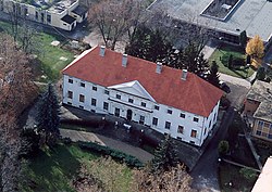
 Palace | |
| Coordinates: 45°58′02″N 18°31′06″E / 45.96729°N 18.51825°E | |
| Country | |
| County | Baranya |
| District | Bóly |
| Area | |
| • Total | 25.44 km2 (9.82 sq mi) |
| Population (2022)
[1] | |
| • Total | 3,819 |
| • Density | 150/km2 (390/sq mi) |
| Time zone | UTC+1 ( CET) |
| • Summer ( DST) | UTC+2 ( CEST) |
| Postal code | 7754 |
| Area code | (+36) 69 |
| Geocode | 33154 |
| Website |
telepules |
Bóly ( German: Bohl; Croatian: Boja) is a town in Baranya County, Hungary. Until the end of World War II, the inhabitants were Danube Swabians, also called locally as Stifolder, because their ancestors arrived in the 17th and 18th centuries from Fulda (district). [2] Most of the former German settlers were expelled to Allied-occupied Germany and Allied-occupied Austria in 1945–1948, under the Potsdam Agreement. [3] Only a few Germans of Hungary live there, the majority today are the descendants of Hungarians from the Czechoslovak–Hungarian population exchange. They got the houses of the former Danube Swabian inhabitants.
Twin towns – sister cities
Bóly is twinned with:
-
 Semriach, Austria
 -
 Heroldsberg, Germany
 -
 Cernat, Romania
 -
 Neded, Slovakia
Sports
The local sports team is called Bólyi SE.
References
- ^ a b "Detailed Gazetteer of Hungary". Hungarian Central Statistics Office. Retrieved 18 November 2022.
- ^ "Die Stiffoller und der Stiffolde" (PDF). feked.hu (in German). Retrieved 7 September 2023.
- ^ "Die Vertreibung – Landsmannschaft der Deutschen aus Ungarn".
External links
- Official website in Hungarian, English and German
Bóly
Bohl | |
|---|---|
 Palace | |
| Coordinates: 45°58′02″N 18°31′06″E / 45.96729°N 18.51825°E | |
| Country | |
| County | Baranya |
| District | Bóly |
| Area | |
| • Total | 25.44 km2 (9.82 sq mi) |
| Population (2022)
[1] | |
| • Total | 3,819 |
| • Density | 150/km2 (390/sq mi) |
| Time zone | UTC+1 ( CET) |
| • Summer ( DST) | UTC+2 ( CEST) |
| Postal code | 7754 |
| Area code | (+36) 69 |
| Geocode | 33154 |
| Website |
telepules |
Bóly ( German: Bohl; Croatian: Boja) is a town in Baranya County, Hungary. Until the end of World War II, the inhabitants were Danube Swabians, also called locally as Stifolder, because their ancestors arrived in the 17th and 18th centuries from Fulda (district). [2] Most of the former German settlers were expelled to Allied-occupied Germany and Allied-occupied Austria in 1945–1948, under the Potsdam Agreement. [3] Only a few Germans of Hungary live there, the majority today are the descendants of Hungarians from the Czechoslovak–Hungarian population exchange. They got the houses of the former Danube Swabian inhabitants.
Twin towns – sister cities
Bóly is twinned with:
-
 Semriach, Austria
 -
 Heroldsberg, Germany
 -
 Cernat, Romania
 -
 Neded, Slovakia
Sports
The local sports team is called Bólyi SE.
References
- ^ a b "Detailed Gazetteer of Hungary". Hungarian Central Statistics Office. Retrieved 18 November 2022.
- ^ "Die Stiffoller und der Stiffolde" (PDF). feked.hu (in German). Retrieved 7 September 2023.
- ^ "Die Vertreibung – Landsmannschaft der Deutschen aus Ungarn".
External links
- Official website in Hungarian, English and German


