Łagiewniki-Borek Fałęcki | |
|---|---|
.jpg) | |
 Location of Łagiewniki-Borek Fałęcki within Kraków | |
| Coordinates: 50°0′59.3″N 19°55′15.9″E / 50.016472°N 19.921083°E | |
| Country | |
| Voivodeship | Lesser Poland |
| County/City | Kraków |
| Government | |
| • President | Jan Pietras |
| Area | |
| • Total | 5.42 km2 (2.09 sq mi) |
| Population (2014) | |
| • Total | 14,859 |
| • Density | 2,700/km2 (7,100/sq mi) |
| Time zone | UTC+1 ( CET) |
| • Summer ( DST) | UTC+2 ( CEST) |
| Area code | +48 12 |
| Website | http://www.dzielnica9.krakow.pl |
| Part of a series on the |
| Divine Mercy |
|---|
 |
| Forms |
| People |
| Places |
| Other |
Łagiewniki-Borek Fałęcki is one of 18 districts of Kraków, located in the southern part of the city. The name Łagiewniki-Borek Fałęcki comes from two villages that are now parts of the district.
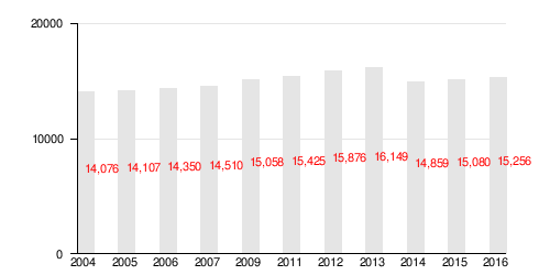
According to the Central Statistical Office data, the district's area is 5.42 square kilometres (2.09 square miles) and 14 859 people inhabit Łagiewniki-Borek Fałęcki. [1]
Subdivisions of Łagiewniki-Borek Fałęcki
Łagiewniki-Borek Fałęcki is divided into smaller subdivisions ( osiedles). Here's a list of them.
- Borek Fałęcki
- Łagiewniki
- Osiedle Cegielniana
- Osiedle Zaułek Jugowicki
Population
References
- ^ "Information about Łagiewniki-Borek Fałęcki district". Biuletyn Informacji Publicznej. Retrieved 30 August 2017.
External links
| ||
|
| This Poland location article is a stub. You can help Wikipedia by expanding it. |
Łagiewniki-Borek Fałęcki | |
|---|---|
|
| |
|
Location of Łagiewniki-Borek Fałęcki within Kraków | |
| Coordinates: 50°0′59.3″N 19°55′15.9″E / 50.016472°N 19.921083°E | |
| Country | |
| Voivodeship | Lesser Poland |
| County/City | Kraków |
| Government | |
| • President | Jan Pietras |
| Area | |
| • Total | 5.42 km2 (2.09 sq mi) |
| Population (2014) | |
| • Total | 14,859 |
| • Density | 2,700/km2 (7,100/sq mi) |
| Time zone | UTC+1 ( CET) |
| • Summer ( DST) | UTC+2 ( CEST) |
| Area code | +48 12 |
| Website | http://www.dzielnica9.krakow.pl |
| Part of a series on the |
| Divine Mercy |
|---|
|
|
| Forms |
| People |
| Places |
| Other |
Łagiewniki-Borek Fałęcki is one of 18 districts of Kraków, located in the southern part of the city. The name Łagiewniki-Borek Fałęcki comes from two villages that are now parts of the district.
According to the Central Statistical Office data, the district's area is 5.42 square kilometres (2.09 square miles) and 14 859 people inhabit Łagiewniki-Borek Fałęcki. [1]
Subdivisions of Łagiewniki-Borek Fałęcki
Łagiewniki-Borek Fałęcki is divided into smaller subdivisions ( osiedles). Here's a list of them.
- Borek Fałęcki
- Łagiewniki
- Osiedle Cegielniana
- Osiedle Zaułek Jugowicki
Population
References
- ^ "Information about Łagiewniki-Borek Fałęcki district". Biuletyn Informacji Publicznej. Retrieved 30 August 2017.
External links
| ||
|
| This Poland location article is a stub. You can help Wikipedia by expanding it. |