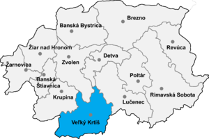
Čeláre ( Hungarian: Csalár) is a village and municipality in the Veľký Krtíš District of the Banská Bystrica Region of southern Slovakia.
History
The village was first mentioned in 1436 (Chalard). It belonged to many feudal families, and Feudal Law was always strictly applied here. From 1554 to 1593 it was occupied by Turks. Until 1918 and from 1938 to 1944 it belonged to Hungary.
Genealogical resources
The records for genealogical research are available at the state archive "Statny Archiv in Banska Bystrica, Slovakia"
- Lutheran church records (births/marriages/deaths): 1745-1931 (parish B)
See also
External links
- http://www.statistics.sk/mosmis/eng/run.html
- http://www.e-obce.sk/obec/celare/celare.html
- Surnames of living people in Celare
48°08′30″N 19°29′27″E / 48.1418°N 19.4907°E