Photos • Location
(Redirected from
Zarrinshahr Airport)
ZarrinShahr Airport | |||||||||||
|---|---|---|---|---|---|---|---|---|---|---|---|
| Summary | |||||||||||
| Airport type | Light | ||||||||||
| Owner | Mohamad Ramezni Pour | ||||||||||
| Operator | Ministry of Defence and Armed Forces Logistics (Iran) | ||||||||||
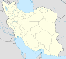
| Location | Isfahan, Iran | ||||||||||
| Coordinates | 32°19′38″N 51°22′38″E / 32.32722°N 51.37722°E | ||||||||||
| Map | |||||||||||
| Runways | |||||||||||
| |||||||||||
Zarrinshahr Airport is located in the Zarrin shahr area of Isfahan, one of the functions of Lenjan city. [1] [2] [3] [4]
- ^ "OIFV - Zarrinshahr Airport | SkyVector". skyvector.com. Retrieved 2021-05-17.
- ^ "Zarrinshahr - Iran". World Airport Codes. Retrieved 2021-05-17.
-
^ IR-04), Esfahan (province; Iran (IR); Great Circle Mapper: Map, Blue Marble; Google Maps: Map, Satellite; Yandex Maps: Map, Satellite; Map, Bing Maps; Retrieval, FAA PilotWeb: NOTAM; Iran, CIA: The World Factbook; DAFIF® (see important details), cycle 0603.
"OIFV - Zarrinshahr [Zarrinshahr Airport], 04, IR - Airport - Great Circle Mapper". www.gcmap.com. Retrieved 2021-05-17.
{{ cite web}}:|last4=has generic name ( help)CS1 maint: numeric names: authors list ( link) - ^ "Zarrinshahr Airport - OIFV". Airport Guide. Retrieved 2021-05-17.
