Photos • Location
Yinmabin Township | |
|---|---|
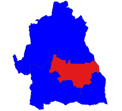
 Location in Yinmabin district | |
 Location in Sagaing region | |
| Coordinates: 22°5′N 94°54′E / 22.083°N 94.900°E | |
| Country | |
| Region | Sagaing Region |
| District | Yinmabin District |
| Capital | Yinmabin |
| Time zone | UTC+6.30 ( MST) |
Yinmabin Township is a township in Yinmabin District in the Sagaing Division of Myanmar. [1] The principal town is Yinmabin.
Notably, 10 kilometers (6.2 mi) southeast of Yinmabin, is the Phowintaung Buddhist cave complex.
- ^ "Myanmar States/Divisions & Townships Overview Map" Archived December 3, 2010, at the Wayback Machine Myanmar Information Management Unit (MIMU)
- Maplandia World Gazetteer - map showing the township boundary
Yinmabin Township | |
|---|---|
 Location in Yinmabin district | |
 Location in Sagaing region | |
| Coordinates: 22°5′N 94°54′E / 22.083°N 94.900°E | |
| Country | |
| Region | Sagaing Region |
| District | Yinmabin District |
| Capital | Yinmabin |
| Time zone | UTC+6.30 ( MST) |
Yinmabin Township is a township in Yinmabin District in the Sagaing Division of Myanmar. [1] The principal town is Yinmabin.
Notably, 10 kilometers (6.2 mi) southeast of Yinmabin, is the Phowintaung Buddhist cave complex.
- ^ "Myanmar States/Divisions & Townships Overview Map" Archived December 3, 2010, at the Wayback Machine Myanmar Information Management Unit (MIMU)
- Maplandia World Gazetteer - map showing the township boundary


