Yanling County
鄢陵县 Yenling | |
|---|---|
 Yanling in Xuchang | |
 Xuchang in Henan | |
| Coordinates: 34°06′07″N 114°10′37″E / 34.102°N 114.177°E | |
| Country | People's Republic of China |
| Province | Henan |
| Prefecture-level city | Xuchang |
| Towns | 12 |
| Area | |
| • Total | 866 km2 (334 sq mi) |
| Population (2019)
[4] | |
| • Total | 574,100 |
| • Density | 660/km2 (1,700/sq mi) |
| Time zone | UTC+8 ( China Standard) |
| Postal code | 461200 |
| Website |
www |
Yanling County ( simplified Chinese: 鄢陵 县; traditional Chinese: 鄢陵 縣; pinyin: Yānlíng Xiàn) is a county in the central part of Henan province, China. It is the easternmost county-level division of the prefecture-level city of Xuchang.
History

Human habitation of the area began around 6000 BC. [1][ better source needed]
In the early Zhou dynasty, the area became the state of Yan (鄢國). [1] [2]
In the Eastern Zhou dynasty, the area became known as Yan Yi (鄢邑) after the destruction of the state of Yan under Duke Wu of Zheng ( 鄭武公) [1] [2] in the early part of the reign of King Ping of Zhou (after 770 BC). [5]
In the fifth month of 722 BC, Duke Zhuang of Zheng defeated his younger brother Gongshu Duan ( 共叔段) north of present-day Yanling County. [1] [2] [6] [7]
The famous Battle of Yanling (575 BC) took place in Yanling County.
Yanling County was established during the Western Han dynasty in the year 201 BC. [1] [2] [8]
In 2014, six men in Yanling County were fined 2,000 yuan each for their roles in catching 1,689 wild geckos in Zhangqiao. [9]
Administrative divisions
The county is made up of twelve towns: [8] [10] [11]
Towns:
- Anling ( 安陵 镇), Malan (Ma-lan-chen; [12] 马栏 镇), Bailiang ( 柏梁 镇), Chenhuadian ( 陈化店 镇), Wangtian ( 望田 镇), Zhangqiao (Chang-ch'iao; [13] 张桥 镇, formerly 张桥 乡), Nanwu ( 南坞 镇, formerly 南坞 乡), Taocheng (T'ao-ch'eng; [13] 陶城 镇, formerly 陶城 乡), Zhile ( 只乐 镇, formerly 只乐 乡), Dama ( 大马 镇, formerly 大马 乡), Pengdian (P'eng-tien; 彭店 镇, formerly 彭店 乡), Mafang ( 马坊 镇, formerly 马坊 乡)
Climate
| Climate data for Yanling (1991–2020 normals, extremes 1981–2010) | |||||||||||||
|---|---|---|---|---|---|---|---|---|---|---|---|---|---|
| Month | Jan | Feb | Mar | Apr | May | Jun | Jul | Aug | Sep | Oct | Nov | Dec | Year |
| Record high °C (°F) | 18.8 (65.8) |
23.7 (74.7) |
29.3 (84.7) |
32.8 (91.0) |
38.7 (101.7) |
40.5 (104.9) |
40.7 (105.3) |
37.6 (99.7) |
36.3 (97.3) |
35.6 (96.1) |
27.8 (82.0) |
20.5 (68.9) |
40.7 (105.3) |
| Mean daily maximum °C (°F) | 6.0 (42.8) |
9.8 (49.6) |
15.4 (59.7) |
21.7 (71.1) |
27.2 (81.0) |
32.0 (89.6) |
32.2 (90.0) |
30.7 (87.3) |
27.0 (80.6) |
22.1 (71.8) |
14.5 (58.1) |
8.1 (46.6) |
20.6 (69.0) |
| Daily mean °C (°F) | 0.5 (32.9) |
3.9 (39.0) |
9.3 (48.7) |
15.4 (59.7) |
21.0 (69.8) |
25.7 (78.3) |
27.3 (81.1) |
25.8 (78.4) |
21.2 (70.2) |
15.5 (59.9) |
8.4 (47.1) |
2.4 (36.3) |
14.7 (58.5) |
| Mean daily minimum °C (°F) | −3.8 (25.2) |
−0.8 (30.6) |
4.0 (39.2) |
9.6 (49.3) |
15.3 (59.5) |
20.3 (68.5) |
23.3 (73.9) |
22.1 (71.8) |
16.8 (62.2) |
10.5 (50.9) |
3.5 (38.3) |
−1.9 (28.6) |
9.9 (49.8) |
| Record low °C (°F) | −17.7 (0.1) |
−17.9 (−0.2) |
−8.4 (16.9) |
−1.9 (28.6) |
2.2 (36.0) |
11.1 (52.0) |
16.8 (62.2) |
12.1 (53.8) |
6.4 (43.5) |
−1.6 (29.1) |
−16.4 (2.5) |
−15.4 (4.3) |
−17.9 (−0.2) |
| Average precipitation mm (inches) | 12.7 (0.50) |
16.4 (0.65) |
27.2 (1.07) |
41.4 (1.63) |
65.8 (2.59) |
89.0 (3.50) |
172.2 (6.78) |
134.5 (5.30) |
82.1 (3.23) |
42.7 (1.68) |
33.0 (1.30) |
12.6 (0.50) |
729.6 (28.73) |
| Average precipitation days (≥ 0.1 mm) | 4.3 | 5.1 | 5.6 | 6.0 | 7.8 | 7.7 | 11.3 | 11.0 | 8.7 | 6.5 | 6.1 | 3.8 | 83.9 |
| Average snowy days | 3.6 | 3.1 | 1.2 | 0.1 | 0 | 0 | 0 | 0 | 0 | 0 | 1.1 | 2.3 | 11.4 |
| Average relative humidity (%) | 67 | 66 | 66 | 70 | 70 | 68 | 81 | 85 | 80 | 74 | 72 | 68 | 72 |
| Mean monthly sunshine hours | 121.8 | 132.1 | 171.3 | 199.8 | 212.0 | 195.8 | 188.2 | 173.2 | 157.7 | 149.2 | 134.7 | 127.6 | 1,963.4 |
| Percent possible sunshine | 39 | 42 | 46 | 51 | 49 | 45 | 43 | 42 | 43 | 43 | 44 | 42 | 44 |
| Source: China Meteorological Administration [14] [15] | |||||||||||||
Economy
The county's primary agricultural products include wheat, beans, sweet potatoes, cotton and tobacco among others. [2] The county is known for growing flowers which began during the Tang dynasty and flourished during the Song dynasty. [1] [16] The county is therefore known as 'Flower County' (花县, or also 花都 and 花乡). [1] [2] Industries in the county include machinery manufacturing, fertilizer, concrete and wine making among others. [2]
In 2017, the value of the county's output in the flower and plant industry reached 7.1 billion yuan (1.03 billion U.S. dollars). [17][ better source needed]
Demographics
| Year | Pop. | ±% p.a. |
|---|---|---|
| 2000 | 564,477 | — |
| 2010 | 551,611 | −0.23% |
| [3] [8] | ||
The population of the county decreased between the 2000 census and 2010 census.
Transportation
People from Yanling County
- Lü Debin (1953–2005), executed politician
References
- ^
a
b
c
d
e
f
g
h
鄢陵概况 [Yanling Overview]. 鄢陵人民政府网 (in Simplified Chinese). 2 May 2018. Retrieved 4 January 2019.
鄢陵县隶属河南省许昌市,现辖12个镇,386个行政村(社区),总人口66.7万人,总面积866平方公里(耕地99.6万亩)。{...}早在8000年前,先民们便开始在此繁衍生息,周初封为鄢国,东周改称鄢邑,汉初置县。郑伯克段于鄢、晋楚鄢陵之战、唐雎不辱使命等事件均发生于此。{...}鄢陵是"南花北移、北花南迁"的天然驯化基地,花木栽培始于唐、兴于宋,素有"花都""花乡"的美称,享有"鄢陵蜡梅冠天下"的盛誉。
- ^
a
b
c
d
e
f
g
h 夏征农; 陈至立, eds. (September 2009). 辞海:第六版彩图本 [
Cihai (Sixth Edition in Color)] (in Chinese). 上海.
Shanghai: 上海辞书出版社.
Shanghai Lexicographical Publishing House. p. 2632.
ISBN
9787532628599.
鄢(yān)1古国名、邑名。西周封国。妘姓,在今河南鄢陵西北。春秋初被郑武公灭后为郑邑。《春秋》隐公元年(公元前722年):"郑伯克段于鄢。"即此。后改称鄢陵。{...}面积866平方千米。{...}西汉置县。{...}农产以小麦、大豆、甘薯、棉花、烟草等为主,并产花卉,有"花县"之称。工业有机械、化肥、水泥、酿酒等。
- ^
a
b
许昌市历史沿革 [Xuchang City Historical Evolution] (in Simplified Chinese). XZQH.org. 19 December 2016. Retrieved 4 January 2020.
1996年,鄢陵县面积871.6平方千米{...}2000年第五次人口普查,许昌市常住总人口4124086人,其中,魏都区373387人,许昌县737384人,鄢陵县564477人,襄城县679863人,禹州市1122669人,长葛市646306人。{...}2010年第六次人口普查,许昌市常住总人口4307488人,其中,魏都区498087人,许昌县767449人,鄢陵县551611人,襄城县671315人,禹州市1131896人,长葛市687130人。
- ^ 最新人口信息 www.hongheiku.com (in Chinese). hongheiku. Retrieved 2021-01-12.
-
^ 靳蓉鏡, ed. (1936).
File:鄢陵縣志 - 民國二十五年 (1936) - 卷00-15.pdf [File: Yanling County Annals - 25th year of the
Republic (1936) Chapter 00-15.pdf] (in Traditional Chinese). p. 37 – via
Wikimedia Commons.
平王初鄭武功滅鄢
-
^ 新譯古文觀止(增訂五版) [New Translation of
Guwen Guanzhi (Expanded and Revised, 5th edition)] (in Chinese (Taiwan)). Translated by
Hsieh Ping-ying, Hsiao-yu Chang (張孝裕) (5 ed.).
Taipei:
San Min Book Co., Ltd. 2012. pp. 1, 2.
ISBN
978-957-14-5607-2.
鄭伯克段于鄢{...}鄢,鄭國邑名,在今河南鄢陵北。
-
^ Stephen Durrant, Wai-yee Li, David Schaberg (2016).
Zuo Tradition / Zuozhuan: Commentary on the "Spring and Autumn Annals".
University of Washington Press. pp. 6, 7.
ISBN
9780295806730 – via
Google Books.
6 Yan 鄢 was located north of present-day Yanling County 鄢陵縣, Henan.{...} LORD YIN 1 (722 BCE) ANNALS{...}In summer, in the fifth month, the Liege of Zheng overcame Duan (Gongshu Duan) at Yan.6
{{
cite book}}
: CS1 maint: multiple names: authors list ( link) - ^
a
b
c
鄢陵县历史沿革 [Yanling County Historical Evolution] (in Simplified Chinese). XZQH.org. 20 August 2013. Retrieved 4 January 2020.
西汉高祖六年(公元前201)置鄢陵县。{...}2000年第五次人口普查,鄢陵县总人口564477人,{...}2012年,大马乡、陶城乡、张桥乡撤乡设镇。调整后,全县辖8个镇、4个乡:安陵镇、马栏镇、柏梁镇、陈化店镇、望田镇、大马镇、陶城镇、张桥镇、南坞乡、只乐乡、彭店乡、马坊乡。
- ^ Zhuang Pinghui (22 December 2014). "Chinese men fined for catching almost 1,700 protected wild geckos in one night". South China Morning Post. Beijing. Retrieved 4 January 2020.
-
^
乡镇政府 [Township-level Division Governments]. 鄢陵人民政府网 (in Simplified Chinese). Retrieved 4 January 2020.
大马镇{...}马坊镇{...}只乐镇{...}安陵镇{...}望田镇{...}陶城镇{...}陈化店镇{...}彭店镇{...}柏梁镇{...}南坞镇{...}张桥镇{...}马栏镇
-
^
2018年统计用区划代码和城乡划分代码:鄢陵县 [2018 Statistical Area Numbers and Rural-Urban Area Numbers: Yanling County] (in Simplified Chinese).
National Bureau of Statistics of the People's Republic of China. 2018. Retrieved 4 January 2020.
统计用区划代码 名称 411024100000 安陵镇 411024101000 马栏镇 411024102000 柏梁镇 411024103000 陈化店镇 411024104000 望田镇 411024105000 大马镇 411024106000 陶城镇 411024107000 张桥镇 411024108000 彭店镇 411024109000 只乐镇 411024110000 南坞镇 411024111000 马坊镇
-
^
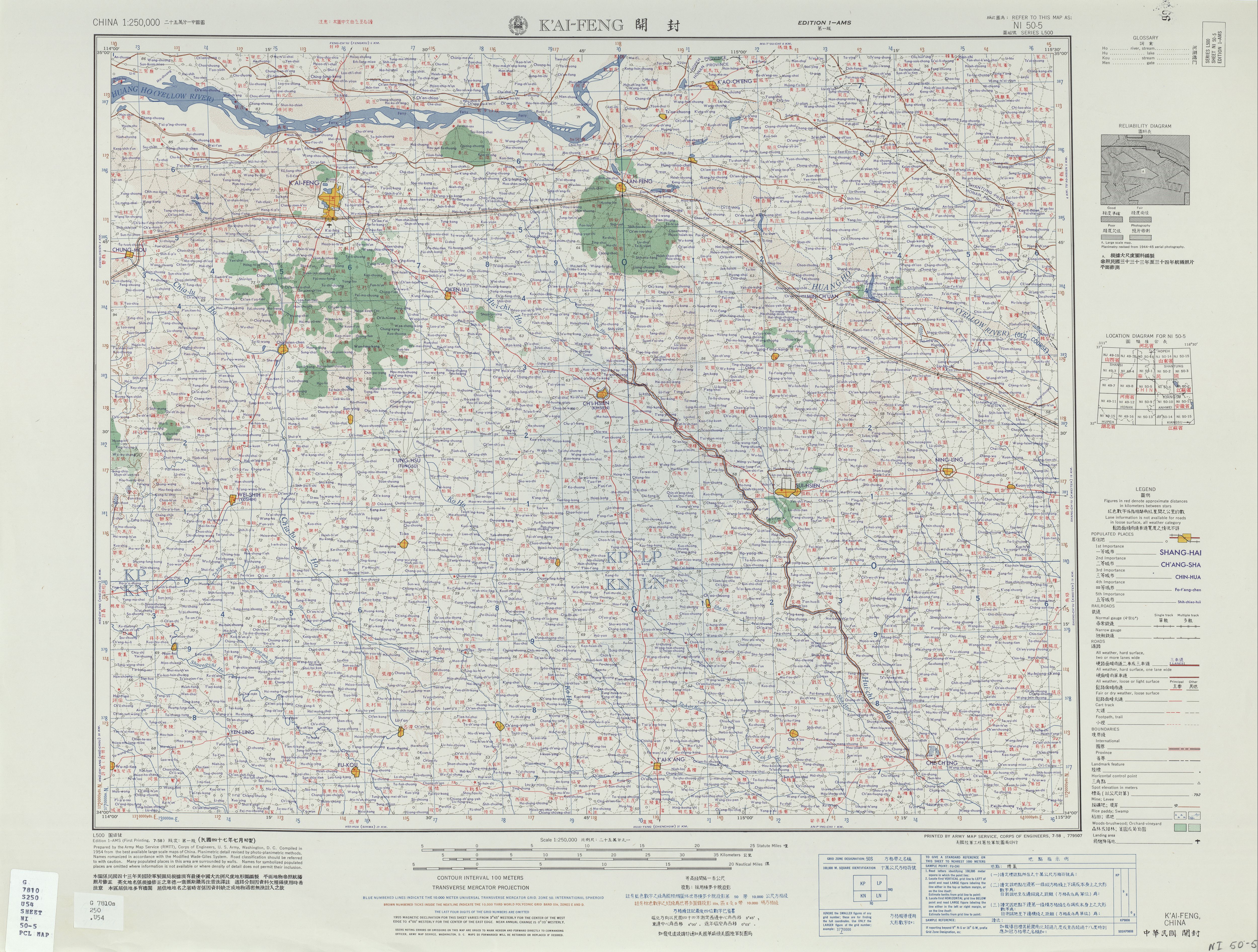
"NI 50-5 K'AI-FENG" (in English and Chinese).
Washington, D. C.:
Army Map Service. July 1958 – via
Perry–Castañeda Library Map Collection.
Ma-lan-chen
- ^
a
b
"NI 50-9 HUAI-YANG" (in English and Chinese).
Washington, D. C.:
Army Map Service. January 1965 – via
Perry–Castañeda Library Map Collection.
Chih-lo-chi{...}Chang-ch'iao 張橋{...}T'ao-ch'eng 陶城
- ^ 中国气象数据网 – WeatherBk Data (in Simplified Chinese). China Meteorological Administration. Retrieved 12 August 2023.
- ^ 中国气象数据网 (in Simplified Chinese). China Meteorological Administration. Retrieved 12 August 2023.
-
^ 王玉燕 (15 August 2019).
美都鄢陵縣 美哉花博園 [Beautiful City Yanling County Beautiful Flower Expo Park].
United Daily News (in Chinese (Taiwan)). Retrieved 4 January 2020.
許昌是大陸花木之鄉,有1千多年的種花歷史;其轄下鄢陵縣,素有「花都」美譽,花木產業歷史悠久,古有「鄢陵蠟梅冠天下」,今有「江北花卉數鄢陵」。
- ^ Liangyu, ed. (5 October 2018). "Flower and plant industry boosts rural economy in China's Henan". Xinhua News Agency. Archived from the original on October 5, 2018. Retrieved 4 January 2020.
Further reading
- 鄢陵志 - 嘉靖十六年 (1537) ('Yanling Annals - Sixteenth Year of the Jiajing Emperor (1537)') (in Chinese)
- 鄢陵縣志 - 順治十六年 (1659) ('Yanling County Annals - Sixteenth Year of the Shunzhi Emperor (1659)') (in Chinese)
- 鄢陵縣志 - 道光十三年 (1833) ('Yanling County Annals - Thirteenth Year of the Daoguang Emperor (1833)') (in Chinese)
- 鄢陵文獻志 - 同治四年 (1865) ('Yanling County Documents & Annals - Fourth Year of the Tongzhi Emperor (1865)') (in Chinese)
- 鄢陵縣志 - 民國二十五年 (1936) ('Yanling County Annals - Twenty-fifth Year of the Republic (1936)') (in Chinese)
External links
- 《生財有道》河南鄢陵:花木興 百業興 20190925 CCTV財經 ('Shengcai Youdao - Henan Yanling: Flowers in Bloom, Strong Economy 25 Sept 2019 CCTV-2') (in Chinese)
Yanling County
鄢陵县 Yenling | |
|---|---|
|
Yanling in Xuchang | |
|
Xuchang in Henan | |
| Coordinates: 34°06′07″N 114°10′37″E / 34.102°N 114.177°E | |
| Country | People's Republic of China |
| Province | Henan |
| Prefecture-level city | Xuchang |
| Towns | 12 |
| Area | |
| • Total | 866 km2 (334 sq mi) |
| Population (2019)
[4] | |
| • Total | 574,100 |
| • Density | 660/km2 (1,700/sq mi) |
| Time zone | UTC+8 ( China Standard) |
| Postal code | 461200 |
| Website |
www |
Yanling County ( simplified Chinese: 鄢陵 县; traditional Chinese: 鄢陵 縣; pinyin: Yānlíng Xiàn) is a county in the central part of Henan province, China. It is the easternmost county-level division of the prefecture-level city of Xuchang.
History
Human habitation of the area began around 6000 BC. [1][ better source needed]
In the early Zhou dynasty, the area became the state of Yan (鄢國). [1] [2]
In the Eastern Zhou dynasty, the area became known as Yan Yi (鄢邑) after the destruction of the state of Yan under Duke Wu of Zheng ( 鄭武公) [1] [2] in the early part of the reign of King Ping of Zhou (after 770 BC). [5]
In the fifth month of 722 BC, Duke Zhuang of Zheng defeated his younger brother Gongshu Duan ( 共叔段) north of present-day Yanling County. [1] [2] [6] [7]
The famous Battle of Yanling (575 BC) took place in Yanling County.
Yanling County was established during the Western Han dynasty in the year 201 BC. [1] [2] [8]
In 2014, six men in Yanling County were fined 2,000 yuan each for their roles in catching 1,689 wild geckos in Zhangqiao. [9]
Administrative divisions
The county is made up of twelve towns: [8] [10] [11]
Towns:
- Anling ( 安陵 镇), Malan (Ma-lan-chen; [12] 马栏 镇), Bailiang ( 柏梁 镇), Chenhuadian ( 陈化店 镇), Wangtian ( 望田 镇), Zhangqiao (Chang-ch'iao; [13] 张桥 镇, formerly 张桥 乡), Nanwu ( 南坞 镇, formerly 南坞 乡), Taocheng (T'ao-ch'eng; [13] 陶城 镇, formerly 陶城 乡), Zhile ( 只乐 镇, formerly 只乐 乡), Dama ( 大马 镇, formerly 大马 乡), Pengdian (P'eng-tien; 彭店 镇, formerly 彭店 乡), Mafang ( 马坊 镇, formerly 马坊 乡)
Climate
| Climate data for Yanling (1991–2020 normals, extremes 1981–2010) | |||||||||||||
|---|---|---|---|---|---|---|---|---|---|---|---|---|---|
| Month | Jan | Feb | Mar | Apr | May | Jun | Jul | Aug | Sep | Oct | Nov | Dec | Year |
| Record high °C (°F) | 18.8 (65.8) |
23.7 (74.7) |
29.3 (84.7) |
32.8 (91.0) |
38.7 (101.7) |
40.5 (104.9) |
40.7 (105.3) |
37.6 (99.7) |
36.3 (97.3) |
35.6 (96.1) |
27.8 (82.0) |
20.5 (68.9) |
40.7 (105.3) |
| Mean daily maximum °C (°F) | 6.0 (42.8) |
9.8 (49.6) |
15.4 (59.7) |
21.7 (71.1) |
27.2 (81.0) |
32.0 (89.6) |
32.2 (90.0) |
30.7 (87.3) |
27.0 (80.6) |
22.1 (71.8) |
14.5 (58.1) |
8.1 (46.6) |
20.6 (69.0) |
| Daily mean °C (°F) | 0.5 (32.9) |
3.9 (39.0) |
9.3 (48.7) |
15.4 (59.7) |
21.0 (69.8) |
25.7 (78.3) |
27.3 (81.1) |
25.8 (78.4) |
21.2 (70.2) |
15.5 (59.9) |
8.4 (47.1) |
2.4 (36.3) |
14.7 (58.5) |
| Mean daily minimum °C (°F) | −3.8 (25.2) |
−0.8 (30.6) |
4.0 (39.2) |
9.6 (49.3) |
15.3 (59.5) |
20.3 (68.5) |
23.3 (73.9) |
22.1 (71.8) |
16.8 (62.2) |
10.5 (50.9) |
3.5 (38.3) |
−1.9 (28.6) |
9.9 (49.8) |
| Record low °C (°F) | −17.7 (0.1) |
−17.9 (−0.2) |
−8.4 (16.9) |
−1.9 (28.6) |
2.2 (36.0) |
11.1 (52.0) |
16.8 (62.2) |
12.1 (53.8) |
6.4 (43.5) |
−1.6 (29.1) |
−16.4 (2.5) |
−15.4 (4.3) |
−17.9 (−0.2) |
| Average precipitation mm (inches) | 12.7 (0.50) |
16.4 (0.65) |
27.2 (1.07) |
41.4 (1.63) |
65.8 (2.59) |
89.0 (3.50) |
172.2 (6.78) |
134.5 (5.30) |
82.1 (3.23) |
42.7 (1.68) |
33.0 (1.30) |
12.6 (0.50) |
729.6 (28.73) |
| Average precipitation days (≥ 0.1 mm) | 4.3 | 5.1 | 5.6 | 6.0 | 7.8 | 7.7 | 11.3 | 11.0 | 8.7 | 6.5 | 6.1 | 3.8 | 83.9 |
| Average snowy days | 3.6 | 3.1 | 1.2 | 0.1 | 0 | 0 | 0 | 0 | 0 | 0 | 1.1 | 2.3 | 11.4 |
| Average relative humidity (%) | 67 | 66 | 66 | 70 | 70 | 68 | 81 | 85 | 80 | 74 | 72 | 68 | 72 |
| Mean monthly sunshine hours | 121.8 | 132.1 | 171.3 | 199.8 | 212.0 | 195.8 | 188.2 | 173.2 | 157.7 | 149.2 | 134.7 | 127.6 | 1,963.4 |
| Percent possible sunshine | 39 | 42 | 46 | 51 | 49 | 45 | 43 | 42 | 43 | 43 | 44 | 42 | 44 |
| Source: China Meteorological Administration [14] [15] | |||||||||||||
Economy
The county's primary agricultural products include wheat, beans, sweet potatoes, cotton and tobacco among others. [2] The county is known for growing flowers which began during the Tang dynasty and flourished during the Song dynasty. [1] [16] The county is therefore known as 'Flower County' (花县, or also 花都 and 花乡). [1] [2] Industries in the county include machinery manufacturing, fertilizer, concrete and wine making among others. [2]
In 2017, the value of the county's output in the flower and plant industry reached 7.1 billion yuan (1.03 billion U.S. dollars). [17][ better source needed]
Demographics
| Year | Pop. | ±% p.a. |
|---|---|---|
| 2000 | 564,477 | — |
| 2010 | 551,611 | −0.23% |
| [3] [8] | ||
The population of the county decreased between the 2000 census and 2010 census.
Transportation
People from Yanling County
- Lü Debin (1953–2005), executed politician
References
- ^
a
b
c
d
e
f
g
h
鄢陵概况 [Yanling Overview]. 鄢陵人民政府网 (in Simplified Chinese). 2 May 2018. Retrieved 4 January 2019.
鄢陵县隶属河南省许昌市,现辖12个镇,386个行政村(社区),总人口66.7万人,总面积866平方公里(耕地99.6万亩)。{...}早在8000年前,先民们便开始在此繁衍生息,周初封为鄢国,东周改称鄢邑,汉初置县。郑伯克段于鄢、晋楚鄢陵之战、唐雎不辱使命等事件均发生于此。{...}鄢陵是"南花北移、北花南迁"的天然驯化基地,花木栽培始于唐、兴于宋,素有"花都""花乡"的美称,享有"鄢陵蜡梅冠天下"的盛誉。
- ^
a
b
c
d
e
f
g
h 夏征农; 陈至立, eds. (September 2009). 辞海:第六版彩图本 [
Cihai (Sixth Edition in Color)] (in Chinese). 上海.
Shanghai: 上海辞书出版社.
Shanghai Lexicographical Publishing House. p. 2632.
ISBN
9787532628599.
鄢(yān)1古国名、邑名。西周封国。妘姓,在今河南鄢陵西北。春秋初被郑武公灭后为郑邑。《春秋》隐公元年(公元前722年):"郑伯克段于鄢。"即此。后改称鄢陵。{...}面积866平方千米。{...}西汉置县。{...}农产以小麦、大豆、甘薯、棉花、烟草等为主,并产花卉,有"花县"之称。工业有机械、化肥、水泥、酿酒等。
- ^
a
b
许昌市历史沿革 [Xuchang City Historical Evolution] (in Simplified Chinese). XZQH.org. 19 December 2016. Retrieved 4 January 2020.
1996年,鄢陵县面积871.6平方千米{...}2000年第五次人口普查,许昌市常住总人口4124086人,其中,魏都区373387人,许昌县737384人,鄢陵县564477人,襄城县679863人,禹州市1122669人,长葛市646306人。{...}2010年第六次人口普查,许昌市常住总人口4307488人,其中,魏都区498087人,许昌县767449人,鄢陵县551611人,襄城县671315人,禹州市1131896人,长葛市687130人。
- ^ 最新人口信息 www.hongheiku.com (in Chinese). hongheiku. Retrieved 2021-01-12.
-
^ 靳蓉鏡, ed. (1936).
File:鄢陵縣志 - 民國二十五年 (1936) - 卷00-15.pdf [File: Yanling County Annals - 25th year of the
Republic (1936) Chapter 00-15.pdf] (in Traditional Chinese). p. 37 – via
Wikimedia Commons.
平王初鄭武功滅鄢
-
^ 新譯古文觀止(增訂五版) [New Translation of
Guwen Guanzhi (Expanded and Revised, 5th edition)] (in Chinese (Taiwan)). Translated by
Hsieh Ping-ying, Hsiao-yu Chang (張孝裕) (5 ed.).
Taipei:
San Min Book Co., Ltd. 2012. pp. 1, 2.
ISBN
978-957-14-5607-2.
鄭伯克段于鄢{...}鄢,鄭國邑名,在今河南鄢陵北。
-
^ Stephen Durrant, Wai-yee Li, David Schaberg (2016).
Zuo Tradition / Zuozhuan: Commentary on the "Spring and Autumn Annals".
University of Washington Press. pp. 6, 7.
ISBN
9780295806730 – via
Google Books.
6 Yan 鄢 was located north of present-day Yanling County 鄢陵縣, Henan.{...} LORD YIN 1 (722 BCE) ANNALS{...}In summer, in the fifth month, the Liege of Zheng overcame Duan (Gongshu Duan) at Yan.6
{{
cite book}}
: CS1 maint: multiple names: authors list ( link) - ^
a
b
c
鄢陵县历史沿革 [Yanling County Historical Evolution] (in Simplified Chinese). XZQH.org. 20 August 2013. Retrieved 4 January 2020.
西汉高祖六年(公元前201)置鄢陵县。{...}2000年第五次人口普查,鄢陵县总人口564477人,{...}2012年,大马乡、陶城乡、张桥乡撤乡设镇。调整后,全县辖8个镇、4个乡:安陵镇、马栏镇、柏梁镇、陈化店镇、望田镇、大马镇、陶城镇、张桥镇、南坞乡、只乐乡、彭店乡、马坊乡。
- ^ Zhuang Pinghui (22 December 2014). "Chinese men fined for catching almost 1,700 protected wild geckos in one night". South China Morning Post. Beijing. Retrieved 4 January 2020.
-
^
乡镇政府 [Township-level Division Governments]. 鄢陵人民政府网 (in Simplified Chinese). Retrieved 4 January 2020.
大马镇{...}马坊镇{...}只乐镇{...}安陵镇{...}望田镇{...}陶城镇{...}陈化店镇{...}彭店镇{...}柏梁镇{...}南坞镇{...}张桥镇{...}马栏镇
-
^
2018年统计用区划代码和城乡划分代码:鄢陵县 [2018 Statistical Area Numbers and Rural-Urban Area Numbers: Yanling County] (in Simplified Chinese).
National Bureau of Statistics of the People's Republic of China. 2018. Retrieved 4 January 2020.
统计用区划代码 名称 411024100000 安陵镇 411024101000 马栏镇 411024102000 柏梁镇 411024103000 陈化店镇 411024104000 望田镇 411024105000 大马镇 411024106000 陶城镇 411024107000 张桥镇 411024108000 彭店镇 411024109000 只乐镇 411024110000 南坞镇 411024111000 马坊镇
-
^
"NI 50-5 K'AI-FENG" (in English and Chinese).
Washington, D. C.:
Army Map Service. July 1958 – via
Perry–Castañeda Library Map Collection.
Ma-lan-chen
- ^
a
b
"NI 50-9 HUAI-YANG" (in English and Chinese).
Washington, D. C.:
Army Map Service. January 1965 – via
Perry–Castañeda Library Map Collection.
Chih-lo-chi{...}Chang-ch'iao 張橋{...}T'ao-ch'eng 陶城
- ^ 中国气象数据网 – WeatherBk Data (in Simplified Chinese). China Meteorological Administration. Retrieved 12 August 2023.
- ^ 中国气象数据网 (in Simplified Chinese). China Meteorological Administration. Retrieved 12 August 2023.
-
^ 王玉燕 (15 August 2019).
美都鄢陵縣 美哉花博園 [Beautiful City Yanling County Beautiful Flower Expo Park].
United Daily News (in Chinese (Taiwan)). Retrieved 4 January 2020.
許昌是大陸花木之鄉,有1千多年的種花歷史;其轄下鄢陵縣,素有「花都」美譽,花木產業歷史悠久,古有「鄢陵蠟梅冠天下」,今有「江北花卉數鄢陵」。
- ^ Liangyu, ed. (5 October 2018). "Flower and plant industry boosts rural economy in China's Henan". Xinhua News Agency. Archived from the original on October 5, 2018. Retrieved 4 January 2020.
Further reading
- 鄢陵志 - 嘉靖十六年 (1537) ('Yanling Annals - Sixteenth Year of the Jiajing Emperor (1537)') (in Chinese)
- 鄢陵縣志 - 順治十六年 (1659) ('Yanling County Annals - Sixteenth Year of the Shunzhi Emperor (1659)') (in Chinese)
- 鄢陵縣志 - 道光十三年 (1833) ('Yanling County Annals - Thirteenth Year of the Daoguang Emperor (1833)') (in Chinese)
- 鄢陵文獻志 - 同治四年 (1865) ('Yanling County Documents & Annals - Fourth Year of the Tongzhi Emperor (1865)') (in Chinese)
- 鄢陵縣志 - 民國二十五年 (1936) ('Yanling County Annals - Twenty-fifth Year of the Republic (1936)') (in Chinese)
External links
- 《生財有道》河南鄢陵:花木興 百業興 20190925 CCTV財經 ('Shengcai Youdao - Henan Yanling: Flowers in Bloom, Strong Economy 25 Sept 2019 CCTV-2') (in Chinese)