Photos • Location
Witte Dorp | |
|---|---|
Neighborhood of Rotterdam | |
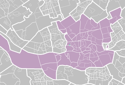
 Map of the Rotterdam districts with Witte Dorp marked out | |
| Coordinates: 51°54′53″N 4°25′34″E / 51.9147°N 4.4261°E | |
| Country | |
| Province | South Holland |
| COROP | Rotterdam |
| Borough | Delfshaven |
| Time zone | UTC+1 ( CET) |
Witte Dorp is a neighborhood of Rotterdam, Netherlands.
Witte Dorp | |
|---|---|
Neighborhood of Rotterdam | |
 Map of the Rotterdam districts with Witte Dorp marked out | |
| Coordinates: 51°54′53″N 4°25′34″E / 51.9147°N 4.4261°E | |
| Country | |
| Province | South Holland |
| COROP | Rotterdam |
| Borough | Delfshaven |
| Time zone | UTC+1 ( CET) |
Witte Dorp is a neighborhood of Rotterdam, Netherlands.