This article needs additional citations for
verification. (December 2016) |
Winseler
Wanseler (
Luxembourgish) | |
|---|---|
 Winseler seen from Schëllerfeld | |
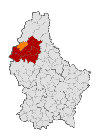
 Map of Luxembourg with Winseler highlighted in orange, and the canton in dark red | |
| Coordinates: 49°58′02″N 5°53′24″E / 49.9672°N 5.89°E | |
| Country | |
| Canton | Wiltz |
| Government | |
| • Mayor | Romain Schroeder |
| Area | |
| • Total | 30.42 km2 (11.75 sq mi) |
| • Rank | 25th of 100 |
| Highest elevation | 520 m (1,710 ft) |
| • Rank | 13th of 100 |
| Lowest elevation | 320 m (1,050 ft) |
| • Rank | 99th of 100 |
| Population (2023) | |
| • Total | 1,455 |
| • Rank | 90th of 100 |
| • Density | 48/km2 (120/sq mi) |
| • Rank | 97th of 100 |
| Time zone | UTC+1 ( CET) |
| • Summer ( DST) | UTC+2 ( CEST) |
| LAU 2 | LU0000808 |
| Website | winseler.lu |
Winseler ( Luxembourgish: Wanseler) is a commune and village in north-western Luxembourg.
It is part of the canton of Wiltz.
As of 2024 [update], the village of Winseler, which lies in the east of the commune, has a population of 197. [2] The ( commune) of Winseler has a population of 1116.
Following the last Luxembourg communal elections in 2017, Romain Schroeder was returned as Mayor, and Charles Pauly as Alderman. Other members of the Council include, Roland Esch, Christophe Hansen, Paul Kayser, Fernand Majerus, Marc Schmitz, and Will Toex. [3]
Other towns within the commune include Berlé, Doncols, Noertrange, Pommerloch, Grummelscheid, Schleif and Sonlez.
Graphs are unavailable due to technical issues. There is more info on
Phabricator and on
MediaWiki.org. |
Like Lasauvage in the south of Luxembourg, Doncols and Sonlez, were formerly known as French-speaking (or, strictly, in their cases, Walloon-speaking) villages.
- ^ "WINSELER - Syvicol". www.syvicol.lu. Retrieved 3 April 2019.
- ^ "Registre national des personnes physiques RNPP : Population par localité". data.public.lu. 2024-01-07.
- ^ "Conseil communal - Administration - Commune de Winseler - Grand-Duché de Luxembourg". www.winseler.lu. Retrieved 3 April 2019.
- ^ "Population par canton et commune". statistiques.public.lu. Retrieved 11 January 2022.
-
 Media related to
Winseler at Wikimedia Commons
This article needs additional citations for
verification. (December 2016) |
Winseler
Wanseler (
Luxembourgish) | |
|---|---|
 Winseler seen from Schëllerfeld | |
 Map of Luxembourg with Winseler highlighted in orange, and the canton in dark red | |
| Coordinates: 49°58′02″N 5°53′24″E / 49.9672°N 5.89°E | |
| Country | |
| Canton | Wiltz |
| Government | |
| • Mayor | Romain Schroeder |
| Area | |
| • Total | 30.42 km2 (11.75 sq mi) |
| • Rank | 25th of 100 |
| Highest elevation | 520 m (1,710 ft) |
| • Rank | 13th of 100 |
| Lowest elevation | 320 m (1,050 ft) |
| • Rank | 99th of 100 |
| Population (2023) | |
| • Total | 1,455 |
| • Rank | 90th of 100 |
| • Density | 48/km2 (120/sq mi) |
| • Rank | 97th of 100 |
| Time zone | UTC+1 ( CET) |
| • Summer ( DST) | UTC+2 ( CEST) |
| LAU 2 | LU0000808 |
| Website | winseler.lu |
Winseler ( Luxembourgish: Wanseler) is a commune and village in north-western Luxembourg.
It is part of the canton of Wiltz.
As of 2024 [update], the village of Winseler, which lies in the east of the commune, has a population of 197. [2] The ( commune) of Winseler has a population of 1116.
Following the last Luxembourg communal elections in 2017, Romain Schroeder was returned as Mayor, and Charles Pauly as Alderman. Other members of the Council include, Roland Esch, Christophe Hansen, Paul Kayser, Fernand Majerus, Marc Schmitz, and Will Toex. [3]
Other towns within the commune include Berlé, Doncols, Noertrange, Pommerloch, Grummelscheid, Schleif and Sonlez.
Graphs are unavailable due to technical issues. There is more info on
Phabricator and on
MediaWiki.org. |
Like Lasauvage in the south of Luxembourg, Doncols and Sonlez, were formerly known as French-speaking (or, strictly, in their cases, Walloon-speaking) villages.
- ^ "WINSELER - Syvicol". www.syvicol.lu. Retrieved 3 April 2019.
- ^ "Registre national des personnes physiques RNPP : Population par localité". data.public.lu. 2024-01-07.
- ^ "Conseil communal - Administration - Commune de Winseler - Grand-Duché de Luxembourg". www.winseler.lu. Retrieved 3 April 2019.
- ^ "Population par canton et commune". statistiques.public.lu. Retrieved 11 January 2022.
-
 Media related to
Winseler at Wikimedia Commons
