| This page is an archive. Do not edit the contents of this page. Please direct any additional comments to the current main page. |

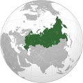
Orthographic map of Russia with long-term occupied territories
{{ resolved}}
-
 Current map in the article, with Crimea and four oblasts of Ukraine in light green
 -
 Example map with only Crimea in light green
 -
 Source for the line of contact: SVG map of Ukraine with the occupied territories
 -
 Finished map
_-_Annexed_Territories_disputed.svg)
_-_Crimea_disputed.svg)

_-_disputed.svg)
- Article(s)
- Russia
- Request
- I’m asking for a green-and-grey locator map of Russia, suitable for the article’s infobox, including in light green the territories that had been persistently occupied for about seven years from February 2015 to February 2022. That includes 1) the southernmost islands involved in the Kuril Islands dispute which are already in light green, and 2) in Ukraine, the peninsula of Crimea and the actual territories east of the line of contact specified in the Minsk agreements, occupied by the Donetsk People's Republic and Luhansk People's Republic.
- I am happy to do any editing necessary on an SVG image myself, if someone can just run the right sources through the perl script for locator maps.
- The relevant map convention: Wikipedia:WikiProject Maps/Conventions/Orthographic maps
- Other sources for the Minsk line of contact:
- Thanks. — Michael Z. 22:35, 5 October 2022 (UTC)
- Discussion
- @ Mzajac: are you after a similar map to this one (but centred on Russia instead of Ukraine)? M.Bitton ( talk) 22:49, 5 October 2022 (UTC)
Blank Upper Silesian Industrial Region svg
-
 Finished request

- Article(s)
- Ekstraklasa, I liga, all articles in Category:Ekstraklasa seasons, all articles in Category:I liga seasons
- Request
Hello, is it possible to create a map of the Upper Silesian Industrial Region, shown here:

In a blank svg format as exampled here (neighboring Gliwice County):

I hasten to add there is a svg map of the voivodeship:

I would be very grateful and this could be used in so many articles, not just the ones I mentioned.
Abcmaxx ( talk) 09:55, 18 October 2022 (UTC)
- Discussion
- @
Berrely: yes!! Thank you! One minor point, is the eastern voivodeship border correct?
Abcmaxx (
talk) 12:40, 18 October 2022 (UTC)
-
Abcmaxx I've uploaded it here:
File:Upper Silesian Industrial Region location map.svg, as for the borders, I downloaded them from the official geoportal of Poland's website, so they should be correct. –
Berrely •
T∕
C 12:58, 18 October 2022 (UTC)
- @
Berrely: thank you so much!
Abcmaxx (
talk) 13:12, 18 October 2022 (UTC)
- Please ping me if you want any changes or have any further queries :) –
Berrely •
T∕
C 13:15, 18 October 2022 (UTC)
- @ Berrely: I have just tried it out at I liga#Stadiums and locations but it didn't seem to do the trick. I triple checked the coordinates, but it's still not placing Sosnowiec in Sosnowiec, Katowice in Katowice etc., they all seem to want to be in Tychy. Any ideas? Abcmaxx ( talk) 13:29, 18 October 2022 (UTC)
- Please ping me if you want any changes or have any further queries :) –
Berrely •
T∕
C 13:15, 18 October 2022 (UTC)
- @
Berrely: thank you so much!
Abcmaxx (
talk) 13:12, 18 October 2022 (UTC)
-
Abcmaxx I've uploaded it here:
File:Upper Silesian Industrial Region location map.svg, as for the borders, I downloaded them from the official geoportal of Poland's website, so they should be correct. –
Berrely •
T∕
C 12:58, 18 October 2022 (UTC)
- @
Berrely: yes!! Thank you! One minor point, is the eastern voivodeship border correct?
Abcmaxx (
talk) 12:40, 18 October 2022 (UTC)
Realms territories and protectorates of Elizabeth II map - Southern Cameroons

- Article(s)
- Any article this map already appears on.
- Request
- w:Southern Cameroons was part of a British mandate -- 112.118.57.99 ( talk) 16:27, 12 September 2022 (UTC)
- Discussion
Blank 118th Congress Map
- Article(s)
- 118th United States Congress and related
- Request
- It seems striking to me that we don't have a blank map showing the redistricted maps for the US House of Representatives. File:2022 United States House of Representatives elections retirements or losses of renomination map.svg on Commons shows the Districts, but with color-coding. Any way to strip the color out and get a blank map? -- Hog Farm Talk 19:24, 27 October 2022 (UTC)
- Discussion
@
Hog Farm: it's very easy to strip those colours: open the file (using a decent text editor) and delete everything between .District {stroke-width:.17;} (on line 9) and </style>" (line 456). Then, replace the fill colour by changing .District {fill:#6d6d6d;} (on line 7) into .District {fill:#c0c0c0;}.
M.Bitton (
talk) 20:07, 27 October 2022 (UTC)
- @ M.Bitton: - What sort of text editor would work? (I'm basically useless with code, and I think the closest thing I have to a text editor currently is Windows Notepad. Hog Farm Talk 02:11, 28 October 2022 (UTC)
@ Hog Farm: It appears that there's already a blank map at File:US House 2022.svg, is that what you want? — twotwofourtysix( talk || edits) 02:49, 28 October 2022 (UTC)
- Yes, thank you! It just wasn't in the categories I was expecting. So {{ resolved}}
Map of Arabic vernaculars
-
 Current map

- Article(s)
- Arabic
- Varieties of Arabic
- Levantine Arabic (and other articles about one specific variety)
- Request
- As discussed in Talk:Arabic#Proposal to Remove Two Maps the only map of Arabic vernaculars that we have is: original research, full of errors and not based on a high-quality reliable source. The list of all Arabic varieties recognized in the ISO 639-3 standard can be found here. Excluding Standard Arabic (arb) and adding Hassaniya Arabic (mey) and Maltese (mlt), there are 30 active Arabic vernaculars. We would like to display all Arabic varieties (and only them) on a single map (with one color for each variety) based on Ethnologue's maps (in linguistics, "Ethnologue...has become the standard reference, and its usefulness is hard to overestimate."):
Algeria, Morocco, Tunisia and Western Sahara- Hassaniya Arabic (mey)
- Moroccan Arabic (ary)
- Algerian Saharan Arabic (aao)
- Algerian Arabic (arq)
- Tunisian Arabic (aeb)
-
Libya and Egypt
- Libyan Arabic (ayl) (also called " Western Egyptian Bedawi Spoken Arabic" on the map)
- Egyptian Arabic (arz)
- Eastern Egyptian Bedawi Arabic (avl)
- Saidi Arabic (aec)
-
Mauritania
- Hassaniya Arabic (mey)
-
Niger
- Algerian Saharan Arabic (aao)
- Hassaniya Arabic (mey)
- Libyan Arabic (ayl)
- Chadian Arabic (shu) (called "Shuwa Arabic" on the map)
- Mali:
Central Mali,
Western Mali, and
All Mali
- Hassaniya Arabic (mey)
-
Northern Chad and
Southern Chad
- Chadian Arabic (shu, number "5" on these maps). Chadian Arabic is also "widespread" so the whole country outside the specific Chadian Arabic regions could then be hatched in the same color
-
Sudan
- Sudanese Arabic (apd) (widespread => hatched area?)
- This more accurate map (p. 194) could be used instead, and the rest of the country would be hatched
- Sudanese Arabic (apd) (widespread => hatched area?)
-
South Sudan
- Sudanese Arabic (apd) (widespread => hatched area?)
- Sudanese Creole Arabic (pga) (widespread => hatched area?)
- According to Ethnologue: " Central Equatoria, Eastern Equatoria, and Western Equatoria states: widespread, into Northern Bahr al Ghazal, Western Bahr al Ghazal, and Upper Nile states."
- Stefano Manfredi's Árabi Júba : un pidgin-créole du Soudan du Sud has a map of Juba Arabic, p. 11: we could use it for pga and hatch the rest of the country
-
Jordan and Syria
- Najdi Arabic (ars)
- Eastern Egyptian Bedawi Arabic (avl, called "Levantine Bedawi" on the map)
- South Levantine Arabic (ajp)
- North Levantine Arabic (apc)
- North Mesopotamian Arabic (ayp)
- Mesopotamian Arabic (acm)
-
Iraq
- Gulf Arabic (afb)
- Mesopotamian Arabic (acm)
- Najdi Arabic (ars)
- North Mesopotamian Arabic (ayp)
-
Bahrain, Kuwait, Qatar, Saudi Arabia and United Arab Emirates
- Baharna Arabic (abv)
- Gulf Arabic (afb)
- Najdi Arabic (ars)
- Hijazi Arabic (acw)
- Shihhi Arabic (ssh)
-
Oman
- Gulf Arabic (afb)
- Omani Arabic (acx)
- Shihhi Arabic (ssh)
- Baharna Arabic (abv)
- Dhofari Arabic (adf)
-
Yemen
- Sanaani Arabic (ayn)
- Ta'izzi-Adeni Arabic (acq)
- Hadrami Arabic (ayh)
-
North East of Nigeria
- Chadian Arabic (shu) (called "Shuwa Arabic" 215 on the map)
-
Northern Cameroon
- Chadian Arabic (shu) (called "Shuwa Arabic" 2 on the map)
-
Uzbekistan
- Uzbeki Arabic (auz)
-
Afghanistan
- Tajiki Arabic (abh)
-
Tajikistan
- Tajiki Arabic (abh)
-
Cyprus
- Cypriot Arabic (acy)
-
Central African Republic
- Chadian Arabic (shu) (also called Baggara Arabic: "Baggara Belt" on this map, just in the Central African Republic, we rely on Ethnologue for other countries)
- Malta
- Maltese (mlt) (whole island)
- Djibouti
- Ta'izzi-Adeni Arabic (acq): This source ("Figure 32.1 Map showing the Arabic‐speaking regions and the status of Arabic in the various countries (courtesy of Peter Behnstedt).", p. 524) and Ethnologue mention that Ta'izzi-Adeni Arabic (also called "Djibouti Arabic") is spoken in Djibouti. However, only about 10% of the population speaks it. So we could hatched the area or add a colored triangle.
- Senegal
- Hassaniya Arabic (mey): The above source (Figure 32.1) and Ethnologue mention that Hassaniya is spoken in Senegal. Hassaniya is also officially recognized by the Senegalese government. Regarding the location, Ethnologue says in the " Matam and Saint-Louis Regions". However, only about 20% of the population speaks it. So we could hatched the area or add a colored triangle.
- Eritrea
- Hijazi Arabic (acw): spoken in the Northern Red Sea Region and Southern Red Sea Region according to Ethnologue. However, only about 10% of the population speaks the language there, so we could hatched the area or add a colored triangle
-
File:Central Asian Arabic enclaves.png
- Khamse Arabs Tribe in Iran: Gulf Arabic (afb)
- Other areas in Iran: Uzbeki Arabic (auz)
- Areas in Uzbekistan: Uzbeki Arabic (auz)
- Areas in Afghanistan: Tajiki Arabic (abh)
- (it may overlap with the maps of Tajikistan, Uzbekistan, and Afghanistan as this is another source, but it's fine)
- Kenya and Uganda
- Nubi (kcn): Figure 32.1 displays the Nubi language, an Arabic-based creole. Ethnologue agrees with this definition ("Creole, Arabic based", "Conflicting reports of intelligibility with Juba Arabic [pga]. 90% of the lexicon comes from Arabic."). Nubi speakers are scattered across these countries. In Kenya, they are concentrated in Nairobi and Mombasa and in Uganda in Arua, Bombo, Koboko, Kumi, Luwero, Ngora, and Yumbe. However, these areas are small and Nubi speakers are only a minority of the population there. So could add colored triangles over Kenya and Uganda for Nubi as Figure 32.1 did. Because I'm afraid the hatched areas won't be visible.
- Iran
- Mesopotamian Arabic (acm) (not in free access => my screenshot, it shows the south west of Iran where [acm] is spoken, same area as on File:Árabe mesopotámico.png.) According to Ethnologue: " Bushehr province: Deylam county; Khuzestan province: southwest Zagros mountains, Shatt al Arab river area."
- Gulf Arabic (afb) (not in free access => my screenshot, it shows the south coast of Iran where [afb] is spoken, more or less the same area as on File:Penninsular Arabic.svg and File:Árabe del Golfo.PNG) According to Ethnologue: " Hormozgan province and nearby Persian gulf islands; also Bushehr, Fars, Kerman, and Yazd provinces."
-
Turkey
- North Mesopotamian Arabic (ayp)
- Mesopotamian Arabic (acm)
- The above map is not precise, we could add a triangle over that area, otherwise we can use "Map 9.2 ‘Bedouin’ and ‘sedentary’ Arabic dialect areas in the Northern Fertile Crescent" (p. 259) in Prochazka, Northern Fertile Crescent that is super accurate ( my screenshot: "Syrian dialects" = North Levantine Arabic // "Mesopotamian qeltu dialects" = North Mesopotamian Arabic // "Shawi dialects" & "Shammar dialects" = Mesopotamian Arabic). A simpler version is this one: File:Levantine Arabic 2022.svg
-
Shuwa Arabic
- Chadian Arabic (shu) (also called Baggara Arabic: "Baggara Belt" on this map): Add areas in Niger, Nigeria, Cameroon, Chad, Sudan, and South Sudan (if doable for the Sudans).
For Israel & Palestine- The basis is this map: File:Levantine Arabic 2022.svg
- BUT, in Israel, the Beersheba Subdistrict (dark blue) should be Eastern Egyptian Bedawi Arabic (avl) only ( source). So no South Levantine Arabic in this area.
In the West Bank: the Eastern part of the West Bank is controlled by Israel (with the exception of the area around Jericho) and South Levantine Arabic is not spoken there: blue on this map, white on this map. On the other hand, there are Bedouins in this area controlled by Israel ( source 1, source 2). The map is super complex, and we don't have super accurate sources either; so to make things simpler: the Eastern part of the West bank should be colored as Eastern Egyptian Bedawi Arabic (avl) (with the exception of the area around Jericho) while the rest of the West Bank (western part + area around Jericho) should be colored as South Levantine Arabic
Thanks for any help you can provide! A455bcd9 ( talk) 08:30, 5 September 2022 (UTC)
- Note: To allow the map to be used in different language editions, the legend should not be included in the SVG file. A455bcd9 ( talk) 19:28, 5 September 2022 (UTC)
- Discussion
- Are the maps' projections mentioned in their respective articles? M.Bitton ( talk) 14:14, 29 September 2022 (UTC)
- Projections are unfortunately not mentioned in these maps of countries, which makes it hard to superimpose them on a blank Mmap of the Middle East (I tried without success...). However, Ethnologue has other maps for each language (for instance ary). These language maps all use the same projection. Unfortunately, you need an account to access them. I could provide my credentials and/or screenshots though. A455bcd9 ( talk) 16:41, 29 September 2022 (UTC)
- Note that there is an ISO request to merge Northern and Southern Levantine Arabic.
[3] Evidently the linguistic distinction is urban vs rural; maybe there is a north/south divide in the rural lects, but that doesn't extend to the cities, as Ethnologue describes. The requesters are from the Polytechnique, Oxford and SOAS, so there's a good change this merger will be accepted.
— kwami (
talk) 21:38, 11 October 2022 (UTC)
- @ A455bcd9 Hi, maybe I can help you here. It's a complex request and to my understanding most (if not all, haven't checked all) of your sources are protected in some way and the maps can't be used to copy from, they can only be used as information. To me that means I can look at the maps and then by eye/hand transfer the areas to your requested map, I can't superimpose (if it's possible to find a base map with the same projection etc) the maps to copy them. So this means the requested map will not be as exact as you probably wants/expect it to be.
- If this is fine with you I can start working on this but I will need your help, knowledge and assistance all the way on the work on this map. --always ping me--
Goran tek-en (
talk) 15:33, 14 October 2022 (UTC)
- Hi @
Goran tek-en, thanks a lot for offering to help! Yes, it's totally fine if the borders aren't "perfect." Boundaries between dialects aren't clear anyway. I'm usually quite responsive on Wikipedia, and I'll be happy to help and assist you.
A455bcd9 (
talk) 16:08, 14 October 2022 (UTC)
- @ A455bcd9 So first we have to agree on the overall area the map should cover, is this the correct area? If not please tell me/show me which it should be, thanks. --always ping me-- Goran tek-en ( talk) 12:28, 15 October 2022 (UTC)
- Hi @
Goran tek-en, thanks a lot for offering to help! Yes, it's totally fine if the borders aren't "perfect." Boundaries between dialects aren't clear anyway. I'm usually quite responsive on Wikipedia, and I'll be happy to help and assist you.
A455bcd9 (
talk) 16:08, 14 October 2022 (UTC)
- @ Kwamikagami: just seeing your message now. I'm the main requester of this proposal :) The decision will be announced in January 2023. If it's not accepted, I hope the ISO 639-3 Registration Authority will at least give their criteria distinguishing South Levantine from North Levantine and the border between the areas where they are spoken. A455bcd9 ( talk) 12:34, 22 October 2022 (UTC)
![]() Request taken by --always ping me--
Goran tek-en (
talk) 12:09, 15 October 2022 (UTC).
Request taken by --always ping me--
Goran tek-en (
talk) 12:09, 15 October 2022 (UTC).
Extended content
|
|---|
A455bcd9 Iraq draft and new patterns, but check all as I often have to move stuff around --always ping me-- Goran tek-en ( talk) 17:37, 28 October 2022 (UTC)
A455bcd9 Two drafts for the area discussed above.
|
@
A455bcd9
7,8 Egypt dialect, not sure. Greater Cario is not really defined.
9b Don't you mean it should be mixed dialects, that's what I have done.
Draft all. --always ping me--
Goran tek-en (
talk) 19:19, 5 November 2022 (UTC)
- @
Goran tek-en 😍
- 7/9: here's a map of the Cairo Governorate. This area should be in 7 (Egyptian) and not in 9 (Sa’idi) or in anything else.
- 9b: perfect!
- 27/28: did you increase the size of the areas by any chance between the previous draft and this one? I thought they were smaller.
- Other than these points, it looks perfect to me. THANK YOU!
A455bcd9 (
talk) 20:09, 5 November 2022 (UTC)
I realize that the 4 Judeo-Arabic languages recognized in the ISO standard do not appear on the map. Most (if not all) of these speakers have moved to Israel and/or switched to another language (the local Arabic dialect, or French, or English, or Italian, or Hebrew). Should we still add them? (poke @ Pathawi)- Judeo-Moroccan Arabic (aju): in Casablanca; it appears on the map we used as a source
- Judeo-Yemeni Arabic (jye): in Sanaa
- Judeo-Tripolitanian Arabic (yud): in Tripoli, Libya
- Judeo-Iraqi Arabic (yhd): in Baghdad
Adding number in the sea/ocean pointing to one dot in Casablanca (32), Sanaa (33), and Tripoli (34) is probably easy. Would be harder for Baghdad though. If it's easy to add them, I would suggest to do so. Otherwise, we can forget about it. We can also have one map with Judeo-Arabic varieties and one map without. A455bcd9 ( talk) 09:13, 6 November 2022 (UTC)Never mind, too complex, not significant. A455bcd9 ( talk) 11:45, 6 November 2022 (UTC)- @ A455bcd9
- 7/9 I don't understand, if I cover this area with 7 it will cut apart 9 like this draft with the source map in the background as oppose what your first source say? --always ping me-- Goran tek-en ( talk) 17:11, 6 November 2022 (UTC)
- @
A455bcd9 27/28 No, do you want me to do something? --always ping me--
Goran tek-en (
talk) 17:22, 6 November 2022 (UTC)
- @
Goran tek-en:
- 7/9: You're right that coloring the whole Cairo Governorate is probably too much. For the area around Cairo, the map says "Area with multiple languages" but doesn't say which ones. I checked the source (Ethnologue) and it says that Egyptian (7) is spoken in Cairo. So I just want to make sure that on the map, this area around Cairo is in 7 and not in 9. It's maybe already the case but I don't have the whole map anymore to check.
- 27/28: OK, no need to do anything then. All good!
-
A455bcd9 (
talk) 17:39, 6 November 2022 (UTC)
- @
A455bcd9
Draft Cairo area, OSM map in the background. --always ping me--
Goran tek-en (
talk) 11:02, 7 November 2022 (UTC)
- @ Goran tek-en: perfect for Cairo!
- By the way, I can't check on the map you've just sent but the western limit of Egyptian Arabic should be
Alexandria (included in Egyptian) and the eastern limit is
Port Said (included in Egyptian) as shown on
the source (the border between Egyptian and Bedawi partially follows the
Suez Canal).
A455bcd9 (
talk) 11:34, 7 November 2022 (UTC)
- @ A455bcd9
-
Draft as above, should not the dotted area be removed from 7
according this? --always ping me--
Goran tek-en (
talk) 13:13, 7 November 2022 (UTC)
- No it's fine @
Goran tek-en! Could you please post the whole map again so that I double check everything one last time?
A455bcd9 (
talk) 13:39, 7 November 2022 (UTC)
- @ A455bcd9 That was my intention.
- If this is fine I will need the following;
- Name of the file
- Description (/language)
- Captions/s (/language)
- Category/ies at commons
- Structured data/Items portrayed in this file, the Q#, to be able to upload it at commons, thanks.
- --always ping me--
Goran tek-en (
talk) 13:55, 7 November 2022 (UTC)
- @
Goran tek-en: looks perfect: thank you so much for your tremendous work!
- Name of the file: Arabic Varieties Map
- Description: Map of the geographical distribution of the various
varieties of Arabic recognized by the
ISO 639-3 standard, including
Arabic-based creoles but excluding
Judeo-Arabic languages. Sources:
- Eberhard, David M., Gary F. Simons, and Charles D. Fennig (eds.). 2022. Ethnologue: Languages of the World. Twenty-fifth edition. Dallas, Texas: SIL International. Online version: http://www.ethnologue.com.
- Al‐Wer, Enam; Jong, Rudolf (2017). "Dialects of Arabic". In Boberg, Charles; Nerbonne, John; Watt, Dominic (eds.). The Handbook of Dialectology. Wiley. pp. 523–534. doi:10.1002/9781118827628.ch32. ISBN 978-1-118-82755-0. OCLC 989950951.
- Prochazka, Stephan (2018). "The Northern Fertile Crescent". In Holes, Clive (ed.). Arabic Historical Dialectology: Linguistic and Sociolinguistic Approaches. Oxford University Press. pp. 257–292. doi:10.1093/oso/9780198701378.003.0009. ISBN 978-0-19-870137-8. OCLC 1059441655.
- Owens, Jonathan. "Manfredi, Stefano: Árabi Júba: Un pidgin-créole du Soudan du Sud. Leuven/Paris: Peeters 2017. X, 227 S. 8° = Les Langues du Monde 8. Brosch. € 28,00. ISBN 978-90-429-3504-4." Orientalistische Literaturzeitung, vol. 114, no. 3, 2019, pp. 223-227. https://doi.org/10.1515/olzg-2019-0075
- File:Baggara belt.png
- File:Central Asian Arabic enclaves.png
- https://www.refworld.org/pdfid/505192fe2.pdf
- Project, Joshua. " Bedouin, Eastern Bedawi in Israel". joshuaproject.net.
- Legend:
- Hassaniyya (mey)
- Moroccan Arabic (ary)
- Algerian Saharan Arabic (aao)
- Algerian Arabic (arq)
- Tunisian Arabic (aeb)
- Libyan Arabic (ayl)
- Egyptian Arabic (arz)
- Eastern Egyptian Bedawi Arabic (avl)
- Saidi Arabic (aed)
- Chadian Arabic (shu)
- Sudanese Arabic (apd)
- Sudanese Creole Arabic (pga)
- Najdi Arabic (ars)
- South Levantine Arabic (ajp)
- North Levantine Arabic (apc)
- North Mesopotamian Arabic (ayp)
- Mesopotamian Arabic (acm)
- Gulf Arabic (afb)
- Baharna Arabic (abv)
- Hijazi Arabic (acw)
- Shihhi Arabic (ssh)
- Omani Arabic (acx)
- Dhofari Arabic (adf)
- Sanaani Arabic (ayn)
- Ta'izzi-Adeni Arabic (acq)
- Hadrami Arabic (ayh)
- Uzbeki Arabic (auz)
- Tajiki Arabic (abh)
- Cypriot Arabic (acy)
- Maltese (mlt)
- Nubi (kcn)
- Captions/s: Map of the varieties of Arabic
- Category/ies at commons: Category:Linguistic maps of the Arabic language
- Structured data/Items portrayed in this file, the Q#: Q1422423
-
A455bcd9 (
talk) 15:01, 7 November 2022 (UTC)
- @
A455bcd9 Now you can find it here
Commons:file:Arabic Varieties Map.svg.
- Please check all the information, also links for wikipedia, wikidata and structured data.
- If you are happy with this please put the code
{{re.solved|~~~~}}(without the ".") on this request so it can be archived, thanks. Done
Done
- --always ping me--
Goran tek-en (
talk) 18:36, 7 November 2022 (UTC)
- Amazing, thank you so much! {{ resolved}}
- @
A455bcd9 Now you can find it here
Commons:file:Arabic Varieties Map.svg.
- @
Goran tek-en: looks perfect: thank you so much for your tremendous work!
- No it's fine @
Goran tek-en! Could you please post the whole map again so that I double check everything one last time?
A455bcd9 (
talk) 13:39, 7 November 2022 (UTC)
- @
A455bcd9
Draft Cairo area, OSM map in the background. --always ping me--
Goran tek-en (
talk) 11:02, 7 November 2022 (UTC)
- @
Goran tek-en:
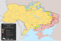
Request 2022 Russian invasion of Ukraine map
-
 Map
Map

.svg)
.gif)
- Article(s)
- 2022 Russian invasion of Ukraine, etc
- Request
- At full size (2,199 × 1,478 px) the names of most smaller localities (villages and settlements) on the map are illegible. Could the map be resized to accommodate larger labels or something else? Brandmeister talk 14:46, 13 November 2022 (UTC)
- Discussion
@ Brandmeister: Are you having difficulty reading the names even after zooming in? M.Bitton ( talk) 14:53, 13 November 2022 (UTC)
- @
M.Bitton: I've downloaded the map, zoomed in and the village names are still not readable due to blurry pixelation (except larger cities and towns). AFAIK there's some technical restriction on resolution in svg images, but perhaps there's a workaround.
Brandmeister
talk 15:37, 13 November 2022 (UTC)
- When i zoom in on "Rivne Nuclear Power Plant" in North West Ukraine, this is what I see: https://imgur.com/a/5zRb6PY - everything is sharp, no blurriness and pixelation. Can you take a screenshot to compare? -- Lommes ( talk) 21:12, 13 November 2022 (UTC)
- @
Brandmeister, the
SVG version seems to have no issues for me, although there may be a slight delay in resolution, but there shouldn't be any long term pixelation as its vectors, just asking, you did not accidentaly download the
PNG preview? (as a webp) done that mistake a few times :D.
Dank
Jae 21:38, 13 November 2022 (UTC)
- Yeah, appears my Firefox forces me to download the PNG version that I was looking at. Actually forgot how to handle such issues... 23:07, 13 November 2022 (UTC)
- {{ resolved}}
- Yeah, appears my Firefox forces me to download the PNG version that I was looking at. Actually forgot how to handle such issues... 23:07, 13 November 2022 (UTC)
| This page is an archive. Do not edit the contents of this page. Please direct any additional comments to the current main page. |
Orthographic map of Russia with long-term occupied territories
{{ resolved}}
-
Current map in the article, with Crimea and four oblasts of Ukraine in light green
-
Example map with only Crimea in light green
-
Source for the line of contact: SVG map of Ukraine with the occupied territories
-
Finished map
- Article(s)
- Russia
- Request
- I’m asking for a green-and-grey locator map of Russia, suitable for the article’s infobox, including in light green the territories that had been persistently occupied for about seven years from February 2015 to February 2022. That includes 1) the southernmost islands involved in the Kuril Islands dispute which are already in light green, and 2) in Ukraine, the peninsula of Crimea and the actual territories east of the line of contact specified in the Minsk agreements, occupied by the Donetsk People's Republic and Luhansk People's Republic.
- I am happy to do any editing necessary on an SVG image myself, if someone can just run the right sources through the perl script for locator maps.
- The relevant map convention: Wikipedia:WikiProject Maps/Conventions/Orthographic maps
- Other sources for the Minsk line of contact:
- Thanks. — Michael Z. 22:35, 5 October 2022 (UTC)
- Discussion
- @ Mzajac: are you after a similar map to this one (but centred on Russia instead of Ukraine)? M.Bitton ( talk) 22:49, 5 October 2022 (UTC)
Blank Upper Silesian Industrial Region svg
-
Finished request
- Article(s)
- Ekstraklasa, I liga, all articles in Category:Ekstraklasa seasons, all articles in Category:I liga seasons
- Request
Hello, is it possible to create a map of the Upper Silesian Industrial Region, shown here:
In a blank svg format as exampled here (neighboring Gliwice County):
I hasten to add there is a svg map of the voivodeship:
I would be very grateful and this could be used in so many articles, not just the ones I mentioned.
Abcmaxx ( talk) 09:55, 18 October 2022 (UTC)
- Discussion
- @
Berrely: yes!! Thank you! One minor point, is the eastern voivodeship border correct?
Abcmaxx (
talk) 12:40, 18 October 2022 (UTC)
-
Abcmaxx I've uploaded it here:
File:Upper Silesian Industrial Region location map.svg, as for the borders, I downloaded them from the official geoportal of Poland's website, so they should be correct. –
Berrely •
T∕
C 12:58, 18 October 2022 (UTC)
- @
Berrely: thank you so much!
Abcmaxx (
talk) 13:12, 18 October 2022 (UTC)
- Please ping me if you want any changes or have any further queries :) –
Berrely •
T∕
C 13:15, 18 October 2022 (UTC)
- @ Berrely: I have just tried it out at I liga#Stadiums and locations but it didn't seem to do the trick. I triple checked the coordinates, but it's still not placing Sosnowiec in Sosnowiec, Katowice in Katowice etc., they all seem to want to be in Tychy. Any ideas? Abcmaxx ( talk) 13:29, 18 October 2022 (UTC)
- Please ping me if you want any changes or have any further queries :) –
Berrely •
T∕
C 13:15, 18 October 2022 (UTC)
- @
Berrely: thank you so much!
Abcmaxx (
talk) 13:12, 18 October 2022 (UTC)
-
Abcmaxx I've uploaded it here:
File:Upper Silesian Industrial Region location map.svg, as for the borders, I downloaded them from the official geoportal of Poland's website, so they should be correct. –
Berrely •
T∕
C 12:58, 18 October 2022 (UTC)
- @
Berrely: yes!! Thank you! One minor point, is the eastern voivodeship border correct?
Abcmaxx (
talk) 12:40, 18 October 2022 (UTC)
Realms territories and protectorates of Elizabeth II map - Southern Cameroons
- Article(s)
- Any article this map already appears on.
- Request
- w:Southern Cameroons was part of a British mandate -- 112.118.57.99 ( talk) 16:27, 12 September 2022 (UTC)
- Discussion
Blank 118th Congress Map
- Article(s)
- 118th United States Congress and related
- Request
- It seems striking to me that we don't have a blank map showing the redistricted maps for the US House of Representatives. File:2022 United States House of Representatives elections retirements or losses of renomination map.svg on Commons shows the Districts, but with color-coding. Any way to strip the color out and get a blank map? -- Hog Farm Talk 19:24, 27 October 2022 (UTC)
- Discussion
@
Hog Farm: it's very easy to strip those colours: open the file (using a decent text editor) and delete everything between .District {stroke-width:.17;} (on line 9) and </style>" (line 456). Then, replace the fill colour by changing .District {fill:#6d6d6d;} (on line 7) into .District {fill:#c0c0c0;}.
M.Bitton (
talk) 20:07, 27 October 2022 (UTC)
- @ M.Bitton: - What sort of text editor would work? (I'm basically useless with code, and I think the closest thing I have to a text editor currently is Windows Notepad. Hog Farm Talk 02:11, 28 October 2022 (UTC)
@ Hog Farm: It appears that there's already a blank map at File:US House 2022.svg, is that what you want? — twotwofourtysix( talk || edits) 02:49, 28 October 2022 (UTC)
- Yes, thank you! It just wasn't in the categories I was expecting. So {{ resolved}}
Map of Arabic vernaculars
-
Current map
- Article(s)
- Arabic
- Varieties of Arabic
- Levantine Arabic (and other articles about one specific variety)
- Request
- As discussed in Talk:Arabic#Proposal to Remove Two Maps the only map of Arabic vernaculars that we have is: original research, full of errors and not based on a high-quality reliable source. The list of all Arabic varieties recognized in the ISO 639-3 standard can be found here. Excluding Standard Arabic (arb) and adding Hassaniya Arabic (mey) and Maltese (mlt), there are 30 active Arabic vernaculars. We would like to display all Arabic varieties (and only them) on a single map (with one color for each variety) based on Ethnologue's maps (in linguistics, "Ethnologue...has become the standard reference, and its usefulness is hard to overestimate."):
Algeria, Morocco, Tunisia and Western Sahara- Hassaniya Arabic (mey)
- Moroccan Arabic (ary)
- Algerian Saharan Arabic (aao)
- Algerian Arabic (arq)
- Tunisian Arabic (aeb)
-
Libya and Egypt
- Libyan Arabic (ayl) (also called " Western Egyptian Bedawi Spoken Arabic" on the map)
- Egyptian Arabic (arz)
- Eastern Egyptian Bedawi Arabic (avl)
- Saidi Arabic (aec)
-
Mauritania
- Hassaniya Arabic (mey)
-
Niger
- Algerian Saharan Arabic (aao)
- Hassaniya Arabic (mey)
- Libyan Arabic (ayl)
- Chadian Arabic (shu) (called "Shuwa Arabic" on the map)
- Mali:
Central Mali,
Western Mali, and
All Mali
- Hassaniya Arabic (mey)
-
Northern Chad and
Southern Chad
- Chadian Arabic (shu, number "5" on these maps). Chadian Arabic is also "widespread" so the whole country outside the specific Chadian Arabic regions could then be hatched in the same color
-
Sudan
- Sudanese Arabic (apd) (widespread => hatched area?)
- This more accurate map (p. 194) could be used instead, and the rest of the country would be hatched
- Sudanese Arabic (apd) (widespread => hatched area?)
-
South Sudan
- Sudanese Arabic (apd) (widespread => hatched area?)
- Sudanese Creole Arabic (pga) (widespread => hatched area?)
- According to Ethnologue: " Central Equatoria, Eastern Equatoria, and Western Equatoria states: widespread, into Northern Bahr al Ghazal, Western Bahr al Ghazal, and Upper Nile states."
- Stefano Manfredi's Árabi Júba : un pidgin-créole du Soudan du Sud has a map of Juba Arabic, p. 11: we could use it for pga and hatch the rest of the country
-
Jordan and Syria
- Najdi Arabic (ars)
- Eastern Egyptian Bedawi Arabic (avl, called "Levantine Bedawi" on the map)
- South Levantine Arabic (ajp)
- North Levantine Arabic (apc)
- North Mesopotamian Arabic (ayp)
- Mesopotamian Arabic (acm)
-
Iraq
- Gulf Arabic (afb)
- Mesopotamian Arabic (acm)
- Najdi Arabic (ars)
- North Mesopotamian Arabic (ayp)
-
Bahrain, Kuwait, Qatar, Saudi Arabia and United Arab Emirates
- Baharna Arabic (abv)
- Gulf Arabic (afb)
- Najdi Arabic (ars)
- Hijazi Arabic (acw)
- Shihhi Arabic (ssh)
-
Oman
- Gulf Arabic (afb)
- Omani Arabic (acx)
- Shihhi Arabic (ssh)
- Baharna Arabic (abv)
- Dhofari Arabic (adf)
-
Yemen
- Sanaani Arabic (ayn)
- Ta'izzi-Adeni Arabic (acq)
- Hadrami Arabic (ayh)
-
North East of Nigeria
- Chadian Arabic (shu) (called "Shuwa Arabic" 215 on the map)
-
Northern Cameroon
- Chadian Arabic (shu) (called "Shuwa Arabic" 2 on the map)
-
Uzbekistan
- Uzbeki Arabic (auz)
-
Afghanistan
- Tajiki Arabic (abh)
-
Tajikistan
- Tajiki Arabic (abh)
-
Cyprus
- Cypriot Arabic (acy)
-
Central African Republic
- Chadian Arabic (shu) (also called Baggara Arabic: "Baggara Belt" on this map, just in the Central African Republic, we rely on Ethnologue for other countries)
- Malta
- Maltese (mlt) (whole island)
- Djibouti
- Ta'izzi-Adeni Arabic (acq): This source ("Figure 32.1 Map showing the Arabic‐speaking regions and the status of Arabic in the various countries (courtesy of Peter Behnstedt).", p. 524) and Ethnologue mention that Ta'izzi-Adeni Arabic (also called "Djibouti Arabic") is spoken in Djibouti. However, only about 10% of the population speaks it. So we could hatched the area or add a colored triangle.
- Senegal
- Hassaniya Arabic (mey): The above source (Figure 32.1) and Ethnologue mention that Hassaniya is spoken in Senegal. Hassaniya is also officially recognized by the Senegalese government. Regarding the location, Ethnologue says in the " Matam and Saint-Louis Regions". However, only about 20% of the population speaks it. So we could hatched the area or add a colored triangle.
- Eritrea
- Hijazi Arabic (acw): spoken in the Northern Red Sea Region and Southern Red Sea Region according to Ethnologue. However, only about 10% of the population speaks the language there, so we could hatched the area or add a colored triangle
-
File:Central Asian Arabic enclaves.png
- Khamse Arabs Tribe in Iran: Gulf Arabic (afb)
- Other areas in Iran: Uzbeki Arabic (auz)
- Areas in Uzbekistan: Uzbeki Arabic (auz)
- Areas in Afghanistan: Tajiki Arabic (abh)
- (it may overlap with the maps of Tajikistan, Uzbekistan, and Afghanistan as this is another source, but it's fine)
- Kenya and Uganda
- Nubi (kcn): Figure 32.1 displays the Nubi language, an Arabic-based creole. Ethnologue agrees with this definition ("Creole, Arabic based", "Conflicting reports of intelligibility with Juba Arabic [pga]. 90% of the lexicon comes from Arabic."). Nubi speakers are scattered across these countries. In Kenya, they are concentrated in Nairobi and Mombasa and in Uganda in Arua, Bombo, Koboko, Kumi, Luwero, Ngora, and Yumbe. However, these areas are small and Nubi speakers are only a minority of the population there. So could add colored triangles over Kenya and Uganda for Nubi as Figure 32.1 did. Because I'm afraid the hatched areas won't be visible.
- Iran
- Mesopotamian Arabic (acm) (not in free access => my screenshot, it shows the south west of Iran where [acm] is spoken, same area as on File:Árabe mesopotámico.png.) According to Ethnologue: " Bushehr province: Deylam county; Khuzestan province: southwest Zagros mountains, Shatt al Arab river area."
- Gulf Arabic (afb) (not in free access => my screenshot, it shows the south coast of Iran where [afb] is spoken, more or less the same area as on File:Penninsular Arabic.svg and File:Árabe del Golfo.PNG) According to Ethnologue: " Hormozgan province and nearby Persian gulf islands; also Bushehr, Fars, Kerman, and Yazd provinces."
-
Turkey
- North Mesopotamian Arabic (ayp)
- Mesopotamian Arabic (acm)
- The above map is not precise, we could add a triangle over that area, otherwise we can use "Map 9.2 ‘Bedouin’ and ‘sedentary’ Arabic dialect areas in the Northern Fertile Crescent" (p. 259) in Prochazka, Northern Fertile Crescent that is super accurate ( my screenshot: "Syrian dialects" = North Levantine Arabic // "Mesopotamian qeltu dialects" = North Mesopotamian Arabic // "Shawi dialects" & "Shammar dialects" = Mesopotamian Arabic). A simpler version is this one: File:Levantine Arabic 2022.svg
-
Shuwa Arabic
- Chadian Arabic (shu) (also called Baggara Arabic: "Baggara Belt" on this map): Add areas in Niger, Nigeria, Cameroon, Chad, Sudan, and South Sudan (if doable for the Sudans).
For Israel & Palestine- The basis is this map: File:Levantine Arabic 2022.svg
- BUT, in Israel, the Beersheba Subdistrict (dark blue) should be Eastern Egyptian Bedawi Arabic (avl) only ( source). So no South Levantine Arabic in this area.
In the West Bank: the Eastern part of the West Bank is controlled by Israel (with the exception of the area around Jericho) and South Levantine Arabic is not spoken there: blue on this map, white on this map. On the other hand, there are Bedouins in this area controlled by Israel ( source 1, source 2). The map is super complex, and we don't have super accurate sources either; so to make things simpler: the Eastern part of the West bank should be colored as Eastern Egyptian Bedawi Arabic (avl) (with the exception of the area around Jericho) while the rest of the West Bank (western part + area around Jericho) should be colored as South Levantine Arabic
Thanks for any help you can provide! A455bcd9 ( talk) 08:30, 5 September 2022 (UTC)
- Note: To allow the map to be used in different language editions, the legend should not be included in the SVG file. A455bcd9 ( talk) 19:28, 5 September 2022 (UTC)
- Discussion
- Are the maps' projections mentioned in their respective articles? M.Bitton ( talk) 14:14, 29 September 2022 (UTC)
- Projections are unfortunately not mentioned in these maps of countries, which makes it hard to superimpose them on a blank Mmap of the Middle East (I tried without success...). However, Ethnologue has other maps for each language (for instance ary). These language maps all use the same projection. Unfortunately, you need an account to access them. I could provide my credentials and/or screenshots though. A455bcd9 ( talk) 16:41, 29 September 2022 (UTC)
- Note that there is an ISO request to merge Northern and Southern Levantine Arabic.
[3] Evidently the linguistic distinction is urban vs rural; maybe there is a north/south divide in the rural lects, but that doesn't extend to the cities, as Ethnologue describes. The requesters are from the Polytechnique, Oxford and SOAS, so there's a good change this merger will be accepted.
— kwami (
talk) 21:38, 11 October 2022 (UTC)
- @ A455bcd9 Hi, maybe I can help you here. It's a complex request and to my understanding most (if not all, haven't checked all) of your sources are protected in some way and the maps can't be used to copy from, they can only be used as information. To me that means I can look at the maps and then by eye/hand transfer the areas to your requested map, I can't superimpose (if it's possible to find a base map with the same projection etc) the maps to copy them. So this means the requested map will not be as exact as you probably wants/expect it to be.
- If this is fine with you I can start working on this but I will need your help, knowledge and assistance all the way on the work on this map. --always ping me--
Goran tek-en (
talk) 15:33, 14 October 2022 (UTC)
- Hi @
Goran tek-en, thanks a lot for offering to help! Yes, it's totally fine if the borders aren't "perfect." Boundaries between dialects aren't clear anyway. I'm usually quite responsive on Wikipedia, and I'll be happy to help and assist you.
A455bcd9 (
talk) 16:08, 14 October 2022 (UTC)
- @ A455bcd9 So first we have to agree on the overall area the map should cover, is this the correct area? If not please tell me/show me which it should be, thanks. --always ping me-- Goran tek-en ( talk) 12:28, 15 October 2022 (UTC)
- Hi @
Goran tek-en, thanks a lot for offering to help! Yes, it's totally fine if the borders aren't "perfect." Boundaries between dialects aren't clear anyway. I'm usually quite responsive on Wikipedia, and I'll be happy to help and assist you.
A455bcd9 (
talk) 16:08, 14 October 2022 (UTC)
- @ Kwamikagami: just seeing your message now. I'm the main requester of this proposal :) The decision will be announced in January 2023. If it's not accepted, I hope the ISO 639-3 Registration Authority will at least give their criteria distinguishing South Levantine from North Levantine and the border between the areas where they are spoken. A455bcd9 ( talk) 12:34, 22 October 2022 (UTC)
![]() Request taken by --always ping me--
Goran tek-en (
talk) 12:09, 15 October 2022 (UTC).
Request taken by --always ping me--
Goran tek-en (
talk) 12:09, 15 October 2022 (UTC).
Extended content
|
|---|
A455bcd9 Iraq draft and new patterns, but check all as I often have to move stuff around --always ping me-- Goran tek-en ( talk) 17:37, 28 October 2022 (UTC)
A455bcd9 Two drafts for the area discussed above.
|
@
A455bcd9
7,8 Egypt dialect, not sure. Greater Cario is not really defined.
9b Don't you mean it should be mixed dialects, that's what I have done.
Draft all. --always ping me--
Goran tek-en (
talk) 19:19, 5 November 2022 (UTC)
- @
Goran tek-en 😍
- 7/9: here's a map of the Cairo Governorate. This area should be in 7 (Egyptian) and not in 9 (Sa’idi) or in anything else.
- 9b: perfect!
- 27/28: did you increase the size of the areas by any chance between the previous draft and this one? I thought they were smaller.
- Other than these points, it looks perfect to me. THANK YOU!
A455bcd9 (
talk) 20:09, 5 November 2022 (UTC)
I realize that the 4 Judeo-Arabic languages recognized in the ISO standard do not appear on the map. Most (if not all) of these speakers have moved to Israel and/or switched to another language (the local Arabic dialect, or French, or English, or Italian, or Hebrew). Should we still add them? (poke @ Pathawi)- Judeo-Moroccan Arabic (aju): in Casablanca; it appears on the map we used as a source
- Judeo-Yemeni Arabic (jye): in Sanaa
- Judeo-Tripolitanian Arabic (yud): in Tripoli, Libya
- Judeo-Iraqi Arabic (yhd): in Baghdad
Adding number in the sea/ocean pointing to one dot in Casablanca (32), Sanaa (33), and Tripoli (34) is probably easy. Would be harder for Baghdad though. If it's easy to add them, I would suggest to do so. Otherwise, we can forget about it. We can also have one map with Judeo-Arabic varieties and one map without. A455bcd9 ( talk) 09:13, 6 November 2022 (UTC)Never mind, too complex, not significant. A455bcd9 ( talk) 11:45, 6 November 2022 (UTC)- @ A455bcd9
- 7/9 I don't understand, if I cover this area with 7 it will cut apart 9 like this draft with the source map in the background as oppose what your first source say? --always ping me-- Goran tek-en ( talk) 17:11, 6 November 2022 (UTC)
- @
A455bcd9 27/28 No, do you want me to do something? --always ping me--
Goran tek-en (
talk) 17:22, 6 November 2022 (UTC)
- @
Goran tek-en:
- 7/9: You're right that coloring the whole Cairo Governorate is probably too much. For the area around Cairo, the map says "Area with multiple languages" but doesn't say which ones. I checked the source (Ethnologue) and it says that Egyptian (7) is spoken in Cairo. So I just want to make sure that on the map, this area around Cairo is in 7 and not in 9. It's maybe already the case but I don't have the whole map anymore to check.
- 27/28: OK, no need to do anything then. All good!
-
A455bcd9 (
talk) 17:39, 6 November 2022 (UTC)
- @
A455bcd9
Draft Cairo area, OSM map in the background. --always ping me--
Goran tek-en (
talk) 11:02, 7 November 2022 (UTC)
- @ Goran tek-en: perfect for Cairo!
- By the way, I can't check on the map you've just sent but the western limit of Egyptian Arabic should be
Alexandria (included in Egyptian) and the eastern limit is
Port Said (included in Egyptian) as shown on
the source (the border between Egyptian and Bedawi partially follows the
Suez Canal).
A455bcd9 (
talk) 11:34, 7 November 2022 (UTC)
- @ A455bcd9
-
Draft as above, should not the dotted area be removed from 7
according this? --always ping me--
Goran tek-en (
talk) 13:13, 7 November 2022 (UTC)
- No it's fine @
Goran tek-en! Could you please post the whole map again so that I double check everything one last time?
A455bcd9 (
talk) 13:39, 7 November 2022 (UTC)
- @ A455bcd9 That was my intention.
- If this is fine I will need the following;
- Name of the file
- Description (/language)
- Captions/s (/language)
- Category/ies at commons
- Structured data/Items portrayed in this file, the Q#, to be able to upload it at commons, thanks.
- --always ping me--
Goran tek-en (
talk) 13:55, 7 November 2022 (UTC)
- @
Goran tek-en: looks perfect: thank you so much for your tremendous work!
- Name of the file: Arabic Varieties Map
- Description: Map of the geographical distribution of the various
varieties of Arabic recognized by the
ISO 639-3 standard, including
Arabic-based creoles but excluding
Judeo-Arabic languages. Sources:
- Eberhard, David M., Gary F. Simons, and Charles D. Fennig (eds.). 2022. Ethnologue: Languages of the World. Twenty-fifth edition. Dallas, Texas: SIL International. Online version: http://www.ethnologue.com.
- Al‐Wer, Enam; Jong, Rudolf (2017). "Dialects of Arabic". In Boberg, Charles; Nerbonne, John; Watt, Dominic (eds.). The Handbook of Dialectology. Wiley. pp. 523–534. doi:10.1002/9781118827628.ch32. ISBN 978-1-118-82755-0. OCLC 989950951.
- Prochazka, Stephan (2018). "The Northern Fertile Crescent". In Holes, Clive (ed.). Arabic Historical Dialectology: Linguistic and Sociolinguistic Approaches. Oxford University Press. pp. 257–292. doi:10.1093/oso/9780198701378.003.0009. ISBN 978-0-19-870137-8. OCLC 1059441655.
- Owens, Jonathan. "Manfredi, Stefano: Árabi Júba: Un pidgin-créole du Soudan du Sud. Leuven/Paris: Peeters 2017. X, 227 S. 8° = Les Langues du Monde 8. Brosch. € 28,00. ISBN 978-90-429-3504-4." Orientalistische Literaturzeitung, vol. 114, no. 3, 2019, pp. 223-227. https://doi.org/10.1515/olzg-2019-0075
- File:Baggara belt.png
- File:Central Asian Arabic enclaves.png
- https://www.refworld.org/pdfid/505192fe2.pdf
- Project, Joshua. " Bedouin, Eastern Bedawi in Israel". joshuaproject.net.
- Legend:
- Hassaniyya (mey)
- Moroccan Arabic (ary)
- Algerian Saharan Arabic (aao)
- Algerian Arabic (arq)
- Tunisian Arabic (aeb)
- Libyan Arabic (ayl)
- Egyptian Arabic (arz)
- Eastern Egyptian Bedawi Arabic (avl)
- Saidi Arabic (aed)
- Chadian Arabic (shu)
- Sudanese Arabic (apd)
- Sudanese Creole Arabic (pga)
- Najdi Arabic (ars)
- South Levantine Arabic (ajp)
- North Levantine Arabic (apc)
- North Mesopotamian Arabic (ayp)
- Mesopotamian Arabic (acm)
- Gulf Arabic (afb)
- Baharna Arabic (abv)
- Hijazi Arabic (acw)
- Shihhi Arabic (ssh)
- Omani Arabic (acx)
- Dhofari Arabic (adf)
- Sanaani Arabic (ayn)
- Ta'izzi-Adeni Arabic (acq)
- Hadrami Arabic (ayh)
- Uzbeki Arabic (auz)
- Tajiki Arabic (abh)
- Cypriot Arabic (acy)
- Maltese (mlt)
- Nubi (kcn)
- Captions/s: Map of the varieties of Arabic
- Category/ies at commons: Category:Linguistic maps of the Arabic language
- Structured data/Items portrayed in this file, the Q#: Q1422423
-
A455bcd9 (
talk) 15:01, 7 November 2022 (UTC)
- @
A455bcd9 Now you can find it here
Commons:file:Arabic Varieties Map.svg.
- Please check all the information, also links for wikipedia, wikidata and structured data.
- If you are happy with this please put the code
{{re.solved|~~~~}}(without the ".") on this request so it can be archived, thanks. Done
- --always ping me--
Goran tek-en (
talk) 18:36, 7 November 2022 (UTC)
- Amazing, thank you so much! {{ resolved}}
- @
A455bcd9 Now you can find it here
Commons:file:Arabic Varieties Map.svg.
- @
Goran tek-en: looks perfect: thank you so much for your tremendous work!
- No it's fine @
Goran tek-en! Could you please post the whole map again so that I double check everything one last time?
A455bcd9 (
talk) 13:39, 7 November 2022 (UTC)
- @
A455bcd9
Draft Cairo area, OSM map in the background. --always ping me--
Goran tek-en (
talk) 11:02, 7 November 2022 (UTC)
- @
Goran tek-en:
Request 2022 Russian invasion of Ukraine map
-
Map
- Article(s)
- 2022 Russian invasion of Ukraine, etc
- Request
- At full size (2,199 × 1,478 px) the names of most smaller localities (villages and settlements) on the map are illegible. Could the map be resized to accommodate larger labels or something else? Brandmeister talk 14:46, 13 November 2022 (UTC)
- Discussion
@ Brandmeister: Are you having difficulty reading the names even after zooming in? M.Bitton ( talk) 14:53, 13 November 2022 (UTC)
- @
M.Bitton: I've downloaded the map, zoomed in and the village names are still not readable due to blurry pixelation (except larger cities and towns). AFAIK there's some technical restriction on resolution in svg images, but perhaps there's a workaround.
Brandmeister
talk 15:37, 13 November 2022 (UTC)
- When i zoom in on "Rivne Nuclear Power Plant" in North West Ukraine, this is what I see: https://imgur.com/a/5zRb6PY - everything is sharp, no blurriness and pixelation. Can you take a screenshot to compare? -- Lommes ( talk) 21:12, 13 November 2022 (UTC)
- @
Brandmeister, the
SVG version seems to have no issues for me, although there may be a slight delay in resolution, but there shouldn't be any long term pixelation as its vectors, just asking, you did not accidentaly download the
PNG preview? (as a webp) done that mistake a few times :D.
Dank
Jae 21:38, 13 November 2022 (UTC)
- Yeah, appears my Firefox forces me to download the PNG version that I was looking at. Actually forgot how to handle such issues... 23:07, 13 November 2022 (UTC)
- {{ resolved}}
- Yeah, appears my Firefox forces me to download the PNG version that I was looking at. Actually forgot how to handle such issues... 23:07, 13 November 2022 (UTC)