Here are some blank maps for color and label in different languages.
IMPORTANT: Only . svg ( vector) and . png ( raster) images are to be used for unanimated maps.
SVG format
SVG is a vector graphics format. SVG has advantages over PNG for creating world maps of arbitrary detail or zoom level, certain editing purposes, saving layers, and rescaling text, curves and lines. SVG is preferred: see Wikipedia:WikiProject_Maps.
World


Political
-
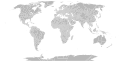
 BlankMap-World.svg: Robinson projection, national borders, areas grouped.
 -
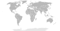
 BlankMap-World-with-Circles.svg: Robinson projection showing countries, dependencies and special-status territories, with smaller ones circled.
 -
 BlankMap-World-Sovereign Nations.svg: Robinson projection showing sovereign countries only, with smaller ones circled.
 -
 Blank Map World Secondary Political Divisions.svg: Robinson projection, national borders, secondary political borders, areas grouped.


Historical
-
 The world in 1959

Obsolete
-
 BlankMap-World-Equirectangular.svg: Same as above, but in equirectangular projection.
 -
 World98.svg: First level administrative boundaries of countries, anno 1998, intended to be used to generate other SVGs and PNG maps
 -
 Worldmap_location_NED_50m.svg: Equirectangular projection, generated from Natural Earth Data (paths grouped by country and sovereign region)
 -
 Based on the UN map (2008). Shows disputed borders.
 -
 66k World Map for Web Data Visualizations – by @F1LT3R of Hyper-Metrix
 -
 Robinson projection with US state boundaries
 -
 Blank Map of the world without Antarctica


Africa

National
-
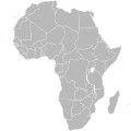 BlankMap-Africa.svg; national borders
 -
 africa98.svg: national primary level divisions as of 1998
 -
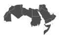 Arab world.svg: Map of Arabic-speaking countries


Asia
-
 File:Blank Asia.png: Map of Asia without national borders
 -
 Asia98.svg: national primary level divisions as of 1998
 -
 Location Map Asia.svg: Gray location map of Asia based off national borders as of 2009


National
- Image:Loc bangladesh2.svg – Bangladesh (obsolete since Bangladesh has 7 divisions)
- Wikipedia:WikiProject Indian maps – India Map Project page. Many maps of India
- Image:India-locator-map-blank.svg – India with the states. States on a separate layer and can be removed if necessary.
Europe
-
 File:Blank map europe no borders.svg: Map of Europe without national borders

National
-
 Image:Blank map of Europe (with disputed regions).svg: national borders shown; borders of disputed regions shown as dotted lines; intranational boundaries of Europe not shown
 -
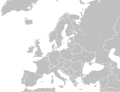 Image:Blank map of Europe (without disputed regions).svg: national borders shown, excluding borders of disputed regions; intranational boundaries of Europe not shown
 -
 Image:Location European nation states.svg: national borders shown, excluding borders of disputed regions (but Kosovo exists as an invisible SVG object which can be styled separately from Serbia); Europe shaded differently from other areas, showing intranational boundaries
 -
 Image:Blank map of Europe (polar stereographic projection) cropped.svg: national borders shown, excluding borders of disputed regions; Europe shaded differently from other areas, showing intranational boundaries
 -
 Image:Europe polar stereographic Caucasus Urals boundary3.svg: national borders shown, excluding borders of disputed regions; Europe shaded differently from other areas, showing intranational boundaries
.svg)
.svg)

_cropped.svg)

See also
North America
-
 north_america98.svg: national primary level divisions as of 1998. Note that lakes are not shown, which makes the Great Lakes region, and in particular Michigan appear unusual since the administrative (over-water) boundaries are used.

National
- Image:Canada_blank_map.svg — Canada.
- File:Blank US Map (states only).svg — United States (including Alaska and Hawaii). Each state is its own vector image, meaning coloring states individually is very easy.
- File:Blank USA, w territories.svg – United States, including all major territories.
Caribbean / Central America
- File:Antilles.svg – Antilles
- File:Lesser_Antilles_location_map.svg – Lesser Antilles location map
Oceania
- Image:oceania98.svg – very large SVG including primary level divisions (states/provinces) of Oceania as of 1998.
National
-

-
 Australia states blank.svg: Australian states as of 2011


South America
- Image:south_america98.svg – very large SVG including primary level divisions (states/provinces) of South America as of 1998.
- Image:Southamerica blank.svg
National
- Image:Brazil Blank Map.svg – Brazilian states.
Hemisphere
-
 Worldmap_southern.svg: Polar / orthographic projection of the southern hemisphere, from Natural Earth Data
 -
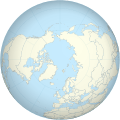 Worldmap_northern.svg: Polar / orthographic projection of the northern hemisphere, from Natural Earth Data


PNG format
PNG is a raster graphics format. PNG has advantages over SVG including smaller filesize (due to less-than-optimal server-side SVG-to-raster conversion), more widely supported and often easier and faster to make simple changes to things such as borders.
World
-
 File:BlankMap-World-large.png – Standard world map.
 -
 Image:BlankMap-World-large-noborders.png – above map with no national borders.
 -
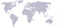 Image:World map stripes for shading.PNG – World map with stripes for shading.
 -
 Image:BlankMap-World-Subdivisions.PNG – World map with national subdivisions.
 -
 Image:BlankMap-World-noborders.png – World without country borders.
 -
-
 Image:BlankMap-World-Continents.PNG – World with continents marked, no country borders. Based on map found at continents. Excludes Antarctica.
 -
 Image:BlankMap-World-Continents-Coloured.PNG World with continents marked, no country borders, contintents colour-coded. Excludes Antarctica.
 -
 File:BlankMap-World-FIFA.png – World with borders of FIFA members.
 -
 File:Pacific-centric-map.png – Pacific centric map.


_cropped.svg)
.svg)
Obsolete
These maps are now deprecated:
- Image:BlankMap-World.png – World map, Robinson projection centered on the meridian circa 11°15' to east from the Greenwich Prime Meridian. Microstates and island nations are generally represented by single or few pixels approximate to the capital; all territories indicated in the UN listing of territories and regions are exhibited. Quite large – 1480 x 625 pixels, 62 628 bytes.
- Image:BlankMap-World-alt.png – Version of Image:BlankMap-World.png, but including the peripheral projection lines and Antarctica. 1488 x 755 pixels, 35 471 bytes.
- Image:Newworldmap.png – Version of Image:BlankMap-World-alt.png, but with bodies of water coloured blue. 1488 x 755, 37 171 bytes.
- Image:Newworldmap-alt.png – Version of Image:BlankMap-World-alt.png, but with bodies of water coloured blue and white land masses. 1488 x 755.
- Image:BlankMap-World-v2.png – Version of Image:BlankMap-World.png, but with sovereign microstates (i.e., under 2 500 km² in area) represented as circles to facilitate identification and colourising. 1357 x 628 pixels, 28 549 bytes.
- Image:BlankMap-World-v3.png – Version of v2, but using thin lines between islands owned by the same country so countries can be colored in one click – may be more convenient for converting large amounts of country data to a map.
- Image:BlankMap-World-v4.png – Version of v2, but it increases the size of other tiny countries as well, for visibility purposes, and uses white borders even for the microstates.
- Image:BlankMap-World-v4-Borders.png – Version of v4 with borders around each country.
- Image:BlankMap-World-v5.png – Version of v4 with thin lines to join areas owned by the same country for one-click colouring.
- Image:BlankMap-World-v5-EU.png – Version of v5 with EU as one country.
- Image:BlankMap-World-v6.png – Version of v4 with dots for dependencies as well as sovereign territories.
- Image:BlankMap-World-v6-Borders.png – Version of v6 with borders around each country.
- Image:BlankMap-World-v7.png – Version of v4 with thin lines to join areas owned by the same country for one-click colouring and with dots for dependencies as well as sovereign territories (merged content from v5 and v6).
- Image:BlankMap-World-v7-Borders.png – Version of v7 with borders around each country.
Historic
- 1: Image:BlankMap-World-1ce.png
- 820: Image:BlankMap-World-820.png
- 1500: Image:BlankMap-World-1500.png
- 1710: Image:BlankMap-World-1710.png
- 1840: Image:BlankMap-World-1840.png
- 1861: Image:BlankMap-World-1861.png
- 1866: Image:BlankMap-World-1866.png
- 1872: Image:BlankMap-World-1872.png
- 1898: Image:BlankMap-World-1898.png
- 1912: Image:BlankMap-World-1912.png
- 1914: Image:Map_of_the_World_(1914).PNG
- WWI: Image:BlankMap-World-WWI.PNG – World from around the time of World War I
- 1918.8: Image:1918.8_Blank_World_Map.PNG
- 1921: Image:BlankMap-World-1921.png
- 1924: Image:BlankMap-World-1924.png
- 1935: Image:BlankMap-World_1935.png
- 1937: Image:BlankMap-World 1937.png
- 1938.3: Image:BlankMap-World 1938march.png
- 1938.10: Image:BlankMap-World 1938.png
- 1939.3: Image:BlankMap-World_1939march.png
- 1939.10: Image:BlankMap-World_1939.png
- WWII: Image:BlankMap-World-WWII.PNG – World from around the time of World War II.
- 1942.11: Image:1942.11 blank world map.PNG
- 1945.5: Image:1945.5 Blank World Map.PNG
- 1957: Image:BlankMap-World-1957.png
- 1962–1963: Image:BlankMap-World-1962.png
- 1970: Image:BlankMap-World-1970.png
- 1985: Image:BlankMap-World-1985.png – World before the fall of the Soviet Union, the reunification of Germany (including West Berlin), and Yemen, and dissolution of Czechoslovakia and Yugoslavia, and the independence of East Timor and Eritrea. Nominally from 1985.
- 1990: Image:BlankMap-World-1990.png
- 1993: Image:BlankMap-World-1993.png
- 2000: Image:BlankMap-World-2000.png
- 2005: Image:BlankMap-World-2005.png
- 2007: Image:BlankMap-World-2007.png
- 2009: Image:BlankMap-World-2009.PNG
.PNG)
Europe
- Image:BlankEurope.png – A large map of Europe. 1236x1245px 44.18 KB.
- Image:BlankMap-Europe.png – Europe as far east as western Russia, western Turkey, and Cyprus. Some of the world's smallest states (e.g., Monaco, Vatican City) appear as single pixels. Includes the former eastern Soviet republics. 450 x 422 pixels, 9 812 bytes.
- Image:BlankMap-Europe-v2.png – Version of Image:BlankMap-Europe.png, but with sovereign microstates (i.e., under 2 500 km² in area) represented as circles to facilitate identification and colourising. 450 x 422 pixels, 9 943 bytes.
- Image:BlankMap-Europe-v3.png – Europe without borders, showing some of North Africa and Western Asia.
- Image:BlankMap-Europe-v4.png – Version of Image:BlankMap-Europe-v3.png, but with borders shown
- Image:BlankMap-Europe-v5.png – White background, black borders, blue sea.
National
- Image:Italy template.png – Italian regions, 25% rescaling factor suggested.
- Image:France template.png – French regions, 50% rescaling factor suggested.
- Image:Blank Map Germany States.png – German states, 40% rescaling factor suggested.
- Image:BlankMap-RussiaDistricts.png
- Image:BlankMap-EnglandRegions.png
- Image:BlankMap-EnglandCeremonialCounties.png
- Image:BlankMap-EnglandAdministrativeCounties.png
- Image:BlankMap-EnglandAdministrativeCounties1974.png
- Image:BlankMap-EnglandSubdivisions.png
- Image:BlankMap-LondonBoroughs.svg
- Image:Scotland1996Blank.png
- Image:Wales1996Blank.png
- Image:GreekPerepheriesBlank.png
- Image:BlankMap-Switzerland.png
Historic
Africa
- Image:Blankmap-Africa2.png – 757x785 px.
- Image:BlankMap-Africa.png – 341x341px.
National
North America
- Image:Map of USA.png – United States with outlines for individual states.
- Image:Map of USA-bw.png – Black and white outlines for states, for the purposes of easy coloring of states.
- Image:BlankMap-USA-states.PNG – US states, grey and white style similar to Vardion's world maps.
- Image:Map of USA with county outlines.png – Grey and white map of USA with county outlines.
Hi-res 2 color images
- Image:Usa-state-boundaries-lower48+2.png – USA state outlines, Hawaii and Alaska displaced, 2005x1289px, black on transparent.
- Image:usa-state-boundaries-1000.png – USA state outlines, true positions, 1000 px wide, black on white
- Image:usa-state-boundaries-1000-transparent.png – USA state outlines, true positions, 1000 px wide, black on transparent
- Image:usa-state-boundaries-4000.png – USA state outlines, true positions, 4000 px wide, black on white
- Image:usa-state-boundaries-4000-transparent.png – USA state outlines, true positions, 4000 px wide, black on transparent
Sub-national
- Image:Map of Florida.png – County boundaries shown.
- File:BlankMap-Florida-Counties.png – Gray map made for easy coloring of counties.
Caribbean / Central America
- Image:BlankMap-Caribbean.png – The Caribbean, including part of South America, part of Central America, and part of Florida. Shows most significant islands, including all the small independent countries (such as Saint Lucia or Dominica). 419 x 445 pixels, 3 064 bytes.
- Image:BlankMap-Caribbean-in-world.png – Same as above, but with added location in world box. 419 x 445 pixels, 10 514 bytes.
National
- Image:Mexico template.png – Mexican states, 33% rescaling factor suggested.
- Image:BlankMap Costa Rica.png – Costa Rica provinces, 30% rescaling factor suggested.
South America
National
- Image:Argentina provinces, blank.png – Argentina provinces, 30% rescaling factor suggested.
Asia
National
- Image:BlankMap Thailand.png – Thailand provinces, 20% rescaling factor suggested.
- Image:China blank map-1.png – People's Republic of China
- Image:China blank map-2.png – People's Republic of China
- Image:Hong Kong District Locator (template map).png – Hong Kong Special Administrative Region of the People's Republic of China.
- Image:BlankMap-Philippines.png
- Image:Macau Parish Locator (template map).png – Macau Special Administrative Region of the People's Republic of China.
- commons:Category:Maps of India – India
- Image:BlankMap-PersianGulf.png – Persian Gulf area, showing all of Kuwait, Bahrain, Qatar, and the United Arab Emirates, as well as large parts of other countries like Saudi Arabia, Oman, Iran, and Iraq. 359 x 251 pixels, 3 271 bytes.
- Image:BlankMap-Caucasus.png – Caucasus region national borders.
.png)
.png)
Historic
- 1949: Image:Map of China (1912-1949).png – Republic of China before Civil War.
.png)
Oceania
National
- Image:BlankMap-Australia.png – No borders
- File:Blank Australia map with inhabited external territories.png – Australia with inhabited external territories, useful for representing demographic data
Antarctica
- Image:Antarctica Map.png – South Pole in the center, also shows the subantarctic islands.
Hemisphere maps
These are azimuthal orthographic projections of the Earth from four sides plus the poles. 726x726 pixels, aliased. XCFs have separate layers for water, land, coastlines, political borders, political borders over water (not shown in PNGs), and latitude & longitude gridlines (not shown in PNGs).
- Image:Blankmap-ao-000 -africa europe.png XCF
- Image:Blankmap-ao-090W-americas.png XCF
- Image:Blankmap-ao-180W-oceania.png XCF
- Image:Blankmap-ao-270W-asia.png XCF
- Image:Blankmap-ao-090N-north pole.png XCF
- Image:Blankmap-ao-090S-south pole.png XCF
Blank maps derived from OMC
- A web interface by Martin Weinelt – It generates maps using GMT (The Generic Mapping Tools), from public domain vector data. The resulting maps should be in the public domain.
These maps show elevation and main rivers, but no modern boundaries. They are intended for use in archaeological/historical contexts ( Kurgan, Ancient Orient, Neolithic Europe, etc.):
- Image:Pontic caspian blank map.png
- Image:Europe 34 62 -12 54 blank map.png
- Image:Northern india blank map.png
- Image:Orient 27 43 22 55 blank map.png
- Image:Greece 34 43 17 30 blank map.png
- Image:Urals blank map.png
See also
- Wikipedia:WikiProject Maps
- Wikipedia:WikiProject Chinese provinces/Locator maps – Locator maps for Chinese provinces.
- Special:Prefixindex/Image:BlankMap
- User:Brion VIBBER/Maps and images for Wikipedia – Continents
- User:Seav#Other Graphics – The Philippines
- List of subnational entities – Shows many of these maps
- commons:Category:Blank maps
- commons:Grey-green orthographic projections maps
- commons:Category:Maps
Here are some blank maps for color and label in different languages.
IMPORTANT: Only . svg ( vector) and . png ( raster) images are to be used for unanimated maps.
SVG format
SVG is a vector graphics format. SVG has advantages over PNG for creating world maps of arbitrary detail or zoom level, certain editing purposes, saving layers, and rescaling text, curves and lines. SVG is preferred: see Wikipedia:WikiProject_Maps.
World
Political
-
BlankMap-World.svg: Robinson projection, national borders, areas grouped.
-
BlankMap-World-with-Circles.svg: Robinson projection showing countries, dependencies and special-status territories, with smaller ones circled.
-
BlankMap-World-Sovereign Nations.svg: Robinson projection showing sovereign countries only, with smaller ones circled.
-
Blank Map World Secondary Political Divisions.svg: Robinson projection, national borders, secondary political borders, areas grouped.
Historical
-
The world in 1959
Obsolete
-
BlankMap-World-Equirectangular.svg: Same as above, but in equirectangular projection.
-
World98.svg: First level administrative boundaries of countries, anno 1998, intended to be used to generate other SVGs and PNG maps
-
Worldmap_location_NED_50m.svg: Equirectangular projection, generated from Natural Earth Data (paths grouped by country and sovereign region)
-
Based on the UN map (2008). Shows disputed borders.
-
66k World Map for Web Data Visualizations – by @F1LT3R of Hyper-Metrix
-
Robinson projection with US state boundaries
-
Blank Map of the world without Antarctica
Africa
National
-
BlankMap-Africa.svg; national borders
-
africa98.svg: national primary level divisions as of 1998
-
Arab world.svg: Map of Arabic-speaking countries
Asia
-
File:Blank Asia.png: Map of Asia without national borders
-
Asia98.svg: national primary level divisions as of 1998
-
Location Map Asia.svg: Gray location map of Asia based off national borders as of 2009
National
- Image:Loc bangladesh2.svg – Bangladesh (obsolete since Bangladesh has 7 divisions)
- Wikipedia:WikiProject Indian maps – India Map Project page. Many maps of India
- Image:India-locator-map-blank.svg – India with the states. States on a separate layer and can be removed if necessary.
Europe
-
File:Blank map europe no borders.svg: Map of Europe without national borders
National
-
Image:Blank map of Europe (with disputed regions).svg: national borders shown; borders of disputed regions shown as dotted lines; intranational boundaries of Europe not shown
-
Image:Blank map of Europe (without disputed regions).svg: national borders shown, excluding borders of disputed regions; intranational boundaries of Europe not shown
-
Image:Location European nation states.svg: national borders shown, excluding borders of disputed regions (but Kosovo exists as an invisible SVG object which can be styled separately from Serbia); Europe shaded differently from other areas, showing intranational boundaries
-
Image:Blank map of Europe (polar stereographic projection) cropped.svg: national borders shown, excluding borders of disputed regions; Europe shaded differently from other areas, showing intranational boundaries
-
Image:Europe polar stereographic Caucasus Urals boundary3.svg: national borders shown, excluding borders of disputed regions; Europe shaded differently from other areas, showing intranational boundaries
See also
North America
-
north_america98.svg: national primary level divisions as of 1998. Note that lakes are not shown, which makes the Great Lakes region, and in particular Michigan appear unusual since the administrative (over-water) boundaries are used.
National
- Image:Canada_blank_map.svg — Canada.
- File:Blank US Map (states only).svg — United States (including Alaska and Hawaii). Each state is its own vector image, meaning coloring states individually is very easy.
- File:Blank USA, w territories.svg – United States, including all major territories.
Caribbean / Central America
- File:Antilles.svg – Antilles
- File:Lesser_Antilles_location_map.svg – Lesser Antilles location map
Oceania
- Image:oceania98.svg – very large SVG including primary level divisions (states/provinces) of Oceania as of 1998.
National
-
-
Australia states blank.svg: Australian states as of 2011
South America
- Image:south_america98.svg – very large SVG including primary level divisions (states/provinces) of South America as of 1998.
- Image:Southamerica blank.svg
National
- Image:Brazil Blank Map.svg – Brazilian states.
Hemisphere
-
Worldmap_southern.svg: Polar / orthographic projection of the southern hemisphere, from Natural Earth Data
-
Worldmap_northern.svg: Polar / orthographic projection of the northern hemisphere, from Natural Earth Data
PNG format
PNG is a raster graphics format. PNG has advantages over SVG including smaller filesize (due to less-than-optimal server-side SVG-to-raster conversion), more widely supported and often easier and faster to make simple changes to things such as borders.
World
-
File:BlankMap-World-large.png – Standard world map.
-
Image:BlankMap-World-large-noborders.png – above map with no national borders.
-
Image:World map stripes for shading.PNG – World map with stripes for shading.
-
Image:BlankMap-World-Subdivisions.PNG – World map with national subdivisions.
-
Image:BlankMap-World-noborders.png – World without country borders.
-
-
Image:BlankMap-World-Continents.PNG – World with continents marked, no country borders. Based on map found at continents. Excludes Antarctica.
-
Image:BlankMap-World-Continents-Coloured.PNG World with continents marked, no country borders, contintents colour-coded. Excludes Antarctica.
-
File:BlankMap-World-FIFA.png – World with borders of FIFA members.
-
File:Pacific-centric-map.png – Pacific centric map.
Obsolete
These maps are now deprecated:
- Image:BlankMap-World.png – World map, Robinson projection centered on the meridian circa 11°15' to east from the Greenwich Prime Meridian. Microstates and island nations are generally represented by single or few pixels approximate to the capital; all territories indicated in the UN listing of territories and regions are exhibited. Quite large – 1480 x 625 pixels, 62 628 bytes.
- Image:BlankMap-World-alt.png – Version of Image:BlankMap-World.png, but including the peripheral projection lines and Antarctica. 1488 x 755 pixels, 35 471 bytes.
- Image:Newworldmap.png – Version of Image:BlankMap-World-alt.png, but with bodies of water coloured blue. 1488 x 755, 37 171 bytes.
- Image:Newworldmap-alt.png – Version of Image:BlankMap-World-alt.png, but with bodies of water coloured blue and white land masses. 1488 x 755.
- Image:BlankMap-World-v2.png – Version of Image:BlankMap-World.png, but with sovereign microstates (i.e., under 2 500 km² in area) represented as circles to facilitate identification and colourising. 1357 x 628 pixels, 28 549 bytes.
- Image:BlankMap-World-v3.png – Version of v2, but using thin lines between islands owned by the same country so countries can be colored in one click – may be more convenient for converting large amounts of country data to a map.
- Image:BlankMap-World-v4.png – Version of v2, but it increases the size of other tiny countries as well, for visibility purposes, and uses white borders even for the microstates.
- Image:BlankMap-World-v4-Borders.png – Version of v4 with borders around each country.
- Image:BlankMap-World-v5.png – Version of v4 with thin lines to join areas owned by the same country for one-click colouring.
- Image:BlankMap-World-v5-EU.png – Version of v5 with EU as one country.
- Image:BlankMap-World-v6.png – Version of v4 with dots for dependencies as well as sovereign territories.
- Image:BlankMap-World-v6-Borders.png – Version of v6 with borders around each country.
- Image:BlankMap-World-v7.png – Version of v4 with thin lines to join areas owned by the same country for one-click colouring and with dots for dependencies as well as sovereign territories (merged content from v5 and v6).
- Image:BlankMap-World-v7-Borders.png – Version of v7 with borders around each country.
Historic
- 1: Image:BlankMap-World-1ce.png
- 820: Image:BlankMap-World-820.png
- 1500: Image:BlankMap-World-1500.png
- 1710: Image:BlankMap-World-1710.png
- 1840: Image:BlankMap-World-1840.png
- 1861: Image:BlankMap-World-1861.png
- 1866: Image:BlankMap-World-1866.png
- 1872: Image:BlankMap-World-1872.png
- 1898: Image:BlankMap-World-1898.png
- 1912: Image:BlankMap-World-1912.png
- 1914: Image:Map_of_the_World_(1914).PNG
- WWI: Image:BlankMap-World-WWI.PNG – World from around the time of World War I
- 1918.8: Image:1918.8_Blank_World_Map.PNG
- 1921: Image:BlankMap-World-1921.png
- 1924: Image:BlankMap-World-1924.png
- 1935: Image:BlankMap-World_1935.png
- 1937: Image:BlankMap-World 1937.png
- 1938.3: Image:BlankMap-World 1938march.png
- 1938.10: Image:BlankMap-World 1938.png
- 1939.3: Image:BlankMap-World_1939march.png
- 1939.10: Image:BlankMap-World_1939.png
- WWII: Image:BlankMap-World-WWII.PNG – World from around the time of World War II.
- 1942.11: Image:1942.11 blank world map.PNG
- 1945.5: Image:1945.5 Blank World Map.PNG
- 1957: Image:BlankMap-World-1957.png
- 1962–1963: Image:BlankMap-World-1962.png
- 1970: Image:BlankMap-World-1970.png
- 1985: Image:BlankMap-World-1985.png – World before the fall of the Soviet Union, the reunification of Germany (including West Berlin), and Yemen, and dissolution of Czechoslovakia and Yugoslavia, and the independence of East Timor and Eritrea. Nominally from 1985.
- 1990: Image:BlankMap-World-1990.png
- 1993: Image:BlankMap-World-1993.png
- 2000: Image:BlankMap-World-2000.png
- 2005: Image:BlankMap-World-2005.png
- 2007: Image:BlankMap-World-2007.png
- 2009: Image:BlankMap-World-2009.PNG
Europe
- Image:BlankEurope.png – A large map of Europe. 1236x1245px 44.18 KB.
- Image:BlankMap-Europe.png – Europe as far east as western Russia, western Turkey, and Cyprus. Some of the world's smallest states (e.g., Monaco, Vatican City) appear as single pixels. Includes the former eastern Soviet republics. 450 x 422 pixels, 9 812 bytes.
- Image:BlankMap-Europe-v2.png – Version of Image:BlankMap-Europe.png, but with sovereign microstates (i.e., under 2 500 km² in area) represented as circles to facilitate identification and colourising. 450 x 422 pixels, 9 943 bytes.
- Image:BlankMap-Europe-v3.png – Europe without borders, showing some of North Africa and Western Asia.
- Image:BlankMap-Europe-v4.png – Version of Image:BlankMap-Europe-v3.png, but with borders shown
- Image:BlankMap-Europe-v5.png – White background, black borders, blue sea.
National
- Image:Italy template.png – Italian regions, 25% rescaling factor suggested.
- Image:France template.png – French regions, 50% rescaling factor suggested.
- Image:Blank Map Germany States.png – German states, 40% rescaling factor suggested.
- Image:BlankMap-RussiaDistricts.png
- Image:BlankMap-EnglandRegions.png
- Image:BlankMap-EnglandCeremonialCounties.png
- Image:BlankMap-EnglandAdministrativeCounties.png
- Image:BlankMap-EnglandAdministrativeCounties1974.png
- Image:BlankMap-EnglandSubdivisions.png
- Image:BlankMap-LondonBoroughs.svg
- Image:Scotland1996Blank.png
- Image:Wales1996Blank.png
- Image:GreekPerepheriesBlank.png
- Image:BlankMap-Switzerland.png
Historic
Africa
- Image:Blankmap-Africa2.png – 757x785 px.
- Image:BlankMap-Africa.png – 341x341px.
National
North America
- Image:Map of USA.png – United States with outlines for individual states.
- Image:Map of USA-bw.png – Black and white outlines for states, for the purposes of easy coloring of states.
- Image:BlankMap-USA-states.PNG – US states, grey and white style similar to Vardion's world maps.
- Image:Map of USA with county outlines.png – Grey and white map of USA with county outlines.
Hi-res 2 color images
- Image:Usa-state-boundaries-lower48+2.png – USA state outlines, Hawaii and Alaska displaced, 2005x1289px, black on transparent.
- Image:usa-state-boundaries-1000.png – USA state outlines, true positions, 1000 px wide, black on white
- Image:usa-state-boundaries-1000-transparent.png – USA state outlines, true positions, 1000 px wide, black on transparent
- Image:usa-state-boundaries-4000.png – USA state outlines, true positions, 4000 px wide, black on white
- Image:usa-state-boundaries-4000-transparent.png – USA state outlines, true positions, 4000 px wide, black on transparent
Sub-national
- Image:Map of Florida.png – County boundaries shown.
- File:BlankMap-Florida-Counties.png – Gray map made for easy coloring of counties.
Caribbean / Central America
- Image:BlankMap-Caribbean.png – The Caribbean, including part of South America, part of Central America, and part of Florida. Shows most significant islands, including all the small independent countries (such as Saint Lucia or Dominica). 419 x 445 pixels, 3 064 bytes.
- Image:BlankMap-Caribbean-in-world.png – Same as above, but with added location in world box. 419 x 445 pixels, 10 514 bytes.
National
- Image:Mexico template.png – Mexican states, 33% rescaling factor suggested.
- Image:BlankMap Costa Rica.png – Costa Rica provinces, 30% rescaling factor suggested.
South America
National
- Image:Argentina provinces, blank.png – Argentina provinces, 30% rescaling factor suggested.
Asia
National
- Image:BlankMap Thailand.png – Thailand provinces, 20% rescaling factor suggested.
- Image:China blank map-1.png – People's Republic of China
- Image:China blank map-2.png – People's Republic of China
- Image:Hong Kong District Locator (template map).png – Hong Kong Special Administrative Region of the People's Republic of China.
- Image:BlankMap-Philippines.png
- Image:Macau Parish Locator (template map).png – Macau Special Administrative Region of the People's Republic of China.
- commons:Category:Maps of India – India
- Image:BlankMap-PersianGulf.png – Persian Gulf area, showing all of Kuwait, Bahrain, Qatar, and the United Arab Emirates, as well as large parts of other countries like Saudi Arabia, Oman, Iran, and Iraq. 359 x 251 pixels, 3 271 bytes.
- Image:BlankMap-Caucasus.png – Caucasus region national borders.
Historic
- 1949: Image:Map of China (1912-1949).png – Republic of China before Civil War.
Oceania
National
- Image:BlankMap-Australia.png – No borders
- File:Blank Australia map with inhabited external territories.png – Australia with inhabited external territories, useful for representing demographic data
Antarctica
- Image:Antarctica Map.png – South Pole in the center, also shows the subantarctic islands.
Hemisphere maps
These are azimuthal orthographic projections of the Earth from four sides plus the poles. 726x726 pixels, aliased. XCFs have separate layers for water, land, coastlines, political borders, political borders over water (not shown in PNGs), and latitude & longitude gridlines (not shown in PNGs).
- Image:Blankmap-ao-000 -africa europe.png XCF
- Image:Blankmap-ao-090W-americas.png XCF
- Image:Blankmap-ao-180W-oceania.png XCF
- Image:Blankmap-ao-270W-asia.png XCF
- Image:Blankmap-ao-090N-north pole.png XCF
- Image:Blankmap-ao-090S-south pole.png XCF
Blank maps derived from OMC
- A web interface by Martin Weinelt – It generates maps using GMT (The Generic Mapping Tools), from public domain vector data. The resulting maps should be in the public domain.
These maps show elevation and main rivers, but no modern boundaries. They are intended for use in archaeological/historical contexts ( Kurgan, Ancient Orient, Neolithic Europe, etc.):
- Image:Pontic caspian blank map.png
- Image:Europe 34 62 -12 54 blank map.png
- Image:Northern india blank map.png
- Image:Orient 27 43 22 55 blank map.png
- Image:Greece 34 43 17 30 blank map.png
- Image:Urals blank map.png
See also
- Wikipedia:WikiProject Maps
- Wikipedia:WikiProject Chinese provinces/Locator maps – Locator maps for Chinese provinces.
- Special:Prefixindex/Image:BlankMap
- User:Brion VIBBER/Maps and images for Wikipedia – Continents
- User:Seav#Other Graphics – The Philippines
- List of subnational entities – Shows many of these maps
- commons:Category:Blank maps
- commons:Grey-green orthographic projections maps
- commons:Category:Maps