Whittier, North Carolina | |
|---|---|
.jpg) | |
 Whittier  Whittier | |
| Coordinates: 35°26′02″N 83°21′23″W / 35.43389°N 83.35639°W | |
| Country | United States |
| State | North Carolina |
| County | Jackson and Swain |
| Named for | Dr. Clarke Whittier [1] |
| Area | |
| • Total | 0.18 sq mi (0.48 km2) |
| • Land | 0.18 sq mi (0.47 km2) |
| • Water | 0.00 sq mi (0.00 km2) |
| Elevation | 1,926 ft (587 m) |
| Population (
2020) | |
| • Total | 25 |
| • Density | 136.61/sq mi (52.80/km2) |
| Time zone | UTC-5 ( Eastern (EST)) |
| • Summer ( DST) | UTC-4 (EDT) |
| ZIP codes | 28789 |
| Area code | 828 |
| FIPS code | 37-73780 |
| GNIS feature ID | 2805285 [3] |
Whittier is an unincorporated community and census-designated place (CDP) in Jackson and Swain counties in the western part of the U.S. state of North Carolina. It was first listed as a CDP in the 2020 census with a population of 25. [4]
Whittier is located on the Tuckasegee River, between Bryson City downstream to the west, and Dillsboro upstream to the southeast. The town of Whittier has its own Post Office, located at 22 Main Street.
History
Founded in 1881 by Dr. Clarke Whittier when he purchased 60,000 acres (24,000 ha) of land in the area, it was incorporated as a town from 1887 to 1933. The town declined following the collapse of the lumber industry during the Great Depression. [5]
Demographics
| Census | Pop. | Note | %± |
|---|---|---|---|
| 2020 | 25 | — | |
| U.S. Decennial Census
[6] 2020 [7] | |||
2020 census
| Race / Ethnicity | Pop 2020 [7] | % 2020 |
|---|---|---|
| White alone (NH) | 21 | 84.00% |
| Black or African American alone (NH) | 0 | 0.00% |
| Native American or Alaska Native alone (NH) | 0 | 0.00% |
| Asian alone (NH) | 0 | 0.00% |
| Pacific Islander alone (NH) | 0 | 0.00% |
| Some Other Race alone (NH) | 0 | 0.00% |
| Mixed Race/Multi-Racial (NH) | 1 | 4.00% |
| Hispanic or Latino (any race) | 3 | 12.00% |
| Total | 25 | 100.00% |
References
- ^ "North Carolina Gazetteer". Retrieved December 24, 2020.
- ^ "ArcGIS REST Services Directory". United States Census Bureau. Retrieved September 20, 2022.
- ^ a b U.S. Geological Survey Geographic Names Information System: Whittier, North Carolina
- ^ "Whittier CDP, North Carolina". United States Census Bureau. Retrieved April 7, 2022.
- ^ Whittier, NC – The Way It Used to Be, Postcards from the Smokies (retrieved 2 July 2014)
- ^ "Decennial Census by Decade". US Census Bureau.
- ^ a b "P2 HISPANIC OR LATINO, AND NOT HISPANIC OR LATINO BY RACE – 2020: DEC Redistricting Data (PL 94-171) – Whittier CDP, North Carolina". United States Census Bureau.
External links
Municipalities and communities of
Swain County, North Carolina, United States | ||
|---|---|---|
| Town | 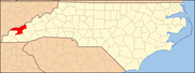 | |
| CDP | ||
|
Unincorporated communities | ||
| Indian reservation | ||
| Footnotes | ‡This populated place also has portions in an adjacent county or counties | |
Municipalities and communities of
Jackson County, North Carolina, United States | ||
|---|---|---|
| Towns | 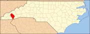 | |
| Village | ||
| CDPs | ||
|
Unincorporated communities | ||
| Indian reservation | ||
| Footnotes | ‡This populated place also has portions in an adjacent county or counties | |
| Authority control databases: National |
|---|
- Communities of the Great Smoky Mountains
- Populated places established in 1881
- 1933 disestablishments in North Carolina
- 1881 establishments in North Carolina
- Populated places disestablished in 1933
- Census-designated places in Jackson County, North Carolina
- Census-designated places in Swain County, North Carolina
- Western North Carolina geography stubs
Whittier, North Carolina | |
|---|---|
|
| |
Whittier Whittier | |
| Coordinates: 35°26′02″N 83°21′23″W / 35.43389°N 83.35639°W | |
| Country | United States |
| State | North Carolina |
| County | Jackson and Swain |
| Named for | Dr. Clarke Whittier [1] |
| Area | |
| • Total | 0.18 sq mi (0.48 km2) |
| • Land | 0.18 sq mi (0.47 km2) |
| • Water | 0.00 sq mi (0.00 km2) |
| Elevation | 1,926 ft (587 m) |
| Population (
2020) | |
| • Total | 25 |
| • Density | 136.61/sq mi (52.80/km2) |
| Time zone | UTC-5 ( Eastern (EST)) |
| • Summer ( DST) | UTC-4 (EDT) |
| ZIP codes | 28789 |
| Area code | 828 |
| FIPS code | 37-73780 |
| GNIS feature ID | 2805285 [3] |
Whittier is an unincorporated community and census-designated place (CDP) in Jackson and Swain counties in the western part of the U.S. state of North Carolina. It was first listed as a CDP in the 2020 census with a population of 25. [4]
Whittier is located on the Tuckasegee River, between Bryson City downstream to the west, and Dillsboro upstream to the southeast. The town of Whittier has its own Post Office, located at 22 Main Street.
History
Founded in 1881 by Dr. Clarke Whittier when he purchased 60,000 acres (24,000 ha) of land in the area, it was incorporated as a town from 1887 to 1933. The town declined following the collapse of the lumber industry during the Great Depression. [5]
Demographics
| Census | Pop. | Note | %± |
|---|---|---|---|
| 2020 | 25 | — | |
| U.S. Decennial Census
[6] 2020 [7] | |||
2020 census
| Race / Ethnicity | Pop 2020 [7] | % 2020 |
|---|---|---|
| White alone (NH) | 21 | 84.00% |
| Black or African American alone (NH) | 0 | 0.00% |
| Native American or Alaska Native alone (NH) | 0 | 0.00% |
| Asian alone (NH) | 0 | 0.00% |
| Pacific Islander alone (NH) | 0 | 0.00% |
| Some Other Race alone (NH) | 0 | 0.00% |
| Mixed Race/Multi-Racial (NH) | 1 | 4.00% |
| Hispanic or Latino (any race) | 3 | 12.00% |
| Total | 25 | 100.00% |
References
- ^ "North Carolina Gazetteer". Retrieved December 24, 2020.
- ^ "ArcGIS REST Services Directory". United States Census Bureau. Retrieved September 20, 2022.
- ^ a b U.S. Geological Survey Geographic Names Information System: Whittier, North Carolina
- ^ "Whittier CDP, North Carolina". United States Census Bureau. Retrieved April 7, 2022.
- ^ Whittier, NC – The Way It Used to Be, Postcards from the Smokies (retrieved 2 July 2014)
- ^ "Decennial Census by Decade". US Census Bureau.
- ^ a b "P2 HISPANIC OR LATINO, AND NOT HISPANIC OR LATINO BY RACE – 2020: DEC Redistricting Data (PL 94-171) – Whittier CDP, North Carolina". United States Census Bureau.
External links
Municipalities and communities of
Swain County, North Carolina, United States | ||
|---|---|---|
| Town | | |
| CDP | ||
|
Unincorporated communities | ||
| Indian reservation | ||
| Footnotes | ‡This populated place also has portions in an adjacent county or counties | |
Municipalities and communities of
Jackson County, North Carolina, United States | ||
|---|---|---|
| Towns | | |
| Village | ||
| CDPs | ||
|
Unincorporated communities | ||
| Indian reservation | ||
| Footnotes | ‡This populated place also has portions in an adjacent county or counties | |
| Authority control databases: National |
|---|
- Communities of the Great Smoky Mountains
- Populated places established in 1881
- 1933 disestablishments in North Carolina
- 1881 establishments in North Carolina
- Populated places disestablished in 1933
- Census-designated places in Jackson County, North Carolina
- Census-designated places in Swain County, North Carolina
- Western North Carolina geography stubs