Photos • Location

- See also Westerville for similarly named places.
Westreville is an unincorporated community in Clay County, South Dakota, United States.
- Latitude: 42.92417
- Longitude: -97.02306
- Elevation: 1309 ft
External links
42°55′27″N 97°01′24″W / 42.92417°N 97.02333°W
Municipalities and communities of
Clay County, South Dakota, United States | ||
|---|---|---|
| Cities | 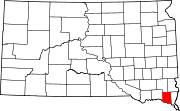 | |
| Town | ||
| CDPs | ||
|
Other communities | ||
| Footnotes | ‡This populated place also has portions in an adjacent county or counties | |
|
| This South Dakota state location article is a stub. You can help Wikipedia by expanding it. |
- See also Westerville for similarly named places.
Westreville is an unincorporated community in Clay County, South Dakota, United States.
- Latitude: 42.92417
- Longitude: -97.02306
- Elevation: 1309 ft
External links
42°55′27″N 97°01′24″W / 42.92417°N 97.02333°W
Municipalities and communities of
Clay County, South Dakota, United States | ||
|---|---|---|
| Cities | | |
| Town | ||
| CDPs | ||
|
Other communities | ||
| Footnotes | ‡This populated place also has portions in an adjacent county or counties | |
|
| This South Dakota state location article is a stub. You can help Wikipedia by expanding it. |