Photos • Location

Ware | |
|---|---|
 Ware Location within the state of Kentucky  Ware Ware (the United States) | |
| Coordinates: 37°12′31″N 84°46′8″W / 37.20861°N 84.76889°W | |
| Country | United States |
| State | Kentucky |
| County | Casey |
| Elevation | 1,132 ft (345 m) |
| Time zone | UTC-6 ( Central (CST)) |
| • Summer ( DST) | UTC-5 (CST) |
| GNIS feature ID | 509318 [1] |
Ware is an unincorporated community in Casey County, Kentucky, United States. Its post office [2] has ceased to exist.
References
Municipalities and communities of
Casey County, Kentucky, United States | ||
|---|---|---|
| City | 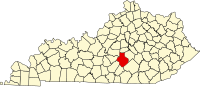 | |
|
Unincorporated Communities | ||
| Ghost Towns | ||
|
| This Casey County, Kentucky state location article is a stub. You can help Wikipedia by expanding it. |
Ware | |
|---|---|
Ware Location within the state of Kentucky Ware Ware (the United States) | |
| Coordinates: 37°12′31″N 84°46′8″W / 37.20861°N 84.76889°W | |
| Country | United States |
| State | Kentucky |
| County | Casey |
| Elevation | 1,132 ft (345 m) |
| Time zone | UTC-6 ( Central (CST)) |
| • Summer ( DST) | UTC-5 (CST) |
| GNIS feature ID | 509318 [1] |
Ware is an unincorporated community in Casey County, Kentucky, United States. Its post office [2] has ceased to exist.
References
Municipalities and communities of
Casey County, Kentucky, United States | ||
|---|---|---|
| City | | |
|
Unincorporated Communities | ||
| Ghost Towns | ||
|
| This Casey County, Kentucky state location article is a stub. You can help Wikipedia by expanding it. |