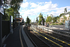
Photos • Location
 | |
| General information | |
| Location |
Vestre Aker,
Oslo Norway |
| Coordinates | 59°58′0″N 10°39′18″E / 59.96667°N 10.65500°E |
| Elevation | 330.5 m (1,084 ft) |
| Owned by | Sporveien |
| Operated by | Sporveien T-banen |
| Line(s) | Holmenkollen Line |
| Distance | 10.8 km (6.7 mi) from Stortinget |
| Construction | |
| Structure type | At-grade |
| Accessible | Yes |
| History | |
| Opened | 16 May 1916 |
Voksenlia is a station on the Holmenkollen Line (Line 1) of the Oslo Metro. It is between Skogen and Holmenkollen. [1] The station was opened on 16 May 1916 when the tramway was extended to Frognerseteren. The station was originally called Lia.
References
| Preceding station |
|
Following station | ||
|---|---|---|---|---|
|
Skogen towards
Frognerseteren
|
Line 1 |
Holmenkollen towards
Bergkrystallen
| ||
