Photos • Location
| Vils | |
|---|---|
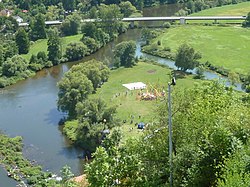
 The Vils flowing into the Naab | |
| Location | |
| Country | Germany |
| State | Bavaria |
| Physical characteristics | |
| Source | |
| • location | Upper Palatinate |
| Mouth | |
• location | Naab |
• coordinates | 49°9′32″N 11°57′19″E / 49.15889°N 11.95528°E |
| Length | 87.4 km (54.3 mi) [1] |
| Basin size | 1,239 km2 (478 sq mi) [1] |
| Basin features | |
| Progression | Naab→ Danube→ Black Sea |
The Vils is a river in Bavaria, Germany.
Its source is near Freihung. The 87 km (54 mi)-long Vils flows generally south through the towns of Vilseck, Amberg and Schmidmühlen. It is a right tributary of the Naab in Kallmünz.
- ^ a b Complete table of the Bavarian Waterbody Register by the Bavarian State Office for the Environment (xls, 10.3 MB)
| Vils | |
|---|---|
 The Vils flowing into the Naab | |
| Location | |
| Country | Germany |
| State | Bavaria |
| Physical characteristics | |
| Source | |
| • location | Upper Palatinate |
| Mouth | |
• location | Naab |
• coordinates | 49°9′32″N 11°57′19″E / 49.15889°N 11.95528°E |
| Length | 87.4 km (54.3 mi) [1] |
| Basin size | 1,239 km2 (478 sq mi) [1] |
| Basin features | |
| Progression | Naab→ Danube→ Black Sea |
The Vils is a river in Bavaria, Germany.
Its source is near Freihung. The 87 km (54 mi)-long Vils flows generally south through the towns of Vilseck, Amberg and Schmidmühlen. It is a right tributary of the Naab in Kallmünz.
- ^ a b Complete table of the Bavarian Waterbody Register by the Bavarian State Office for the Environment (xls, 10.3 MB)