Photos • Location
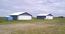
The hangars at Viking Airport

Viking Airport | |||||||||||
|---|---|---|---|---|---|---|---|---|---|---|---|
 Runway 13 | |||||||||||
| Summary | |||||||||||
| Airport type | Public | ||||||||||
| Operator | Town of Viking | ||||||||||
| Location | Beaver County, near Viking, Alberta | ||||||||||
| Time zone | MST ( UTC−07:00) | ||||||||||
| • Summer ( DST) | MDT ( UTC−06:00) | ||||||||||
| Elevation AMSL | 2,260 ft / 689 m | ||||||||||
| Coordinates | 53°06′29″N 111°51′50″W / 53.10806°N 111.86389°W | ||||||||||
| Map | |||||||||||
 CEE8 Location in Alberta | |||||||||||
| Runways | |||||||||||
| |||||||||||
Source:
Canada Flight Supplement
[1] | |||||||||||
Viking Airport ( TC LID: CEE8) is an airport which is located 3 nautical miles (5.6 km; 3.5 mi) northwest of Viking, Alberta, Canada.
See also
References
External links
- Place to Fly on COPA's Places to Fly airport directory

| By name | |
|---|---|
| By location indicator | |
| By province/territory | |
| By area | |
| National Airports System | |
| Related | |
|
| This article about an airport in Alberta is a stub. You can help Wikipedia by expanding it. |
Viking Airport | |||||||||||
|---|---|---|---|---|---|---|---|---|---|---|---|
|
Runway 13 | |||||||||||
| Summary | |||||||||||
| Airport type | Public | ||||||||||
| Operator | Town of Viking | ||||||||||
| Location | Beaver County, near Viking, Alberta | ||||||||||
| Time zone | MST ( UTC−07:00) | ||||||||||
| • Summer ( DST) | MDT ( UTC−06:00) | ||||||||||
| Elevation AMSL | 2,260 ft / 689 m | ||||||||||
| Coordinates | 53°06′29″N 111°51′50″W / 53.10806°N 111.86389°W | ||||||||||
| Map | |||||||||||
CEE8 Location in Alberta | |||||||||||
| Runways | |||||||||||
| |||||||||||
Source:
Canada Flight Supplement
[1] | |||||||||||
Viking Airport ( TC LID: CEE8) is an airport which is located 3 nautical miles (5.6 km; 3.5 mi) northwest of Viking, Alberta, Canada.
See also
References
External links
- Place to Fly on COPA's Places to Fly airport directory
| By name | |
|---|---|
| By location indicator | |
| By province/territory | |
| By area | |
| National Airports System | |
| Related | |
|
| This article about an airport in Alberta is a stub. You can help Wikipedia by expanding it. |