Photos • Location
| Vigia | |
|---|---|
northwestern
Boa Vista island, Cape Verde | |
| Highest point | |
| Elevation | 146 m (479 ft) |
| Coordinates | 16°12′44″N 22°54′45″W / 16.2121°N 22.9125°W |
| Geography | |
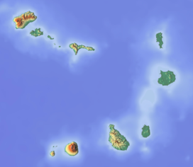
| Location | northwestern Boa Vista island, Cape Verde |
Vigia is a low mountain in the northwestern part of the island of Boa Vista, Cape Verde. Its elevation is 146 m. It is situated 4 km north of the island capital Sal Rei, and 2 km south of the headland Ponta do Sol. It is part of the Ponta do Sol Nature Reserve covering 467 hectares of land and sea. [1]
See also
References
- ^ Protected areas in the island of Boa Vista - Municipality of Boa Vista, March 2013 (in Portuguese)

