Veliko Golovode
Велико Головоде | |
|---|---|
Village | |
 | |
 Veliko Golovode | |
| Coordinates: 43°32′50″N 21°21′36″E / 43.54722°N 21.36000°E | |
| Country | |
| District | Rasina District |
| Municipality | Kruševac |
| Elevation | 430 ft (130 m) |
| Population (2011) | |
| • Total | 801 |
| Time zone | UTC+1 ( CET) |
| • Summer ( DST) | UTC+2 ( CEST) |
Veliko Golovode is a village in the city of Kruševac, Serbia. According to the 2011 census, the village has a population of 801 people. [1]
Geography
Veliko Golovode village forms a rough triangle with the villages of Modrica and Mudrakovac, south of the main urban area of Kruševac. The Rasina River flows through the village and just through this part of its flow is known for gold deposits.
Economy
|
| This section needs expansion. You can help by
adding to it. (October 2021) |
Education
|
| This section needs expansion. You can help by
adding to it. (October 2021) |
Gallery
-
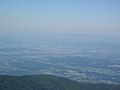 Kruševac basin from "Bela stena" peak (Jastrebac mountain)
 -
 Rtanj mountain(Peak Siljak 1565m)seen from Golovode
 -
 Golovode and Kruševac suburbs, Mudrakovac, Bagdala and Rasadnik
 -
 Mountain Jastrebac seen from Golovode
 -
 Veliko Golovode, Kruševac in sunset, Goč in the background

%D0%B8%D0%B7_%D0%92%D0%B5%D0%BB%D0%B8%D0%BA%D0%BE%D0%B3_%D0%93%D0%BE%D0%BB%D0%BE%D0%B2%D0%BE%D0%B4%D0%B0.jpg)


References
- ^ Popis stanovništva, domaćinstava i Stanova 2002. Knjiga 1: Nacionalna ili etnička pripadnost po naseljima. Republika Srbija, Republički zavod za statistiku Beograd 2003. ISBN 86-84433-00-9
43°32′50″N 21°21′36″E / 43.54722°N 21.36000°E
|
| This Rasina District, Serbia location article is a stub. You can help Wikipedia by expanding it. |
Veliko Golovode
Велико Головоде | |
|---|---|
Village | |
|
| |
Veliko Golovode | |
| Coordinates: 43°32′50″N 21°21′36″E / 43.54722°N 21.36000°E | |
| Country | |
| District | Rasina District |
| Municipality | Kruševac |
| Elevation | 430 ft (130 m) |
| Population (2011) | |
| • Total | 801 |
| Time zone | UTC+1 ( CET) |
| • Summer ( DST) | UTC+2 ( CEST) |
Veliko Golovode is a village in the city of Kruševac, Serbia. According to the 2011 census, the village has a population of 801 people. [1]
Geography
Veliko Golovode village forms a rough triangle with the villages of Modrica and Mudrakovac, south of the main urban area of Kruševac. The Rasina River flows through the village and just through this part of its flow is known for gold deposits.
Economy
|
| This section needs expansion. You can help by
adding to it. (October 2021) |
Education
|
| This section needs expansion. You can help by
adding to it. (October 2021) |
Gallery
-
Kruševac basin from "Bela stena" peak (Jastrebac mountain)
-
Rtanj mountain(Peak Siljak 1565m)seen from Golovode
-
Golovode and Kruševac suburbs, Mudrakovac, Bagdala and Rasadnik
-
Mountain Jastrebac seen from Golovode
-
Veliko Golovode, Kruševac in sunset, Goč in the background
References
- ^ Popis stanovništva, domaćinstava i Stanova 2002. Knjiga 1: Nacionalna ili etnička pripadnost po naseljima. Republika Srbija, Republički zavod za statistiku Beograd 2003. ISBN 86-84433-00-9
43°32′50″N 21°21′36″E / 43.54722°N 21.36000°E
|
| This Rasina District, Serbia location article is a stub. You can help Wikipedia by expanding it. |