|
I've left a comment at commons. 89.243.33.170 ( talk) 10:25, 1 February 2009 (UTC)
Hello, Please have a look at the SVG-file File:WidespreadWrongUsageOfRomanianDiacritics.PNG you've put in romanian alphabet and review it. It says that the "a", "s" and "t" letters are out of the romanian alphabet. Thank you 188.25.28.82 ( talk) 21:35, 12 October 2010 (UTC)
- No it doesn't say that! Instead it just says that in written Romanian there is a widespread wrong habit of replacing diacritics such as ă, â, î, ș and ț with simple plain letters such as a, i, s and t, among other replacements.
-
Scooter20 (
talk)
11:28, 14 October 2010 (UTC)
- Yes, the "correct diacritics" column is true. If you are kind, the image should include a distinct column for "correct letters A, S, T". It confuses people to replace everywhere the a, s, t-letters with the one you say.
188.25.52.56 (
talk)
02:55, 22 October 2010 (UTC)
- I changed the table headers to eliminate confusion, but I still don't fully see what you are concerned about.
- The image itself is self explanatory, it just says that there is a wide spread usage of diacritic replacement with plain letters, it does not say that those plain letters are not part of the alphabet.
- I mean people often write words such as casa instead of casă, sant instead of șanț and so forth.
- This is the most obvious miss usage but there are others more subtle and less visible such as: ã instead of ă or even ş and ţ instead of ș and ț.
- Also ș is replaced by sh and ț is replaced by tz in modern computer instant messaging slang.
- I made this image to show what are the standard valid diacritics in Romanian and what are the main wrong replacements (I did not say that plain letter replacements are not valid letters in the alphabet).
- Hope this helps!
- Scooter20 ( talk) 19:02, 24 October 2010 (UTC)
- Yes, the "correct diacritics" column is true. If you are kind, the image should include a distinct column for "correct letters A, S, T". It confuses people to replace everywhere the a, s, t-letters with the one you say.
188.25.52.56 (
talk)
02:55, 22 October 2010 (UTC)
- The correct encoding of romanian diacritics is as follows:
for the capital-form S- and T-diacritics with cedilla, as of Windows Vista, it will use the international standard iso/iec8859-2/1998. The capital letters bare unicode U+015E, U+0162.
The official romanian standard is SR13411-1999, "character set encoded for the romanian language" and assign diacritics with codes U+0218, U+021A, unicode compliant. These are each written using commas.
The use of lines in diacritics is incorect The use of curves is also incorrect The use of plain letters with no diacritics is tolerated, and it's done in respect to the english alphabet. Same goes for the small-form diacritics familly, 188.25.104.76 ( talk) 16:54, 14 November 2010 (UTC)
The vandal is back. -- Olahus ( talk) 20:06, 2 February 2009 (UTC)
- What do you mean? are you talking about those who keep reverting the Latin Europe article? Scooter20 ( talk) 09:48, 4 February 2009 (UTC)
This map is all well and good, except:
- The microstates again need to be enlarged as before.
- The parts coloured in blue on Croatia, Greece, Macedonia, Bulgaria, Albania, Serbia, Hungary, and Ukraine need to be light blue. And Malta needs to be added in light blue.
- Also, the uncoloured areas of France, Spain, Romania, and Moldova need to be coloured in light blue.
- The title of the map needs to be moved away from the idea of "Latin Europe", since consensus on the talk page and the article itself show that a country is not in "Latin Europe" simply for speaking a Romance language. The more correct name of the map would be something along the lines of "RomanceEurope" (see Romance Europe).
- Cheers 78.146.228.71 ( talk) 09:04, 7 February 2009 (UTC)
Some time ago it was decided (as part of the Romanian Wikiproject) to merge all the articles concerning the villages to the communes they belong to. Have a look here: Wikipedia:Romanian_Wikipedians'_notice_board/Archive10#Villages. I fully agree with the policy, since 1) the villages are just informal subdivisions of a commune, and 2) most of village articles would be stubs forever. I do admit that some villages are worth having their own articles, but in order to keep it consistent, I don't see anything wrong with describing a village within the article for its parent commune. Cheers, Mentatus ( talk) 21:46, 9 February 2009 (UTC)
- I copied the village article content into the article of its corresponding commune. Why should we keep them both? We either apply this policy in a consistent manner or not at all. The link is redirected to the commune, so nothing is lost. As I said before, if we were to create articles for each village, we would have a lot of stubs with duplicate data from the commune infobox. Of course we can expand the village description but within the article of its parent commune. Mentatus ( talk) 22:10, 9 February 2009 (UTC)
- If I may intrude a little - the idea is that the information is preserved, and that anyone looking for Josani will easily find it at Căbeşti. Also keep in mind that having separate articles on villages creates a dilemma: Căbeşti is the name of both a five-village commune and the village at its centre. Do we have one article on each village, including Căbeşti (village), and one just on the commune? Or do we have a single article on the commune, with five sections, one for each village? I think the latter solution is much neater. - Biruitorul Talk 03:07, 10 February 2009 (UTC)

|
The Geography Barnstar | |
| For your extensive work on Latin Europe related maps 78.146.228.71 ( talk) 13:48, 7 February 2009 (UTC) |
- Thanks! Scooter20 ( talk) 13:57, 7 February 2009 (UTC)
I don't know what to say. It's just an esthetic effect, which adds nothing to the information. In heraldry science and in law texts, there are no such things as shadow and transparency. You'd better open a pool in each discussion page. -- Alex:D ( talk) 18:14, 5 March 2009 (UTC)
On this image, you have written "Germanic Europe". Germanic Europe is a different idea from "Germanic-speaking Europe", which is what the map that you have created, should be called. 78.149.218.56 ( talk) 10:03, 8 April 2009 (UTC)
- Fixed!
Scooter20 (
talk)
20:49, 8 April 2009 (UTC)
- Hey that's great. Sorry to bother you, but as an IP, I am unable to do page moves.
- Could you move Romance Europe to Romance-speaking Europe.
- Romance-speaking African countries to Romance-speaking Africa.
- Romance-speaking Asian countries to Romance-speaking Asia.
- Thanks!
78.151.99.117 (
talk)
09:14, 9 April 2009 (UTC)
- Hi! If you want to have more privileges you can create an account
- I didn't actually move the old articles to the new articles that you suggested, because this should be discussed on the talk page of the original articles first. What I did was to redirect the new articles to the old ones.
-
Scooter20 (
talk)
10:02, 9 April 2009 (UTC)
- Hello. Now that you've directed the unmade pages to those pages, it will be impossible to move them without administrator help. Discussion over moves occurs when there is controversy about the moves - there is nothing controversial at all about these.
78.146.101.10 (
talk)
13:39, 10 April 2009 (UTC)
- Hi. I have to disagree about that. It is still possible to move them without admin help.
- I have moved the old pages to the new pages as you initially requested.
- You will find that the old articles are now redirected to the new articles which were specified by you (they hold the actual data).
- Scooter20 ( talk) 14:55, 10 April 2009 (UTC)
- Hello. Now that you've directed the unmade pages to those pages, it will be impossible to move them without administrator help. Discussion over moves occurs when there is controversy about the moves - there is nothing controversial at all about these.
78.146.101.10 (
talk)
13:39, 10 April 2009 (UTC)
- Fixed!
Scooter20 (
talk)
20:49, 8 April 2009 (UTC)
Hi there. I see you've been making lots of great maps lately, and I congratulate you on that - you are possibly the best map-maker here. ;)
However, there's just a couple of things with this picture...
- The part that says "Distribution of Romance speaking peoples in Europe" should probably be changed to "Romance-speaking Europe", in line with the article.
- The part that says "Area with an official Romance language inhabited by a Romance speaking majority" would probably be simpler and easier to understand as something like "Official Romance language used by majority"
- The next bit, that says "Area with an official Romance language inhabited by a Romance speaking minority" could be "Official Romance language used by minority"
- The last bit, "Area with an official/unofficial Romance language inhabited by a Romance speaking majority" is a bit misleading (and complicated), and would possibly be better as "Significant unofficial/co-official/historical Romance usage". Also, the color used for this bit is very similar to the first color... is it possible to make it a very dark blue, to distinguish?
Cheers, and keep up the good work 78.147.159.55 ( talk) 21:30, 13 April 2009 (UTC)
- It's great, as always! Thanks
78.147.159.55 (
talk)
22:15, 13 April 2009 (UTC)
- Thanks!
- Check out these maps that I created lately:
- Tell me what do you think! Scooter20 ( talk) 22:20, 13 April 2009 (UTC)
- It's great, as always! Thanks
78.147.159.55 (
talk)
22:15, 13 April 2009 (UTC)
-
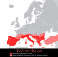 Southern Europe
 -
Distribution of Roman Catholicism in Europe

- I was looking at them earlier. They're good and accurate. It'd be nice to have one for Orthodox Christianity in Europe, to go with the other two
Image:RomanCatholicismInEurope.png , if you ever have time :)
78.147.159.55 (
talk)
22:38, 13 April 2009 (UTC)
- Hi, I actually created this map for Distribution of Orthodoxy in Europe.
-
Scooter20 (
talk)
23:54, 13 April 2009 (UTC)
- I also created an Islam in Europe map.
- Scooter20 ( talk) 22:58, 14 April 2009 (UTC)
- I was looking at them earlier. They're good and accurate. It'd be nice to have one for Orthodox Christianity in Europe, to go with the other two
Image:RomanCatholicismInEurope.png , if you ever have time :)
78.147.159.55 (
talk)
22:38, 13 April 2009 (UTC)
It would be great if you would change your map of protestantism in Europe by making England Grey ,to keep consistent with the rest of Wikipedia and the protestantism Article that Anglicanism is a distict branch of Christianity, i will remove the map from the page until then, thank you-- Sfcongeredwards ( talk) 23:49, 22 May 2009 (UTC)
- The descriptions of these maps is lacking an explanation of on what data these maps are based on. With the contemporary borders shown the map attempts to illustrate religious adherence in current times. But these maps are not in line with data as collected by (national) churches, national census and so on...so I am wondering what the factual basis is for these maps. — Preceding
unsigned comment added by
83.87.2.139 (
talk)
11:49, 14 December 2012 (UTC)
- The 'religion' maps were made a long time ago and were based on this
map. I see now that the accuracy of the source map is disputed. Since I did not create it, I am not sure what the source map tried to show, probably the most dominant religion in each area of Europe despite the fact that in some places such as the Czech Republic, non-religious are the majority! At the time I made my maps, the source map was widely used on Wikipedia but not anymore, so my maps are disputed as well. Hope this helps!
Scooter20 (
talk)
12:37, 14 December 2012 (UTC)
- Should these maps not either be corrected or retracted? What is the point of having these misleading maps, as is? Thanks — Preceding
unsigned comment added by
107.0.7.44 (
talk)
06:27, 3 September 2013 (UTC)
- Why have these non-WIKI compliant maps not been deleted, if even the maker admits that accuracy etc. is an issue? 188.206.100.246 ( talk) 07:18, 13 November 2017 (UTC)
- Should these maps not either be corrected or retracted? What is the point of having these misleading maps, as is? Thanks — Preceding
unsigned comment added by
107.0.7.44 (
talk)
06:27, 3 September 2013 (UTC)
- The 'religion' maps were made a long time ago and were based on this
map. I see now that the accuracy of the source map is disputed. Since I did not create it, I am not sure what the source map tried to show, probably the most dominant religion in each area of Europe despite the fact that in some places such as the Czech Republic, non-religious are the majority! At the time I made my maps, the source map was widely used on Wikipedia but not anymore, so my maps are disputed as well. Hope this helps!
Scooter20 (
talk)
12:37, 14 December 2012 (UTC)
- The descriptions of these maps is lacking an explanation of on what data these maps are based on. With the contemporary borders shown the map attempts to illustrate religious adherence in current times. But these maps are not in line with data as collected by (national) churches, national census and so on...so I am wondering what the factual basis is for these maps. — Preceding
unsigned comment added by
83.87.2.139 (
talk)
11:49, 14 December 2012 (UTC)
Hello. I see that you appear to be the main map-producer for the Germanic/Latin Europe articles. I would like to ask you, as a neutral party, since we are having some content disputes, what your view is on the placing of this map (or perhaps even your version) in the opening section of Germanic Peoples? Lingamondo ( talk) 14:12, 14 April 2009 (UTC)
- <sarcasm>excellent suggestion. And let's place
this map in the lead section of
Sumer while we're at it!</sarcasm> --
dab
(𒁳)
14:47, 14 April 2009 (UTC)
- You asked for me to get a 3rd opinion, and that's exactly what I went and did. Sarcasm is not going to get us anywhere. The placing of a map of Germanic languages into an article about an ethnolinguistic group based on these languages, is hardly a controversial concept to be honest.
Lingamondo (
talk)
14:56, 14 April 2009 (UTC)
- Hi, I'm not sure if I'm the most qualified person to give you the best answer.
- My opinion is, that such a picture, if put in the article, would not be out of context.
- After all, the Germanic peoples speak modern Germanic languages which have evolved from a common Proto-Germanic language spoken by early Germanic tribes.
- However, it should be made clear that the picture represents the distribution of modern Germanic-speaking populations and not an ancient distribution of the Germanic-speaking populations.
- The map caption should probably say something like: Current distribution of Germanic-speaking populations (in the case of this map) or Distribution of Modern Germanic languages (in the case of this map).
- Thanks! Scooter20 ( talk) 19:31, 14 April 2009 (UTC)
- You asked for me to get a 3rd opinion, and that's exactly what I went and did. Sarcasm is not going to get us anywhere. The placing of a map of Germanic languages into an article about an ethnolinguistic group based on these languages, is hardly a controversial concept to be honest.
Lingamondo (
talk)
14:56, 14 April 2009 (UTC)
- The "Area inhabited by a Germanic-speaking majority" should read "Germanic language official and used by majority"
- The "Area inhabited by a Germanic-speaking majority/minority/bilingual which is considered to be part of Celtic Culture and Heritage" should read "Germanic language co-official"
- The parts of France, Finland, and Italy, should be colored in a different color, which reads "Germanic language significantly used unofficially/historically".
- Luxembourg needs be colored the same as Ireland, Scotland, and Wales. Cornwall should be colored the same as England.
- Gibraltar and Malta should be added (in another color) as "Germanic language co-officially used due to British presence". 78.147.158.77 ( talk) 09:36, 17 April 2009 (UTC)
- Done. Tell me what do you think!
- Thanks! Scooter20 ( talk) 11:09, 21 April 2009 (UTC)
Greece is not in Western Europe, if this is not corrected I will request deletion due to inaccuracy. Izzedine ( talk) 06:03, 30 April 2009 (UTC)
- If you would read the map legend more carefully you would see that Greece is sometimes (not always) considered Western European (ie: Maximum extent of Western Europe) even though it is geographically situated in Southeastern Europe.
- Scooter20 ( talk) 08:44, 30 April 2009 (UTC)
Greece is on the Balkan peninsula which is in Southeastern Europe, if this is not corrected I will request deletion due to inaccuracy. Izzedine ( talk) 06:09, 30 April 2009 (UTC)
- Eastern Europe has many definitions but the core states are mainly the East Slavic nations (Russia, Ukraine and Belarus). Some definitions of Eastern Europe include East Central Europe, the Baltic States and Southeastern Europe but without Greece because Greece is sometimes seen as a Western European country.
- Scooter20 ( talk) 08:50, 30 April 2009 (UTC)
Britain and Ireland are in Northern Europe, if this is not corrected I will request deletion due to inaccuracy. Izzedine ( talk) 06:15, 30 April 2009 (UTC)
- Northern Europe proper is composed of the Nordic countries (Iceland, Denmark, Sweden, Norway and Finland) and the Baltic states (Latvia, Lithuania and Estonia). The British Isles (Great Britain and Ireland) are sometimes included in Northern Europe (as the map says) but primarily are part of Western Europe (proper).
- Scooter20 ( talk) 08:54, 30 April 2009 (UTC)
Cyprus and Rhodes are geographically in Western Asia, if this is not corrected I will request deletion due to inaccuracy. Izzedine ( talk) 06:19, 30 April 2009 (UTC)
- 1. Cyprus in considered European for cultural and historic reasons, despite being geographically in Asia.
- 2. Rhodes is part of Greece, which is a country geographically situated in Southeastern Europe but also sometimes considered Western European.
- Scooter20 ( talk) 08:56, 30 April 2009 (UTC)
Could you turn-on the email function? It's in the "my preferences tab" at the top of your screen. Once you turn it on you can send and receive email. Hobartimus ( talk) 13:46, 2 May 2009 (UTC)
- Thanks for the suggestion, but I'd rather not receive any spam, or get my inbox filled with messages every day!
-
Scooter20 (
talk)
13:49, 2 May 2009 (UTC)
- That would hardly be the case it simply means you get an extra link on your user page (email this user) at the left hand side, so other wikipedians can click on it and send mail. Only wikipedians can use the link, you can disable it any time you want. You can send me an email the same way, using a link on the user page.
Hobartimus (
talk)
14:46, 2 May 2009 (UTC)
- Scooter if you change your mind, please send me an email, I think we can find much common ground regarding a lot of stuff. I will probably try to edit the map originally uploaded by you, in the future but don't want to get into a conflict over it. Also semi-personal discussions like the one you had on the image talk page do not really belong there, the page is for discussion about improving the image.
Hobartimus (
talk)
15:35, 3 May 2009 (UTC)
- I'm not sure if I'm going to enable my email.
- I don't understand why would you want to edit my map, the source of the map is specified on the file page, and it show only the places where Hungarians are over 50% of the population. That's why Hungarians in Austria, Croatia and Slovenia are absent from the map.
- In case you still want to edit the map, I suggest creating a new image based on my map and uploading it. This way my map would stay intact.
- I agree that the discussion didn't belonged on the map talk page, but was stopped since it didn't lead anywhere.
- Thank you!
-
Scooter20 (
talk)
17:04, 3 May 2009 (UTC)
- It would be pointless to create a new map, then I would have to remove the image from the articles and replace it with the new image every time. There are few things simple things I would change, but I will think about it. Hobartimus ( talk) 17:09, 19 May 2009 (UTC)
- Scooter if you change your mind, please send me an email, I think we can find much common ground regarding a lot of stuff. I will probably try to edit the map originally uploaded by you, in the future but don't want to get into a conflict over it. Also semi-personal discussions like the one you had on the image talk page do not really belong there, the page is for discussion about improving the image.
Hobartimus (
talk)
15:35, 3 May 2009 (UTC)
- That would hardly be the case it simply means you get an extra link on your user page (email this user) at the left hand side, so other wikipedians can click on it and send mail. Only wikipedians can use the link, you can disable it any time you want. You can send me an email the same way, using a link on the user page.
Hobartimus (
talk)
14:46, 2 May 2009 (UTC)
Hey Scooter20, I'd like to comment on the map showing the geography of Slavic languages you uploaded to a number of Wikipedia articles. There are a number of inaccuracies which I'd like to point out to:
1. Russian is not spoken by a minority in Leningrad Region (around St Petersburg);
2. Russian is not spoken by a minority in areas between Moscow and St Petersburg;
3. According to a 1970 census 92.000 people claimed they were speakers of Karelian dialects while the overall population of the then Karelian Autonomous Socialist Republic was at 715.000 people. If you can provide updated data on that, that'll be fine. If we rely on the data I provided there is no way for Russian to be spoken by a minority in Karelia.
4. Russian is the native language of ethnic Russians in Estonia and Latvia who make up around 25 percent of Estonia's and Latvia's population respectively.
These are some of the inaccuracies I spotted in your map. If you claim to have a good knowledge of the geography of Slavic languages, please, be more accurate and edit your map. If you are not qualified enough, please do not upload inaccurate maps. Thank you. Denghu ( talk)
- I sent a reply on your talk page!
- Scooter20 ( talk) 08:10, 4 May 2009 (UTC)
- If you are interested in the section of Slavic languages in Greece then here are some more accurate maps of the Slavic population in Greece and Macedonia. PMK1 ( talk) 06:23, 17 May 2009 (UTC)
Hi there! I just mentioned the map about Albanian diaspora and its last version [ [1]] with some dots in Greece. Although there are Albanian speaking (bilingual) villages in nw Greece, Alb. speaking populations dont form a clear majority (in a municipicality or town) as far as i know. This map [ [2]], shows that there'snt an Albanian majority, in this region. Some sources would be in handy about the majority claim. Thank you. Alexikoua ( talk) 16:17, 5 May 2009 (UTC)
![[1]](/info/en/?search=File:AlbaniansOutsideAlbania.png)
![[2]](/info/en/?search=File:Northerngreecelanguages.png)
- Hi, thanks for the heads-up! Fixed!
- Scooter20 ( talk) 18:39, 5 May 2009 (UTC)
By the way, very nice map-job (according to Balkan related topics). Thanks too Alexikoua ( talk) 13:51, 7 May 2009 (UTC)
- Thanks! Scooter20 ( talk) 16:29, 7 May 2009 (UTC)
- One Question, in your map of Albanian people; why is the Republic of Macedonia listed as FYROM?
PMK1 (
talk)
06:19, 17 May 2009 (UTC)
- Hi, I chose the name FYROM ( Former Yugoslav Republic of Macedonia) because of the naming dispute with Greece.
- As you probably know, the territory of FYROM was inhabited by Macedonian-Greeks long before Slavic peoples settled in the region.
- This is a way to differentiate the Greek term of Macedonia from the Slav-inhabited neighboring country (FYROM).
- Scooter20 ( talk) 11:28, 17 May 2009 (UTC)
- One Question, in your map of Albanian people; why is the Republic of Macedonia listed as FYROM?
PMK1 (
talk)
06:19, 17 May 2009 (UTC)
- Be it is at may, you may consider changing it to Macedonia sometime in the future, should " FYROM" remain here. PMK1 ( talk) 13:40, 17 May 2009 (UTC)
Thank you for creating the map on the Albanian-inhabited areas ( AlbaniansOutsideAlbania.png). However, I do have concerns regarding the Albanians in Macedonia. There are regions where they constitute at least a significant minority and those should be added to the map to increase accuracy. I understand the vulnerability of the issue at stake; there is just too much nationalism in the Balkans to get honest work done, but I would suggest you consider foreign sources. A lot of Albanians live especially in Skopje, Kumanovo, and Struga; in the latter they may constitute a plurality if not a majority. Again, thank you for your contribution!-- Getoar TX ( talk) 02:19, 5 June 2009 (UTC)
- P.S. I forgot to mention the town of
Medveđa in Serbia; about a third of the population is Albanian. Also, there is a significant Albanian population in
Plava, Montenegro, just north of Albania's northernmost tip (the border with Montenegro).--
Getoar TX (
talk)
02:23, 5 June 2009 (UTC)
- Hi! Thanks for the suggestions. I improved the map regarding the Rep of Macedonia, Montenegro and Serbia.
- Tell me what do you think!
- Thanks! Scooter20 ( talk) 15:31, 8 June 2009 (UTC)
Thank you for updating the map. I am happy with the improvements, but I am unable to endorse them from a professional point of view. It is easier to tell whether something is missing, or it is exactly how it should be. Thank you again and keep up with the good work on Wikipedia!-- Getoar TX —Preceding undated comment added 09:43, 9 June 2009 (UTC).
- In case you were wondering about sources.
- I've updated the map description page with the sources (maps) that I used for creating and updating it.
- See here
- Thanks! Scooter20 ( talk) 12:18, 9 June 2009 (UTC)
File:Romanian adi.png [3]
![[3]](/info/en/?search=File:Romanian_adi.png)
Hello! The names of the cities on the map you have created do not parallel to wikipedi guidlines. Please fix them. The cities should be mentioned under their official names. Example: Debreţin should be changed to Debrecen "Bichişciaba" to Békéscsaba, Vârşeţ to Vršac, Vidin is ok, Cetatea Albă to Bilhorod-Dnistrovskyi etc. Please check all names. Cheers, B@xter 9 14:10, 12 June 2009 (UTC)
- This map is seen through a Romanian perspective, therefore every city is referred to under it's Romanian name.
- As you probably have noticed, the map is only present on my userpage.
- Since users are allowed to use any content that they like on their userpages, I don't see any problem with this map as long as it stays only on my userpage.
-
Scooter20 (
talk)
15:29, 12 June 2009 (UTC)
- I understand. "Since users are allowed to use any content that they like on their userpages" I am not sure about this, I mean rascist, pornographic and other materials are forbidden (I think, but I did not read the rules about this). So this image is created for your userpage and you are not using this elsewhere? (because this image in its current form could inaccurate)
B@xter
9
16:20, 12 June 2009 (UTC)
- Is this map racist or pornographic? I think not!
- Of course that by "any content" I didn't mean pornographic, racist or other similar material.
- This map was created primarily for my userpage. And even if I were to use it for other articles it would most likely be removed by other users.
-
Scooter20 (
talk)
17:37, 12 June 2009 (UTC)
- No, no! Of course it is not rscist or pornographic. That was just an example, which proves that not everything can be used on userpages. Use this image on your userpage if you would like. Cheers, B@xter 9 19:44, 12 June 2009 (UTC)
- I understand. "Since users are allowed to use any content that they like on their userpages" I am not sure about this, I mean rascist, pornographic and other materials are forbidden (I think, but I did not read the rules about this). So this image is created for your userpage and you are not using this elsewhere? (because this image in its current form could inaccurate)
B@xter
9
16:20, 12 June 2009 (UTC)
Hi! You added a move request tag on the description page of Romanian adi.png. Unfortunately, the requested moves page does not handle the renaming of files. See here for more information. I've re-uploaded the image as File:RomanianTerritories.png, changed the links to point to that location, and filed the old one for deletion at Files for deletion. Jafeluv ( talk) 11:06, 29 June 2009 (UTC)
- Hi, I made the request as opposed to uploading the image under a new name myself, because I was hoping that it would somehow be possible to rename it (using admin privileges) in order to preserve the history of the image.
- If this is not supported yet, I understand, and thanks for uploading the new file.
- Regards Scooter20 ( talk) 12:05, 29 June 2009 (UTC)
Hello. Thank you for correcting this map! It's much better now :) Ælfgar ( talk) 19:25, 7 July 2009 (UTC)
- Hello. I was glad to do it!
- Scooter20 ( talk) 19:29, 7 July 2009 (UTC)
This is a image showing the number of cases in Romania. I you want please modify. Thanks! TouLouse ( talk) 16:43, 10 August 2009 (UTC)
Congratulations with the map! Please allow me to point out some inconsistency concerning Belgium, however. Either the whole of Belgium should be highlighted in orange (since Dutch is co-official nationally), or Flanders should be highlighted in dark brown (since only Dutch is official there). Making Flanders orange and leaving Wallonia out would imply that French is also official in Flanders (but Dutch that is not co-official in the south), which is not correct. I suggest you make Flanders dark brown, since there actually is no language is official everywhere in Belgium (we have language areas). To be completely accurate, Brussels should be orange (since both languages are official there - and only there). I hope you will take my comments into account. Kind regards, -- Roofbird ( talk) 09:53, 12 August 2009 (UTC)
- Hello, thanks for the suggestion, I'll do the necessary changes when I'll have some free time!.
- Scooter20 ( talk) 10:33, 12 August 2009 (UTC)
Hello! Can you add the Russian-speaking minority in Estonia to this map please? They're in majority in the east, in Narva for instance 94% of the population consist of Russian speakers. Aaker ( talk) 16:56, 18 August 2009 (UTC)
- Hello. I guess I could do that but this map has been rejected from the articles that I put it in and it only resides on my userpage now.
- It might not be very accurate and I'm not sure if it worth investing time in it.
- I'll update the Russian minority in Estonia when I'll have some time, that shouldn't take much.
-
Scooter20 (
talk)
09:09, 19 August 2009 (UTC)
- Okay, thank you. I liked the map though! Aaker ( talk) 13:56, 19 August 2009 (UTC)
Hey there! I saw you made a map of distribution of ethnic Romanians in South-Eastern Europe, and I saw wondering if you can translate it in Romanian language so we can publish it on ro.wikipedia.org. and btw, I'm from Romania too :) —Preceding unsigned comment added by Radu Gherasim ( talk • contribs) 10:47, 25 August 2009 (UTC)
- Hello.
- I translated the image and uploaded the new version over the original image that you uploaded on the Romanian Wikipedia.
- See here: image link
- Thanks!

Hello Scooter20, HappyInGeneral has smiled at you! Smiles promote
WikiLove and hopefully this one has made your day better. Spread the
WikiLove by smiling at someone else, whether it be someone you have had disagreements with in the past or a good friend. Go on, smile! Cheers, and happy editing!
Smile at others by adding {{
subst:Smile}} to their talk page with a friendly message.
Buna ziua, ma numesc Mihai si sunt pasionat de istoria Romaniei. As vrea sa va intreb daca ma puteti lamuri si pe mine cum pot face harti? In cazul in care doriti sa imi dati o mana de ajutor adresa mea de messenger este tyras1980@yahoo.com Va multumesc! —Preceding unsigned comment added by Tyras1980 ( talk • contribs) 18:22, 27 November 2009 (UTC)
- Salut Mihai,
- (Nu e necesar să-mi vorbeşti la persoana a II-a plural).
- Pentru a crea hărţi / desene, eu folosesc Inkscape, un editor SVG open-source.
- Poţi să creezi o hartă şi de la 0, dar cel mai simplu este de a folosi o hartă deja existentă de pe wiki şi să o modifici pentru a crea o hartă nouă.
- Harta se creează prin desenarea de segmente, poligoane etc în acest editor.
- Editorul are şi opţiunea de a exporta harta creată în format PNG.
- Scooter20 ( talk) 18:48, 1 December 2009 (UTC)
Salut, mi-ar face placere sa putem vorbi pe messenger. Promit ca nu te stresez si ca nu iti voi rapi mult timp, adresa mea de messenger este tyras1980@yahoo.com Sarbatori fericite si un an nou plin de impliniri! Multumesc! —Preceding unsigned comment added by Tyras1980 ( talk • contribs) 21:55, 16 December 2009 (UTC)
An image or media file that you uploaded or altered, File:GreatestRomaniaInEurope.png, has been listed at Wikipedia:Files for deletion. Please see the discussion to see why this is (you may have to search for the title of the image to find its entry), if you are interested in it not being deleted. Thank you. ЛенинВладимир ( talk) 22:42, 28 December 2009 (UTC) ЛенинВладимир ( talk) 22:42, 28 December 2009 (UTC)
Please do not add maps to articles that are absurd on their face. Such as you did here [4] [5]. By doing this You will discredit yourself and all the maps you create will be regarded as nonsense. I hope there is no need to explain what's wrong with that map. Hobartimus ( talk) 22:19, 29 December 2009 (UTC)
![[4]](/info/en/?search=File:SE_Europe_Romanians.png)
- Please do!
Scooter20 (
talk)
22:36, 29 December 2009 (UTC)
- Well let's start with this. Dear Flavius, as a proud ethnic Romanian
[6], what do you think, why would another Romanian describe that map as "unrealistic POV & OR map"
[7]? Why do you think that is? Maybe because it's one of those personal maps of yours, that you promise not to include in any article? A similar which is under deletion currently and were invented entirely by you?
Hobartimus (
talk)
23:48, 29 December 2009 (UTC)
- Dear annonymous Hungarian, do you have a problem with the fact that the Kingdom of Hungary was a multiethnic state which barely had a Magyar majority in the late XIXth and early XXth century, after intensive Magyarization? ( [8]). Or is it that you don't like the fact that the map shows Hungarian majorities and not minority scaling from 1 to 50% by doing so creating an optical illusion that the Magyars would be a majority on a greater territory. Or shortly put, is it that you don't like the truth?
- 6, Unlike you, at least I had the guts to show my name!
- 6, I am a proud ethnic-Romanian, as I am sure you are a proud Magyar, right?
- 7, How should I know? With a name like Anonimu (The annonymous) he might be a Hungarian, a sockpuppet or something else for what I can tell.
- The map that is under deletion was not to be included in any article since it shows an alternate history view of a Romanian state. I already mentioned this!
- Most of the rest of the maps were intented for articles. Although some of them might have minor issues, it doesn't mean that they are bad or wrong!
-
Scooter20 (
talk)
00:09, 30 December 2009 (UTC)
- You are creating false maps period. More and more ppl notice this and if you continue your aggressive POV pushing campaign of the past few days this will have consequences. You can't even use the correct name for Hungarians (Hungarians) in English and you want to create maps? And the official language in 1890 was Hungarian in Hungary not anything else like you attempt to portray on some of your maps. As I said even others called "unrealistic POV & OR map" in connection with your map. And let's stop joking about other users. The Romanian in question who removed your absurd map is editing since 2005 and has a lot more edits than you. If he is a Hungarian, or sockpuppet, maybe you are one as well?
[9] You are creating false maps, sooner or later this will not be tolerated. For example using "50-1%" category in map for Romanians, but not doing the same for Hungarians. And in any case you should know that we already have historical maps that were made by professional geographers and are historicly correct and these will most likely be preferred by an unscientific map (you are not a geographer, correct?). Anyway as you could well see I'm not the only one who pointed out severe problems with most of these maps. So how about you don't try to push your maps into articles until so many users have concerns? And some maps are described as "unrealistic POV & OR map" by Romanian editor editing since 2005?
Hobartimus (
talk)
00:00, 31 December 2009 (UTC)
- That is your opinion!
- Both Hungarians and Magyars are accepted names for Hungarians in the English language. Do you have something against the word Magyar?
- I know Hungarian was the official language in the Kingdom of Hungary in 1890, I never said that it wasn't. I wanted to show areas where Hungarians were the majority (50%+) and areas where Romanians were the majority (50%+) on two different maps.
- Regarding the extra layer on the map with Romanian majorities, I never intended to use it but someone complained on the talk page so I added it. I didn't update the other map (Hungarian majorities) yet, because I was working on something else!
- Those 2 maps were perfectly true and correct, based on a good source. They show the majorities (over 50%, Hungarian, respectively Romanian) and offer an unique view, which the article did not have.
- But Hungarian users, like yourself, seem to have a problem with that, possibly because they think that by doing so (showing something which is perfectly true) people would realize the real concentration of Hungarians on the map and not be blinded by the result of Magyarization.
- And last but not least, I am not a Hungarian (I think that is quite obvious) and I am not a sockpuppet either!
- Scooter20 ( talk) 00:22, 31 December 2009 (UTC)
- You are creating false maps period. More and more ppl notice this and if you continue your aggressive POV pushing campaign of the past few days this will have consequences. You can't even use the correct name for Hungarians (Hungarians) in English and you want to create maps? And the official language in 1890 was Hungarian in Hungary not anything else like you attempt to portray on some of your maps. As I said even others called "unrealistic POV & OR map" in connection with your map. And let's stop joking about other users. The Romanian in question who removed your absurd map is editing since 2005 and has a lot more edits than you. If he is a Hungarian, or sockpuppet, maybe you are one as well?
[9] You are creating false maps, sooner or later this will not be tolerated. For example using "50-1%" category in map for Romanians, but not doing the same for Hungarians. And in any case you should know that we already have historical maps that were made by professional geographers and are historicly correct and these will most likely be preferred by an unscientific map (you are not a geographer, correct?). Anyway as you could well see I'm not the only one who pointed out severe problems with most of these maps. So how about you don't try to push your maps into articles until so many users have concerns? And some maps are described as "unrealistic POV & OR map" by Romanian editor editing since 2005?
Hobartimus (
talk)
00:00, 31 December 2009 (UTC)
- Well let's start with this. Dear Flavius, as a proud ethnic Romanian
[6], what do you think, why would another Romanian describe that map as "unrealistic POV & OR map"
[7]? Why do you think that is? Maybe because it's one of those personal maps of yours, that you promise not to include in any article? A similar which is under deletion currently and were invented entirely by you?
Hobartimus (
talk)
23:48, 29 December 2009 (UTC)
I just checked the Greater Romania Party article and it has an interesting map in it, titled "Greater Romania". This party is described in the article "is a Romanian ultra-nationalist political party, led by Corneliu Vadim Tudor" after comparing the map in the article with the maps you made it's interesting that your maps are much more "hardcore" than the Greater Romania Party map in that it includes much more territory as was pointed out earlier. This is territory that even the Greater Romania Party considers as not being part of "Greater Romania". I just thought I point this out to you, as being an interesting fact. Here is the map in question [10]. Hobartimus ( talk) 03:50, 1 January 2010 (UTC)
![[10]](/info/en/?search=File:Greater_Romania_histprov.svg)
- I don't know where you're going with this, but I am not a member nor am I a supporter of the party in question.
- Greater Romania existed between 1918-1940 (as you can see on my timeline map that I made recently, and on this article), it was composed of today's Romania + Northern Bukovina, Hertza Region, Bessarabia and Southern Dobruja.
- Here's a map of the Kingdom made by myself ( map). I guess not all of my maps are "false", "absurd" or "a mess"!
- That party is trying to take advantage of the Romanian sentiment for those lost times, but had little luck so far.
- My "claims" are mostly nostlgic and go even further back in time, to the Dacians (ancestors of Romanias, long before Hungarians arrived in Europe) which held a territory even greater than my claims.
- The maps that do that ( 1, 2), as I'm sure you have seen, are not present on any articles.
-
Scooter20 (
talk)
12:26, 1 January 2010 (UTC)
- Of course not all your maps are absurd, I never said that, when I made that statement I pointed to a specific map that depicted 80-90% Hungarian areas as inhabited by "Daco-Romanians". Of course since than you went even farther and listed as Romanian areas (in a different map) places where as little as 1% Romanians live. I wonder if you realize that based on that standard whole countries could be viewed as a single unit and colored based on the 1%>"rule". Anyway some maps of yours are of course better than others but ones with severe problems should not be put in articles not even temporarily. But it's not the maps which are the main concern, but things like the "Dacian" theories as far as I am told it's nothing but unscientific Protochronism, a line of thought which "flourished in Ceausescu's Romania". Today it is not accepted as a real scientific theory, and is not supported by any evidence(see WP:FRINGE). Anyway I just wanted to point out that making such "nostalgic" (as you say) maps maybe one of the reasons why your other maps are scrutinized much more by other editors. And of course everything must be based on WP:Reliable sources. Hobartimus ( talk) 08:47, 3 January 2010 (UTC)
Happy New Year Scooter20! Please read my answer.-- ЛенинВладимир ( talk) 18:08, 1 January 2010 (UTC)
)
- Thank You. I hope you have a Happy New Year as well!
- I replied to your note and uploaded a new map!
- Scooter20 ( talk) 19:45, 1 January 2010 (UTC)
In that map you try to impose your own counter-factual POV, contradicted by the self-identification of those people, that "Romanians", "Moldovans" and "Vlachs" are the same. The manipulation of the sources to support your original POV is in clear breach of WP:SYNTH. Please understand that WP is not about promoting the peculiar nationalist ideas of Romanians, Hungarians or Hindutvadis, it's about building an encyclopaedia in the spirit of NPOV, and most importantly supported by reliable sources, not based on what may be considered in your entourage "common knowledge".
PS: The fact that WP:OTHERCRAPEXISTS is not an argument. Anonimu ( talk) 15:05, 2 January 2010 (UTC)
- You are free to remove that map too. You can notice it was contested several times, and my personal opinion is that it is worse than your map. However that map has the slight advantage of showing all Eastern Romance speaking groups in relation, even if their extent is greatly exaggerated. Anonimu ( talk) 15:20, 2 January 2010 (UTC)
A file that you uploaded or altered, File:Beius Loc.gif, has been listed at Wikipedia:Files for deletion. Please see the discussion to see why this is (you may have to search for the title of the image to find its entry), if you are interested in it not being deleted. Thank you. Calliopejen1 ( talk) 23:44, 3 January 2011 (UTC)

-- Codrin.B ( talk) 18:35, 7 January 2011 (UTC)
- Hello, I am interested in Dacia and Dacians and I would like to join the project.
- However I do not have a deep knowledge about Dacia related topics (but I guess that's what sources are for) and I don't have a lot of time for contributing.
- If this is ok with you, what to I need to do in order to join in?
- Thanks! Scooter20 ( talk) 23:38, 9 January 2011 (UTC)
BTW, great maps! Regards! -- Codrin.B ( talk) 18:36, 7 January 2011 (UTC)
- Thanks, I'm glad that you like them! Scooter20 ( talk) 23:39, 9 January 2011 (UTC)
Hi, greetings. As Romanian you may haven't found all Bulgarian important cities and towns, I have already add in the article 3 Bulgarian towns bigger than the last taken ( Karnobat, Pomorie, Nesebar) and two smaller than it ( Kavarna and Balchik), if you want you may add them in your map. For Constanta as bigger, Varna is not more smaller than Constanta without city limits (330,486 compared to 302,040) and as the two largest cities of Bulgaria and Romania in the region you may take them with equal mark. I don't know is Constanta now second in Romania, but Varna now is second in Bulgaria. Pensionero ( talk) 22:43, 12 April 2011 (UTC)
Speedy deletion nomination of Berg Computers

If this is the first article that you have created, you may want to read the guide to writing your first article.
You may want to consider using the Article Wizard to help you create articles.
A tag has been placed on Berg Computers requesting that it be speedily deleted from Wikipedia. This has been done under section A7 of the criteria for speedy deletion, because the article appears to be about an organization or company, but it does not indicate how or why the subject is important or significant: that is, why an article about that subject should be included in an encyclopedia. Under the criteria for speedy deletion, such articles may be deleted at any time. Please see the guidelines for what is generally accepted as notable.
If you think that this notice was placed here in error, contest the deletion by clicking on the button labelled "Click here to contest this speedy deletion," which appears inside of the speedy deletion ({{db-...}}) tag (if no such tag exists, the page is no longer a speedy delete candidate). Doing so will take you to the talk page where you will find a pre-formatted place for you to explain why you believe the page should not be deleted. You can also visit the
the page's talk page directly to give your reasons, but be aware that once tagged for speedy deletion, if the page meets the criterion, it may be deleted without delay. Please do not remove the speedy deletion tag yourself, but don't hesitate to add information to the page that would render it more in conformance with Wikipedia's policies and guidelines. If the page is deleted, you can contact
one of these administrators to request that the administrator
userfy the page or email a copy to you.
Gurt Posh (
talk)
19:53, 23 July 2011 (UTC)
A file that you uploaded or altered, File:Beius COA.jpg, has been listed at Wikipedia:Files for deletion. Please see the discussion to see why this is (you may have to search for the title of the image to find its entry), if you are interested in it not being deleted. Thank you. – Drilnoth ( T/ C) 14:36, 31 July 2011 (UTC)
I'm really amazed of your works. Especially the one about Armenians is particularly valuable for me, myself being Armenian.

So what I wanted to tell you is that i'm trying to improve the article called Greater Armenia (political concept) and I wanted to use this map, but I noticed some problems.
So, I would like to ask you to make another map. I can’t because when I try to erase “Greatest extent of the Kingdom of Armenia”, I have some problems. So I would like to ask you to make a new map with following changes to the old one:
- Please change the name “Armenia today” to “Republic of Armenia”
- Please change the Karabakh part to the de-facto controlled areas, erase the dashed borders, that’s the former borders of Karabakh Autonomy with no effect today
- Please add Turkish-Armenian border as of US President Wilson’s arbitral award. you can find it here ( http://en.wikipedia.org/wiki/File:First_republic_of_Armenia-west_boarders_by_Woodrow_Wilson.png)
- Erase the are marked as the “Greatest extent of the Kingdom of Armenia”
- Area with significant Armenian population prior to the Karabakh Conflict --------- I wanna talk about this a little bit more.
So you have to add 2 regions – Nakhichevan and Northern Artsakh So I need a map looking almost like this. ( http://i012.radikal.ru/1109/bd/840bdb17db45.jpg) I would really be thankful. -- Yerevanci ( talk) 23:43, 4 September 2011 (UTC)
- Do you want a new map or to change the original map here?
I want a new map.
- Do you really want to remove the area controller by Tigranes the Great, the greatest extent of Armenia, in 80 BC? I think that is useful to emphasize how small modern Armenia is today compared to its greatest extent.
Yes, please, because it really doesn't have anything to do ith modern United/Greater Armenia idea. Although, it is for the Armenians article.
- Initially I added areas populated by Armenians in the Ottoman Empire before the Armenian Genocide. Do you want another layer saying 'Areas populated by Armenians before the Armenian - Azerbaijani conflict' in (Nakhichevan and Northern Artsakh)?
Yeah, please.
I would be really thankful. -- Yerevanci ( talk) 11:50, 5 September 2011 (UTC)
Done, I think I addressed all your requests and also fix the map a bit here and there!
- Thank you very much.
And let me know what you think!
- I think it's really great. And thank you again. -- Yerevanci ( talk) 21:50, 5 September 2011 (UTC)
- Hello, you would be interesed to know that the user Yerevanci is a sock of user Hovik. You can see the full report
here . Thank you.
Neftchi (
talk)
14:37, 8 September 2011 (UTC)
- Hello, thanks for letting me know!
Scooter20 (
talk)
15:35, 8 September 2011 (UTC)
- Dear Scooter20, if you see the report you'll notice that they didn't prove it, it's just a hatred from some users from some countires (I don't wanna mention their name, so I won't be blamed for racism or ethnic discrimination). But I'm not here to justify myself. I just have a proposal to you. I think we can work toghether well. I am really thankful to you for the last map on distribution of Armenians. So I want to ask you if you can make another similar map for Poles. So what you think. I'll make the draft and if you'll like it you can make a map of distribution of Poles.--
Yerevanci (
talk)
03:19, 17 September 2011 (UTC)
- Thanks in advance. And sure I’ll give relevant sources, I forgot to do for the last one (also, I would add the sources for it as soon as possible). I already collected some sources. And again, thank you. -- Yerevanci ( talk) 21:06, 17 September 2011 (UTC)
- Dear Scooter20, if you see the report you'll notice that they didn't prove it, it's just a hatred from some users from some countires (I don't wanna mention their name, so I won't be blamed for racism or ethnic discrimination). But I'm not here to justify myself. I just have a proposal to you. I think we can work toghether well. I am really thankful to you for the last map on distribution of Armenians. So I want to ask you if you can make another similar map for Poles. So what you think. I'll make the draft and if you'll like it you can make a map of distribution of Poles.--
Yerevanci (
talk)
03:19, 17 September 2011 (UTC)
- Hello, thanks for letting me know!
Scooter20 (
talk)
15:35, 8 September 2011 (UTC)
- Hello, you would be interesed to know that the user Yerevanci is a sock of user Hovik. You can see the full report
here . Thank you.
Neftchi (
talk)
14:37, 8 September 2011 (UTC)
Here's my draft. http://s45.radikal.ru/i110/1109/21/0ddaa2f2c383.jpg
- Republic of Poland
- Second Polish Republic (1918-1939) (line border) http://www.ivrozbiorpolski.pl/en/img/mapa1-5.gif
- Areas of Polish majority in early 20th century
(Sources:
File:Bevölkerungsverteilung Ostmitteleuropa um 1918.jpg
or
 or
or

- Areas of Polish majority today (+50%)
- Areas with significant Polish population today (20-50%)
- Polish majority/significant minority today
- Lithuania

- Belarus
 — Preceding
unsigned comment added by
Yerevanci (
talk •
contribs)
23:09, 17 September 2011 (UTC)
— Preceding
unsigned comment added by
Yerevanci (
talk •
contribs)
23:09, 17 September 2011 (UTC)
- Scooter20, thank you very much for the map.
- Mulţumesc.-- Yerevanci ( talk) 16:04, 18 September 2011 (UTC)
Scooter20, I really appreciate your work. And I'm little ashamed to ask you to make another map. So, I'll ask you to make it whenever you have time, and whenever you want. And thank you in advance.
My draft: http://s06.radikal.ru/i179/1109/b0/5aea8419e408.jpg
- Republic of Azerbaijan
- Nagorno-Karabakh Republic (de facto independent separatist region)
- Azerbaijani majorities in neighboring countries today
- Borchali (Georgia)
- Southern Azerbaijan (Iran)
- Derbent (Russia)
- Kars/Igdir (Turkey)
- Azerbaijan / Russia / Georgia
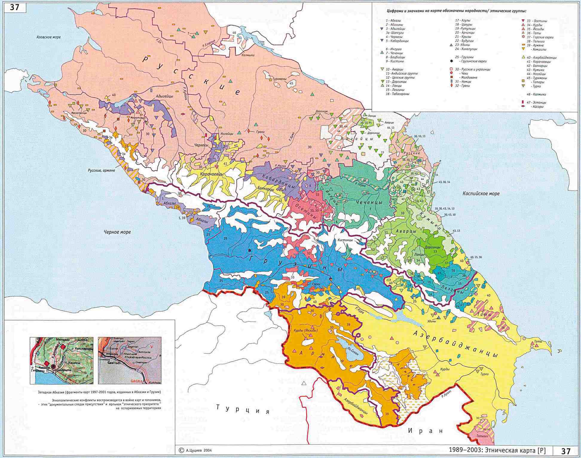
http://www.iriston.com/books/cuciev_-_etno_atlas/maps/map37.jpg
- Georgia (2nd version)
http://www.ecmicaucasus.org/maps/ETHNIC_MAP_of_Georgia.jpg
- Iran

- Turkey
File:Ethnic Groups Turkey123.png
-- Yerevanci ( talk) 18:41, 18 September 2011 (UTC)
Scooter20, thank you again. I think it's just perfect. Thank you again. I think this should be the last one :)-- Yerevanci ( talk) 13:42, 19 September 2011 (UTC)
Would you please change the colours on the map so they are more distinct. There have been complaints that the map is wrong because people don't see the difference between the mid-green and light-green. — Coroboy ( talk) 12:36, 25 September 2011 (UTC)
- Hi,
- I changed the shades of green so that the image would be easier to understand.
- Let me know if the way I changed it is fine with you! Here is a link to the image: link
- Cheers!
Scooter20 (
talk)
15:48, 25 September 2011 (UTC)
- Could you and
Kwamikagami coordinate your changes to
File:Cyrillic_alphabet_world_distribution.svg
- different colours as per last edit by Scooter20 (although I think the lightest colour, used on Azerbaijan and Moldova is too light – it's barely visible)
- lastest distibution of colours as per last edit by Kwamikagami
- Sorry I can't help, I don't know anything about editing images. — Coroboy ( talk) 08:03, 26 September 2011 (UTC)
- Could you and
Kwamikagami coordinate your changes to
File:Cyrillic_alphabet_world_distribution.svg
What were you thinking of? — kwami ( talk) 08:07, 26 September 2011 (UTC)
- Hi all, I think user Kwamikagami's last change should be good enough. I don't think any further changes are needed regarding colors.
- However he did change some countries. Cyrillic is not official in Moldova (only in Transnistria, which is an unrecognized republic). I am not sure about Georgia either (Abkhazia and South Ossetia are unrecognized too).
- I am not familiar with Turkmenistan & Uzbekistan, but I will take your word for it, that they do not use Cyrillic (co-)officially anymore.
- Regarding Estonia and Latvia, I am not sure if they ever did use Cyrillic while they were part of the USSR. And if they did what about Lithuania?
- Cheers!
Scooter20 (
talk)
18:34, 26 September 2011 (UTC)
- Cyrillic is used officially in breakaway regions of Moldova and Georgia. Latin is used officially in Kosovo. Do we count such regions? Currently in our article they're labeled. If Moldova is grey, then Georgia should be as well, and Serbia should be dark green. Unless we want to split off Kosovo on the map.
- Cyrillic is used by the Uzbek govt, but not officially. Rather like Latin in Serbia proper.
- Cyrillic continues to be used by a quarter of the Estonian and Latvian population. If we mark it for Azerbaijan, why not there? What is our criterion for light green? Latvia is only 10%; FAIK there are other countries at a 10% level. —
kwami (
talk)
00:47, 27 September 2011 (UTC)
- Hello,
- I see. I think Georgia and Moldova are different from Serbia. In Georgia and Moldova you have unrecognized breakaway republics / autonomous regions that use Cyrillic, while the state alphabet is Georgian resp Latin.
- In Serbia, the state alphabets are Cyrillic and Latin and a smaller de facto independent region is using Latin exclusively (Kosovo).
- Maybe Moldova and Georgia can be moved to the 3rd case, which should be rephrased to include "and usage in breakaway unrecognized regions")
- As for Latvia and Estonia, I guess they can stay in the 3rd case, since they have a large minority of Russian speakers.
- Cheers!
Scooter20 (
talk)
14:53, 27 September 2011 (UTC)
- Actually, in Serbia the only official script is Cyrillic. Of course, even the govt uses Latin sometimes, but that's like Uzbekistan (er, anti-Uzbekistan). So, the only way to get mixed script is to recognize the independence of a province which Serbia itself does not recognize, which IMO is like Abxazia. (Only diff is that Anglophone countries tend to recognize Kosovo but not Abxazia, but that's a bit provincial.) Either that, or abandon officialness. — kwami ( talk) 15:18, 27 September 2011 (UTC)
A file that you uploaded or altered, File:Beius Loc.jpg, has been listed at Wikipedia:Files for deletion. Please see the discussion to see why this is (you may have to search for the title of the image to find its entry), if you are interested in it not being deleted. Thank you. Kelly hi! 19:37, 8 November 2011 (UTC)
Hey, Scooter!!! So, I've been trying to edit Greater Serbia and I wanted to make a new map which would show the distribution of Serbs in Yugoslavia in 1981 (according to the census) and the areas controlled by Serb forces in 1992-1995. I think it would be interesting to show how much of the controlled area was inhabited by the Serbs.
By using this two ( Serbs in Yugoslavia (1981) and Ethnic map of Montenegro according to the 1981 census.) maps I drew a new map which shows the distribution of Serbs and Montenegrins in Serbia, Kosovo, Croatia, Bosnia and Montenegro.
This map shows the areas controlled by Serb forces in 1992-1995.
So, could you make a new map that would show both distribution of Serbs (and Montenegrins, because they are so close to Serbs) and areas controlled by the Serb forces in 1992-1995?-- Yerevanci ( talk) 20:07, 24 November 2011 (UTC)
- It's great. Thanks alot.-- Yerevanci ( talk) 05:15, 26 November 2011 (UTC)
 |
-- Codrin.B ( talk) 04:47, 21 January 2012 (UTC)
Hi,
I wanted to congratulate you on your works and maps that you've made over the years. I have noticed this ethnic map you made.

I was wondering whether you could correct the areas in Ukraine as per the latest censa and get rid of the 'green shade' about Greater Romania as they may be interpreted as irredentist and then the map could perhaps be used in articles dealing with Romanians and the areas they inhabit. Dapiks ( talk) 19:43, 3 March 2012 (UTC)
- Hi, thank you.
- I will take a look these days whenever I will have some time. I am busy with other things right now.
- Cheers
Scooter20 (
talk)
13:07, 5 March 2012 (UTC)
- Hey it's looking much better. I think in Budjak, the area around Reni city is quite Ukrainian though so it should be significantly reduced and in North Maramuresh - on the contrary, that lighter-green shade should be darkened. Nonetheless, I think we should try to put this one up on relevant pages. The wording maybe we should be changed a little to make it more acceptable: "Distribution of Romanians, Moldovans and Vlachs"/Areas inhabited by 50% or more/Areas inhabited by 25%-50%. What sources did you use for the map this time?
Dapiks (
talk)
03:08, 8 March 2012 (UTC)
- Wow, it looks amazing. I think this may be the most accurate modern ethnic map of Romanians to date. I will add it myself whenever I will see an article pertinent to it. Cheers mate!
Dapiks (
talk)
06:16, 9 March 2012 (UTC)
- I concur, looks great! What about other parts of Bulgaria? Also, since you mentioned Vlachs, maybe Aromanians, Istro-Romanians and Megleno-Romanians should also be depicted. Although I guess the focus is just the immediate proximity of Romania. Maybe you wish to take a look to
File:Map-balkans-vlachs.png,
File:Evolution of the Eastern Romance languages and of the Wallachian territories from 6th century to the 16th century AD.jpg,
commons:Category:Linguistic maps of the Romanian language and apply any updates that make sense. And I think we should propose for deletion this one
File:Moldavané.png.--
Codrin.B (
talk)
15:36, 9 March 2012 (UTC)
- Yeah that map is pure garbage - should be deleted asap as it is major OR. About including Aromanians and Megleno-Romanians, I have strong reservations though. There is already a pretty clear map on that subject made by Scooter20 already and there is this map also File:South-Balkan-Romance-languages.png which is extremely detailed and deals with them exclusively. Moreover, if this map is intended for articles on Romanians and Romanian Language and other such related articles, it would be quite problematic to include Aromanian and Megleno-Romanian populations as separate articles deal with these other topics. But this is just my opinion. In any case Scooter20, I think your maps and contributions here are really amazing and quite useful for the community as a whole. Dapiks ( talk) 18:56, 14 March 2012 (UTC)
- I concur, looks great! What about other parts of Bulgaria? Also, since you mentioned Vlachs, maybe Aromanians, Istro-Romanians and Megleno-Romanians should also be depicted. Although I guess the focus is just the immediate proximity of Romania. Maybe you wish to take a look to
File:Map-balkans-vlachs.png,
File:Evolution of the Eastern Romance languages and of the Wallachian territories from 6th century to the 16th century AD.jpg,
commons:Category:Linguistic maps of the Romanian language and apply any updates that make sense. And I think we should propose for deletion this one
File:Moldavané.png.--
Codrin.B (
talk)
15:36, 9 March 2012 (UTC)
- Wow, it looks amazing. I think this may be the most accurate modern ethnic map of Romanians to date. I will add it myself whenever I will see an article pertinent to it. Cheers mate!
Dapiks (
talk)
06:16, 9 March 2012 (UTC)
- Hey it's looking much better. I think in Budjak, the area around Reni city is quite Ukrainian though so it should be significantly reduced and in North Maramuresh - on the contrary, that lighter-green shade should be darkened. Nonetheless, I think we should try to put this one up on relevant pages. The wording maybe we should be changed a little to make it more acceptable: "Distribution of Romanians, Moldovans and Vlachs"/Areas inhabited by 50% or more/Areas inhabited by 25%-50%. What sources did you use for the map this time?
Dapiks (
talk)
03:08, 8 March 2012 (UTC)
- Yeah, the focus was mainly to show the distribution of Daco-Romanians / Vlachs which are in the near proximity of Romania (forming a compact Romanian populated region).
- The Aromanians, Megleno-Romanians and Istro-Romanians are somewhat isolated and are depicted (along with Daco-Romanians) in another map: here
- Regarding other areas of Bulgaria, I am not sure where Romanians would live besides Vidin region, there are no good fairly recent ethnic maps of Bulgaria. Perhaps some communities live in the north along the Danube in some areas.
- I guess we can delete this map, since it's not very accurate, highly increasing the area of Moldovans into Transylvania.
- Cheers!
Scooter20 (
talk)
19:38, 10 March 2012 (UTC)
- I moved the conversation in one place to keep things simple. Great points both of you. I didn't know about the detailed South Balkan language map. It looks great! I wonder if Scooter20 will be open to create a "megamap" with the same level of detail for the entire Central and Southeastern Europe depicting all areas where various Romance languages are spoken. That would be very useful. Or at least a complementary version for the Northern and Western areas not depicted in the Balkan map (i.e. Romania, Moldova, Croatia etc). A great start for all the areas to be covered is
Vlachs. Regards.--
Codrin.B (
talk)
16:46, 15 March 2012 (UTC)
- Hi there,
- Recently I created this map, which shows the Distribution of Romanians, Moldovans, Vlachs, Aromanians, Megleno-Romanians and Istro-Romanians in the Balkans.
- Le me know what you think!
- Cheers!
Scooter20 (
talk)
21:34, 20 March 2012 (UTC)
- I think from the data perspective looks really great but two important notes:
- I would work on the colors: too many shades of blue and too close to the colors of the seas. For an untrained eye, it is very hard to spot the Istro-Romanians and somewhat hard to distinguish the Vlachs in the Balkans. Those regions may seem like lakes to those who don't know geography or history. I would use more vivid colors, orange, red etc.
- It is great that you aggregated all those maps as sources, but it is important to get a step further and try to identify the books/papers/census documents, authors, pages for the data (like you would do in an article). Otherwise it will be challenged forever. An example of sources for a map: File:Dacia around 100 AD - Italian.png
- But over all it is really great to have it and thanks for all the work! Another thing on my wish list is a historical map of the all the
Vlachs, showing "
all Wallachias" and places where Vlachs used to live (especially northern regions that people forget about like the
Moravian Wallachia). It could be either showing
Late Middle Ages (i.e. probably greatest extent) or be a atemporal/ahistorical map (although that would make a source of disputes). Maybe you can make it happen one day ;-) P.S. I would call the map region "Central and Southeastern Europe" even if it is longer rather than "
Balkans" as it is spans more than core Balkan areas. This is a general problem with Romania as it doesn't properly fit any of the buckets of Central, Eastern, Southern or Balkan Europe but a bit of each. --01:50, 21 March 2012 (UTC)
- Ok, I understand. I created a new version of the map that has better colors and other improvements like emphasizing the countries which house Romanian / Vlach population with flags and more visible text.
- I also changed the title of the map and added some better references to the sources.
- As for the historical map of all the Vlachs. I will work on that whenever I will have some time. Do you have any sources / maps of all the regions which you would like to include on that map?
- Cheers! Scooter20 ( talk) 20:50, 21 March 2012 (UTC)
- I think from the data perspective looks really great but two important notes:
- I moved the conversation in one place to keep things simple. Great points both of you. I didn't know about the detailed South Balkan language map. It looks great! I wonder if Scooter20 will be open to create a "megamap" with the same level of detail for the entire Central and Southeastern Europe depicting all areas where various Romance languages are spoken. That would be very useful. Or at least a complementary version for the Northern and Western areas not depicted in the Balkan map (i.e. Romania, Moldova, Croatia etc). A great start for all the areas to be covered is
Vlachs. Regards.--
Codrin.B (
talk)
16:46, 15 March 2012 (UTC)
It looks much better! Thanks for that! Regarding the historical map of all the Vlachs, I would start with the references/external links already present in the articles like Vlachs, Moravian Wallachia and others in the Category:Eastern Romance people etc. as well as look at commons:Category:Maps of the Vlachs. It is not an easy feat, and I'll try to help as well, but it would be quite a unique work. I haven't seen such a comprehensive map anywhere, but I'll look for examples. I would also suggest you chat with commons:User:Asybaris01 and commons:User:Spiridon Ion Cepleanu unless you already done it. They are working on similar maps/topics, know many sources and are great to collaborate with. Also I suggest to move most of map related conversations on commons talk pages as it is where the mentioned users are more active, is more relevant for the maps and the use of other languages is encouraged.-- Codrin.B ( talk) 21:15, 22 March 2012 (UTC)
- Wow, I really like the new map - the bright colours are much better. About the new historical map of the Wallachias, I am just wondering: are you concerned with the territories where we used to live in or just regions that have been called at one time or another "Valachia". Like Codrinb said, there will be a lot of effort, referencing and study going into this but just off the top of my head, in some cases places or people would have been called Vlachs even though they had nothing to do with ethnic Romanians. In Bosnia, for example, a Vlach was a peasant at a certain time or rebel (in yet another context) - so although a region called Valachia certainly existed at some point in Bosnia, it may have not reflected a Romanian presence.
Dapiks (
talk)
04:58, 6 April 2012 (UTC)
- Hi, thanks I'm glad you like the new map. As for the historical map of Wallachias, that was Codrin.B ( talk)'s idea. I do not currently have the time to look for sources and create such a map. I guess he was mainly referring to having a map which shows historical ares where Vlachs used to live and still do, like an asynchronous map of their greatest geographical distribution.
- I recently saw a map of areas in Europe which are named from the root Vlach and derived from it, including Wallonia, and Wlochy (Polish name for Italy) and so forth, but I can't remember where I saw that.
- Cheers! Scooter20 ( talk) 15:55, 6 April 2012 (UTC)
- Wow, I really like the new map - the bright colours are much better. About the new historical map of the Wallachias, I am just wondering: are you concerned with the territories where we used to live in or just regions that have been called at one time or another "Valachia". Like Codrinb said, there will be a lot of effort, referencing and study going into this but just off the top of my head, in some cases places or people would have been called Vlachs even though they had nothing to do with ethnic Romanians. In Bosnia, for example, a Vlach was a peasant at a certain time or rebel (in yet another context) - so although a region called Valachia certainly existed at some point in Bosnia, it may have not reflected a Romanian presence.
Dapiks (
talk)
04:58, 6 April 2012 (UTC)
Hello, could you make Serb inhabited Balkan areas map as you have done with the Romanian map? thanks Drax90 ( talk) 17:38, 6 May 2012 (UTC)
Hey i have posted a reply in case you didnt notice it on my page :) Drax90 ( talk) 13:35, 8 May 2012 (UTC)
Hi,
I reverted your edit because one of the potential title holders (Bayern Munich) have already qualified for the group stage. If they win, their place in the group stage will be transferred to Belgian champions Anderlecht (see 2012–13 UEFA Champions League#Distribution for details). Hence the flags insert an inaccuracy which may confuse readers. -- Soccer-holic I hear voices in my head... 13:32, 17 May 2012 (UTC)
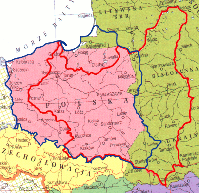
Could you correct Szecin to Szczecin? BartekChom ( talk) 20:29, 29 August 2012 (UTC)
- Done! thanks for spotting the error! Scooter20 ( talk) 07:42, 30 August 2012 (UTC)
Could you update the map Islam in Europe [11] adding Muslim population in Montenegro based on this map [12] and also removing the eastern orthodox [13] population from some Montenegrin territories. The map of montenegro is based on 2011 census. Also could you update this map [14] with some informatios from this [15]. With respect -- Ammartivari ( talk) 21:14, 3 February 2013 (UTC)
![[11]](https://upload.wikimedia.org/wikipedia/commons/thumb/8/84/IslamInEurope.png/120px-IslamInEurope.png)
![[12]](/info/en/?search=File:MontenegroReligion2011.PNG)
![[13]](https://upload.wikimedia.org/wikipedia/en/thumb/d/d5/EasternOrthodoxyInEurope.png/120px-EasternOrthodoxyInEurope.png)
![[15]](/info/en/?search=File:MontenegroEthnic2011.PNG)
- Thanks
Ammartivari (
talk)
18:37, 4 February 2013 (UTC)
- Thank you very much, they are better now ;) Ammartivari ( talk) 14:06, 5 February 2013 (UTC)
File:CarpatEuroreg.gif missing description details
is missing a description and/or other details on its image description page. If possible, please add this information. This will help other editors make better use of the image, and it will be more informative to readers.
If the information is not provided, the image may eventually be proposed for deletion, a situation which is not desirable, and which can easily be avoided.
If you have any questions, please see Help:Image page. Thank you. Theo's Little Bot ( error?) 05:05, 14 April 2013 (UTC)A file that you uploaded or altered, File:CarpatEuroreg.gif, has been listed at Wikipedia:Files for deletion. Please see the discussion to see why this is (you may have to search for the title of the image to find its entry), if you are interested in it not being deleted. Thank you. Sfan00 IMG ( talk) 19:28, 17 April 2013 (UTC)
Hello,
I was wondering...Look at the map of Europe (complete one): http://todayinsocialsciences.blogspot.co.uk/2010/10/wednesday-october-272010.html Don't you think that Romania is actually not in the crossroads between Central and Southeastern Europe but actually between central Europe and the Balkan region of southern Europe (not necessarily sooutheastern geographically - southern Russia, Georgia and Armenia would be, but nor Romania)? Do Romanians consider themselves southeastern Eurpean? It would be irrational if they would -- 81.100.242.0 ( talk) 00:02, 6 June 2013 (UTC)
- Hi there,
- Southeastern Europe is generally viewed as the Balkan region, not the Caucasus, as the latter was considered part of Asia for a long time during history.
- Romania lies geographically in Southeastern Europe but can be included culturally and historically in both Central Europe or the Balkans.
- Cheers! Scooter20 ( talk) 21:38, 8 June 2013 (UTC)
- Not really. geographically southeastern Europe would be southern Russia, perhaps Turkey and Caucasus... Romanis is actually in the very middle of Europe's south, yet still partly in Central Europe-- 81.100.242.0 ( talk) 00:56, 14 June 2013 (UTC)
There is no colouring of the Orthodox community in Croatia in your map ( File:OrthodoxyInEurope.png), which is widespread: File:Croatia-Religion-2001.png.-- Zoupan 20:59, 23 July 2015 (UTC)
- I have been off wiki for years now. Feel free to modify the map accordingly. I thought Croatia was mostly Catholic, in which areas would Orthodoxy be present? In those inhabited by ethnic Serbs? Scooter20 ( talk) 07:02, 24 July 2015 (UTC)
Hi,
You appear to be eligible to vote in the current
Arbitration Committee election. The
Arbitration Committee is the panel of editors responsible for conducting the Wikipedia
arbitration process. It has the authority to enact binding solutions for disputes between editors, primarily related to serious behavioural issues that the community has been unable to resolve. This includes the ability to impose
site bans,
topic bans, editing restrictions, and other measures needed to maintain our editing environment. The
arbitration policy describes the Committee's roles and responsibilities in greater detail. If you wish to participate, you are welcome to
review the candidates' statements and submit your choices on
the voting page. For the Election committee,
MediaWiki message delivery (
talk)
13:43, 23 November 2015 (UTC)

A file that you uploaded or altered, File:Josani.gif, has been listed at Wikipedia:Files for discussion. Please see the discussion to see why it has been listed (you may have to search for the title of the image to find its entry). Feel free to add your opinion on the matter below the nomination. Thank you. Cloudbound ( talk) 22:15, 1 June 2016 (UTC)
ArbCom Elections 2016: Voting now open!
Hello, Scooter20. Voting in the 2016 Arbitration Committee elections is open from Monday, 00:00, 21 November through Sunday, 23:59, 4 December to all unblocked users who have registered an account before Wednesday, 00:00, 28 October 2016 and have made at least 150 mainspace edits before Sunday, 00:00, 1 November 2016.
The Arbitration Committee is the panel of editors responsible for conducting the Wikipedia arbitration process. It has the authority to impose binding solutions to disputes between editors, primarily for serious conduct disputes the community has been unable to resolve. This includes the authority to impose site bans, topic bans, editing restrictions, and other measures needed to maintain our editing environment. The arbitration policy describes the Committee's roles and responsibilities in greater detail.
If you wish to participate in the 2016 election, please review the candidates' statements and submit your choices on the voting page. MediaWiki message delivery ( talk) 22:08, 21 November 2016 (UTC)
A file that you uploaded or altered, File:Scooter20.jpg, has been listed at Wikipedia:Files for discussion. Please see the discussion to see why it has been listed (you may have to search for the title of the image to find its entry). Feel free to add your opinion on the matter below the nomination. Thank you. Jon Kolbert ( talk) 00:39, 2 December 2016 (UTC)
Hello, Scooter20. Voting in the 2017 Arbitration Committee elections is now open until 23.59 on Sunday, 10 December. All users who registered an account before Saturday, 28 October 2017, made at least 150 mainspace edits before Wednesday, 1 November 2017 and are not currently blocked are eligible to vote. Users with alternate accounts may only vote once.
The Arbitration Committee is the panel of editors responsible for conducting the Wikipedia arbitration process. It has the authority to impose binding solutions to disputes between editors, primarily for serious conduct disputes the community has been unable to resolve. This includes the authority to impose site bans, topic bans, editing restrictions, and other measures needed to maintain our editing environment. The arbitration policy describes the Committee's roles and responsibilities in greater detail.
If you wish to participate in the 2017 election, please review the candidates and submit your choices on the voting page. MediaWiki message delivery ( talk) 18:42, 3 December 2017 (UTC)

The file File:EasternOrthodoxyInEurope.png has been proposed for deletion because of the following concern:
Orphaned map.
While all constructive contributions to Wikipedia are appreciated, pages may be deleted for any of several reasons.
You may prevent the proposed deletion by removing the {{proposed deletion/dated files}} notice, but please explain why in your
edit summary or on
the file's talk page.
Please consider addressing the issues raised. Removing {{proposed deletion/dated files}} will stop the
proposed deletion process, but other
deletion processes exist. In particular, the
speedy deletion process can result in deletion without discussion, and
files for discussion allows discussion to reach
consensus for deletion. ~
Rob13
Talk
16:53, 21 October 2018 (UTC)
Hello, Scooter20. Voting in the 2018 Arbitration Committee elections is now open until 23.59 on Sunday, 3 December. All users who registered an account before Sunday, 28 October 2018, made at least 150 mainspace edits before Thursday, 1 November 2018 and are not currently blocked are eligible to vote. Users with alternate accounts may only vote once.
The Arbitration Committee is the panel of editors responsible for conducting the Wikipedia arbitration process. It has the authority to impose binding solutions to disputes between editors, primarily for serious conduct disputes the community has been unable to resolve. This includes the authority to impose site bans, topic bans, editing restrictions, and other measures needed to maintain our editing environment. The arbitration policy describes the Committee's roles and responsibilities in greater detail.
If you wish to participate in the 2018 election, please review the candidates and submit your choices on the voting page. MediaWiki message delivery ( talk) 18:42, 19 November 2018 (UTC)
Could you add a version of the Romania timeline map that starts in 1850, ie to show the borders of Wallachia and Moldovia. A fuller timeline would be good from even longer before too — Preceding unsigned comment added by 153.186.70.147 ( talk) 02:44, 27 October 2019 (UTC)
- I don't have the time to do so at the moment. Since before 1859 there was no political entity known as Romania, I was thinking it may make sense to create another timeline that shows the history of the "Carpathian / Danube / Black Sea space", such as: Dacian Kingdom, Roman Dacia, nomadic peoples (Huns, Avars), Slavs, early Vlach voidvodships, Hungarians, medieval states (Wallachia, Moldavia, Transylvania), Ottomans, Russians, Habsburgs and modern (post 1859) stages of Romania. Once I get the time perhaps I will make a more complete map like this, what do you think? Scooter20 ( talk) 09:52, 28 October 2019 (UTC)

|
The Graphic Designer's Barnstar | |
| I like the maps you have made! Super Ψ Dro 16:49, 18 September 2020 (UTC) |
- Thanks! Scooter20 ( talk) 13:51, 28 September 2020 (UTC)
The file File:RomanCatholicismEurope.png has been proposed for deletion because of the following concern:
Unused map with no clear encyclopedic purpose
While all constructive contributions to Wikipedia are appreciated, pages may be deleted for any of several reasons.
You may prevent the proposed deletion by removing the {{proposed deletion/dated files}} notice, but please explain why in your
edit summary or on
the file's talk page.
Please consider addressing the issues raised. Removing {{proposed deletion/dated files}} will stop the
proposed deletion process, but other
deletion processes exist. In particular, the
speedy deletion process can result in deletion without discussion, and
files for discussion allows discussion to reach
consensus for deletion.
Logan
Talk
Contributions
19:54, 14 January 2024 (UTC)
|
I've left a comment at commons. 89.243.33.170 ( talk) 10:25, 1 February 2009 (UTC)
Hello, Please have a look at the SVG-file File:WidespreadWrongUsageOfRomanianDiacritics.PNG you've put in romanian alphabet and review it. It says that the "a", "s" and "t" letters are out of the romanian alphabet. Thank you 188.25.28.82 ( talk) 21:35, 12 October 2010 (UTC)
- No it doesn't say that! Instead it just says that in written Romanian there is a widespread wrong habit of replacing diacritics such as ă, â, î, ș and ț with simple plain letters such as a, i, s and t, among other replacements.
-
Scooter20 (
talk)
11:28, 14 October 2010 (UTC)
- Yes, the "correct diacritics" column is true. If you are kind, the image should include a distinct column for "correct letters A, S, T". It confuses people to replace everywhere the a, s, t-letters with the one you say.
188.25.52.56 (
talk)
02:55, 22 October 2010 (UTC)
- I changed the table headers to eliminate confusion, but I still don't fully see what you are concerned about.
- The image itself is self explanatory, it just says that there is a wide spread usage of diacritic replacement with plain letters, it does not say that those plain letters are not part of the alphabet.
- I mean people often write words such as casa instead of casă, sant instead of șanț and so forth.
- This is the most obvious miss usage but there are others more subtle and less visible such as: ã instead of ă or even ş and ţ instead of ș and ț.
- Also ș is replaced by sh and ț is replaced by tz in modern computer instant messaging slang.
- I made this image to show what are the standard valid diacritics in Romanian and what are the main wrong replacements (I did not say that plain letter replacements are not valid letters in the alphabet).
- Hope this helps!
- Scooter20 ( talk) 19:02, 24 October 2010 (UTC)
- Yes, the "correct diacritics" column is true. If you are kind, the image should include a distinct column for "correct letters A, S, T". It confuses people to replace everywhere the a, s, t-letters with the one you say.
188.25.52.56 (
talk)
02:55, 22 October 2010 (UTC)
- The correct encoding of romanian diacritics is as follows:
for the capital-form S- and T-diacritics with cedilla, as of Windows Vista, it will use the international standard iso/iec8859-2/1998. The capital letters bare unicode U+015E, U+0162.
The official romanian standard is SR13411-1999, "character set encoded for the romanian language" and assign diacritics with codes U+0218, U+021A, unicode compliant. These are each written using commas.
The use of lines in diacritics is incorect The use of curves is also incorrect The use of plain letters with no diacritics is tolerated, and it's done in respect to the english alphabet. Same goes for the small-form diacritics familly, 188.25.104.76 ( talk) 16:54, 14 November 2010 (UTC)
The vandal is back. -- Olahus ( talk) 20:06, 2 February 2009 (UTC)
- What do you mean? are you talking about those who keep reverting the Latin Europe article? Scooter20 ( talk) 09:48, 4 February 2009 (UTC)
This map is all well and good, except:
- The microstates again need to be enlarged as before.
- The parts coloured in blue on Croatia, Greece, Macedonia, Bulgaria, Albania, Serbia, Hungary, and Ukraine need to be light blue. And Malta needs to be added in light blue.
- Also, the uncoloured areas of France, Spain, Romania, and Moldova need to be coloured in light blue.
- The title of the map needs to be moved away from the idea of "Latin Europe", since consensus on the talk page and the article itself show that a country is not in "Latin Europe" simply for speaking a Romance language. The more correct name of the map would be something along the lines of "RomanceEurope" (see Romance Europe).
- Cheers 78.146.228.71 ( talk) 09:04, 7 February 2009 (UTC)
Some time ago it was decided (as part of the Romanian Wikiproject) to merge all the articles concerning the villages to the communes they belong to. Have a look here: Wikipedia:Romanian_Wikipedians'_notice_board/Archive10#Villages. I fully agree with the policy, since 1) the villages are just informal subdivisions of a commune, and 2) most of village articles would be stubs forever. I do admit that some villages are worth having their own articles, but in order to keep it consistent, I don't see anything wrong with describing a village within the article for its parent commune. Cheers, Mentatus ( talk) 21:46, 9 February 2009 (UTC)
- I copied the village article content into the article of its corresponding commune. Why should we keep them both? We either apply this policy in a consistent manner or not at all. The link is redirected to the commune, so nothing is lost. As I said before, if we were to create articles for each village, we would have a lot of stubs with duplicate data from the commune infobox. Of course we can expand the village description but within the article of its parent commune. Mentatus ( talk) 22:10, 9 February 2009 (UTC)
- If I may intrude a little - the idea is that the information is preserved, and that anyone looking for Josani will easily find it at Căbeşti. Also keep in mind that having separate articles on villages creates a dilemma: Căbeşti is the name of both a five-village commune and the village at its centre. Do we have one article on each village, including Căbeşti (village), and one just on the commune? Or do we have a single article on the commune, with five sections, one for each village? I think the latter solution is much neater. - Biruitorul Talk 03:07, 10 February 2009 (UTC)
|
|
The Geography Barnstar | |
| For your extensive work on Latin Europe related maps 78.146.228.71 ( talk) 13:48, 7 February 2009 (UTC) |
- Thanks! Scooter20 ( talk) 13:57, 7 February 2009 (UTC)
I don't know what to say. It's just an esthetic effect, which adds nothing to the information. In heraldry science and in law texts, there are no such things as shadow and transparency. You'd better open a pool in each discussion page. -- Alex:D ( talk) 18:14, 5 March 2009 (UTC)
On this image, you have written "Germanic Europe". Germanic Europe is a different idea from "Germanic-speaking Europe", which is what the map that you have created, should be called. 78.149.218.56 ( talk) 10:03, 8 April 2009 (UTC)
- Fixed!
Scooter20 (
talk)
20:49, 8 April 2009 (UTC)
- Hey that's great. Sorry to bother you, but as an IP, I am unable to do page moves.
- Could you move Romance Europe to Romance-speaking Europe.
- Romance-speaking African countries to Romance-speaking Africa.
- Romance-speaking Asian countries to Romance-speaking Asia.
- Thanks!
78.151.99.117 (
talk)
09:14, 9 April 2009 (UTC)
- Hi! If you want to have more privileges you can create an account
- I didn't actually move the old articles to the new articles that you suggested, because this should be discussed on the talk page of the original articles first. What I did was to redirect the new articles to the old ones.
-
Scooter20 (
talk)
10:02, 9 April 2009 (UTC)
- Hello. Now that you've directed the unmade pages to those pages, it will be impossible to move them without administrator help. Discussion over moves occurs when there is controversy about the moves - there is nothing controversial at all about these.
78.146.101.10 (
talk)
13:39, 10 April 2009 (UTC)
- Hi. I have to disagree about that. It is still possible to move them without admin help.
- I have moved the old pages to the new pages as you initially requested.
- You will find that the old articles are now redirected to the new articles which were specified by you (they hold the actual data).
- Scooter20 ( talk) 14:55, 10 April 2009 (UTC)
- Hello. Now that you've directed the unmade pages to those pages, it will be impossible to move them without administrator help. Discussion over moves occurs when there is controversy about the moves - there is nothing controversial at all about these.
78.146.101.10 (
talk)
13:39, 10 April 2009 (UTC)
- Fixed!
Scooter20 (
talk)
20:49, 8 April 2009 (UTC)
Hi there. I see you've been making lots of great maps lately, and I congratulate you on that - you are possibly the best map-maker here. ;)
However, there's just a couple of things with this picture...
- The part that says "Distribution of Romance speaking peoples in Europe" should probably be changed to "Romance-speaking Europe", in line with the article.
- The part that says "Area with an official Romance language inhabited by a Romance speaking majority" would probably be simpler and easier to understand as something like "Official Romance language used by majority"
- The next bit, that says "Area with an official Romance language inhabited by a Romance speaking minority" could be "Official Romance language used by minority"
- The last bit, "Area with an official/unofficial Romance language inhabited by a Romance speaking majority" is a bit misleading (and complicated), and would possibly be better as "Significant unofficial/co-official/historical Romance usage". Also, the color used for this bit is very similar to the first color... is it possible to make it a very dark blue, to distinguish?
Cheers, and keep up the good work 78.147.159.55 ( talk) 21:30, 13 April 2009 (UTC)
- It's great, as always! Thanks
78.147.159.55 (
talk)
22:15, 13 April 2009 (UTC)
- Thanks!
- Check out these maps that I created lately:
- Tell me what do you think! Scooter20 ( talk) 22:20, 13 April 2009 (UTC)
- It's great, as always! Thanks
78.147.159.55 (
talk)
22:15, 13 April 2009 (UTC)
-
Southern Europe
-
Distribution of Roman Catholicism in Europe
- I was looking at them earlier. They're good and accurate. It'd be nice to have one for Orthodox Christianity in Europe, to go with the other two
Image:RomanCatholicismInEurope.png , if you ever have time :)
78.147.159.55 (
talk)
22:38, 13 April 2009 (UTC)
- Hi, I actually created this map for Distribution of Orthodoxy in Europe.
-
Scooter20 (
talk)
23:54, 13 April 2009 (UTC)
- I also created an Islam in Europe map.
- Scooter20 ( talk) 22:58, 14 April 2009 (UTC)
- I was looking at them earlier. They're good and accurate. It'd be nice to have one for Orthodox Christianity in Europe, to go with the other two
Image:RomanCatholicismInEurope.png , if you ever have time :)
78.147.159.55 (
talk)
22:38, 13 April 2009 (UTC)
It would be great if you would change your map of protestantism in Europe by making England Grey ,to keep consistent with the rest of Wikipedia and the protestantism Article that Anglicanism is a distict branch of Christianity, i will remove the map from the page until then, thank you-- Sfcongeredwards ( talk) 23:49, 22 May 2009 (UTC)
- The descriptions of these maps is lacking an explanation of on what data these maps are based on. With the contemporary borders shown the map attempts to illustrate religious adherence in current times. But these maps are not in line with data as collected by (national) churches, national census and so on...so I am wondering what the factual basis is for these maps. — Preceding
unsigned comment added by
83.87.2.139 (
talk)
11:49, 14 December 2012 (UTC)
- The 'religion' maps were made a long time ago and were based on this
map. I see now that the accuracy of the source map is disputed. Since I did not create it, I am not sure what the source map tried to show, probably the most dominant religion in each area of Europe despite the fact that in some places such as the Czech Republic, non-religious are the majority! At the time I made my maps, the source map was widely used on Wikipedia but not anymore, so my maps are disputed as well. Hope this helps!
Scooter20 (
talk)
12:37, 14 December 2012 (UTC)
- Should these maps not either be corrected or retracted? What is the point of having these misleading maps, as is? Thanks — Preceding
unsigned comment added by
107.0.7.44 (
talk)
06:27, 3 September 2013 (UTC)
- Why have these non-WIKI compliant maps not been deleted, if even the maker admits that accuracy etc. is an issue? 188.206.100.246 ( talk) 07:18, 13 November 2017 (UTC)
- Should these maps not either be corrected or retracted? What is the point of having these misleading maps, as is? Thanks — Preceding
unsigned comment added by
107.0.7.44 (
talk)
06:27, 3 September 2013 (UTC)
- The 'religion' maps were made a long time ago and were based on this
map. I see now that the accuracy of the source map is disputed. Since I did not create it, I am not sure what the source map tried to show, probably the most dominant religion in each area of Europe despite the fact that in some places such as the Czech Republic, non-religious are the majority! At the time I made my maps, the source map was widely used on Wikipedia but not anymore, so my maps are disputed as well. Hope this helps!
Scooter20 (
talk)
12:37, 14 December 2012 (UTC)
- The descriptions of these maps is lacking an explanation of on what data these maps are based on. With the contemporary borders shown the map attempts to illustrate religious adherence in current times. But these maps are not in line with data as collected by (national) churches, national census and so on...so I am wondering what the factual basis is for these maps. — Preceding
unsigned comment added by
83.87.2.139 (
talk)
11:49, 14 December 2012 (UTC)
Hello. I see that you appear to be the main map-producer for the Germanic/Latin Europe articles. I would like to ask you, as a neutral party, since we are having some content disputes, what your view is on the placing of this map (or perhaps even your version) in the opening section of Germanic Peoples? Lingamondo ( talk) 14:12, 14 April 2009 (UTC)
- <sarcasm>excellent suggestion. And let's place
this map in the lead section of
Sumer while we're at it!</sarcasm> --
dab
(𒁳)
14:47, 14 April 2009 (UTC)
- You asked for me to get a 3rd opinion, and that's exactly what I went and did. Sarcasm is not going to get us anywhere. The placing of a map of Germanic languages into an article about an ethnolinguistic group based on these languages, is hardly a controversial concept to be honest.
Lingamondo (
talk)
14:56, 14 April 2009 (UTC)
- Hi, I'm not sure if I'm the most qualified person to give you the best answer.
- My opinion is, that such a picture, if put in the article, would not be out of context.
- After all, the Germanic peoples speak modern Germanic languages which have evolved from a common Proto-Germanic language spoken by early Germanic tribes.
- However, it should be made clear that the picture represents the distribution of modern Germanic-speaking populations and not an ancient distribution of the Germanic-speaking populations.
- The map caption should probably say something like: Current distribution of Germanic-speaking populations (in the case of this map) or Distribution of Modern Germanic languages (in the case of this map).
- Thanks! Scooter20 ( talk) 19:31, 14 April 2009 (UTC)
- You asked for me to get a 3rd opinion, and that's exactly what I went and did. Sarcasm is not going to get us anywhere. The placing of a map of Germanic languages into an article about an ethnolinguistic group based on these languages, is hardly a controversial concept to be honest.
Lingamondo (
talk)
14:56, 14 April 2009 (UTC)
- The "Area inhabited by a Germanic-speaking majority" should read "Germanic language official and used by majority"
- The "Area inhabited by a Germanic-speaking majority/minority/bilingual which is considered to be part of Celtic Culture and Heritage" should read "Germanic language co-official"
- The parts of France, Finland, and Italy, should be colored in a different color, which reads "Germanic language significantly used unofficially/historically".
- Luxembourg needs be colored the same as Ireland, Scotland, and Wales. Cornwall should be colored the same as England.
- Gibraltar and Malta should be added (in another color) as "Germanic language co-officially used due to British presence". 78.147.158.77 ( talk) 09:36, 17 April 2009 (UTC)
- Done. Tell me what do you think!
- Thanks! Scooter20 ( talk) 11:09, 21 April 2009 (UTC)
Greece is not in Western Europe, if this is not corrected I will request deletion due to inaccuracy. Izzedine ( talk) 06:03, 30 April 2009 (UTC)
- If you would read the map legend more carefully you would see that Greece is sometimes (not always) considered Western European (ie: Maximum extent of Western Europe) even though it is geographically situated in Southeastern Europe.
- Scooter20 ( talk) 08:44, 30 April 2009 (UTC)
Greece is on the Balkan peninsula which is in Southeastern Europe, if this is not corrected I will request deletion due to inaccuracy. Izzedine ( talk) 06:09, 30 April 2009 (UTC)
- Eastern Europe has many definitions but the core states are mainly the East Slavic nations (Russia, Ukraine and Belarus). Some definitions of Eastern Europe include East Central Europe, the Baltic States and Southeastern Europe but without Greece because Greece is sometimes seen as a Western European country.
- Scooter20 ( talk) 08:50, 30 April 2009 (UTC)
Britain and Ireland are in Northern Europe, if this is not corrected I will request deletion due to inaccuracy. Izzedine ( talk) 06:15, 30 April 2009 (UTC)
- Northern Europe proper is composed of the Nordic countries (Iceland, Denmark, Sweden, Norway and Finland) and the Baltic states (Latvia, Lithuania and Estonia). The British Isles (Great Britain and Ireland) are sometimes included in Northern Europe (as the map says) but primarily are part of Western Europe (proper).
- Scooter20 ( talk) 08:54, 30 April 2009 (UTC)
Cyprus and Rhodes are geographically in Western Asia, if this is not corrected I will request deletion due to inaccuracy. Izzedine ( talk) 06:19, 30 April 2009 (UTC)
- 1. Cyprus in considered European for cultural and historic reasons, despite being geographically in Asia.
- 2. Rhodes is part of Greece, which is a country geographically situated in Southeastern Europe but also sometimes considered Western European.
- Scooter20 ( talk) 08:56, 30 April 2009 (UTC)
Could you turn-on the email function? It's in the "my preferences tab" at the top of your screen. Once you turn it on you can send and receive email. Hobartimus ( talk) 13:46, 2 May 2009 (UTC)
- Thanks for the suggestion, but I'd rather not receive any spam, or get my inbox filled with messages every day!
-
Scooter20 (
talk)
13:49, 2 May 2009 (UTC)
- That would hardly be the case it simply means you get an extra link on your user page (email this user) at the left hand side, so other wikipedians can click on it and send mail. Only wikipedians can use the link, you can disable it any time you want. You can send me an email the same way, using a link on the user page.
Hobartimus (
talk)
14:46, 2 May 2009 (UTC)
- Scooter if you change your mind, please send me an email, I think we can find much common ground regarding a lot of stuff. I will probably try to edit the map originally uploaded by you, in the future but don't want to get into a conflict over it. Also semi-personal discussions like the one you had on the image talk page do not really belong there, the page is for discussion about improving the image.
Hobartimus (
talk)
15:35, 3 May 2009 (UTC)
- I'm not sure if I'm going to enable my email.
- I don't understand why would you want to edit my map, the source of the map is specified on the file page, and it show only the places where Hungarians are over 50% of the population. That's why Hungarians in Austria, Croatia and Slovenia are absent from the map.
- In case you still want to edit the map, I suggest creating a new image based on my map and uploading it. This way my map would stay intact.
- I agree that the discussion didn't belonged on the map talk page, but was stopped since it didn't lead anywhere.
- Thank you!
-
Scooter20 (
talk)
17:04, 3 May 2009 (UTC)
- It would be pointless to create a new map, then I would have to remove the image from the articles and replace it with the new image every time. There are few things simple things I would change, but I will think about it. Hobartimus ( talk) 17:09, 19 May 2009 (UTC)
- Scooter if you change your mind, please send me an email, I think we can find much common ground regarding a lot of stuff. I will probably try to edit the map originally uploaded by you, in the future but don't want to get into a conflict over it. Also semi-personal discussions like the one you had on the image talk page do not really belong there, the page is for discussion about improving the image.
Hobartimus (
talk)
15:35, 3 May 2009 (UTC)
- That would hardly be the case it simply means you get an extra link on your user page (email this user) at the left hand side, so other wikipedians can click on it and send mail. Only wikipedians can use the link, you can disable it any time you want. You can send me an email the same way, using a link on the user page.
Hobartimus (
talk)
14:46, 2 May 2009 (UTC)
Hey Scooter20, I'd like to comment on the map showing the geography of Slavic languages you uploaded to a number of Wikipedia articles. There are a number of inaccuracies which I'd like to point out to:
1. Russian is not spoken by a minority in Leningrad Region (around St Petersburg);
2. Russian is not spoken by a minority in areas between Moscow and St Petersburg;
3. According to a 1970 census 92.000 people claimed they were speakers of Karelian dialects while the overall population of the then Karelian Autonomous Socialist Republic was at 715.000 people. If you can provide updated data on that, that'll be fine. If we rely on the data I provided there is no way for Russian to be spoken by a minority in Karelia.
4. Russian is the native language of ethnic Russians in Estonia and Latvia who make up around 25 percent of Estonia's and Latvia's population respectively.
These are some of the inaccuracies I spotted in your map. If you claim to have a good knowledge of the geography of Slavic languages, please, be more accurate and edit your map. If you are not qualified enough, please do not upload inaccurate maps. Thank you. Denghu ( talk)
- I sent a reply on your talk page!
- Scooter20 ( talk) 08:10, 4 May 2009 (UTC)
- If you are interested in the section of Slavic languages in Greece then here are some more accurate maps of the Slavic population in Greece and Macedonia. PMK1 ( talk) 06:23, 17 May 2009 (UTC)
Hi there! I just mentioned the map about Albanian diaspora and its last version [ [1]] with some dots in Greece. Although there are Albanian speaking (bilingual) villages in nw Greece, Alb. speaking populations dont form a clear majority (in a municipicality or town) as far as i know. This map [ [2]], shows that there'snt an Albanian majority, in this region. Some sources would be in handy about the majority claim. Thank you. Alexikoua ( talk) 16:17, 5 May 2009 (UTC)
- Hi, thanks for the heads-up! Fixed!
- Scooter20 ( talk) 18:39, 5 May 2009 (UTC)
By the way, very nice map-job (according to Balkan related topics). Thanks too Alexikoua ( talk) 13:51, 7 May 2009 (UTC)
- Thanks! Scooter20 ( talk) 16:29, 7 May 2009 (UTC)
- One Question, in your map of Albanian people; why is the Republic of Macedonia listed as FYROM?
PMK1 (
talk)
06:19, 17 May 2009 (UTC)
- Hi, I chose the name FYROM ( Former Yugoslav Republic of Macedonia) because of the naming dispute with Greece.
- As you probably know, the territory of FYROM was inhabited by Macedonian-Greeks long before Slavic peoples settled in the region.
- This is a way to differentiate the Greek term of Macedonia from the Slav-inhabited neighboring country (FYROM).
- Scooter20 ( talk) 11:28, 17 May 2009 (UTC)
- One Question, in your map of Albanian people; why is the Republic of Macedonia listed as FYROM?
PMK1 (
talk)
06:19, 17 May 2009 (UTC)
- Be it is at may, you may consider changing it to Macedonia sometime in the future, should " FYROM" remain here. PMK1 ( talk) 13:40, 17 May 2009 (UTC)
Thank you for creating the map on the Albanian-inhabited areas ( AlbaniansOutsideAlbania.png). However, I do have concerns regarding the Albanians in Macedonia. There are regions where they constitute at least a significant minority and those should be added to the map to increase accuracy. I understand the vulnerability of the issue at stake; there is just too much nationalism in the Balkans to get honest work done, but I would suggest you consider foreign sources. A lot of Albanians live especially in Skopje, Kumanovo, and Struga; in the latter they may constitute a plurality if not a majority. Again, thank you for your contribution!-- Getoar TX ( talk) 02:19, 5 June 2009 (UTC)
- P.S. I forgot to mention the town of
Medveđa in Serbia; about a third of the population is Albanian. Also, there is a significant Albanian population in
Plava, Montenegro, just north of Albania's northernmost tip (the border with Montenegro).--
Getoar TX (
talk)
02:23, 5 June 2009 (UTC)
- Hi! Thanks for the suggestions. I improved the map regarding the Rep of Macedonia, Montenegro and Serbia.
- Tell me what do you think!
- Thanks! Scooter20 ( talk) 15:31, 8 June 2009 (UTC)
Thank you for updating the map. I am happy with the improvements, but I am unable to endorse them from a professional point of view. It is easier to tell whether something is missing, or it is exactly how it should be. Thank you again and keep up with the good work on Wikipedia!-- Getoar TX —Preceding undated comment added 09:43, 9 June 2009 (UTC).
- In case you were wondering about sources.
- I've updated the map description page with the sources (maps) that I used for creating and updating it.
- See here
- Thanks! Scooter20 ( talk) 12:18, 9 June 2009 (UTC)
File:Romanian adi.png [3]
Hello! The names of the cities on the map you have created do not parallel to wikipedi guidlines. Please fix them. The cities should be mentioned under their official names. Example: Debreţin should be changed to Debrecen "Bichişciaba" to Békéscsaba, Vârşeţ to Vršac, Vidin is ok, Cetatea Albă to Bilhorod-Dnistrovskyi etc. Please check all names. Cheers, B@xter 9 14:10, 12 June 2009 (UTC)
- This map is seen through a Romanian perspective, therefore every city is referred to under it's Romanian name.
- As you probably have noticed, the map is only present on my userpage.
- Since users are allowed to use any content that they like on their userpages, I don't see any problem with this map as long as it stays only on my userpage.
-
Scooter20 (
talk)
15:29, 12 June 2009 (UTC)
- I understand. "Since users are allowed to use any content that they like on their userpages" I am not sure about this, I mean rascist, pornographic and other materials are forbidden (I think, but I did not read the rules about this). So this image is created for your userpage and you are not using this elsewhere? (because this image in its current form could inaccurate)
B@xter
9
16:20, 12 June 2009 (UTC)
- Is this map racist or pornographic? I think not!
- Of course that by "any content" I didn't mean pornographic, racist or other similar material.
- This map was created primarily for my userpage. And even if I were to use it for other articles it would most likely be removed by other users.
-
Scooter20 (
talk)
17:37, 12 June 2009 (UTC)
- No, no! Of course it is not rscist or pornographic. That was just an example, which proves that not everything can be used on userpages. Use this image on your userpage if you would like. Cheers, B@xter 9 19:44, 12 June 2009 (UTC)
- I understand. "Since users are allowed to use any content that they like on their userpages" I am not sure about this, I mean rascist, pornographic and other materials are forbidden (I think, but I did not read the rules about this). So this image is created for your userpage and you are not using this elsewhere? (because this image in its current form could inaccurate)
B@xter
9
16:20, 12 June 2009 (UTC)
Hi! You added a move request tag on the description page of Romanian adi.png. Unfortunately, the requested moves page does not handle the renaming of files. See here for more information. I've re-uploaded the image as File:RomanianTerritories.png, changed the links to point to that location, and filed the old one for deletion at Files for deletion. Jafeluv ( talk) 11:06, 29 June 2009 (UTC)
- Hi, I made the request as opposed to uploading the image under a new name myself, because I was hoping that it would somehow be possible to rename it (using admin privileges) in order to preserve the history of the image.
- If this is not supported yet, I understand, and thanks for uploading the new file.
- Regards Scooter20 ( talk) 12:05, 29 June 2009 (UTC)
Hello. Thank you for correcting this map! It's much better now :) Ælfgar ( talk) 19:25, 7 July 2009 (UTC)
- Hello. I was glad to do it!
- Scooter20 ( talk) 19:29, 7 July 2009 (UTC)
This is a image showing the number of cases in Romania. I you want please modify. Thanks! TouLouse ( talk) 16:43, 10 August 2009 (UTC)
Congratulations with the map! Please allow me to point out some inconsistency concerning Belgium, however. Either the whole of Belgium should be highlighted in orange (since Dutch is co-official nationally), or Flanders should be highlighted in dark brown (since only Dutch is official there). Making Flanders orange and leaving Wallonia out would imply that French is also official in Flanders (but Dutch that is not co-official in the south), which is not correct. I suggest you make Flanders dark brown, since there actually is no language is official everywhere in Belgium (we have language areas). To be completely accurate, Brussels should be orange (since both languages are official there - and only there). I hope you will take my comments into account. Kind regards, -- Roofbird ( talk) 09:53, 12 August 2009 (UTC)
- Hello, thanks for the suggestion, I'll do the necessary changes when I'll have some free time!.
- Scooter20 ( talk) 10:33, 12 August 2009 (UTC)
Hello! Can you add the Russian-speaking minority in Estonia to this map please? They're in majority in the east, in Narva for instance 94% of the population consist of Russian speakers. Aaker ( talk) 16:56, 18 August 2009 (UTC)
- Hello. I guess I could do that but this map has been rejected from the articles that I put it in and it only resides on my userpage now.
- It might not be very accurate and I'm not sure if it worth investing time in it.
- I'll update the Russian minority in Estonia when I'll have some time, that shouldn't take much.
-
Scooter20 (
talk)
09:09, 19 August 2009 (UTC)
- Okay, thank you. I liked the map though! Aaker ( talk) 13:56, 19 August 2009 (UTC)
Hey there! I saw you made a map of distribution of ethnic Romanians in South-Eastern Europe, and I saw wondering if you can translate it in Romanian language so we can publish it on ro.wikipedia.org. and btw, I'm from Romania too :) —Preceding unsigned comment added by Radu Gherasim ( talk • contribs) 10:47, 25 August 2009 (UTC)
- Hello.
- I translated the image and uploaded the new version over the original image that you uploaded on the Romanian Wikipedia.
- See here: image link
- Thanks!
Hello Scooter20, HappyInGeneral has smiled at you! Smiles promote
WikiLove and hopefully this one has made your day better. Spread the
WikiLove by smiling at someone else, whether it be someone you have had disagreements with in the past or a good friend. Go on, smile! Cheers, and happy editing!
Smile at others by adding {{
subst:Smile}} to their talk page with a friendly message.
Buna ziua, ma numesc Mihai si sunt pasionat de istoria Romaniei. As vrea sa va intreb daca ma puteti lamuri si pe mine cum pot face harti? In cazul in care doriti sa imi dati o mana de ajutor adresa mea de messenger este tyras1980@yahoo.com Va multumesc! —Preceding unsigned comment added by Tyras1980 ( talk • contribs) 18:22, 27 November 2009 (UTC)
- Salut Mihai,
- (Nu e necesar să-mi vorbeşti la persoana a II-a plural).
- Pentru a crea hărţi / desene, eu folosesc Inkscape, un editor SVG open-source.
- Poţi să creezi o hartă şi de la 0, dar cel mai simplu este de a folosi o hartă deja existentă de pe wiki şi să o modifici pentru a crea o hartă nouă.
- Harta se creează prin desenarea de segmente, poligoane etc în acest editor.
- Editorul are şi opţiunea de a exporta harta creată în format PNG.
- Scooter20 ( talk) 18:48, 1 December 2009 (UTC)
Salut, mi-ar face placere sa putem vorbi pe messenger. Promit ca nu te stresez si ca nu iti voi rapi mult timp, adresa mea de messenger este tyras1980@yahoo.com Sarbatori fericite si un an nou plin de impliniri! Multumesc! —Preceding unsigned comment added by Tyras1980 ( talk • contribs) 21:55, 16 December 2009 (UTC)
An image or media file that you uploaded or altered, File:GreatestRomaniaInEurope.png, has been listed at Wikipedia:Files for deletion. Please see the discussion to see why this is (you may have to search for the title of the image to find its entry), if you are interested in it not being deleted. Thank you. ЛенинВладимир ( talk) 22:42, 28 December 2009 (UTC) ЛенинВладимир ( talk) 22:42, 28 December 2009 (UTC)
Please do not add maps to articles that are absurd on their face. Such as you did here [4] [5]. By doing this You will discredit yourself and all the maps you create will be regarded as nonsense. I hope there is no need to explain what's wrong with that map. Hobartimus ( talk) 22:19, 29 December 2009 (UTC)
- Please do!
Scooter20 (
talk)
22:36, 29 December 2009 (UTC)
- Well let's start with this. Dear Flavius, as a proud ethnic Romanian
[6], what do you think, why would another Romanian describe that map as "unrealistic POV & OR map"
[7]? Why do you think that is? Maybe because it's one of those personal maps of yours, that you promise not to include in any article? A similar which is under deletion currently and were invented entirely by you?
Hobartimus (
talk)
23:48, 29 December 2009 (UTC)
- Dear annonymous Hungarian, do you have a problem with the fact that the Kingdom of Hungary was a multiethnic state which barely had a Magyar majority in the late XIXth and early XXth century, after intensive Magyarization? ( [8]). Or is it that you don't like the fact that the map shows Hungarian majorities and not minority scaling from 1 to 50% by doing so creating an optical illusion that the Magyars would be a majority on a greater territory. Or shortly put, is it that you don't like the truth?
- 6, Unlike you, at least I had the guts to show my name!
- 6, I am a proud ethnic-Romanian, as I am sure you are a proud Magyar, right?
- 7, How should I know? With a name like Anonimu (The annonymous) he might be a Hungarian, a sockpuppet or something else for what I can tell.
- The map that is under deletion was not to be included in any article since it shows an alternate history view of a Romanian state. I already mentioned this!
- Most of the rest of the maps were intented for articles. Although some of them might have minor issues, it doesn't mean that they are bad or wrong!
-
Scooter20 (
talk)
00:09, 30 December 2009 (UTC)
- You are creating false maps period. More and more ppl notice this and if you continue your aggressive POV pushing campaign of the past few days this will have consequences. You can't even use the correct name for Hungarians (Hungarians) in English and you want to create maps? And the official language in 1890 was Hungarian in Hungary not anything else like you attempt to portray on some of your maps. As I said even others called "unrealistic POV & OR map" in connection with your map. And let's stop joking about other users. The Romanian in question who removed your absurd map is editing since 2005 and has a lot more edits than you. If he is a Hungarian, or sockpuppet, maybe you are one as well?
[9] You are creating false maps, sooner or later this will not be tolerated. For example using "50-1%" category in map for Romanians, but not doing the same for Hungarians. And in any case you should know that we already have historical maps that were made by professional geographers and are historicly correct and these will most likely be preferred by an unscientific map (you are not a geographer, correct?). Anyway as you could well see I'm not the only one who pointed out severe problems with most of these maps. So how about you don't try to push your maps into articles until so many users have concerns? And some maps are described as "unrealistic POV & OR map" by Romanian editor editing since 2005?
Hobartimus (
talk)
00:00, 31 December 2009 (UTC)
- That is your opinion!
- Both Hungarians and Magyars are accepted names for Hungarians in the English language. Do you have something against the word Magyar?
- I know Hungarian was the official language in the Kingdom of Hungary in 1890, I never said that it wasn't. I wanted to show areas where Hungarians were the majority (50%+) and areas where Romanians were the majority (50%+) on two different maps.
- Regarding the extra layer on the map with Romanian majorities, I never intended to use it but someone complained on the talk page so I added it. I didn't update the other map (Hungarian majorities) yet, because I was working on something else!
- Those 2 maps were perfectly true and correct, based on a good source. They show the majorities (over 50%, Hungarian, respectively Romanian) and offer an unique view, which the article did not have.
- But Hungarian users, like yourself, seem to have a problem with that, possibly because they think that by doing so (showing something which is perfectly true) people would realize the real concentration of Hungarians on the map and not be blinded by the result of Magyarization.
- And last but not least, I am not a Hungarian (I think that is quite obvious) and I am not a sockpuppet either!
- Scooter20 ( talk) 00:22, 31 December 2009 (UTC)
- You are creating false maps period. More and more ppl notice this and if you continue your aggressive POV pushing campaign of the past few days this will have consequences. You can't even use the correct name for Hungarians (Hungarians) in English and you want to create maps? And the official language in 1890 was Hungarian in Hungary not anything else like you attempt to portray on some of your maps. As I said even others called "unrealistic POV & OR map" in connection with your map. And let's stop joking about other users. The Romanian in question who removed your absurd map is editing since 2005 and has a lot more edits than you. If he is a Hungarian, or sockpuppet, maybe you are one as well?
[9] You are creating false maps, sooner or later this will not be tolerated. For example using "50-1%" category in map for Romanians, but not doing the same for Hungarians. And in any case you should know that we already have historical maps that were made by professional geographers and are historicly correct and these will most likely be preferred by an unscientific map (you are not a geographer, correct?). Anyway as you could well see I'm not the only one who pointed out severe problems with most of these maps. So how about you don't try to push your maps into articles until so many users have concerns? And some maps are described as "unrealistic POV & OR map" by Romanian editor editing since 2005?
Hobartimus (
talk)
00:00, 31 December 2009 (UTC)
- Well let's start with this. Dear Flavius, as a proud ethnic Romanian
[6], what do you think, why would another Romanian describe that map as "unrealistic POV & OR map"
[7]? Why do you think that is? Maybe because it's one of those personal maps of yours, that you promise not to include in any article? A similar which is under deletion currently and were invented entirely by you?
Hobartimus (
talk)
23:48, 29 December 2009 (UTC)
I just checked the Greater Romania Party article and it has an interesting map in it, titled "Greater Romania". This party is described in the article "is a Romanian ultra-nationalist political party, led by Corneliu Vadim Tudor" after comparing the map in the article with the maps you made it's interesting that your maps are much more "hardcore" than the Greater Romania Party map in that it includes much more territory as was pointed out earlier. This is territory that even the Greater Romania Party considers as not being part of "Greater Romania". I just thought I point this out to you, as being an interesting fact. Here is the map in question [10]. Hobartimus ( talk) 03:50, 1 January 2010 (UTC)
- I don't know where you're going with this, but I am not a member nor am I a supporter of the party in question.
- Greater Romania existed between 1918-1940 (as you can see on my timeline map that I made recently, and on this article), it was composed of today's Romania + Northern Bukovina, Hertza Region, Bessarabia and Southern Dobruja.
- Here's a map of the Kingdom made by myself ( map). I guess not all of my maps are "false", "absurd" or "a mess"!
- That party is trying to take advantage of the Romanian sentiment for those lost times, but had little luck so far.
- My "claims" are mostly nostlgic and go even further back in time, to the Dacians (ancestors of Romanias, long before Hungarians arrived in Europe) which held a territory even greater than my claims.
- The maps that do that ( 1, 2), as I'm sure you have seen, are not present on any articles.
-
Scooter20 (
talk)
12:26, 1 January 2010 (UTC)
- Of course not all your maps are absurd, I never said that, when I made that statement I pointed to a specific map that depicted 80-90% Hungarian areas as inhabited by "Daco-Romanians". Of course since than you went even farther and listed as Romanian areas (in a different map) places where as little as 1% Romanians live. I wonder if you realize that based on that standard whole countries could be viewed as a single unit and colored based on the 1%>"rule". Anyway some maps of yours are of course better than others but ones with severe problems should not be put in articles not even temporarily. But it's not the maps which are the main concern, but things like the "Dacian" theories as far as I am told it's nothing but unscientific Protochronism, a line of thought which "flourished in Ceausescu's Romania". Today it is not accepted as a real scientific theory, and is not supported by any evidence(see WP:FRINGE). Anyway I just wanted to point out that making such "nostalgic" (as you say) maps maybe one of the reasons why your other maps are scrutinized much more by other editors. And of course everything must be based on WP:Reliable sources. Hobartimus ( talk) 08:47, 3 January 2010 (UTC)
Happy New Year Scooter20! Please read my answer.-- ЛенинВладимир ( talk) 18:08, 1 January 2010 (UTC)
- Thank You. I hope you have a Happy New Year as well!
- I replied to your note and uploaded a new map!
- Scooter20 ( talk) 19:45, 1 January 2010 (UTC)
In that map you try to impose your own counter-factual POV, contradicted by the self-identification of those people, that "Romanians", "Moldovans" and "Vlachs" are the same. The manipulation of the sources to support your original POV is in clear breach of WP:SYNTH. Please understand that WP is not about promoting the peculiar nationalist ideas of Romanians, Hungarians or Hindutvadis, it's about building an encyclopaedia in the spirit of NPOV, and most importantly supported by reliable sources, not based on what may be considered in your entourage "common knowledge".
PS: The fact that WP:OTHERCRAPEXISTS is not an argument. Anonimu ( talk) 15:05, 2 January 2010 (UTC)
- You are free to remove that map too. You can notice it was contested several times, and my personal opinion is that it is worse than your map. However that map has the slight advantage of showing all Eastern Romance speaking groups in relation, even if their extent is greatly exaggerated. Anonimu ( talk) 15:20, 2 January 2010 (UTC)
A file that you uploaded or altered, File:Beius Loc.gif, has been listed at Wikipedia:Files for deletion. Please see the discussion to see why this is (you may have to search for the title of the image to find its entry), if you are interested in it not being deleted. Thank you. Calliopejen1 ( talk) 23:44, 3 January 2011 (UTC)
-- Codrin.B ( talk) 18:35, 7 January 2011 (UTC)
- Hello, I am interested in Dacia and Dacians and I would like to join the project.
- However I do not have a deep knowledge about Dacia related topics (but I guess that's what sources are for) and I don't have a lot of time for contributing.
- If this is ok with you, what to I need to do in order to join in?
- Thanks! Scooter20 ( talk) 23:38, 9 January 2011 (UTC)
BTW, great maps! Regards! -- Codrin.B ( talk) 18:36, 7 January 2011 (UTC)
- Thanks, I'm glad that you like them! Scooter20 ( talk) 23:39, 9 January 2011 (UTC)
Hi, greetings. As Romanian you may haven't found all Bulgarian important cities and towns, I have already add in the article 3 Bulgarian towns bigger than the last taken ( Karnobat, Pomorie, Nesebar) and two smaller than it ( Kavarna and Balchik), if you want you may add them in your map. For Constanta as bigger, Varna is not more smaller than Constanta without city limits (330,486 compared to 302,040) and as the two largest cities of Bulgaria and Romania in the region you may take them with equal mark. I don't know is Constanta now second in Romania, but Varna now is second in Bulgaria. Pensionero ( talk) 22:43, 12 April 2011 (UTC)
Speedy deletion nomination of Berg Computers
If this is the first article that you have created, you may want to read the guide to writing your first article.
You may want to consider using the Article Wizard to help you create articles.
A tag has been placed on Berg Computers requesting that it be speedily deleted from Wikipedia. This has been done under section A7 of the criteria for speedy deletion, because the article appears to be about an organization or company, but it does not indicate how or why the subject is important or significant: that is, why an article about that subject should be included in an encyclopedia. Under the criteria for speedy deletion, such articles may be deleted at any time. Please see the guidelines for what is generally accepted as notable.
If you think that this notice was placed here in error, contest the deletion by clicking on the button labelled "Click here to contest this speedy deletion," which appears inside of the speedy deletion ({{db-...}}) tag (if no such tag exists, the page is no longer a speedy delete candidate). Doing so will take you to the talk page where you will find a pre-formatted place for you to explain why you believe the page should not be deleted. You can also visit the
the page's talk page directly to give your reasons, but be aware that once tagged for speedy deletion, if the page meets the criterion, it may be deleted without delay. Please do not remove the speedy deletion tag yourself, but don't hesitate to add information to the page that would render it more in conformance with Wikipedia's policies and guidelines. If the page is deleted, you can contact
one of these administrators to request that the administrator
userfy the page or email a copy to you.
Gurt Posh (
talk)
19:53, 23 July 2011 (UTC)
A file that you uploaded or altered, File:Beius COA.jpg, has been listed at Wikipedia:Files for deletion. Please see the discussion to see why this is (you may have to search for the title of the image to find its entry), if you are interested in it not being deleted. Thank you. – Drilnoth ( T/ C) 14:36, 31 July 2011 (UTC)
I'm really amazed of your works. Especially the one about Armenians is particularly valuable for me, myself being Armenian.
So what I wanted to tell you is that i'm trying to improve the article called Greater Armenia (political concept) and I wanted to use this map, but I noticed some problems.
So, I would like to ask you to make another map. I can’t because when I try to erase “Greatest extent of the Kingdom of Armenia”, I have some problems. So I would like to ask you to make a new map with following changes to the old one:
- Please change the name “Armenia today” to “Republic of Armenia”
- Please change the Karabakh part to the de-facto controlled areas, erase the dashed borders, that’s the former borders of Karabakh Autonomy with no effect today
- Please add Turkish-Armenian border as of US President Wilson’s arbitral award. you can find it here ( http://en.wikipedia.org/wiki/File:First_republic_of_Armenia-west_boarders_by_Woodrow_Wilson.png)
- Erase the are marked as the “Greatest extent of the Kingdom of Armenia”
- Area with significant Armenian population prior to the Karabakh Conflict --------- I wanna talk about this a little bit more.
So you have to add 2 regions – Nakhichevan and Northern Artsakh So I need a map looking almost like this. ( http://i012.radikal.ru/1109/bd/840bdb17db45.jpg) I would really be thankful. -- Yerevanci ( talk) 23:43, 4 September 2011 (UTC)
- Do you want a new map or to change the original map here?
I want a new map.
- Do you really want to remove the area controller by Tigranes the Great, the greatest extent of Armenia, in 80 BC? I think that is useful to emphasize how small modern Armenia is today compared to its greatest extent.
Yes, please, because it really doesn't have anything to do ith modern United/Greater Armenia idea. Although, it is for the Armenians article.
- Initially I added areas populated by Armenians in the Ottoman Empire before the Armenian Genocide. Do you want another layer saying 'Areas populated by Armenians before the Armenian - Azerbaijani conflict' in (Nakhichevan and Northern Artsakh)?
Yeah, please.
I would be really thankful. -- Yerevanci ( talk) 11:50, 5 September 2011 (UTC)
Done, I think I addressed all your requests and also fix the map a bit here and there!
- Thank you very much.
And let me know what you think!
- I think it's really great. And thank you again. -- Yerevanci ( talk) 21:50, 5 September 2011 (UTC)
- Hello, you would be interesed to know that the user Yerevanci is a sock of user Hovik. You can see the full report
here . Thank you.
Neftchi (
talk)
14:37, 8 September 2011 (UTC)
- Hello, thanks for letting me know!
Scooter20 (
talk)
15:35, 8 September 2011 (UTC)
- Dear Scooter20, if you see the report you'll notice that they didn't prove it, it's just a hatred from some users from some countires (I don't wanna mention their name, so I won't be blamed for racism or ethnic discrimination). But I'm not here to justify myself. I just have a proposal to you. I think we can work toghether well. I am really thankful to you for the last map on distribution of Armenians. So I want to ask you if you can make another similar map for Poles. So what you think. I'll make the draft and if you'll like it you can make a map of distribution of Poles.--
Yerevanci (
talk)
03:19, 17 September 2011 (UTC)
- Thanks in advance. And sure I’ll give relevant sources, I forgot to do for the last one (also, I would add the sources for it as soon as possible). I already collected some sources. And again, thank you. -- Yerevanci ( talk) 21:06, 17 September 2011 (UTC)
- Dear Scooter20, if you see the report you'll notice that they didn't prove it, it's just a hatred from some users from some countires (I don't wanna mention their name, so I won't be blamed for racism or ethnic discrimination). But I'm not here to justify myself. I just have a proposal to you. I think we can work toghether well. I am really thankful to you for the last map on distribution of Armenians. So I want to ask you if you can make another similar map for Poles. So what you think. I'll make the draft and if you'll like it you can make a map of distribution of Poles.--
Yerevanci (
talk)
03:19, 17 September 2011 (UTC)
- Hello, thanks for letting me know!
Scooter20 (
talk)
15:35, 8 September 2011 (UTC)
- Hello, you would be interesed to know that the user Yerevanci is a sock of user Hovik. You can see the full report
here . Thank you.
Neftchi (
talk)
14:37, 8 September 2011 (UTC)
Here's my draft. http://s45.radikal.ru/i110/1109/21/0ddaa2f2c383.jpg
- Republic of Poland
- Second Polish Republic (1918-1939) (line border) http://www.ivrozbiorpolski.pl/en/img/mapa1-5.gif
- Areas of Polish majority in early 20th century
(Sources:
File:Bevölkerungsverteilung Ostmitteleuropa um 1918.jpg
or
or
- Areas of Polish majority today (+50%)
- Areas with significant Polish population today (20-50%)
- Polish majority/significant minority today
- Lithuania
- Belarus
— Preceding
unsigned comment added by
Yerevanci (
talk •
contribs)
23:09, 17 September 2011 (UTC)
- Scooter20, thank you very much for the map.
- Mulţumesc.-- Yerevanci ( talk) 16:04, 18 September 2011 (UTC)
Scooter20, I really appreciate your work. And I'm little ashamed to ask you to make another map. So, I'll ask you to make it whenever you have time, and whenever you want. And thank you in advance.
My draft: http://s06.radikal.ru/i179/1109/b0/5aea8419e408.jpg
- Republic of Azerbaijan
- Nagorno-Karabakh Republic (de facto independent separatist region)
- Azerbaijani majorities in neighboring countries today
- Borchali (Georgia)
- Southern Azerbaijan (Iran)
- Derbent (Russia)
- Kars/Igdir (Turkey)
- Azerbaijan / Russia / Georgia
http://www.iriston.com/books/cuciev_-_etno_atlas/maps/map37.jpg
- Georgia (2nd version)
http://www.ecmicaucasus.org/maps/ETHNIC_MAP_of_Georgia.jpg
- Iran
- Turkey
File:Ethnic Groups Turkey123.png
-- Yerevanci ( talk) 18:41, 18 September 2011 (UTC)
Scooter20, thank you again. I think it's just perfect. Thank you again. I think this should be the last one :)-- Yerevanci ( talk) 13:42, 19 September 2011 (UTC)
Would you please change the colours on the map so they are more distinct. There have been complaints that the map is wrong because people don't see the difference between the mid-green and light-green. — Coroboy ( talk) 12:36, 25 September 2011 (UTC)
- Hi,
- I changed the shades of green so that the image would be easier to understand.
- Let me know if the way I changed it is fine with you! Here is a link to the image: link
- Cheers!
Scooter20 (
talk)
15:48, 25 September 2011 (UTC)
- Could you and
Kwamikagami coordinate your changes to
File:Cyrillic_alphabet_world_distribution.svg
- different colours as per last edit by Scooter20 (although I think the lightest colour, used on Azerbaijan and Moldova is too light – it's barely visible)
- lastest distibution of colours as per last edit by Kwamikagami
- Sorry I can't help, I don't know anything about editing images. — Coroboy ( talk) 08:03, 26 September 2011 (UTC)
- Could you and
Kwamikagami coordinate your changes to
File:Cyrillic_alphabet_world_distribution.svg
What were you thinking of? — kwami ( talk) 08:07, 26 September 2011 (UTC)
- Hi all, I think user Kwamikagami's last change should be good enough. I don't think any further changes are needed regarding colors.
- However he did change some countries. Cyrillic is not official in Moldova (only in Transnistria, which is an unrecognized republic). I am not sure about Georgia either (Abkhazia and South Ossetia are unrecognized too).
- I am not familiar with Turkmenistan & Uzbekistan, but I will take your word for it, that they do not use Cyrillic (co-)officially anymore.
- Regarding Estonia and Latvia, I am not sure if they ever did use Cyrillic while they were part of the USSR. And if they did what about Lithuania?
- Cheers!
Scooter20 (
talk)
18:34, 26 September 2011 (UTC)
- Cyrillic is used officially in breakaway regions of Moldova and Georgia. Latin is used officially in Kosovo. Do we count such regions? Currently in our article they're labeled. If Moldova is grey, then Georgia should be as well, and Serbia should be dark green. Unless we want to split off Kosovo on the map.
- Cyrillic is used by the Uzbek govt, but not officially. Rather like Latin in Serbia proper.
- Cyrillic continues to be used by a quarter of the Estonian and Latvian population. If we mark it for Azerbaijan, why not there? What is our criterion for light green? Latvia is only 10%; FAIK there are other countries at a 10% level. —
kwami (
talk)
00:47, 27 September 2011 (UTC)
- Hello,
- I see. I think Georgia and Moldova are different from Serbia. In Georgia and Moldova you have unrecognized breakaway republics / autonomous regions that use Cyrillic, while the state alphabet is Georgian resp Latin.
- In Serbia, the state alphabets are Cyrillic and Latin and a smaller de facto independent region is using Latin exclusively (Kosovo).
- Maybe Moldova and Georgia can be moved to the 3rd case, which should be rephrased to include "and usage in breakaway unrecognized regions")
- As for Latvia and Estonia, I guess they can stay in the 3rd case, since they have a large minority of Russian speakers.
- Cheers!
Scooter20 (
talk)
14:53, 27 September 2011 (UTC)
- Actually, in Serbia the only official script is Cyrillic. Of course, even the govt uses Latin sometimes, but that's like Uzbekistan (er, anti-Uzbekistan). So, the only way to get mixed script is to recognize the independence of a province which Serbia itself does not recognize, which IMO is like Abxazia. (Only diff is that Anglophone countries tend to recognize Kosovo but not Abxazia, but that's a bit provincial.) Either that, or abandon officialness. — kwami ( talk) 15:18, 27 September 2011 (UTC)
A file that you uploaded or altered, File:Beius Loc.jpg, has been listed at Wikipedia:Files for deletion. Please see the discussion to see why this is (you may have to search for the title of the image to find its entry), if you are interested in it not being deleted. Thank you. Kelly hi! 19:37, 8 November 2011 (UTC)
Hey, Scooter!!! So, I've been trying to edit Greater Serbia and I wanted to make a new map which would show the distribution of Serbs in Yugoslavia in 1981 (according to the census) and the areas controlled by Serb forces in 1992-1995. I think it would be interesting to show how much of the controlled area was inhabited by the Serbs.
By using this two ( Serbs in Yugoslavia (1981) and Ethnic map of Montenegro according to the 1981 census.) maps I drew a new map which shows the distribution of Serbs and Montenegrins in Serbia, Kosovo, Croatia, Bosnia and Montenegro.
This map shows the areas controlled by Serb forces in 1992-1995.
So, could you make a new map that would show both distribution of Serbs (and Montenegrins, because they are so close to Serbs) and areas controlled by the Serb forces in 1992-1995?-- Yerevanci ( talk) 20:07, 24 November 2011 (UTC)
- It's great. Thanks alot.-- Yerevanci ( talk) 05:15, 26 November 2011 (UTC)
|
-- Codrin.B ( talk) 04:47, 21 January 2012 (UTC)
Hi,
I wanted to congratulate you on your works and maps that you've made over the years. I have noticed this ethnic map you made.
I was wondering whether you could correct the areas in Ukraine as per the latest censa and get rid of the 'green shade' about Greater Romania as they may be interpreted as irredentist and then the map could perhaps be used in articles dealing with Romanians and the areas they inhabit. Dapiks ( talk) 19:43, 3 March 2012 (UTC)
- Hi, thank you.
- I will take a look these days whenever I will have some time. I am busy with other things right now.
- Cheers
Scooter20 (
talk)
13:07, 5 March 2012 (UTC)
- Hey it's looking much better. I think in Budjak, the area around Reni city is quite Ukrainian though so it should be significantly reduced and in North Maramuresh - on the contrary, that lighter-green shade should be darkened. Nonetheless, I think we should try to put this one up on relevant pages. The wording maybe we should be changed a little to make it more acceptable: "Distribution of Romanians, Moldovans and Vlachs"/Areas inhabited by 50% or more/Areas inhabited by 25%-50%. What sources did you use for the map this time?
Dapiks (
talk)
03:08, 8 March 2012 (UTC)
- Wow, it looks amazing. I think this may be the most accurate modern ethnic map of Romanians to date. I will add it myself whenever I will see an article pertinent to it. Cheers mate!
Dapiks (
talk)
06:16, 9 March 2012 (UTC)
- I concur, looks great! What about other parts of Bulgaria? Also, since you mentioned Vlachs, maybe Aromanians, Istro-Romanians and Megleno-Romanians should also be depicted. Although I guess the focus is just the immediate proximity of Romania. Maybe you wish to take a look to
File:Map-balkans-vlachs.png,
File:Evolution of the Eastern Romance languages and of the Wallachian territories from 6th century to the 16th century AD.jpg,
commons:Category:Linguistic maps of the Romanian language and apply any updates that make sense. And I think we should propose for deletion this one
File:Moldavané.png.--
Codrin.B (
talk)
15:36, 9 March 2012 (UTC)
- Yeah that map is pure garbage - should be deleted asap as it is major OR. About including Aromanians and Megleno-Romanians, I have strong reservations though. There is already a pretty clear map on that subject made by Scooter20 already and there is this map also File:South-Balkan-Romance-languages.png which is extremely detailed and deals with them exclusively. Moreover, if this map is intended for articles on Romanians and Romanian Language and other such related articles, it would be quite problematic to include Aromanian and Megleno-Romanian populations as separate articles deal with these other topics. But this is just my opinion. In any case Scooter20, I think your maps and contributions here are really amazing and quite useful for the community as a whole. Dapiks ( talk) 18:56, 14 March 2012 (UTC)
- I concur, looks great! What about other parts of Bulgaria? Also, since you mentioned Vlachs, maybe Aromanians, Istro-Romanians and Megleno-Romanians should also be depicted. Although I guess the focus is just the immediate proximity of Romania. Maybe you wish to take a look to
File:Map-balkans-vlachs.png,
File:Evolution of the Eastern Romance languages and of the Wallachian territories from 6th century to the 16th century AD.jpg,
commons:Category:Linguistic maps of the Romanian language and apply any updates that make sense. And I think we should propose for deletion this one
File:Moldavané.png.--
Codrin.B (
talk)
15:36, 9 March 2012 (UTC)
- Wow, it looks amazing. I think this may be the most accurate modern ethnic map of Romanians to date. I will add it myself whenever I will see an article pertinent to it. Cheers mate!
Dapiks (
talk)
06:16, 9 March 2012 (UTC)
- Hey it's looking much better. I think in Budjak, the area around Reni city is quite Ukrainian though so it should be significantly reduced and in North Maramuresh - on the contrary, that lighter-green shade should be darkened. Nonetheless, I think we should try to put this one up on relevant pages. The wording maybe we should be changed a little to make it more acceptable: "Distribution of Romanians, Moldovans and Vlachs"/Areas inhabited by 50% or more/Areas inhabited by 25%-50%. What sources did you use for the map this time?
Dapiks (
talk)
03:08, 8 March 2012 (UTC)
- Yeah, the focus was mainly to show the distribution of Daco-Romanians / Vlachs which are in the near proximity of Romania (forming a compact Romanian populated region).
- The Aromanians, Megleno-Romanians and Istro-Romanians are somewhat isolated and are depicted (along with Daco-Romanians) in another map: here
- Regarding other areas of Bulgaria, I am not sure where Romanians would live besides Vidin region, there are no good fairly recent ethnic maps of Bulgaria. Perhaps some communities live in the north along the Danube in some areas.
- I guess we can delete this map, since it's not very accurate, highly increasing the area of Moldovans into Transylvania.
- Cheers!
Scooter20 (
talk)
19:38, 10 March 2012 (UTC)
- I moved the conversation in one place to keep things simple. Great points both of you. I didn't know about the detailed South Balkan language map. It looks great! I wonder if Scooter20 will be open to create a "megamap" with the same level of detail for the entire Central and Southeastern Europe depicting all areas where various Romance languages are spoken. That would be very useful. Or at least a complementary version for the Northern and Western areas not depicted in the Balkan map (i.e. Romania, Moldova, Croatia etc). A great start for all the areas to be covered is
Vlachs. Regards.--
Codrin.B (
talk)
16:46, 15 March 2012 (UTC)
- Hi there,
- Recently I created this map, which shows the Distribution of Romanians, Moldovans, Vlachs, Aromanians, Megleno-Romanians and Istro-Romanians in the Balkans.
- Le me know what you think!
- Cheers!
Scooter20 (
talk)
21:34, 20 March 2012 (UTC)
- I think from the data perspective looks really great but two important notes:
- I would work on the colors: too many shades of blue and too close to the colors of the seas. For an untrained eye, it is very hard to spot the Istro-Romanians and somewhat hard to distinguish the Vlachs in the Balkans. Those regions may seem like lakes to those who don't know geography or history. I would use more vivid colors, orange, red etc.
- It is great that you aggregated all those maps as sources, but it is important to get a step further and try to identify the books/papers/census documents, authors, pages for the data (like you would do in an article). Otherwise it will be challenged forever. An example of sources for a map: File:Dacia around 100 AD - Italian.png
- But over all it is really great to have it and thanks for all the work! Another thing on my wish list is a historical map of the all the
Vlachs, showing "
all Wallachias" and places where Vlachs used to live (especially northern regions that people forget about like the
Moravian Wallachia). It could be either showing
Late Middle Ages (i.e. probably greatest extent) or be a atemporal/ahistorical map (although that would make a source of disputes). Maybe you can make it happen one day ;-) P.S. I would call the map region "Central and Southeastern Europe" even if it is longer rather than "
Balkans" as it is spans more than core Balkan areas. This is a general problem with Romania as it doesn't properly fit any of the buckets of Central, Eastern, Southern or Balkan Europe but a bit of each. --01:50, 21 March 2012 (UTC)
- Ok, I understand. I created a new version of the map that has better colors and other improvements like emphasizing the countries which house Romanian / Vlach population with flags and more visible text.
- I also changed the title of the map and added some better references to the sources.
- As for the historical map of all the Vlachs. I will work on that whenever I will have some time. Do you have any sources / maps of all the regions which you would like to include on that map?
- Cheers! Scooter20 ( talk) 20:50, 21 March 2012 (UTC)
- I think from the data perspective looks really great but two important notes:
- I moved the conversation in one place to keep things simple. Great points both of you. I didn't know about the detailed South Balkan language map. It looks great! I wonder if Scooter20 will be open to create a "megamap" with the same level of detail for the entire Central and Southeastern Europe depicting all areas where various Romance languages are spoken. That would be very useful. Or at least a complementary version for the Northern and Western areas not depicted in the Balkan map (i.e. Romania, Moldova, Croatia etc). A great start for all the areas to be covered is
Vlachs. Regards.--
Codrin.B (
talk)
16:46, 15 March 2012 (UTC)
It looks much better! Thanks for that! Regarding the historical map of all the Vlachs, I would start with the references/external links already present in the articles like Vlachs, Moravian Wallachia and others in the Category:Eastern Romance people etc. as well as look at commons:Category:Maps of the Vlachs. It is not an easy feat, and I'll try to help as well, but it would be quite a unique work. I haven't seen such a comprehensive map anywhere, but I'll look for examples. I would also suggest you chat with commons:User:Asybaris01 and commons:User:Spiridon Ion Cepleanu unless you already done it. They are working on similar maps/topics, know many sources and are great to collaborate with. Also I suggest to move most of map related conversations on commons talk pages as it is where the mentioned users are more active, is more relevant for the maps and the use of other languages is encouraged.-- Codrin.B ( talk) 21:15, 22 March 2012 (UTC)
- Wow, I really like the new map - the bright colours are much better. About the new historical map of the Wallachias, I am just wondering: are you concerned with the territories where we used to live in or just regions that have been called at one time or another "Valachia". Like Codrinb said, there will be a lot of effort, referencing and study going into this but just off the top of my head, in some cases places or people would have been called Vlachs even though they had nothing to do with ethnic Romanians. In Bosnia, for example, a Vlach was a peasant at a certain time or rebel (in yet another context) - so although a region called Valachia certainly existed at some point in Bosnia, it may have not reflected a Romanian presence.
Dapiks (
talk)
04:58, 6 April 2012 (UTC)
- Hi, thanks I'm glad you like the new map. As for the historical map of Wallachias, that was Codrin.B ( talk)'s idea. I do not currently have the time to look for sources and create such a map. I guess he was mainly referring to having a map which shows historical ares where Vlachs used to live and still do, like an asynchronous map of their greatest geographical distribution.
- I recently saw a map of areas in Europe which are named from the root Vlach and derived from it, including Wallonia, and Wlochy (Polish name for Italy) and so forth, but I can't remember where I saw that.
- Cheers! Scooter20 ( talk) 15:55, 6 April 2012 (UTC)
- Wow, I really like the new map - the bright colours are much better. About the new historical map of the Wallachias, I am just wondering: are you concerned with the territories where we used to live in or just regions that have been called at one time or another "Valachia". Like Codrinb said, there will be a lot of effort, referencing and study going into this but just off the top of my head, in some cases places or people would have been called Vlachs even though they had nothing to do with ethnic Romanians. In Bosnia, for example, a Vlach was a peasant at a certain time or rebel (in yet another context) - so although a region called Valachia certainly existed at some point in Bosnia, it may have not reflected a Romanian presence.
Dapiks (
talk)
04:58, 6 April 2012 (UTC)
Hello, could you make Serb inhabited Balkan areas map as you have done with the Romanian map? thanks Drax90 ( talk) 17:38, 6 May 2012 (UTC)
Hey i have posted a reply in case you didnt notice it on my page :) Drax90 ( talk) 13:35, 8 May 2012 (UTC)
Hi,
I reverted your edit because one of the potential title holders (Bayern Munich) have already qualified for the group stage. If they win, their place in the group stage will be transferred to Belgian champions Anderlecht (see 2012–13 UEFA Champions League#Distribution for details). Hence the flags insert an inaccuracy which may confuse readers. -- Soccer-holic I hear voices in my head... 13:32, 17 May 2012 (UTC)
Could you correct Szecin to Szczecin? BartekChom ( talk) 20:29, 29 August 2012 (UTC)
- Done! thanks for spotting the error! Scooter20 ( talk) 07:42, 30 August 2012 (UTC)
Could you update the map Islam in Europe [11] adding Muslim population in Montenegro based on this map [12] and also removing the eastern orthodox [13] population from some Montenegrin territories. The map of montenegro is based on 2011 census. Also could you update this map [14] with some informatios from this [15]. With respect -- Ammartivari ( talk) 21:14, 3 February 2013 (UTC)
- Thanks
Ammartivari (
talk)
18:37, 4 February 2013 (UTC)
- Thank you very much, they are better now ;) Ammartivari ( talk) 14:06, 5 February 2013 (UTC)
File:CarpatEuroreg.gif missing description details
is missing a description and/or other details on its image description page. If possible, please add this information. This will help other editors make better use of the image, and it will be more informative to readers.
If the information is not provided, the image may eventually be proposed for deletion, a situation which is not desirable, and which can easily be avoided.
If you have any questions, please see Help:Image page. Thank you. Theo's Little Bot ( error?) 05:05, 14 April 2013 (UTC)A file that you uploaded or altered, File:CarpatEuroreg.gif, has been listed at Wikipedia:Files for deletion. Please see the discussion to see why this is (you may have to search for the title of the image to find its entry), if you are interested in it not being deleted. Thank you. Sfan00 IMG ( talk) 19:28, 17 April 2013 (UTC)
Hello,
I was wondering...Look at the map of Europe (complete one): http://todayinsocialsciences.blogspot.co.uk/2010/10/wednesday-october-272010.html Don't you think that Romania is actually not in the crossroads between Central and Southeastern Europe but actually between central Europe and the Balkan region of southern Europe (not necessarily sooutheastern geographically - southern Russia, Georgia and Armenia would be, but nor Romania)? Do Romanians consider themselves southeastern Eurpean? It would be irrational if they would -- 81.100.242.0 ( talk) 00:02, 6 June 2013 (UTC)
- Hi there,
- Southeastern Europe is generally viewed as the Balkan region, not the Caucasus, as the latter was considered part of Asia for a long time during history.
- Romania lies geographically in Southeastern Europe but can be included culturally and historically in both Central Europe or the Balkans.
- Cheers! Scooter20 ( talk) 21:38, 8 June 2013 (UTC)
- Not really. geographically southeastern Europe would be southern Russia, perhaps Turkey and Caucasus... Romanis is actually in the very middle of Europe's south, yet still partly in Central Europe-- 81.100.242.0 ( talk) 00:56, 14 June 2013 (UTC)
There is no colouring of the Orthodox community in Croatia in your map ( File:OrthodoxyInEurope.png), which is widespread: File:Croatia-Religion-2001.png.-- Zoupan 20:59, 23 July 2015 (UTC)
- I have been off wiki for years now. Feel free to modify the map accordingly. I thought Croatia was mostly Catholic, in which areas would Orthodoxy be present? In those inhabited by ethnic Serbs? Scooter20 ( talk) 07:02, 24 July 2015 (UTC)
Hi,
You appear to be eligible to vote in the current
Arbitration Committee election. The
Arbitration Committee is the panel of editors responsible for conducting the Wikipedia
arbitration process. It has the authority to enact binding solutions for disputes between editors, primarily related to serious behavioural issues that the community has been unable to resolve. This includes the ability to impose
site bans,
topic bans, editing restrictions, and other measures needed to maintain our editing environment. The
arbitration policy describes the Committee's roles and responsibilities in greater detail. If you wish to participate, you are welcome to
review the candidates' statements and submit your choices on
the voting page. For the Election committee,
MediaWiki message delivery (
talk)
13:43, 23 November 2015 (UTC)
A file that you uploaded or altered, File:Josani.gif, has been listed at Wikipedia:Files for discussion. Please see the discussion to see why it has been listed (you may have to search for the title of the image to find its entry). Feel free to add your opinion on the matter below the nomination. Thank you. Cloudbound ( talk) 22:15, 1 June 2016 (UTC)
ArbCom Elections 2016: Voting now open!
Hello, Scooter20. Voting in the 2016 Arbitration Committee elections is open from Monday, 00:00, 21 November through Sunday, 23:59, 4 December to all unblocked users who have registered an account before Wednesday, 00:00, 28 October 2016 and have made at least 150 mainspace edits before Sunday, 00:00, 1 November 2016.
The Arbitration Committee is the panel of editors responsible for conducting the Wikipedia arbitration process. It has the authority to impose binding solutions to disputes between editors, primarily for serious conduct disputes the community has been unable to resolve. This includes the authority to impose site bans, topic bans, editing restrictions, and other measures needed to maintain our editing environment. The arbitration policy describes the Committee's roles and responsibilities in greater detail.
If you wish to participate in the 2016 election, please review the candidates' statements and submit your choices on the voting page. MediaWiki message delivery ( talk) 22:08, 21 November 2016 (UTC)
A file that you uploaded or altered, File:Scooter20.jpg, has been listed at Wikipedia:Files for discussion. Please see the discussion to see why it has been listed (you may have to search for the title of the image to find its entry). Feel free to add your opinion on the matter below the nomination. Thank you. Jon Kolbert ( talk) 00:39, 2 December 2016 (UTC)
Hello, Scooter20. Voting in the 2017 Arbitration Committee elections is now open until 23.59 on Sunday, 10 December. All users who registered an account before Saturday, 28 October 2017, made at least 150 mainspace edits before Wednesday, 1 November 2017 and are not currently blocked are eligible to vote. Users with alternate accounts may only vote once.
The Arbitration Committee is the panel of editors responsible for conducting the Wikipedia arbitration process. It has the authority to impose binding solutions to disputes between editors, primarily for serious conduct disputes the community has been unable to resolve. This includes the authority to impose site bans, topic bans, editing restrictions, and other measures needed to maintain our editing environment. The arbitration policy describes the Committee's roles and responsibilities in greater detail.
If you wish to participate in the 2017 election, please review the candidates and submit your choices on the voting page. MediaWiki message delivery ( talk) 18:42, 3 December 2017 (UTC)
The file File:EasternOrthodoxyInEurope.png has been proposed for deletion because of the following concern:
Orphaned map.
While all constructive contributions to Wikipedia are appreciated, pages may be deleted for any of several reasons.
You may prevent the proposed deletion by removing the {{proposed deletion/dated files}} notice, but please explain why in your
edit summary or on
the file's talk page.
Please consider addressing the issues raised. Removing {{proposed deletion/dated files}} will stop the
proposed deletion process, but other
deletion processes exist. In particular, the
speedy deletion process can result in deletion without discussion, and
files for discussion allows discussion to reach
consensus for deletion. ~
Rob13
Talk
16:53, 21 October 2018 (UTC)
Hello, Scooter20. Voting in the 2018 Arbitration Committee elections is now open until 23.59 on Sunday, 3 December. All users who registered an account before Sunday, 28 October 2018, made at least 150 mainspace edits before Thursday, 1 November 2018 and are not currently blocked are eligible to vote. Users with alternate accounts may only vote once.
The Arbitration Committee is the panel of editors responsible for conducting the Wikipedia arbitration process. It has the authority to impose binding solutions to disputes between editors, primarily for serious conduct disputes the community has been unable to resolve. This includes the authority to impose site bans, topic bans, editing restrictions, and other measures needed to maintain our editing environment. The arbitration policy describes the Committee's roles and responsibilities in greater detail.
If you wish to participate in the 2018 election, please review the candidates and submit your choices on the voting page. MediaWiki message delivery ( talk) 18:42, 19 November 2018 (UTC)
Could you add a version of the Romania timeline map that starts in 1850, ie to show the borders of Wallachia and Moldovia. A fuller timeline would be good from even longer before too — Preceding unsigned comment added by 153.186.70.147 ( talk) 02:44, 27 October 2019 (UTC)
- I don't have the time to do so at the moment. Since before 1859 there was no political entity known as Romania, I was thinking it may make sense to create another timeline that shows the history of the "Carpathian / Danube / Black Sea space", such as: Dacian Kingdom, Roman Dacia, nomadic peoples (Huns, Avars), Slavs, early Vlach voidvodships, Hungarians, medieval states (Wallachia, Moldavia, Transylvania), Ottomans, Russians, Habsburgs and modern (post 1859) stages of Romania. Once I get the time perhaps I will make a more complete map like this, what do you think? Scooter20 ( talk) 09:52, 28 October 2019 (UTC)
|
|
The Graphic Designer's Barnstar | |
| I like the maps you have made! Super Ψ Dro 16:49, 18 September 2020 (UTC) |
- Thanks! Scooter20 ( talk) 13:51, 28 September 2020 (UTC)
The file File:RomanCatholicismEurope.png has been proposed for deletion because of the following concern:
Unused map with no clear encyclopedic purpose
While all constructive contributions to Wikipedia are appreciated, pages may be deleted for any of several reasons.
You may prevent the proposed deletion by removing the {{proposed deletion/dated files}} notice, but please explain why in your
edit summary or on
the file's talk page.
Please consider addressing the issues raised. Removing {{proposed deletion/dated files}} will stop the
proposed deletion process, but other
deletion processes exist. In particular, the
speedy deletion process can result in deletion without discussion, and
files for discussion allows discussion to reach
consensus for deletion.
Logan
Talk
Contributions
19:54, 14 January 2024 (UTC)