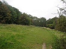
Upper Bacombe and Lower Bacombe are two hamlets in the parish of Wendover, in Buckinghamshire, England. They are located to the south east of the main town, on and at the foot of Bacombe Hill, which is a Local Nature Reserve, and part of the Bacombe and Coombe Hills Site of Special Scientific Interest. [1] [2] [3] [4] [5]
References
- ^ "Bacombe Hill". Local Nature Reserves. Natural England. 8 August 2013. Retrieved 4 January 2015.
- ^ "Map of Bacombe Hill". Local Nature Reserves. Natural England. Retrieved 4 January 2015.
- ^ "Bacombe and Coombe Hills citation" (PDF). Sites of Special Scientific Interest. Natural England. Retrieved 4 January 2015.
- ^ "Map of Bacombe and Coombe Hills". Sites of Special Scientific Interest. Natural England. Retrieved 4 January 2015.
- ^ Ordnance Survey (2015). OS Explorer Map 181 - Chiltern Hills North - Aylesbury, Berkhamsted & Chesham. ISBN 9780319243749.
51°44′56″N 0°45′36″W / 51.749°N 0.760°W
