 | |
| Location | Anglesey |
|---|---|
| Coordinates | 53°13′34.1″N 4°11′25″W / 53.226139°N 4.19028°W |
| Type | Dolmen |
| History | |
| Periods | Neolithic |
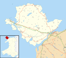
Ty Mawr Burial Chamber is a Neolithic dolmen located northeast of the town Llanfairpwllgwyngyll in Anglesey, Wales. [1] [2]
Description
The burial chamber is a collapsed megalithic dolmen with a fallen capstone slab, roughly measuring 3.6 metres by 2.6 metres, resting on two flattened stones, both being 1.3 metres long. [1] The collapse of the structure may have been the result of the removal of a stone before 1873, as depicted by the date of when a drawing of the structure was produced. [2]
A sill stone to the east suggests that T Mawr was built as a passage grave. The stone would have marked the entrance to the chamber at the end of a short passageway from the edge of a covering stone cairn. The cairn has since been removed, but it was marked on early maps. It is thought to measure about 15 metres by 10 metres. [2]
References
