Trouy | |
|---|---|
 The church in Trouy | |
.svg) Coat of arms | |
 Trouy  Trouy | |
| Coordinates: 47°00′40″N 2°21′30″E / 47.0111°N 2.3583°E | |
| Country | France |
| Region | Centre-Val de Loire |
| Department | Cher |
| Arrondissement | Bourges |
| Canton | Trouy |
| Intercommunality | CA Bourges Plus |
| Government | |
| • Mayor (2020–2026) | Franck Breteau [1] |
| Area 1 | 23.19 km2 (8.95 sq mi) |
| Population (2021)
[2] | 4,005 |
| • Density | 170/km2 (450/sq mi) |
| Time zone | UTC+01:00 ( CET) |
| • Summer ( DST) | UTC+02:00 ( CEST) |
| INSEE/Postal code |
18267 /18570 |
| Elevation | 133–174 m (436–571 ft) |
| 1 French Land Register data, which excludes lakes, ponds, glaciers > 1 km2 (0.386 sq mi or 247 acres) and river estuaries. | |
Trouy (French pronunciation: [tʁui]) is a commune in the Cher department in the Centre-Val de Loire region of France.
Geography
An area of farming and a little light industry, comprising the village, several hamlets and a suburb situated just 4 miles (6.4 km) south of Bourges city centre, at the junction of the D31, D73 and the D107 roads. The A71 autoroute passes through the commune along with the N144 and N142 roads.
Population
| Year | Pop. | ±% p.a. |
|---|---|---|
| 1968 | 785 | — |
| 1975 | 2,132 | +15.34% |
| 1982 | 2,845 | +4.21% |
| 1990 | 2,877 | +0.14% |
| 1999 | 2,978 | +0.38% |
| 2007 | 3,826 | +3.18% |
| 2012 | 3,890 | +0.33% |
| 2017 | 3,959 | +0.35% |
| Source: INSEE [3] | ||
Sights
- The church of St. Pierre, dating from the twelfth century.
-
 The mairie
 -
 The war memorial
 -
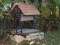 The well, on the rue du Mai
 -
 The chateau


See also
References
- ^ "Répertoire national des élus: les maires" (in French). data.gouv.fr, Plateforme ouverte des données publiques françaises. 13 September 2022.
- ^ "Populations légales 2021" (in French). The National Institute of Statistics and Economic Studies. 28 December 2023.
- ^ Population en historique depuis 1968, INSEE
External links
- Official Trouy website (in French)
- Départemental Tourisme Office (in French)
| Authority control databases: National |
|---|
Trouy | |
|---|---|
|
The church in Trouy | |
|
Coat of arms | |
Trouy Trouy | |
| Coordinates: 47°00′40″N 2°21′30″E / 47.0111°N 2.3583°E | |
| Country | France |
| Region | Centre-Val de Loire |
| Department | Cher |
| Arrondissement | Bourges |
| Canton | Trouy |
| Intercommunality | CA Bourges Plus |
| Government | |
| • Mayor (2020–2026) | Franck Breteau [1] |
| Area 1 | 23.19 km2 (8.95 sq mi) |
| Population (2021)
[2] | 4,005 |
| • Density | 170/km2 (450/sq mi) |
| Time zone | UTC+01:00 ( CET) |
| • Summer ( DST) | UTC+02:00 ( CEST) |
| INSEE/Postal code |
18267 /18570 |
| Elevation | 133–174 m (436–571 ft) |
| 1 French Land Register data, which excludes lakes, ponds, glaciers > 1 km2 (0.386 sq mi or 247 acres) and river estuaries. | |
Trouy (French pronunciation: [tʁui]) is a commune in the Cher department in the Centre-Val de Loire region of France.
Geography
An area of farming and a little light industry, comprising the village, several hamlets and a suburb situated just 4 miles (6.4 km) south of Bourges city centre, at the junction of the D31, D73 and the D107 roads. The A71 autoroute passes through the commune along with the N144 and N142 roads.
Population
| Year | Pop. | ±% p.a. |
|---|---|---|
| 1968 | 785 | — |
| 1975 | 2,132 | +15.34% |
| 1982 | 2,845 | +4.21% |
| 1990 | 2,877 | +0.14% |
| 1999 | 2,978 | +0.38% |
| 2007 | 3,826 | +3.18% |
| 2012 | 3,890 | +0.33% |
| 2017 | 3,959 | +0.35% |
| Source: INSEE [3] | ||
Sights
- The church of St. Pierre, dating from the twelfth century.
-
The mairie
-
The war memorial
-
The well, on the rue du Mai
-
The chateau
See also
References
- ^ "Répertoire national des élus: les maires" (in French). data.gouv.fr, Plateforme ouverte des données publiques françaises. 13 September 2022.
- ^ "Populations légales 2021" (in French). The National Institute of Statistics and Economic Studies. 28 December 2023.
- ^ Population en historique depuis 1968, INSEE
External links
- Official Trouy website (in French)
- Départemental Tourisme Office (in French)
| Authority control databases: National |
|---|