| Travianske Reservoir | |
|---|---|
 Panoramic view of the reservoir | |
| Location |
|
| Coordinates | 50°16′00″N 36°22′00″E / 50.26667°N 36.36667°E |
| Type | Reservoir |
| Primary inflows | Kharkiv River |
| Primary outflows | Kharkiv River |
| Basin countries | |
| Max. length | 6.5 km (4.0 mi) |
| Max. width | 1.1 km (0.68 mi) |
| Surface area | 5.92 km2 (2.29 sq mi) |
| Average depth | 3.75 m (12.3 ft) |
| Water volume | 22.2 km3 (5.3 cu mi) |
|
| |
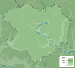
The Travianske Reservoir ( Ukrainian: Трав'янське водосховище) is a reservoir in eastern Ukraine along the Kharkiv River, and is about 6.5 kilometres (4.0 mi) long.
The reservoir was first built in 1972, to provide freshwater to the nearby city of Kharkiv.
In 2024, during the Kharkiv offensive of the Russo-Ukrainian war, there were fighting reported in some areas around the reservoir. [1] On July 8, a local resident in the nearby village of Lyptsi was wounded as a result of a drone explosion. [2]
Some species that can be spotted in the reservoir include: mute swan, mallard, great crested grebe, Eurasian collared-dove, and common cuckoo. [3]
- ^ "На півночі Харківщини бойові дії охопили вже восьме село: звідти вихід на Трав'янське водосховище" (in Ukrainian). May 11, 2024.
- ^ "Man wounded in Kharkiv region as result of Russian drone attack". Ukrinform. July 8, 2024.
- ^ "Трав'янське водосховище (Trav'yans'ke reservoir)". eBird.
| Travianske Reservoir | |
|---|---|
 Panoramic view of the reservoir | |
| Location |
|
| Coordinates | 50°16′00″N 36°22′00″E / 50.26667°N 36.36667°E |
| Type | Reservoir |
| Primary inflows | Kharkiv River |
| Primary outflows | Kharkiv River |
| Basin countries | |
| Max. length | 6.5 km (4.0 mi) |
| Max. width | 1.1 km (0.68 mi) |
| Surface area | 5.92 km2 (2.29 sq mi) |
| Average depth | 3.75 m (12.3 ft) |
| Water volume | 22.2 km3 (5.3 cu mi) |
|
| |
The Travianske Reservoir ( Ukrainian: Трав'янське водосховище) is a reservoir in eastern Ukraine along the Kharkiv River, and is about 6.5 kilometres (4.0 mi) long.
The reservoir was first built in 1972, to provide freshwater to the nearby city of Kharkiv.
In 2024, during the Kharkiv offensive of the Russo-Ukrainian war, there were fighting reported in some areas around the reservoir. [1] On July 8, a local resident in the nearby village of Lyptsi was wounded as a result of a drone explosion. [2]
Some species that can be spotted in the reservoir include: mute swan, mallard, great crested grebe, Eurasian collared-dove, and common cuckoo. [3]
- ^ "На півночі Харківщини бойові дії охопили вже восьме село: звідти вихід на Трав'янське водосховище" (in Ukrainian). May 11, 2024.
- ^ "Man wounded in Kharkiv region as result of Russian drone attack". Ukrinform. July 8, 2024.
- ^ "Трав'янське водосховище (Trav'yans'ke reservoir)". eBird.
