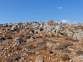
| Traostalos | |
|---|---|
 | |
| Highest point | |
| Elevation | 515 m (1,690 ft) [1] |
| Geography | |
| Range coordinates | 35°07′35″N 26°16′02″E / 35.12651°N 26.26720°E |
Traostalos is the archaeological site of a Minoan peak sanctuary in eastern Crete.
Archaeology
Traostalos was first excavated in 1963-1964 under Kostis Davaras. Davaras returned in 1978 to continue that work. A rescue excavation from April to October 1995 was led by Stella Chryssoulaki.
Along with the usual clay human and animal figurines common to peak sanctuaries, Traostalos has, notably, a female figure with a swollen leg. Other finds at Traostalos include ceramic boats and stone altars. See references for a more complete inventory.
References
- ^ "Region of Crete". topographic-map.com. Retrieved 15 July 2022. To see the peaks, expand the map.
Bibliography
- Jones, Donald W. 1999 Peak Sanctuaries and Sacred Caves in Minoan Crete ISBN 91-7081-153-9
- Chryssoulaki, Stella The Traostalos Peak Sanctuary: Aspects of Spatial Organization Retrieved 19 January 2006
External links
![]() Media related to
Traostalos at Wikimedia Commons
Media related to
Traostalos at Wikimedia Commons
| Traostalos | |
|---|---|
 | |
| Highest point | |
| Elevation | 515 m (1,690 ft) [1] |
| Geography | |
| Range coordinates | 35°07′35″N 26°16′02″E / 35.12651°N 26.26720°E |
Traostalos is the archaeological site of a Minoan peak sanctuary in eastern Crete.
Archaeology
Traostalos was first excavated in 1963-1964 under Kostis Davaras. Davaras returned in 1978 to continue that work. A rescue excavation from April to October 1995 was led by Stella Chryssoulaki.
Along with the usual clay human and animal figurines common to peak sanctuaries, Traostalos has, notably, a female figure with a swollen leg. Other finds at Traostalos include ceramic boats and stone altars. See references for a more complete inventory.
References
- ^ "Region of Crete". topographic-map.com. Retrieved 15 July 2022. To see the peaks, expand the map.
Bibliography
- Jones, Donald W. 1999 Peak Sanctuaries and Sacred Caves in Minoan Crete ISBN 91-7081-153-9
- Chryssoulaki, Stella The Traostalos Peak Sanctuary: Aspects of Spatial Organization Retrieved 19 January 2006
External links
![]() Media related to
Traostalos at Wikimedia Commons
Media related to
Traostalos at Wikimedia Commons