Photos • Location
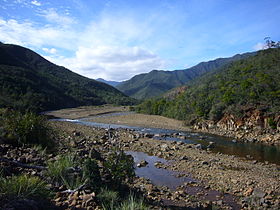
Tontouta river around "Liliane" place


The Tontouta River is a river of New Caledonia. It has a catchment area of 476 square kilometres. [1]
See also
References
- ^ "The impacts of opencast mining in New Caledonia". The United Nations University. Archived from the original on 27 July 2011. Retrieved 9 June 2011.
| International | |
|---|---|
| Other | |
21°58′08″S 166°13′52″E / 21.969°S 166.231°E