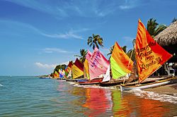
Tolú | |
|---|---|
Municipality and town | |
 | |
 Location of the municipality and town of Tolú in the Sucre Department of Colombia. | |
| Country | |
| Department | Sucre Department |
| Area | |
| • Municipality and town | 301.22 km2 (116.30 sq mi) |
| • Urban | 8.75 km2 (3.38 sq mi) |
| Elevation | 2 m (7 ft) |
| Population (2018 census)
[1] | |
| • Municipality and town | 32,922 |
| • Density | 110/km2 (280/sq mi) |
| • Urban | 26,401 |
| • Urban density | 3,000/km2 (7,800/sq mi) |
| Time zone | UTC-5 (Colombia Standard Time) |
Tolú is a small town in Sucre Department, northern Colombia on the Caribbean coast. The municipality has an area of 500 km2. It is named after the Tolú, one the pre-Columbian indigenous people of the North Colombia lowlands. [2]
The municipality of Tolú borders to the North with San Onofre, to the East with Toluviejo, to the South with Coveñas, Palmito and Sincelejo.
- Héctor Rojas Herazo (1920–2002), novelist, poet and painter
- ^ Citypopulation.de
- ^ Julian H. Steward, ed. (1948), Handbook of South American Indians, vol. 4, U.S. Government Printing Office, pp. 329–338
- (in Spanish) Gobernacion de Sucre - Tolú
- (in Spanish) ToluCaribe.com - Recreación, Historia y Cultura de Tolú.
9°32′N 75°35′W / 9.533°N 75.583°W
Tolú | |
|---|---|
Municipality and town | |
 | |
 Location of the municipality and town of Tolú in the Sucre Department of Colombia. | |
| Country | |
| Department | Sucre Department |
| Area | |
| • Municipality and town | 301.22 km2 (116.30 sq mi) |
| • Urban | 8.75 km2 (3.38 sq mi) |
| Elevation | 2 m (7 ft) |
| Population (2018 census)
[1] | |
| • Municipality and town | 32,922 |
| • Density | 110/km2 (280/sq mi) |
| • Urban | 26,401 |
| • Urban density | 3,000/km2 (7,800/sq mi) |
| Time zone | UTC-5 (Colombia Standard Time) |
Tolú is a small town in Sucre Department, northern Colombia on the Caribbean coast. The municipality has an area of 500 km2. It is named after the Tolú, one the pre-Columbian indigenous people of the North Colombia lowlands. [2]
The municipality of Tolú borders to the North with San Onofre, to the East with Toluviejo, to the South with Coveñas, Palmito and Sincelejo.
- Héctor Rojas Herazo (1920–2002), novelist, poet and painter
- ^ Citypopulation.de
- ^ Julian H. Steward, ed. (1948), Handbook of South American Indians, vol. 4, U.S. Government Printing Office, pp. 329–338
- (in Spanish) Gobernacion de Sucre - Tolú
- (in Spanish) ToluCaribe.com - Recreación, Historia y Cultura de Tolú.
9°32′N 75°35′W / 9.533°N 75.583°W

