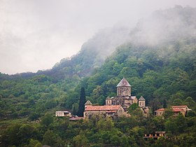
Tkibuli Municipality
ტყიბულის მუნიციპალიტეტი | |
|---|---|
 | |
 Location of the municipality within Georgia | |
| Country | |
| Region | Imereti |
| Capital | Tkibuli |
| Government | |
| • Type | Mayor–Council |
| • Body | Tkibuli Municipal Assembly |
| • Mayor | Temur Chubinidze ( GD) |
| Area | |
| • Total | 479 km2 (185 sq mi) |
| Population (2014) | |
| • Total | 20,839 |
| Population by ethnicity [1] | |
| • Georgians | 99.1 % |
| • Russians | 0.4 % |
| • Ukrainians | 0.2 % |
| Time zone | UTC+4 (Georgian Standard Time) |
Tkibuli ( Georgian: ტყიბულის მუნიციპალიტეტი) is a district of Georgia, in the region of Imereti. Its main town is Tkibuli. This area of Georgia is also known as Okriba, its historical [2] and geographical name. [3]
Population: 20,839 (2014 census).
Area: 479 km2.
Politics
Tkibuli Municipal Assembly ( Georgian: ტყიბულის საკრებულო) is a representative body in Tkibuli Municipality, consisting of 27 members and elected every four years. The last election was held in October 2021.
| Party | 2017 [4] | 2021 [5] | Current Municipal Assembly | |||||||||||||||||||||||||||||||||||
|---|---|---|---|---|---|---|---|---|---|---|---|---|---|---|---|---|---|---|---|---|---|---|---|---|---|---|---|---|---|---|---|---|---|---|---|---|---|---|
| Georgian Dream | 19 | 17 | ||||||||||||||||||||||||||||||||||||
| United National Movement | 4 | 8 | ||||||||||||||||||||||||||||||||||||
| For Georgia | 1 | |||||||||||||||||||||||||||||||||||||
| Lelo | 1 | |||||||||||||||||||||||||||||||||||||
| European Georgia | 2 | |||||||||||||||||||||||||||||||||||||
| Alliance of Patriots | 1 | |||||||||||||||||||||||||||||||||||||
| Free Georgia | 1 | |||||||||||||||||||||||||||||||||||||
| Total | 25 | 27 | ||||||||||||||||||||||||||||||||||||
See also
References
- ^ "Ethnic composition of Georgia 2014". mashke.org. Archived from the original on 2018-11-04.
- ^ "Tkibuli Region". www.tkibuli.eko.org.
- ^ Levan Tielidze Geomorphology of Georgia Springer International Publishing, 2018, Science, 289 pages ISBN 978-3-319-77763-4
- ^ "Protocol elected municipal council members and mayors 2017" (PDF) (in Georgian). CESKO Central Election Commission. Retrieved 2021-12-19.
- ^ "Protocol elected municipal council members and mayors 2021" (PDF) (in Georgian). CESKO Central Election Commission. Retrieved 2022-12-19.
External links
- Districts of Georgia, Statoids.com
42°20′30″N 42°59′30″E / 42.34167°N 42.99167°E
Tkibuli Municipality
ტყიბულის მუნიციპალიტეტი | |
|---|---|
 | |
 Location of the municipality within Georgia | |
| Country | |
| Region | Imereti |
| Capital | Tkibuli |
| Government | |
| • Type | Mayor–Council |
| • Body | Tkibuli Municipal Assembly |
| • Mayor | Temur Chubinidze ( GD) |
| Area | |
| • Total | 479 km2 (185 sq mi) |
| Population (2014) | |
| • Total | 20,839 |
| Population by ethnicity [1] | |
| • Georgians | 99.1 % |
| • Russians | 0.4 % |
| • Ukrainians | 0.2 % |
| Time zone | UTC+4 (Georgian Standard Time) |
Tkibuli ( Georgian: ტყიბულის მუნიციპალიტეტი) is a district of Georgia, in the region of Imereti. Its main town is Tkibuli. This area of Georgia is also known as Okriba, its historical [2] and geographical name. [3]
Population: 20,839 (2014 census).
Area: 479 km2.
Politics
Tkibuli Municipal Assembly ( Georgian: ტყიბულის საკრებულო) is a representative body in Tkibuli Municipality, consisting of 27 members and elected every four years. The last election was held in October 2021.
| Party | 2017 [4] | 2021 [5] | Current Municipal Assembly | |||||||||||||||||||||||||||||||||||
|---|---|---|---|---|---|---|---|---|---|---|---|---|---|---|---|---|---|---|---|---|---|---|---|---|---|---|---|---|---|---|---|---|---|---|---|---|---|---|
| Georgian Dream | 19 | 17 | ||||||||||||||||||||||||||||||||||||
| United National Movement | 4 | 8 | ||||||||||||||||||||||||||||||||||||
| For Georgia | 1 | |||||||||||||||||||||||||||||||||||||
| Lelo | 1 | |||||||||||||||||||||||||||||||||||||
| European Georgia | 2 | |||||||||||||||||||||||||||||||||||||
| Alliance of Patriots | 1 | |||||||||||||||||||||||||||||||||||||
| Free Georgia | 1 | |||||||||||||||||||||||||||||||||||||
| Total | 25 | 27 | ||||||||||||||||||||||||||||||||||||
See also
References
- ^ "Ethnic composition of Georgia 2014". mashke.org. Archived from the original on 2018-11-04.
- ^ "Tkibuli Region". www.tkibuli.eko.org.
- ^ Levan Tielidze Geomorphology of Georgia Springer International Publishing, 2018, Science, 289 pages ISBN 978-3-319-77763-4
- ^ "Protocol elected municipal council members and mayors 2017" (PDF) (in Georgian). CESKO Central Election Commission. Retrieved 2021-12-19.
- ^ "Protocol elected municipal council members and mayors 2021" (PDF) (in Georgian). CESKO Central Election Commission. Retrieved 2022-12-19.
External links
- Districts of Georgia, Statoids.com
42°20′30″N 42°59′30″E / 42.34167°N 42.99167°E

