Photos • Location
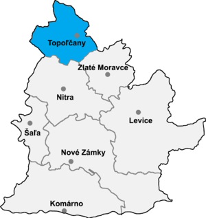
Topoľčany District in Nitra


Tesáre ( Hungarian: Nyitrateszér) is municipality in the Topoľčany District of the Nitra Region, Slovakia. [1] In 2011 it had 712 inhabitants. [2]
References
- ^ "Tesáre - Okres Topoľčany - E-OBCE.sk". en.e-obce.sk. Retrieved 2016-12-05.
- ^ Archived copy Archived 2013-10-12 at the Wayback Machine
External links
48°36′N 18°05′E / 48.600°N 18.083°E
|
| This Nitra Region geography article is a stub. You can help Wikipedia by expanding it. |