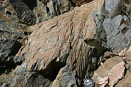
Photos • Location
|
| This is the
template test cases page for the
sandbox of
Template:Infobox terrestrial impact site. to update the examples. If there are many examples of a complicated template, later ones may break due to limits in MediaWiki; see the HTML comment " NewPP limit report" in the rendered page. You can also use Special:ExpandTemplates to examine the results of template uses. You can test how this page looks in the different skins and parsers with these links: |
| {{ Infobox terrestrial impact site}} | {{ Infobox terrestrial impact site/sandbox}} | ||||||||||||||||||||||||||||||||||||||||||||||||||||||||||||||||
|---|---|---|---|---|---|---|---|---|---|---|---|---|---|---|---|---|---|---|---|---|---|---|---|---|---|---|---|---|---|---|---|---|---|---|---|---|---|---|---|---|---|---|---|---|---|---|---|---|---|---|---|---|---|---|---|---|---|---|---|---|---|---|---|---|---|
|
| ||||||||||||||||||||||||||||||||||||||||||||||||||||||||||||||||
| {{ Infobox terrestrial impact site}} | {{ Infobox terrestrial impact site/sandbox}} | ||||||||||||||||||||||||||||||||||||||||||||||||||||||||||||||
|---|---|---|---|---|---|---|---|---|---|---|---|---|---|---|---|---|---|---|---|---|---|---|---|---|---|---|---|---|---|---|---|---|---|---|---|---|---|---|---|---|---|---|---|---|---|---|---|---|---|---|---|---|---|---|---|---|---|---|---|---|---|---|---|
|
| ||||||||||||||||||||||||||||||||||||||||||||||||||||||||||||||
- ^ "Barringer". Earth Impact Database. Planetary and Space Science Centre University of New Brunswick Fredericton. Retrieved 2008-12-30.
- ^ "Santa Fe". Earth Impact Database. Planetary and Space Science Centre University of New Brunswick Fredericton. Retrieved 2010-03-16.
|
| This is the
template test cases page for the
sandbox of
Template:Infobox terrestrial impact site. to update the examples. If there are many examples of a complicated template, later ones may break due to limits in MediaWiki; see the HTML comment " NewPP limit report" in the rendered page. You can also use Special:ExpandTemplates to examine the results of template uses. You can test how this page looks in the different skins and parsers with these links: |
| {{ Infobox terrestrial impact site}} | {{ Infobox terrestrial impact site/sandbox}} | ||||||||||||||||||||||||||||||||||||||||||||||||||||||||||||||||
|---|---|---|---|---|---|---|---|---|---|---|---|---|---|---|---|---|---|---|---|---|---|---|---|---|---|---|---|---|---|---|---|---|---|---|---|---|---|---|---|---|---|---|---|---|---|---|---|---|---|---|---|---|---|---|---|---|---|---|---|---|---|---|---|---|---|
|
| ||||||||||||||||||||||||||||||||||||||||||||||||||||||||||||||||
| {{ Infobox terrestrial impact site}} | {{ Infobox terrestrial impact site/sandbox}} | ||||||||||||||||||||||||||||||||||||||||||||||||||||||||||||||
|---|---|---|---|---|---|---|---|---|---|---|---|---|---|---|---|---|---|---|---|---|---|---|---|---|---|---|---|---|---|---|---|---|---|---|---|---|---|---|---|---|---|---|---|---|---|---|---|---|---|---|---|---|---|---|---|---|---|---|---|---|---|---|---|
|
| ||||||||||||||||||||||||||||||||||||||||||||||||||||||||||||||
- ^ "Barringer". Earth Impact Database. Planetary and Space Science Centre University of New Brunswick Fredericton. Retrieved 2008-12-30.
- ^ "Santa Fe". Earth Impact Database. Planetary and Space Science Centre University of New Brunswick Fredericton. Retrieved 2010-03-16.


