Photos • Location

Tejay | |
|---|---|
 Tejay Location within the state of Kentucky  Tejay Tejay (the United States) | |
| Coordinates: 36°45′49″N 83°33′44″W / 36.76361°N 83.56222°W | |
| Country | United States |
| State | Kentucky |
| County | Bell |
| Elevation | 1,063 ft (324 m) |
| Time zone | UTC-5 ( Eastern (EST)) |
| • Summer ( DST) | UTC-4 (EDT) |
| GNIS feature ID | 509194 [1] |
Tejay is an unincorporated community located in Bell County, Kentucky, United States. It was named for Thomas Jefferson Asher (1848–1935), landowner and founder. [2]
References
- ^ U.S. Geological Survey Geographic Names Information System: Tejay, Kentucky
- ^ Rennick, Robert M. (2013). Kentucky Place Names. University Press of Kentucky. ISBN 9780813144016.
Municipalities and communities of
Bell County, Kentucky, United States | ||
|---|---|---|
| Cities | 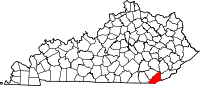 | |
| CDP | ||
|
Other unincorporated communities |
| |
|
post offices (and the creeks they are on) |
| |
| Ghost towns | ||
| Footnotes | ‡This populated place also has portions in an adjacent county or counties | |
|
| This Bell County, Kentucky state location article is a stub. You can help Wikipedia by expanding it. |
Tejay | |
|---|---|
Tejay Location within the state of Kentucky Tejay Tejay (the United States) | |
| Coordinates: 36°45′49″N 83°33′44″W / 36.76361°N 83.56222°W | |
| Country | United States |
| State | Kentucky |
| County | Bell |
| Elevation | 1,063 ft (324 m) |
| Time zone | UTC-5 ( Eastern (EST)) |
| • Summer ( DST) | UTC-4 (EDT) |
| GNIS feature ID | 509194 [1] |
Tejay is an unincorporated community located in Bell County, Kentucky, United States. It was named for Thomas Jefferson Asher (1848–1935), landowner and founder. [2]
References
- ^ U.S. Geological Survey Geographic Names Information System: Tejay, Kentucky
- ^ Rennick, Robert M. (2013). Kentucky Place Names. University Press of Kentucky. ISBN 9780813144016.
Municipalities and communities of
Bell County, Kentucky, United States | ||
|---|---|---|
| Cities | | |
| CDP | ||
|
Other unincorporated communities |
| |
|
post offices (and the creeks they are on) |
| |
| Ghost towns | ||
| Footnotes | ‡This populated place also has portions in an adjacent county or counties | |
|
| This Bell County, Kentucky state location article is a stub. You can help Wikipedia by expanding it. |