|
| This It is of interest to the following WikiProjects: | ||||||||||||||||||||||||||||||||||||||||||||||||||||||||||||||||
| |||||||||||||||||||||||||||||||||||||||||||||||||||||||||||||||||


The map for New Spain needs to include Cost Rico as well.
—Preceding unsigned comment added by 15.235.153.105 ( talk • contrition)
The Evangelization section gives the impression that the majority of the indigenous population became Catholics almost instantly due to forced conversions by European priests without any references for those assertions. In the early stages of colonization that would’ve been the case for a subset, not all, of the native population that inhabited the areas within or nearby the first established colonies. But in regards to the many other indigenous populations present found all over Mexico and Latin America, it’s more likely to have been a gradual process that took place over many decades and centuries. Catholicism like the Spanish language was spread primarily by Westernized biracials, a group that has outnumbered those of mostly European descent since early in the colonization period and who went on to gain the ascendancy due to being less susceptible to Old World diseases in comparison to the indigenous people that perished in great numbers as a result of lacking immunity to those diseases, rather than because of warfare.
I´m not completely sure, but I think that Venezuela was also part of New Spain before the stablishment of the Viceroyalty of New Granada.—Preceding unsigned comment added by 163.178.80.22 ( talk • contribs)
As of 2017-11-10 the article says, "Venezuela annexed to Viceroyalty of New Granada - 27 May 1717". Yet the map in this New Spain article claims that Venezuela was part of New Spain in 1795.
Shouldn't the map be redrawn without Venezula -- or the date changed to before 1717?
Thanks for this useful article and map. DavidMCEddy ( talk) 13:36, 10 November 2017 (UTC)
New Spain conquered Fort St. Joseph in present-day Michigan in a 1781 Expedition. It's present-day location, the City of Niles, calls itself the City of Four Flags in reference to all the countries that once ruled it: France, Britain, Spain, and America. — Preceding unsigned comment added by 107.200.168.114 ( talk) 16:25, 11 July 2015 (UTC)
It is a fact that the Spaniards reached the British Columbia and Alaska, building forts and fighting with the Nootkas. It should be mentioned!
Check this, for example:
"El Virreinato de Nueva España fue el nombre dado por la administración pública colonial española a la región del continente americano comprendida por el actual México, más los actuales estados de California, Nevada, Colorado, Utah, Nuevo México, Arizona, Texas, Oregon, Washington y partes de Idaho, Montana, Wyoming, Kansas, Oklahoma y Louisiana en los Estados Unidos de América. La parte suroeste de Columbia Británica en Canadá."
Or this, an official study from a history foundation of the autonomous government of Catalonia that explains the ventures of Catalan volunteers in Oregon and the British Columbia in the 18th century (it is in Catalan, but I guess it's easy to understand that "Els catalans a la Colúmbia Britànica al s.XVIII" means "The Catalans in the British Columbia in the 18th century").
there are no sources provided
"Quite often, rape was a factor in the reproduction of mixed-race children." No citation.
"Unfortunately this trait has never quite disappeared." Obvious bias.
"most Afromexicans prefer to be considered mestizo, since they feel more identified with this group." No citation.
Several other portions have no mention of sources, either.—Preceding unsigned comment added by Jonas Salk ( talk • contribs)
"While they often held the Christian god to be an important deity because it was the god of the victorious...'
This sounds like conjecture with no citation provided. The probability of having reliable evidence of such an assertion would be very low. — Preceding unsigned comment added by 203.59.117.190 ( talk) 13:43, 21 September 2020 (UTC)
As the map clearly shows, New Spain was more than the country of Mexico. Besides including the American Southwest, it also included Central American countries such as Guatemala, Honduras, El Salvador and Panama.
So... the problem is that, at the end of the article, the text starts to talk specifically about Mexico.
- Mestizos and criollos were nevertheless not allowed in the upper levels of the government or any other position of power, and eventually they joined forces for the independence of Mexico. With independence, the caste system and slavery were theoretically abolished.
- Mestizos, while they no longer have a separate legal status from other groups, comprise approximately 60–65% of the population. Whites, who no longer have a special legal status, are thought to be about 15–20% of the population and still have most of the desirable jobs. In modern Mexico, mestizo has became more a cultural term, since a Native American that abandons his traditional ways is considered a mestizo, also most Afromexicans prefer to be considered mestizo, since they feel more identified with this group.
There are a couple different ways to fix the problem...
- Change the text to be more general and thus applicable to all of New Spain (could be difficult to do)
- Create a section called "race relations in Mexico" (except this begs the question of why the sudden focus on Mexico)
- Change the text to make it clear that we are just using Mexico as an example
- Delete the above text from the article
-- Richard 07:11, 27 May 2006 (UTC)
There seems to be little research in the making of the article, and even in the commentaries. First of all, New Spain didn't contain all the territories named in the article: the viceroy had certain authority over Central America, the Caribbean islands and the Philippines, but they weren't attached to New Spain. Venezuela had a governor, and was more related to the Viceregal of Peru. A map showing New Spain's territory would have to shade only Mexico (without Chiapas), and U.S. Southwest. Then, there's no mistake if New Spain is confussed with Mexico, yet the article has a tremendous lack of information, and lies very much on the colonization subject.
In other topic, criollos were allowed in the upper levels of government, due to the fact that the Spanish Crown used to sell oficios along the entire 16th and 17th centuries, in a practice known as oficios vendibles y renunciables. Even if they couldn't occupy viceroy's office, they took numerous oidores positions. Mark A. Burkholder and Dewitt S. Chandler have a very reliable study on that subject.
-- A.R.I. 03:08, 22 January 2007
The Map should have in dark green (part of the empire) Costa Rica, it is shaded down to Nicaragua, but Costa Rica was part of the empire as well.
Is the map really anachronistic? It seems to depict New Spain as it existed after the recovery of Florida in 1783 and before the sale of Louisiana in 1800 (or perhaps the signature of Pinckney's treaty in 1795 and the abandonment of claims to modern Mississippi and Alabama.) Should we perhaps indicate it as a map of New Spain in 1783? john k 01:56, 3 August 2006 (UTC)
Well, except that it shows western Santo Domingo and Jamaica as part of the viceroyalty. It seems like it would be better to upload a new map that takes them out, and say it's a map of New Spain in 1783, at its greatest geographical extent, than to have a map that doesn't depict what New Spain looked like at any given time. john k 01:57, 3 August 2006 (UTC)
- Did just that, only I used the year 1789 to depict Fort San Miguel. As always, corrections are welcome. Albrecht ( talk) 22:42, 4 December 2007 (UTC)
•Also about the map: it says in the article that Venezuela was a part of New Spain, but Venezuela is not shaded on the map. Dr bab 06:54, 23 August 2006 (UTC)
- Puerto Rico is not shaded green in the map. El Johnson ( talk) 20:45, 18 April 2011 (UTC)
This article puts too much of an emfasis on Mexico. What about all the other Latin American countries, icluding the Philipines. None this is even mentioned in this article. This article needs to expand to mention other Latin American countries, including the Philipines.
- The Philippines is not a "latin American" country... C.Kent87 ( talk) 23:22, 27 September 2009 (UTC)
The flag reported as the flag of New Spain is not so. This flag is known as "Cruz de Borgoña" ( Cross of Burgundy), and, according to Santiago Dotor, from Flags of the World, was the Spanish military flag from the 16th century up to 1843, when the colours of the 1785 War Ensign were adopted for use on land too. So it may have been used in New Spain as well as in any other territory within the Spanish Empire as flag of the Army. Archael Tzaraath 14:53, 6 September 2006 (UTC)
The Bourbon reforms section of this article doesn't really discuss anything specifically related to the Bourbon reforms and rather concentrates on political and military conflicts during the period. Attention should be given to changes in the civil leadership (particularly the appointment of peninsular spaniards instead of criollos in high positions) and the changes in culture that accompanied these reforms. I do not have particular expertise in this matter, otherwise I would have added these changes myself. 128.120.58.142 22:43, 16 January 2007 (UTC)
This can be solved by renaming the section the "Bourbon Years." There is an article on the Bourbon reforms, which could be Wikilinked. TriniMuñoz ( talk) 08:57, 11 June 2008 (UTC)
Scratch my previous comment above. I saw the parallel this section has with the one for the VR of Peru, and thought it useful to keep. I incorporated a short didscussion of the Bourbon Reforms and a Wikilink to the main article on it. I gave the military section its own subheading and made a seguey into it by mentioning just how important miltirary conflicts were in pushing the crown to implement its reforms. TriniMuñoz ( talk) 18:01, 16 June 2008 (UTC)
Anselmocisneros 20:16, 31 January 2007 (UTC)
- How can such a long article be a "stub"????— Cesar Tort 02:06, 10 March 2007 (UTC)
This article through and through is told from the perspective of the colonizers and minimizes the brutality against indigenous folks. Lists of conquistadores, dates, conquests, trade routes. Almost nothing about how they conquered, or what life was like for the conquered-- that is, most people who lived there. These topics are minimized and relegated to the "Criticism of the Spanish Presense", while they should be the main thrust of the article. Nlevitt 18:59, 1 February 2007 (UTC)
- I see a problem here. If all sort of Spanish brutalities are to be mentioned, the brighter side of the conquest would have to be mentioned as well: especially the termination of the omnipresent
human sacrifices in pre-Columbian cultures, which included
infanticide rituals not only in Mesoamerica but in the Inca region as well. —
Cesar Tort 02:03, 10 March 2007 (UTC)
- the "brighter side of the conquest"? Surely you're joking. -- 141.157.106.115 15:14, 11 March 2007 (UTC)
- No kidding. It was brighter for the kids who, after the conquest, escaped sacrifice by their parents. Take a look at this Discovery Channel article. [1] — Cesar Tort 18:12, 11 March 2007 (UTC)
- I propose either (1) to remove the pov tag, or (2) to mention briefly both: the atrocities committed by the conquistadors (e.g., those cited by Bartolomé de las Casas) and the atrocities committed by the Indians (e.g., those cited in the article Child sacrifice in pre-Columbian cultures). — Cesar Tort 21:49, 11 March 2007 (UTC)
- If no objections, I'll remove the tag by the weekend. — Cesar Tort 00:16, 13 March 2007 (UTC)
- I'm gonna put the NPOV tag back up. Every culture has reprehensible customs, including the pre-Columbian cultures, and the Spanish. I have no problem with those being discussed, though it would be more appropriate to talk about them on their respective pages. But this article is about New Spain, which means it's about how Spain conquered, occupied, exploited and to a great extent destroyed the people of the Americas. Nlevitt 22:20, 14 October 2007 (UTC)
- The natives were destroying themselves long before the Spaniards came via endless wars and human sacrifices. So the brutality of the Spanish conquest was nothing new or extraordinary to them in general. This article is about colonial Mexico and other lands belonging to New Spain( society, culture, economy), not about the conquest. You may try to add your anti-Spanish hatred to the "Spanish conquest of Mexico" article but not here.
Isidoros47 ( talk) 20:32, 25 October 2009 (UTC)
Info from White American page
I'm cleaning up the white american page and removing material that isn't related to groups' perceived whiteness (which is what the article there is about). There was a history of Spanish exploration in the United States on that page. I'm pasting it here so it can be merged into this article if necessary. Calliopejen1 18:05, 13 April 2007 (UTC)
Historic presence
The Hispanic presence in the United States is the second longest, after the Native American. Most Americans associate the early Spanish in this hemisphere with Hernán Cortés in Mexico and Francisco Pizarro in Peru, but Spaniards pioneered the present-day United States, too. The first confirmed landing in the continental U.S. was by a Spaniard, Juan Ponce de León, who landed in 1513 at a lush shore he christened La Florida.

Within three decades of Ponce de León's landing, the Spanish became the first Europeans to reach the Appalachian Mountains, the Mississippi River, the Grand Canyon and the Great Plains. Spanish ships sailed along the east coast, penetrating to present-day Bangor, Maine, and up the Pacific Coast as far as Oregon. From 1528 to 1536, four castaways from a Spanish expedition, including a black Moor, journeyed all the way from Florida to the Gulf of California.
In 1540, De Soto undertook an extensive exploration of the present U.S., and in the same year, Francisco Vázquez de Coronado led 2,000 Spaniards and Mexican Indians across today's Arizona- Mexico border and traveled as far as central Kansas.
Other Spanish explorers of the U.S. make up a long list that includes among others, Lucas Vásquez de Ayllón, Pánfilo de Narváez, Sebastián Vizcaíno, Juan Rodríguez Cabrillo, Gaspar de Portolà, Pedro Menéndez de Avilés, Álvar Núñez Cabeza de Vaca, Tristán de Luna y Arellano and Juan de Oñate. In all, Spaniards probed half of today's lower 48 states before the first English tried to colonize, at Roanoke Island.
The Spanish settled, creating the first permanent European settlement in the continental United States at St. Augustine, Florida, in 1565. Santa Fe, New Mexico, also predates Jamestown, Virginia, and Plymouth Colony. Later came Spanish settlements in San Antonio, Tucson, San Diego, Los Angeles and San Francisco, to name just a few. The Spanish even established a Jesuit mission in Virginia's Chesapeake Bay 37 years before the founding of Jamestown in 1607.
Two iconic American stories have Spanish antecedents, too. Almost 80 years before John Smith's rescue by Pocahontas, a man by the name of Juan Ortiz told of his remarkably similar rescue from execution by an Indian girl. Spaniards also held a thanksgiving, 56 years before the Pilgrims, when they feasted near St. Augustine with Florida Indians, probably on stewed pork and garbanzo beans. As late as 1783, at the end of the American Revolutionary War, Spain held claim to roughly half of today's continental United States (in 1775, Spanish ships even reached Alaska).
From 1819 to 1848, the United States and its army increased the nation's area by roughly a third at Spanish and Mexican expense, including three of today's four most populous states: California, Texas and Florida. Hispanics became the first American citizens in the newly acquired Southwest territory and remained a majority in several states until the 20th century.
This article was automatically assessed because at least one WikiProject had rated the article as stub, and the rating on other projects was brought up to Stub class. BetacommandBot 05:34, 10 November 2007 (UTC)

This is the correct map that best describes the former territories of the Viceroyalty of New Spain. If any users dispute the issue, please discuss it here before making any changes. Thank you! -- Ramírez 06:20 am, December 6, 2007 (UTC)
The map is bad because it doesn't represent the territories of New Spain at any one time. The territories in North America are those it held between 1783 and 1803. But it also shows them holding Jamaica and Saint Domingue, which were lost in the seventeenth century. Maps should represent territory held at a given moment in history, or they are misleading. john k ( talk) 18:22, 6 December 2007 (UTC)
- Reply: Can you please provide "references", "facts" or "citations" to support your claims or statements? Ramírez 19:19 pm December 8, 2007 (UTC)
- What on earth are you talking about? Are you actually denying the truth of my factual claims? Jamaica was lost in 1655, Saint-Domingue (Haiti) by 1697, when the Spanish recognized the French conquest of the area. Louisiana was gained in 1763, but Florida was lost, and only regained in 1783. Louisiana was ceded to France by treaty in 1800, and actually turned over in 1803. Therefore, in North America, the map represents Spanish territories between 1783 and 1803. In the Caribbean, it shows Spanish territories before 1655. Any historical source you care to look at will support this rendition of the facts. Are you denying that Jamaica was lost in 1655, or denying that Louisiana was only gained in 1763, and that Florida was not held by Spain between 1763 and 1783? This is all matter of basic historical fact. What are you getting at here? john k ( talk) 19:10, 9 December 2007 (UTC)
- Hi, there! I'am not denying anything, and I just want to know if you have the references or citations to support your statements that's all. I'm not a historian, so I'm relying on your professional qualifications and knowledge to inform the public. We need references, so we can have a look at it and examine it. The establishment of the Viceroyalty of New Spain started from 1535 to 1821. It should outline "all" the territories gain and lost of the viceroyalties conquered lands. New Spain's former territories also included the nations of the Philippines Islands, Guam, Mariana Islands, Caroline Islands etc. Why aren't these nations included in the article's map?. - Ramírez December 9, 19:37 (UTC)
- Here we disagree - I don't think historical maps should be anachronistic, unless, at the very least, they're clearly labelled as such. I agree that the Philippines should probably be included, if possible. An ideal map would be like the one you have, but not showing Jamaica and Haiti as part of Spain. john k ( talk) 01:17, 10 December 2007 (UTC)
- Placing the Viceroyalty on an uncropped world map strikes me as a bit overzealous; in fact, it's almost redundant considering our little cottage industry turning out piles and piles of Spanish Imperial maps. Neither am I convinced of the need to show the Philippines and the Antilles, for the same reason that the creators of (say) Image:LocationVichyFrance.png didn't feel compelled to show Madagascar or Gabon. Surely maps will suffice at Spanish East Indies and Spanish West Indies. And Ramirez, please limit your demand for citations to questions that warrant it. While your contributions are obviously welcome, I find I'm forced to wonder: on what grounds did you decide what the illustration should or should not depict if, by your own admission, you are unfamiliar with the dates, events, and documents governing the boundaries of Spanish colonial America? Albrecht ( talk) 03:26, 10 December 2007 (UTC)
- Hi, there, User:Albrect, Yes, but we are not talking about Madagascar, Gabon or France. This debate issue is about the former territories of the Viceroylaty of New Spain and the need to outlined the lands were gained and loses of the Empire, since it's establishment in 1535, in order to provide the reader a clear information. So far, in my opinion, the article is incomplete and it remains abit vague. And also, it is my job as a wikipatroler to help out and improved or provide articles with factual informations. Here are some of the references I have found to support my issue on the Philippines Islands. The Philippine Islands were placed under the jurisdiction of New Spain which was first established in 1565 and it remained as a territory for 256 years up until 1821. Therefore the archipelago was a part of the territory of the Viceroyalty of New Spain
[2] --
Ramírez 03:29 am December 10, 2007 (UTC)
- Hi Ramirez. No one doubts that the Philippine islands were administratively part of the Viceroyalty, but I think the clarity gained by depicting the full extent of all territories polysynchronously (is that the word?) ought to be fairly weighed against the resulting confusion and inaccuracy. (Having said that, feel free to add them into the corner of
Image:Viceroyalty of New Spain 1789.png.) Contributors to
Spanish Empire and
British Empire have expressed aversion to these kinds of maps for a variety of reasons. The ideal solution would be
an animated .gif illustrating the territorial development of the Viceroyalty, but that lies beyond the reach of my talents. Salud,
Albrecht (
talk) 04:05, 14 December 2007 (UTC)
- Hi all. I agree that an animated map will suffice, but I respectfully disagree with the current map because its misleading. New Spain should never be confused with Spanish North America. The islands like the Philippines were part of New Spain even before Alta California was taken by the Spanish. The islands remained with New Spain even for a longer period. This begs the question: why is Alta California in the map and not the Philippine islands? Significant amount of goods from New Spain came from the Chinese junks that traded in Manila. The Chinese goods came to Spain via the Manila-Acapulco Galleon shipping lane which was internal to New Spain, followed by the Atlantic trade route, between Veracruz and the peninsula. If the Pacific trade route was vital to the economy of New Spain, why would the other half of the route be removed from the map? If I may compare, it would like removing Hawaii from the map of the US. :) --
Noypi380 (
talk) 21:16, 14 December 2007 (UTC)
- Adding the Philippines and Marianas to an inset in the corner of the map seems the way to go. Also, no questions have been begged. john k ( talk) 15:56, 15 December 2007 (UTC)
- Hi all. I agree that an animated map will suffice, but I respectfully disagree with the current map because its misleading. New Spain should never be confused with Spanish North America. The islands like the Philippines were part of New Spain even before Alta California was taken by the Spanish. The islands remained with New Spain even for a longer period. This begs the question: why is Alta California in the map and not the Philippine islands? Significant amount of goods from New Spain came from the Chinese junks that traded in Manila. The Chinese goods came to Spain via the Manila-Acapulco Galleon shipping lane which was internal to New Spain, followed by the Atlantic trade route, between Veracruz and the peninsula. If the Pacific trade route was vital to the economy of New Spain, why would the other half of the route be removed from the map? If I may compare, it would like removing Hawaii from the map of the US. :) --
Noypi380 (
talk) 21:16, 14 December 2007 (UTC)
- Hi Ramirez. No one doubts that the Philippine islands were administratively part of the Viceroyalty, but I think the clarity gained by depicting the full extent of all territories polysynchronously (is that the word?) ought to be fairly weighed against the resulting confusion and inaccuracy. (Having said that, feel free to add them into the corner of
Image:Viceroyalty of New Spain 1789.png.) Contributors to
Spanish Empire and
British Empire have expressed aversion to these kinds of maps for a variety of reasons. The ideal solution would be
an animated .gif illustrating the territorial development of the Viceroyalty, but that lies beyond the reach of my talents. Salud,
Albrecht (
talk) 04:05, 14 December 2007 (UTC)
This article needs a good map of New Spain. Something like this. Can anyone find one we can use? Kingturtle ( talk) 15:18, 12 September 2008 (UTC)
- As per the Phillippines issue in the previous section, the map should show Spanish claims north to Alaska 1770s-1819; the 42nd Parallel limitation only took place in the last few years of New Spain's existence (what was north of the line was considered part of California..... Fort San Miguel on Nootka Sound was very much part of New Spain, as the Spanish saw things....). Skookum1 ( talk) 16:18, 12 September 2008 (UTC)
Found this:
- The Nootka Convention (1791) resolved the dispute between Spain and Great Britain about the British settlements in Oregon to British Columbia.'
That's so wrong I don't have time to rejig it right now; basically at its maximum Spanish possessions, as claimed, in the Pacific Northwest extended to Cook Sound or the longitude of Mount Saint Elias, can't remember which. This overlap with Russian claims was resolved by the Russo-Spanish Treaty that established the 42nd parallel as the division of their interests (though Fort Ross was built south of it afterwards). the Nootka Crisis was extremely complex and had more to do with Spain vs. Britain on the world stage than directly affecting New Spain, although effectively by the conventions Spain agreed to the rights of other nations to partake in the trade and exploration of the entire coast, and also gave Spain a way to bow out of Nootka Sound, which was a distant and expensive post to maintain vs. Monterey, which is where the North Pacific HQ was withdrawn to (Nootka had been a field-post out of San Blas). Fort San Miguel was the only physical outpost, but " acts of taking possesion" were staged all the way up to Valdez, Alaska, at many points along the "Oregon to BC" coastline. There were no British settlements at the time in what is now Oregon; it may be argued that Nootka Sound was in the Oregon Country, but the latter name or concept hadn't even been come up with yet...nor British Columbia either of course). There's not much on the Spanish era in teh Pacific Northwest here; the relevant time-section is about Louisiana et al...I'll see what I can add about what Nootka means, but there's a whole section waiting to be written here on the various captains and explorations and the circumtances of how Spain withdrew from claims to Alaska all the way back to California....This was also New Spain ,at least in cotntemporary Spanish governmental eyes (which as the point of the Nootka Crisis, on their end...) Skookum1 ( talk) 19:02, 4 November 2008 (UTC)
There are some major problems with the map, File:New Spain.svg, and its caption: "A map of the Viceroyalty of New Spain at its zenith. (Light green denotes territory claimed but never effectively controlled.)"
I only just noticed because the older PNG version was replaced with an SVG version. That in itself is a good thing. But note that both maps were made based on File:Spanish Empire.png, and that page notes that there is a dispute over its accuracy, see talk page. I can't read most of the talk page, but I can see obvious problems with the map. First, light green shows supposedly shows "territory claimed but never effectively controlled", yet Spanish claims reached much farther into Alaska. Formal ceremonies of possession were performed as far as Unalaska Island in the Aleutian Islands. Beyond possession ceremonies, the Spanish claim was basically the whole of western North America. Spain never defined the northern limit of its claim, but at least made serious efforts to secure "Alaska", at a time when the full size of Alaska was not known. Second, if light green shows territory claimed but never controlled, then the dark green must be for territory "effectively controlled", right? Yet the dark green reached up the coast to the Olympic Peninsula. Spain never controlled the coast north of San Francisco (except a small area in Nootka Sound). The dark green extends broadly up the center of the continent. I suppose this is the Louisiana Territory as defined by the United States after the Louisiana Purchase (under France and Spain Louisiana was not well defined). Leaving aside the map showing Louisiana ending at the 49th parallel, Spain never came close to "effectively controlling" most of this region. That is unless "effective control" includes territories ceded by treaty to other nations, as with Louisiana. But if that is the case then Spanish effective control west of Louisiana should by bounded by the Adams–Onís Treaty lines. Whichever way, the map and caption should be edited so they are not essentially self-contradictory. It is bizarre to show Utah, for example, as "claimed but not effectively controlled" but North Dakota, Puget Sound, the Olympic Peninsula, and the coast of Oregon as "effectively controlled". Pfly ( talk) 09:50, 10 September 2010 (UTC)
- That bit of border along the 49th Parallel isn't that far off; west of where the Red River basin just below the 49th, the "border" of the Louisiana Purchase - the drainage divide between the Missouri basin on the south and the Saskatchewan and I think the Assiniboine basins on the north of it - only very marginally went north of the 49th, in a long slow curve; I'm not sure of the variance but yes, that line should be "bowed" northwards slightly, not a straight line. And I concur on the northward limit; in Spanish terms, the whole "Pacific Slope" and what's inland from the Alaskan coast otherwise (i.e. the Yukon-Tanana basin) was also claimed, though nobody had ever mapped it. Spanish claims, in other words, went to the Continental Divide from the Pacific side....i.e. if the Russian, British and American ones did, so did the Spanish, even though in all cases they had only dabbled their toes on the beaches and headlands....and this bit:
- It is bizarre to show Utah, for example, as "claimed but not effectively controlled" but North Dakota, Puget Sound, the Olympic Peninsula, and the coast of Oregon as "effectively controlled".
- ...reminds me of things constantly inserted in Russian America history pages claiming that there were Russian settlements/colonies in Oregon and British Columbia....poppycock. "Effectively controlled" turns up in other-empire history pages too; political conceits, liek the efforts of certain contributors to claim there were such things as the Haida Empire, the Tsimshian Empire, the Tlingit Empire...confabulation masquerading as if real history, and there's too much of this going on in Wikipedia....you can't make history by inventing it post-facto, that's just called fiction Skookum1 ( talk) 18:52, 10 September 2010 (UTC)
- Here's an interesting map of the Spanish Empire, showing New Spain extending north into Canada north of Lake Superior, off the map edge. The map is even sourced in the caption, and the book is a respected, strongly scholarly work. It's rare to see New Spain shown this way though. Empires of the Atlantic World, p. 354. I think Spain's northern claims were never well-defined. Even saying "to the Continental Divide from the Pacific side" may be a more precise definition than Spain ever made. Even in the time of Quadra Spain was ready to assert sovereign over the entire width of the northern continent, if the Northwest Passage was found to exist. Quadra and the others were instructed to sail through if possible, to Hudsons Bay or where ever the passage connected with the Atlantic. If such a passage existed Spain would certainly have attempted to control the whole thing. The primary mission of Galiano and Valdes was to find the passage or prove it was not there. Thus their careful exploration of inlets reaching east, like Toba, and their passing over things like Puget Sound's entrance, which was less promising as a possible Northwest Passage. Pfly ( talk) 19:18, 10 September 2010 (UTC)
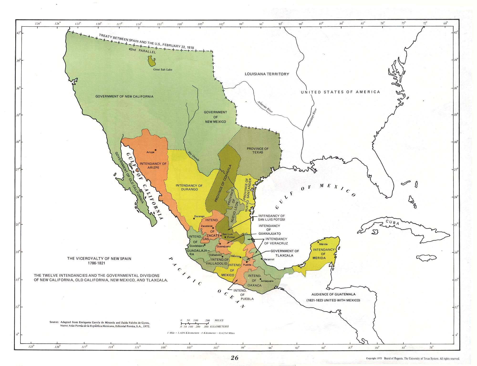
The information about the administrative structure of New Spain is confusing. Considering this article and the spanish one i found capitania generals, (autonomous) kingdoms, provincias, intendancias, audiencias, gobernaciones as terms for units. I didn't find out if they existed side by side (equal but with different names) or if one unit consisted of another class/category of units. Also the map doesn't help, on the contrary. Maybe someone can produce relief.-- Severino ( talk) 10:58, 22 January 2011 (UTC)
Hi! I was looking at the infobox under "today part of" and Kansas is missing even though it's shaded in the map. Is this a mistake or is there a reason for this? -- Bentendo24 ( talk) 04:59, 24 February 2011 (UTC)
We don't need the title "Viceroyalty of New Spain". "New Spain" is simpler and a much more common term for it, and there's nothing else by the title that this would be confused with.-- Cúchullain t/ c 20:48, 29 March 2011 (UTC)
Nomination here. Good Ol’factory (talk) 10:32, 8 July 2011 (UTC)
The coat of arms of colony of Spain never used the Greater coat of arms of King/Emperor Charles V. instead the colonial government used the Lesser Coat of arms of the Monarch. -- Oren neu dag ( talk) 19:57, 27 May 2012 (UTC)

.svg)
- Well, Commons has yet another coat of arms that allegedly represents New Spain. But this is only the coat of arms that appeared in the naval flag and the coastal fortification flag. It didn't become a national flag until 1843.
- As far as I know, the viceroys used only the coat of arms of the current monarch, and they didn't have a representative coat of arms of their own. The easiest solution is to remove the coat entirely except in special cases like Viceroyalty of New Granada, where the king assigned a specific coat that was adopted by everyone. -- Enric Naval ( talk) 17:32, 3 January 2013 (UTC)

- Sofía García Murillo, Ernesto Soto Páez (2003),
En un día como hoy--: efemérides de la historia de México (illustrated ed.), Editorial Lectorum, p. 156,
ISBN
9789707320482,
1821. Con la firma de los Tratados de Córdoba deja de tener vigencia el estandarte virreinal o de la dominación española, el cual ondeó en la Nueva España desde el siglo XVII. El estandarte es un lienzo de seda cuadrado, de color pardo leonado, con la cruz de San Andrés al cenro, de color morado.
- Luis Tinajero Portes (1994),
Días Conmemorativos en la Historia de México,
Universidad Autónoma de San Luis Potosí, p. 39,
ISBN
9789686194654,
(...) atravesado diagonalmente por dos brazos que formaba la cruz de San Andrés, también de seda y de color morado. (...) Este estandarte virreinal duró como símbolo de la Nueva España hasta el ya citado 24 de agosto de 1821 (...) Translation: (...) Crossed diagonally by two arms forming the cross of St. Andrew, also of silk and purple. (...) This viceroyal banner lasted as a symbol of colonial New Spain to the aforementioned 24 August 1821 (...) "
-
Deja de ordenar el estandarte virreinal,
Noticias MVS,
Deja de ordenar el estandarte virreinal.
El 24 de agosto de 1821, con la firma de los Tratados de Córdoba, dejó de tener vigencia elestandarte virreinal o de la dominación española, el que ondeó en la Nueva España desde elsiglo XVII; lienzo de seda en forma de cuadrado, de color pardo leonado, con la cruz de SanAndrés al centro, de color morado. En el siglo XVII fue cuando empezó a usarse la bandera específicamente trazada para la Nueva España.
Se hizo un estandarte con un cuadro rectangular de seda de color pardo o café, y una cruz aspada o cruz de San Andrés que cruzaba el cuadro y cuyos brazos terminaban con los escudos de la Ciudad de México. (...)
La bandera que casi por dos siglos fue la insignia de la Nueva España, se conserva en el Museo Nacional de Historia.{{ citation}}: Unknown parameter|fecha=ignored (|date=suggested) ( help)
-
"unknown title", Geosur, Asociación Sudamericana de Estudios Geopolíticos e Internacionales: 39, 2000,
Los actuales Estados norteamericanos de Alabama y Florida llevan como banderas estaduales -como lo indicáramos anteriormente- las tradicionales banderas españolas de fondo blanco con la roja cruz de San Andrés superpuesta, ya que hasta 1819 formaron parte de España.
{{
citation}}
: Unknown parameter|issues=ignored ( help)
- Francisco López-Nieto y Mallo (2006),
Honores y protocolo: Parte general, Honores y protocolo, vol. 1 (3 ed.), EL CONSULTOR, p. 530,
ISBN
9788470523878,
Durante el reinado de la Casa de Austria, en virtud de la unión de Doña Juana la Loca con Don Felipe el Hermoso, la enseña consistía, por primera vez, en la emblemática Cruz de San Andrés o Aspas de Borgoña, colocada en un lienzo blanco o rojo pálido, con los atributos de la Dinastía, y en el centro de la misma las armas de España (25). Al advenimiento de los Borbones, las banderas pierden el carácter personal o familiar que tuvieron hasta la llegada al trono de Felipe V (1700), y la nueva bandera ostanta las flores de lis, aunque permanecen las Aspas de Borgoña. (...)
(25) Señala Rodríguez Lizcano que las banderas que prevalecen en España son las siguientes: siglos XV y XVI: blanca y Cruz Roja de San Andrés; siglo XVII, primera mitad: rojas; siglo XVII, segunda mitad, colores diversos y Cruz de Borgoña; siglo XVIII: blancas con la Cruz de Borgoña. José Luis Rodríguez Lizcano "La bandera roja y gualda: orígenes e historia", en Revista Internacional de Protocolo, núm. 9, p. 51.
- "Felipe V (1700-1746) (...) Este Rey va a ser el primero que dará a España un símbolo unificado y propio, al poner, sobre tela blanca, el aspa de borgoña y el escudo. No es aún una bandera nacional, pero si es el primer atisbo.[p. 33] (...) Sin embargo al establecerse la Bandera, roja y amarilla como nacional, en 1843, las armas que ella deben figurar son las simples de la monarquía sobre las aspas de San Andrés [p. 103]" El origen militar de los símbolos de España. Revista de Historia Militar.
- "Las PRIMERAS BANDERAS - Mientras el territorio uruguayo estuvo bajo el dominio español usó el mismo pabellón que la madre patria: era blanco, con la cruz de Borgoña, de acuerdo con el Reglamento de 28 de Febrero de 1707. dictado por Felipe V-" Anales- Uruguay. Consejo Nacional de Enseñanza Primaria y Normal, Volumen 4 Departmento Technico of Consejo Nacional de Enseñanza Primaria y Normal., 1907
- "Después de la Conquista, los españoles introdujeron sus propias banderas y sus estandartes, la principal era la de los monarcas de España; entre 1517 y 1700, la bandera tenía un águila bicéfala abierta de alas y con la Cruz de Borgoña sobre campo blanco.
En la etapa de los Borbones, de 1700 a 1821, una bandera con la Cruz de San Andrés, con los colores rojo gualda y blanco." Data la bandera mexicana de la consumación de nuestra independencia Consejo Nacional para la Cultura y las Artes (Mexico)
- "Royal standard taken by the French at the capture of Cartagena de Indias in 1697. This elaborately decorated standard was probably flown on feast days and other formal occasions, the ordinary standard usually being white with the red ragged cross of Burgundy." The Spanish Main 1492- 1800, Osprey
-- Enric Naval ( talk) 22:18, 21 November 2012 (UTC)

And the Castile pendon was outdated and was not a symbol in New Spain, so let's stop adding it everywhere:
- "The Flag of Castile and León. This flag was the Flag of Castile and León from 1230 to 1516. Even though the Kingdoms of Castile and León had been united from time to time under the same monarch since 1037 (King Ferdinand I) until 1157, it was in 1230 when both kingdoms became definitively united under King Ferdinand III (Saint Ferdinand), at which time the quartered arms were devised. This flag became to a certain extent obsolete when the accession of the Catholic Monarchs in 1475 produced the union of the Castilian and Aragonese crowns, and definitively so in 1516, when King Charles I (Holy Roman Emperor Charles V) became the first King of all Spanish territories (Castile and León, Aragón and Navarre)." The Historical Flag Project. US District Court for the District of Puerto Rico.
-- Enric Naval ( talk) 05:00, 22 November 2012 (UTC)
- It is not the same the flag of the armed forces to the flag of the country. The viceroyalty is an administrative territory of Spain. The viceroyalty is not a independent country, the flag of the country is Spain. Cross of burgundy is a flag of armed forces of Spain around the world from Europe, Asia and Americas. But Burgundy is not a flag of any territory. The last flag of Spain in Mexico was the flag red and yellow (1821).
- [3] "The companies portentous discovery and conquest of the New World, met under the banners of Castile incarnate".
Americas was a part of crown of Castile, not Aragon. See talk in crown of Castile.-- Santos30 ( talk) 08:00, 23 November 2012 (UTC)
- The problem is that countries didn't have national flags at that time. Each viceroyalty and each army regiment had its own flag, and the navy had a different flag, too. From es:Bandera_de_España#Historia: in 1785 Charles III two different "rojigualdas" as a military navy flag and as a merchant navy flag, in 1793 the "rojigualda with 3 strips" was designated as flag for ports and forts of the navy, in 1843 it was designated national flag and all army flags were unified. The previous naval flag had been the Cross of Burgundy with a coat of arms in the center (same flag as other monarchies also controlled by Bourbons, only the central coat was different, this made it difficult to tell enemies from friends from a distance). You can confirm, for example, in p. 36
- New Spain had its own flag since ~1700 and it was never abolished during its existence. In 1821, when New Spain revolted, no national flag had been designated yet.
- Regarding your source, the "portentous discovery and conquest of the New World" was finished well before 1700. The emblem of the Catholic Kings was outdated after 1516 with the death of Ferdinand. The Cross of Burgundy was introduced as emblem of the Spanish monarchy in 1506 with the marriage of Philip I of Castile, and it generalized from there. For Charles III, see the first paragraph of my comment. -- Enric Naval ( talk) 08:31, 23 November 2012 (UTC)
- "Con anterioridad a la aparición del Estado liberal ( antes de 1833?) no existieron en España banderas que propiamente la representasen como nación, a pesar de la fuerte identificación que con ella mantuvieron a lo largo de varios siglos la cruz de San Andrés y el pabellón de tres franjas horizontales, con los colores rojo, blanco y amarillo, que se mantuvo en uso desde principios del XVI. (...) Además, la Encyclopedia añade otro "Pavillon particulier d'Espagne" más, de tres listas horizontales, con los colores rojos, amarillo y azul, en este orden." [4] p. 164]. In pages 164-170 it discusses the several naval flags that represented Spain. Castilians are described as using striped flags in 1684 and 1754 (see the source). -- Enric Naval ( talk) 09:46, 23 November 2012 (UTC)

- Not insist in the same of the same. This is the same talk that it is in the talk of Spanish empire and Crown of Castile. Americas was a part of Crown of Castile, not a part of kingdom of Aragon or Catalonia or any other kingdom of Spanish empire. Only Crown of Castile.
- The viceroyalty is an administrative territory of Spain. The viceroyalty is not a independent country. The viceroyalties not have its own national flag. "Estandarte Virreinal" is not a flag of the vicerolaty of Peru, or Rio de la Plata or New Granada. They not have national flags neither. The country and flag is Spain.
- The first flags in Americas was of the banners of Castile. The last flags in Americas was red-yellow flag of Spain. In New Spain the last flags of Spain was in Veracruz and San Juan Ulúa, red and yellow (roja y gualda). see here.
-- Santos30 ( talk) 21:36, 23 November 2012 (UTC)
- No.
Back in Spanish wikipedia this same matter was discussed, including sources like " Señala Rodríguez Lizcano que las banderas que prevalecen en España son las siguientes: siglos XV y XVI: blanca y Cruz Roja de San Andrés; siglo XVII, primera mitad: rojas; siglo XVII, segunda mitad: colores diversos y Cruz de Borgoña; siglo XVIII: blancas con la Cruz de Borgoña.". Back in August you are already aware that the Cross of Burgundy was the most representative symbol for the Spanish Empire. --
Enric Naval (
talk) 13:21, 24 November 2012 (UTC)
- Back in August consensus for Cross or Burgundy is for use as global symbol for all dominions of Spanish empire: Castile, Aragon, Low Countries, Mexico, Peru, Philippines,etc. Overall as global symbol.
- No.
Back in Spanish wikipedia this same matter was discussed, including sources like " Señala Rodríguez Lizcano que las banderas que prevalecen en España son las siguientes: siglos XV y XVI: blanca y Cruz Roja de San Andrés; siglo XVII, primera mitad: rojas; siglo XVII, segunda mitad: colores diversos y Cruz de Borgoña; siglo XVIII: blancas con la Cruz de Borgoña.". Back in August you are already aware that the Cross of Burgundy was the most representative symbol for the Spanish Empire. --
Enric Naval (
talk) 13:21, 24 November 2012 (UTC)
- Americas is a part of Crown of Castile and Spain and use this symbols. Before the national flag of Spain (Roja y Gualda), the symbol of Spain is the royal coat of arms. [5] "el escudo de las armas reales, símbolo común de la nacionalidad española" Traslation: "the coat of royal arms the common symbol of Spanish nationality".
- Boletín de la Academia Puertorriqueña de la Historia Las armas de Castilla y León eran las únicas concedidas en los escudos americanos a los nuevos territorios. "The arms of Castile and Leon were the only Americans coats granted to new territories" traslation.
- "Estandarte Virreinal", the flag of the viceroy and city council (Ayuntamiento) of Mexico city.
- [6] "Mandamos a los virreyes (de Hispanoamérica, Flandes, Italia,etc) que en los guiones no pongan más que nuestras armas reales, ni usen de las suyas propias, ni de ninguna otras, en actos y concursos como virreyes, presidentes, gobernadores o capitanes generales.". "sent to the viceroys (in Spanish America, Flanders, Italy, etc) in the banners do not put more than our royal arms, not use of their own, or any other, in events and contest as viceroys, presidents, governors or captains general".Traslation.
- Jahrbuch für Geschichte Lateinamerikas.p205 "En el Nuevo Mundo el guión fue el símbolo real usado normalmente por los virreyes, como insignia de su poder militar y emblema de jurisdicción" "In the New World the banner was a royal symbol normally used by the viceroys, as their military insignia and emblem of jurisdiction" Traslation.
-- Santos30 ( talk) 09:35, 25 November 2012 (UTC)

The lion & castle emblem stopped being used after the death of Ferdinand in 1516, his son used the Royal Bend of Castile. This is described in your second source in page 46 [7]. Each king had a different coat of arms and estandarte. After 1516 the symbol of the Spanish monarchy became the Cross of Burgundy, your third source describes the situation before 1516. -- Enric Naval ( talk) 13:38, 26 November 2012 (UTC)Oh, never mind, you are talking about the Royal_Standard_of_Spain. See the image. -- Enric Naval ( talk) 13:48, 26 November 2012 (UTC)
- Eric you are totally erroneous. Take a look the Royal Standard of 1666.
- Furthermore you can see the Fleur-de-lis in the center of the next coat of arms: this is unequivocal symbol of House of Bourbon (after 1700). This book talk exclusively about the Americas and put the royal coat of arms specific for the territory: Take a look the coat of royal arms with Fleur-de-lis.
- If you put the link to Royal_Standard_of_Spain to show the cross of Burgundy in the banner of King of Spain TODAY, you must to Know that it is a modern symbol imposed by Francoist Spain that it is not before inside the Royal Standard. The coat of arms of king Juan Carlos I of Spain with the cross of Burgundy was decided by Francisco Franco on 1971. It have the cross of burgundy (symbol of Carlism) and the yoke and arrows (symbol of Falange) as symbols of "Movimiento Nacional":
- here
- here
- here
- here
- Sorry but I can see Eric that you do not know about antique Heraldry and castilian symbols, neither about the symbols of the actual royal Standard and Francoist Spain.
- -- Santos30 ( talk) 20:03, 26 November 2012 (UTC)
- Please, no more tendentious POV-pushing.
- Your first link says that it's strange that the estandarte uses these symbols from 150 years before ("(...) nos sigue sorprendiendo la reutilización de unos antiguos escudos de Castilla y León en un estandarte real de proclamaciones confeccionado ciento cincuenta años después. (...) quizá, pueda ligarse a la proclamación de la reina Juana acaecida en la Plaza Mayor de Medina del Campo tras la muerte de la reina Isabel en noviembre de 1504.").
- What happened decades or centuries later, during franquism or carlism, is irrelevant for this article. The cross of burgundy is part of the Spanish monarchy since 1506. I am not going to enter into side discussions that have nothing to do with the article topic. But the way, this was already told to you in the Spanish wikipedia!
- Try to read this source. -- Enric Naval ( talk) 21:41, 26 November 2012 (UTC)
_Variant_without_the_Arms_of_Granada.svg)
_Golden_Fleece_Variant.svg)
- Eric, you, you put the link to the banner of the king Today. You. I only explain what is what: it have the cross of burgundy (symbol of Carlism) as symbols of "Movimiento Nacional" of Francoist Spain. You put the link remember "Oh, never mind, you are talking about the Royal_Standard_of_Spain". You. Not me. Franco not uses flag of Burgundy as flag of Dukes of Burgundy or Burgundian Netherlands. No, no. Francisco Franco uses flag or Burgundy as symbol of Carlism.
- The fact is that the royal coat of arms is in heraldry after Catholic Kings as you can see the Royal Standard of 1666 in the (very important ceremony) of coronation of the king.
- [8] Another example, California. This is the royal standard of Carlos V which appeared at the head of every band of Spanish explorers, as Spain had no national flag at the time. The field is white and bears the arms of Castile and Leon, with the royal crown at the top of the shield and around it the collar of the Order of the Golden Fleece.
- Another example the same coat of arms is used in the history of Americas, you can see the Fleur-de-lis in the center of the next coat of arms: this is unequivocal symbol of House of Bourbon (after year 1700). This book talk exclusively about the Americas and put the royal coat of arms specific for the territory: Take a look the coat of royal arms with Fleur-de-lis.
- [9] Another example, the banner with royal coat of arms with Fleur-de-lis of Bourbon (after 1700). You can read the other side of the flag (with specific symbol of city council) is lost.
- I read your source but nothing about uses as flag of Burgundy in Americas. The link talk about Carlism, Tercios, Armed forces in Spanish empire, but nothing about colonial viceroyalties. No one word. Nothing.
- Eric why we not see any, nothing, no one word, to use cross of Burgundy for viceroyalties?. No word. Nothing. For the contrary, totally clear, what the colonial laws of Americas say clear, totally clear and definitive, what banner must to uses in Viceroyalties:
- [10] "Mandamos a los virreyes que en los guiones no pongan más que nuestras armas reales, ni usen de las suyas propias, ni de ninguna otras, en actos y concursos como virreyes, presidentes, gobernadores o capitanes generales.". "sent to the viceroys in the banners do not put more than our royal arms, not use of their own, or any other, in events and contest as viceroys, presidents, governors or captains general".Traslation.
-- Santos30 ( talk) 05:49, 27 November 2012 (UTC)
Proposal of consensus:
- |flag = Cross of Burgundy
- |flag_type = Estandarte Virreinal (Mexico City-1821)
- |image_flag = Flag of the Mexican Royalists.svg
- |symbol = Coat of arms of Spain
- |symbol_type = Coat of arms
- |image_coat = Lesser Royal Coat of Arms of Spain (1700-c.1843) Variant without the Arms of Granada.svg
-- Santos30 ( talk) 09:37, 27 November 2012 (UTC)
First, that's the flag of revolutionaries, not the flag of New Spain. File:BANDERA_VIRREINAL_NOVOHISPANA.svg is nearer to the estandarte vicerreal, with the correct coat fo arms. I see that you altered Flag of Mexico to remove any mention to the Cross of Burgundy....
Second, you put that coat of arms everywhere in replacement of the more common version with the Granada symbol. You asked for the creatio of that symbol by providing a few dubious sources, so I don't trust that coat. -- Enric Naval ( talk) 11:21, 27 November 2012 (UTC)
- Yes asked. It is illogical the symbol of another jurisdiction of the Crown of Castile over another jurisdiction. You must to read the crown and dynasty. You must to understand the coat of arms. You not see symbol of Kingdom of Granada if you take a look this book of Americas. It give a logical symbol to read and understand. This is the reason no other.
- About Estandarte virreinal. Sorry, Eric why you say "revolutionaries" to the most correct file is File:Flag of the Mexican Royalists.svg???. Please explain. Maybe your eyes (because the word is "royalists"). Or you don't know who are the "royalists"?. This File:Flag of the Mexican Royalists.svg is the most correct "Estandarte virreinal" in Wikipedia, the most common description, with yellow field with the correct coat of arms of colonial city of Mexico.
- About your flag. Eric sorry you show very little knowledge of Heraldry: take a look the 4 coat of arms and you can see why is wrong in File:BANDERA_VIRREINAL_NOVOHISPANA.svg. The eagle, the snake and nopal is a symbol of Insurgency!. Maybe is a joke [11] (or obsession to have the same flag of Spanish empire), but it is very big mistake. The eagle, the snake and nopal. It is ridiculous!.
-- Santos30 ( talk) 13:06, 27 November 2012 (UTC)
- You keep using that book cover as proof, but it's a book about "Castilians", so they might have used a coat that had only the arms of the original Castilla y Leon. The symbols of Granada were added after the conquest of Granada, and they should appear in all later coats of arms. "El Escudo de los Reyes Católicos (1474-1492) está constituido por las Armas de los Reinos de Castilla, León y los de la Corona de Aragón. A partir de la conquista de Granada, incorporan las armas de este Reino a su escudo." [12] You seem to be removing the symbols of Granada because of your personal opinion of how the coat of arms should have been made in the past.
- Good point there. Royalists can't be called "revolutionaries", that's the name for the other side.
- That's not the correct flag, this is the correct flag, according to the Instituto Nacional de Estudios Históricos de las Revoluciones de México, see "Pendón utilizado durante el Virreinato, el escudo de la Cruz de Borgoña o de San Andrés, rematada con cuatro escudos, dos leones y dos castillos. Imagen tomada del Catálogo de la Colección de Banderas, Museo Nacional de Historia, INAH, México, Secretaría de Gobernación, 1990, p. 29." [13]. And the Consejo Nacional para la Cultura y las Artes says that it had white background [14]. And the coats of arms are also oriented the wrong way, the crown should be at the end of the arms of the cross.
- -- Enric Naval ( talk) 13:25, 27 November 2012 (UTC)
- Forget the idea of add symbols the crown of Aragon or Catalonia for viceroyalties of Americas before Latin American Independence. Unacceptable.
- Flag File:BANDERA_VIRREINAL_NOVOHISPANA.svg is wrong. You must to read the description. The cloth are discolored with the pass of time. It is not white. And The eagle, the snake and nopal is a symbol of Insurgency. Unacceptable.
- You must to give a chance to consensus and look flags in commons.
-- Santos30 ( talk) 14:33, 27 November 2012 (UTC)
- Where does it say that it's discolored? The Consejo Nacional source says that it always had white background: "Después de la Conquista, los españoles introdujeron sus propias banderas y sus estandartes, la principal era la de los monarcas de España; entre 1517 y 1700, la bandera tenía un águila bicéfala abierta de alas y con la Cruz de Borgoña sobre campo blanco. En la etapa de los Borbones, de 1700 a 1821, una bandera con la Cruz de San Andrés, con los colores rojo gualda y blanco." [15]
- The flag of es:Primera Junta de Gobierno Autónoma de Quito had inverted colors: a white cross over a red background, to oppose the Spanish Empire flag. A fact that you removed from the Spanish wikipedia [16].
- Some of the sources at the start of the section, posted by me, talk about yellow background or a "pardo leaonado" background, but they don't include any photography of the actual flag, they only have drawings. Other say that it has white background. I can't find other photographies of that flag, I can only find a photography of a different flag with no date or information, only a big coat of arms in the center, with the red cross in white background [17]. Anyways, the sources from the Consejo Nacional and the Instituto Nacional should be much more reliable.
- I don't know why you mention Aragon or Catalonia. It's you who keeps pushing the arms of Castilla y Leon in places where they don't belong, like you did in the Spanish wikipedia [18]. -- Enric Naval ( talk) 14:53, 27 November 2012 (UTC)
- Warning: Your personal attacks not help to consensus. Right or wrong Spanish wikipedia not will change nothing here. Not insist in call your friends to make disruptive editions. [19].
- Your source not say nothing of "Estandarte Virreinal". It could be whatever flag.
- This book say clearly "Estandarte virreinal" is yellow ("amarillo"). Others sources say "pardo leonado", "café" or "amarillo ocre".
- .-- Santos30 ( talk) 16:27, 27 November 2012 (UTC)
.svg)

- Santos30: You are wrong again, your argument about "The eagle, the snake and nopal is a symbol of Insurgency" reflects only your POV, which is a primary source, that is only your personal opinion. The eagle, nopal and snake are not symbols of the insurgency, they are symbols of the Conquest of Tenochtitlan or just Tenochtitlan. Those symbols are in the coat of arms of Mexico City since early XVI Century, you can read the reasons here, pag. 39 to 75.
- And of course, you are wrong about the color. There were yellow flags, that's right, but mostly they were white with the Cross of Burgundy: [20], [21]. Jaontiveros ( talk) 15:41, 27 November 2012 (UTC)
- No Jaontiveros you are wrong. The eagle, the snake and nopal is a symbol of Insurgency. [22]. But this is other discussion. And we not talk of whatever shield of city of México (from XVI century to present) or whatever flag. We only talk about coat of arms of council of Mexico of flag "Estandarte Virreinal" (If it is the royal flag of New Spain).
- There are not Eagle, Snake and Nopal in "Estandarte Virreinal". Unquestionable
- -- Santos30 ( talk) 16:43, 27 November 2012 (UTC)
You said twice that they are symbols of the insurgency. There were not insurgents in XVI, XVII or XVIII Century. The eagle, nopal and snake are symbols of Tenocthtitlan, and they were used by the colonial authorities and colonial institutions since XVI Century [23]. Of course the insurgents, Morelos or even Iturbide, used those symbols, and now are used in the flag of Mexico. But if you think they are only symbols of the insurgency you are completly wrong. Now I understand why you think the Cross of Burgundy only represents the Carlism. Jaontiveros ( talk) 16:53, 27 November 2012 (UTC)
- Sorry but I make an effort in english. Do not insist in this other topic. I try to solve the Estandarte Virreinal.-- Santos30 ( talk) 17:21, 27 November 2012 (UTC)
- My "personal attacks" are accurate descriptions of your persistent POV pushing here and in Spanish wikipedia, backed with relevant diffs. I have quoted above the most reliable sources from all I could find it, and they say it had white background. The only photography of the flag I could find of the flag, found in a website of a reliable source, also shows a white background. --
Enric Naval (
talk) 17:46, 27 November 2012 (UTC)
- Eric you are far from "accurate". Your descriptions confused royalist with revolutionaries, confused eagles and snakes with royal symbols of Spain, as confused white with yellow (Amarillo). Your flag File:BANDERA_VIRREINAL_NOVOHISPANA.svg is wrong as I have shown quite clearly.-- Santos30 ( talk) 18:28, 27 November 2012 (UTC)
- My "personal attacks" are accurate descriptions of your persistent POV pushing here and in Spanish wikipedia, backed with relevant diffs. I have quoted above the most reliable sources from all I could find it, and they say it had white background. The only photography of the flag I could find of the flag, found in a website of a reliable source, also shows a white background. --
Enric Naval (
talk) 17:46, 27 November 2012 (UTC)
- I told you, eagles, snakes and cactus were used by the authorities and institutions of the Viceroyalty of New Spain, in this picture you can see the blazon of the Inquisition (of New Spain) which contains three coats of arms, right in the bottom is the coat of arms of Mexico City with nopals and an eagle eating a snake in the top of the castle. Over nearly three hundred years, sometimes the eagle and the snake were removed, but most of the time they were present in the coat of arms. That depended on who was the Viceroy.
...del principio del águila y la tuna que trae por armas hoy en sus banderas...
— Bernardo de Balbuena (1561-1627)
- Bernardo de Balbuena Pag.32, Raquel Chang Rodríguez Pag.167, Jorge González Angulo [24], or Enrique Florescano El águila y el nopal y la virgen de Guadalupe en la época colonial: "El emblema del águila era también un símbolo popular de los trabajadores del ayuntamiento de la Ciudad de México. A fines del siglo XVIII, los empleados de la ciudad que anunciaban en las calles los actos públicos, llevaban el escudo con las insignias del águila en el sombrero o en los estandartes". Jaontiveros ( talk) 04:42, 28 November 2012 (UTC)
- Please Jaontiveros how many coat of arms of Mexico exist it is not the discussion. It is the royal flag. There are not a certain and unequivocal description if "Estandarte virreinal" is a royal flag or not. We see the Burgundy cross with coat of arms of city of Mexico. However we not see the other side of the flag (the coat of arms of Spain is lost). But there are a mention of "San Hipólito" and I assuming it is well. There are not a correct picture in Wikipedia-commons neither. But as "Estandarte Virreinal" is mentioned in relation the Independendence of Mexico my 2ºProposal of consensus: to solve is the use of own criterion:
- |flag = Enric Naval
- |flag_type = Enric Naval
- |image_flag = Enric Naval
- |symbol = Santos30
- |symbol_type = Santos30
- |image_coat = Santos30
-- Santos30 ( talk) 05:12, 28 November 2012 (UTC)
- Please be more specific: what does "Enric Naval" or "Santos30" mean on each item?
Jaontiveros (
talk) 14:26, 28 November 2012 (UTC)
- To resolve (resolver) with criterion of this person and finish this discussion.--
Santos30 (
talk) 15:11, 28 November 2012 (UTC)
- What?, is that consensus for you? I can not believe it! When I asked to be more specific, I asked to display the image for each item proposed. Please show those proposed images. And, please answer me: What are you assuming about San Hipólito?
Jaontiveros (
talk) 17:26, 28 November 2012 (UTC)
- Yes is a proposal of consensus. Have you another proposal of consensus?.--
Santos30 (
talk) 18:18, 28 November 2012 (UTC)
-
Yes, what about following our policies, for example? Please show me the proposed images and answer my question about San Hipólito.
Jaontiveros (
talk) 19:43, 28 November 2012 (UTC)
- before what you want we must to talk. Have you another proposal of consensus? (besides third opinion).-- Santos30 ( talk) 05:25, 29 November 2012 (UTC)
-
Yes, what about following our policies, for example? Please show me the proposed images and answer my question about San Hipólito.
Jaontiveros (
talk) 19:43, 28 November 2012 (UTC)
- Yes is a proposal of consensus. Have you another proposal of consensus?.--
Santos30 (
talk) 18:18, 28 November 2012 (UTC)
- What?, is that consensus for you? I can not believe it! When I asked to be more specific, I asked to display the image for each item proposed. Please show those proposed images. And, please answer me: What are you assuming about San Hipólito?
Jaontiveros (
talk) 17:26, 28 November 2012 (UTC)
- To resolve (resolver) with criterion of this person and finish this discussion.--
Santos30 (
talk) 15:11, 28 November 2012 (UTC)
- Please be more specific: what does "Enric Naval" or "Santos30" mean on each item?
Jaontiveros (
talk) 14:26, 28 November 2012 (UTC)
Ok, let´s see if I've got this straight, when you say: "There are not certain and unequivocal description if 'Estandarte virreinal' is a royal flag or not", that means nobody found a source to confirm that 'viceroyal banner' was used like a 'viceroyal flag' in New Spain? or, are you looking for a source to confirm that flag with Cross of Burgundy was used in New Spain? Jaontiveros ( talk) 06:07, 29 November 2012 (UTC)
- Do not focus in the translation of words. Have you another proposal of consensus at this moment? Yes or not.-- Santos30 ( talk) 06:39, 29 November 2012 (UTC)
- I asked four questions:
- Which one is the image proposed for each item?
- What are you assuming about San Hipólito?
- Did somebody find a source to confirm that viceroyal banner was used like a viceryoal flag?
- Are you looking for a source to confirm that flag with Cross of Burgundy was used in New Spain?
- Please answer me. Jaontiveros ( talk) 13:35, 29 November 2012 (UTC)
- Under the personal attacks over me, it seems better not extend discussion. I gave you two proposals. Give me a proposal of consensus. -- Santos30 ( talk) 16:57, 29 November 2012 (UTC)
- Well, I don´t see any personal attack here. Are you accusing anyone here about that?. My proposal is simple: put again the white flag with the Cross of Burgundy, we don't need anything more. I think it is not necessary to add any coat for New Spain. But, in order to get a consensus, and for the third time, I am asking you to answer my questions. Jaontiveros ( talk) 21:35, 29 November 2012 (UTC)
- Las Guerras de Independencia en la América Española.Marta Mier y Terán.2002 La Nueva España era un reino perteneciente a la Corona de Castilla por un acuerdo o pacto entre los conquistadores y Carlos V. De ninguna manera y hay que subrayarlo, la Nueva España podría considerarse de Aragón. No way, and it must be stressed, New Spain could be considered of Aragon.
-- Santos30 ( talk) 23:16, 29 November 2012 (UTC)
I say one more time: my proposal is to put again the white flag with the Cross of Burgundy which is a very well known flag to identify the Spanish Empire (and New Spain) and removed any coat of arms. The red and yellow flag that you, or someone else, added into the infobox (
[25]) was a naval pavilion (my mistake: I wanted to say
pabellón naval = flag etiquette used at the stern of the ships) created over the last years of the viceroyalty, it was not used by the infantry in New Spain as the Cross of Burgundy was, and it was not placed in the viceroyal palace like the Cross of Burgundy was. In the other hand, several cities of New Spain had their own coat of arms (you can see
here at least 13 differents coats of arms of those cities) and there were many kings and
many coats in the Spanish Empire over three hundred years, in order to be neutral is better to remove anyone. I did not ask you anything about Aragon, is not necessary that you yell me anything about that with big and black letters (?). I asked you four questions that you have refused to answer.
Jaontiveros (
talk) 01:49, 30 November 2012 (UTC)
- You can not demand answers, this is a talk, not interrogation. And I not yell to you. I emphasized references over discussion with big and black. Finally, one more time, you do not incorporate nothing of my proposal. None. I disagree.
- The File:Flag_of_Cross_of_Burgundy.svg is flag a of Dukes of Burgundy or Burgundian Netherlands. It is a flag for overall Spanish empire. It is a Franco and fascist flag too. Without specific symbols could be whatever flag. However I can accept a more specific proposal.
- El Supremo Poder Conservador: El Diseño Institucional en Las Primeras constituciones mexicanas.David Pantoja Morán. 2005 "La situación era paradójica,pues,al desvanecerse los títulos de la corona de Castilla sobre los territorios americanos, éstos dejaban de ser reinos independientes de la península. Más la renuncia a esa secular independencia -ficticia,pero legal- y la unión con España, confundiendose en una sola nación suponía necesariamente un pacto de conformidad entre esas partes autónomas de la monarquía, un pacto que sólo podía concluirse en el ejercicio de las varias soberanías involucradas."
- New Spain is a kingdom of throne of Castile (unquestionable). Royal coat of arms with castilian field is specific for Americas of the Crown of Castile. Not Aragon. Not Netherlands. Not all crowns of Spain. In order to neutral, you can not remove the coat of arms with throne of castilian field for New Spain is totally unacceptable.
This is a very long discussion but you do not incorporate nothing of my proposal. None a word of what I have shown with references. Nothing. -- Santos30 ( talk) 08:24, 30 November 2012 (UTC)
- Of course this is not an interrogation, I did not demand you anything, I have asked you nicely four questions in order to get a consensus. It is up to you if you want to
ignore those reasonable questions.
- I really don't know why you say that I did not incorporate anything: On November 27,
I have already linked three sources to show the white flag with the Cross of Burgundy (and you did not say any word about those sources):
- 1)
México a través de los siglos this book show an image where you can see in the bottom a white flag with a red Cross of Burgundy. If you use the tools to zoom it, you can read in the text of the image: "14. Bandera tomada á los españoles" (= "14. This flag was taken to the Spanish").
- 2)
Enciclopedia de México: "...y la Cruz de Borgoña en campo blanco" (= "and the Cross of Burgundy in white background [or field]").
- 3)
Bandera de México: "Estandarte Virreinal. Fue pintado sobre un paño de algodón blanco" ("Viceroyal Banner: It was painted on a white cotton cloth").
- 1)
México a través de los siglos this book show an image where you can see in the bottom a white flag with a red Cross of Burgundy. If you use the tools to zoom it, you can read in the text of the image: "14. Bandera tomada á los españoles" (= "14. This flag was taken to the Spanish").
- A) Flag: If I remember well, Durero, Escarlati, Trasamundo, MarshalN20, Enric Naval and I have already told you several times that the current concept of flag was developed later on, as a matter of fact the first official national flag was ordered by Queen Isabella II of Spain in October 13, 1843.
[26]
[27]
[28]. There was not official flag of New Spain, we are just trying to reach a consensus about the most representative flag to New Spain. Trasamundo has already told you that Cross of Burgundy is very representative and it was used continuously throughout the Spanish Empire (New Spain included, of course). You can see some images about white flags with the Cross of Burgundy in these books:
- a.1)
Historia de los actos solemnes vinculados a la bandera de España, p.24-25 "Cruz de Borgoña o Aspa de San Andrés: ...Este signo distintivo pasaría de inmediato, y por varios siglos, a nuestras banderas..." (Cross of Burgundy or St Andrew's Cross:...this symbol was used immediately, and for several centuries, in our flags..."). Please take a look to page 25: "Banderas y estandartes segunda mitad del siglo XVI" ("Flags and banners, second half of the Sixteenth Century")
- a.2)
Guia Histórica del Museo Militar Regional de Canarias p.35: White flag with a red Cross of Burgundy attributed to the infantry battalion (XVIII Century, taffeta, 203x196 cm), in that museum there is another flag with the red cross of Burgundy, is the genuine infantry flag began to be used in the battle of Pavia in 1525 (p.37).
- a.3)
Instituto de Historia y Cultura Militar: "Aspa de Borgoña. Es una de las piezas mas importantes en la historia de la bandera en España [...] se convirtió más tarde en el símbolo hispano por antonomasia..." ("Cross of Burgundy: It is one of the most important pieces in the history of the flag in Spain [...] later became the symbol par excellence Hispanic...").
- a.1)
Historia de los actos solemnes vinculados a la bandera de España, p.24-25 "Cruz de Borgoña o Aspa de San Andrés: ...Este signo distintivo pasaría de inmediato, y por varios siglos, a nuestras banderas..." (Cross of Burgundy or St Andrew's Cross:...this symbol was used immediately, and for several centuries, in our flags..."). Please take a look to page 25: "Banderas y estandartes segunda mitad del siglo XVI" ("Flags and banners, second half of the Sixteenth Century")
- I have already linked three sources about white flags with Cross of Burgundy in New Spain, but there are several more:
- a.4) The flag of
this image shows inside another flags, one of them is a white flag with a red Cross of Burgundy and another one is a red flag with a white Cross of Burgundy.
- a.5) The flag of
this image shows inside a white flag with a red Cross of Burgundy. In the same link, an article of Marta Terán, says both sides (royalists and insurgents) of the Independence War used flag with Cross of Burgundy ("Aspas de Borgoña y guiones españoles se enfrentaron por los dos costados en este primer movimiento").
- a.6)
This flag with a red Cross of Burgundy was captured in 1829, it belonged to Isidro Barradas and it was made in Cuba (Cuba was part of New Spain).
- a.7)
Banderas de la Independencia con imágenes marianas: las de San Miguel el Grande, Guanajuato, de 1810 (Marta Terán), in campaign, reglamentary Cross of Burgundy were used by both military formations [insurgents and royalists] at least up to 1814 ("En campaña, las aspas de Borgoña y los guiones reglamentarios de los regimientos ondearon en las dos formaciones militares opuestas por la guerra, hasta casi la restauración del rey en 1814").
- a.8)
Las primeras banderas del movimiento por la independencia. El patrimonio histórico de México en el Museo del Ejército Español: "Las aspas de Borgoña, en cambio, con mínima variación fueron las banderas de los dos ejércitos, al menos hasta finales de 1813 o a la restauración del rey en 1814". ("The Cross of Burgundy, however, with minimal variation were the flags of the two armies, at least until the end of 1813 or the restoration of the king in 1814").
- a.9) The white flag with Cross of Burgundy was used even in Micronesia (part of New Spain) in civilian ships.
History of Micronesia: Full census of the Marianas, 1746-1773: "...para la correspondencia con los Reynos de la Nueva España, no podrán usar los particulares, sino de la blanca, con Cruz de Borgoña...". ("...for correspondence with the Kingdoms of New Spain, civilians can not use, but the white with Cross of Burgundy...").
- a.10) The Cross of Burgundy was used in the Viceroyal Banner in the Viceroyal Palace.
La bandera y el escudo de México: "El estandarte virreinal...los extremos de la cruz rematan en escudos de la ciudad de México...". ("The Viceroyal Banner...there are coats of arms of Mexico City in the tips of the arms of the Cross...").
- a.4) The flag of
this image shows inside another flags, one of them is a white flag with a red Cross of Burgundy and another one is a red flag with a white Cross of Burgundy.
- In summary, flags with Cross of Burgundy (mostly white) were used in New Spain in cavalry (dragones), infantry, military ships, civilians ships (merchant ships) and in the Viceroyal Palace.
- B) Coats of arms. I have already said there were many coats of arms used in New Spain, all of them were assigned by royal orders. My favorite, the first one in New Spain, and most important, is the coat of arms of Mexico City. It was used in the first banners around
15381531, and with the motto: Non in multitudine exercitus consistit victoria, sed in voluntate Dei since 1538 [29] [30] and in the last banner of New Spain as Enric Naval showed before [31]. Jaontiveros ( talk) 23:01, 30 November 2012 (UTC)
- Of course this is not an interrogation, I did not demand you anything, I have asked you nicely four questions in order to get a consensus. It is up to you if you want to
ignore those reasonable questions.
![[31]](http://www.inehrm.gob.mx/imagenes/bandera/03.jpg)
- That we have seen already:
- Cross of Burgundy could be a symbol of whatever (Insurgents of Mexico, Spanish Armed Forces, Carlism, Fascism, Spanish Empire, Burgundian Netherlands, Duke of Burgundy, civil particular people, etc, etc,etc). Anything.
- Coat of arms of city of Mexico is a particular own symbol of Mexico (not Spain), that is in the flag of the council of city of Mexico "Estandarte Virreinal".
- Enric (I beg pardon) shows short in Heraldry and Latin Americas issues. The last banner of New Spain was the flag "roja y gualda" (red and yellow), as you should know. The red and yellow flag of the Spanish monarchy [32] "en el otoño de 1822 desembarcó en Veracruz, cuando todavía ondeaba en San Juan de Ulúa la bandera roja y gualda de la monarquía española"". Far to 1825 we must to add.
- Biblioteca de legislacion ultramarina (year 1595, in force 1856) "Mandamos a los virreyes que en los guiones no pongan más que nuestras armas reales, ni usen de las suyas propias, ni de ninguna otras." "sent to the viceroys in the banners do not put more than our royal arms, not use of their own, or any other.
- Jahrbuch für Geschichte Lateinamerikas.p205 "En el Nuevo Mundo el guión fue el símbolo real usado normalmente por los virreyes, como insignia de su poder militar y emblema de jurisdicción" "In the New World the banner was a royal symbol normally used by the viceroys, as their military insignia and emblem of jurisdiction"
- Jaontiveros you insists in do not incorporate nothing of my proposal. No one word. Nothing. I disagree.-- Santos30 ( talk) 07:58, 1 December 2012 (UTC)
First that all, you must learn to distinguish a banner of a flag, they are not the same. You will understand the differences by reading the articles
flag and
banner. You are very confused when you say that the last banner of New Spain was red and yellow (roja y gualda). That's not true, the red and yellow flag was not the viceroyal banner, to be exact: that red and yellow flag was a pabellón naval, a flag etiquette used at the stern of the ships. This pabellón naval was used in some forts in coastal cities too. This flag was never representative of New Spain, even more, when it was used in Veracruz in 1822 or 1824, Mexico and Central America were already independent countries. By the way, this red and white flag etiquette became the first national flag of Spain, but that happened until 1843. Enric Naval has already told you before, anyway, there are many sources where you can read the history of the flag of Spain:
[33]
[34].
The viceroyal banner changed over three hundred years. At the very beginning the banner was red, green and even purple
[35]
[36]. In the days of Hernán Cortés a celebration wq=%22Estandarte%20virreinal%22%20amarilloas established, it was named
Paseo del Pendón, which took place every August 13 (San Hipólito's Day) in order to remember the fall of Tenochtilan. Initially the banner of Hernán Cortés was used on the celebration but in 1531
[37] it was replaced by the banner with the coat of arms of Mexico city in one side and the coats of arms of
Charles I of Spain in the other side. Over the years, the banner changed. The last Paseo del Pendón was held in 1820
[38]. Today this custom is celebrated in Chilpancingo
[39]. As I said before, the viceroyal banner had the coat of arms of Mexico City in 1538,of course sometimes had the royal coat too, sometimes the coat of arms of Mexico City had the snake and eagle, it changed over the years. The viceroyal banner accompanied the viceroy anywhere to announce his presence and it has usually placed in a balcony of the viceroyal palace. The last viceroyal banner was withdrawn from viceroyal palace in August 24, 1821, after the
Treaty of Córdoba was signed.
You are making a big mistake when you say that
this image was the flag of the council of city of Mexico (?), that image is precisely the viceroyal banner withdrawn from the viceroyal palace, it even has a square shape (!). Please read carefully the same source at the National Institute of Historical Studies of the Revolutions of Mexico where the image was taken, or read other sources where it is described:
-
INEHRM La bandera nacional, síntesis de nuestro mestizaje: "Pendón utilizado durante el Virreinato, el escudo de la Cruz de Borgoña o de San Andrés, rematada con cuatro escudos [escudo de armas de la Ciudad de México], dos leones y dos castillos" ("Banner used during the Viceroyalty, the Cross of Burgundy or St Andrew's Cross, topped with four coats [Mexico City's coats of arms], two lions and two castles")
-
Días conmemorativos en la historia de México: "Durante la colonia no hubo bandera nacional [...] A principios del siglo XVII se hizo un estandarte virreinal que se utilizó hasta el 24 de agosto de 1821; fue realizado en seda color amarillo [en realidad pardo leonado] con una cruz en forma de aspa colocada diagonalmente" ("During the colonial period there was no national flag [...] In the early seventeenth century there was a viceroyal banner used until August 24, 1821; it was made in yellow silk [actually pardo leonado, tawny brown almost beige] with a cross shaped blade diagonally placed [Cross of Burgundy]"
-
En un día como hoy. Efemérides de la historia de México: "Con la firma de los Tratados de Córdoba deja de tener vigencia el estandarte virreinal [...] El estandarte es un lienzo de seda cuadrado, de color pardo leonado, con la cruz de San Andrés al centro, de color morado". (With the signing of the Treaty of Cordoba ceases to have effect the viceroyal banner [...] The banner is a square silk canvas, tawny brown, with a St. Andrew's Cross in the center in purple")
-
La palabra escrita: "Estandarte virreinal: En la época virreinal, a principios del siglo XVII, se hizo un estandarte rectangular en seda de color amarillo ocre, con una cruz en forma de aspa (Cruz de San Andrés) que cruzaba la seda diagonalmente y cuyos brazos terminaban con emblemas de los escudos de la ciudad de México..." ("Viceroyal banner: In the colonial period, in the early seventeenth century, it became a rectangular silk yellow ocher banner, with a cross-shaped (St. Andrew's Cross) crossing diagonally silk and whose arms ended with emblems of the coats of arms of Mexico city...")
There are many sources that describe the viceroy banner of New Spain with the Cross of Burgundy and with the coats of arms of Mexico City. There are some sources (
like this one) that even say the viceroyal banner was the "national flag" of New Spain, but that is not true. There was no national flag of Spain and there was no national flag of New Spain, actually, the viceroyal banner was more similar to a
Presidential Standard or a
Royal Standard.
You are misunderstanding the royal decree of Philip II of Spain (1596) because you are not reading completly
your source, that decree is talking about the personal coats of arms of viceroys, presidents, governors, admirals or captains ("...corregir el abuso de ostentar blasones particulares para mantener la pureza legal de aquellas...") Of course, the personal coats of arms of admirals and captains could not use on the ships of the Spanish Navy. Of course, the personal coat of arms of the viceroy could not add at the viceroyal banner, and of course the personal coat of arms or the viceroy could not use in official events . The viceroyal banner could only share the royal arms with the coat of arms of Mexico City (given by royal decree too). Perhaps in some years the viceroyal banner did not have the coat of arms of Mexico City, but we do have evidence and sources to confirm that the viceroyal banner had the coat of arms of Mexico city in XVI, XVIII and XIX centuries. I repeat: since 1531 the viceroyal banner had the coat of arms of Mexico City (since 1538 with the motto Non in multitudine exercitus consistit victoria, sed in voluntate Dei) in one side and in the other side it had the royal arms of Charles I (of course, it never had a San Hipólito image) and in the House of Bourbon´s period, since 1700 up to 1821, the viceroyal banner had not one but four coats of arms of Mexico City in the tip of each arm of the Cross of Burgundy; we don't have information if the royal arms still remained in the other side of the banner during the Bourbon's period.
This is correct, actually the coat of arms of Mexico City was the emblem of the jurisdiction of New Spain, which is why it was used in the viceroyal banner. One more reason to select this coat of arms to identify, in a particular way, the viceroyalty of New Spain.
Jaontiveros (
talk) 05:33, 2 December 2012 (UTC)
- Secretos del protocolo.Barquero.2007. Distinguish between Flag,Banner,Guion,etc is not the focus. The focus is what represent. Cross of burgundy is ambiguous (could be a symbol of insurgency). Ulúa and Veracruz in 1825 have the symbols that represent a dominion of throne of Spain. Flag in oposite to Insurgency.
- If your reasoning is true, the "coat of arms of Mexico City was the emblem of the jurisdiction of New Spain" (you say), it must use after 1821, the independence of Mexico, and before, along New Spain, from Florida, Cuba to Philipines. But your reasoning is false. Totally erroneous. The coat of arms of city of Mexico is not the royal coat of arms of Spain. Your reasoning result is oposite what laws of colonies say for symbols, not use of their own, or any other (explicit):
- Biblioteca de legislacion ultramarina (year 1595, in force 1856) "Mandamos a los virreyes que en los guiones no pongan más que nuestras armas reales, ni usen de las suyas propias, ni de ninguna otras." "sent to the viceroys in the banners do not put more than our royal arms, not use of their own, or any other.
Symbols of Spain could be alone in the template. But symbols of Mexico must to be with the arms of Spain in the template, in the flag or coat of arms. Jaontiveros you insists (4º) in do not incorporate nothing of my proposal.-- Santos30 ( talk) 10:03, 2 December 2012 (UTC)
- First: You said eagles, snake and nopals are symbols of insurgency. That is not true, those are symbols of Tenochtitlan.
- Second: You said yellow and red flag was the last banner or New Spain. That is not true, that was a (pabellón naval) flag etiquette used in Spanish Navy.
- Third: You said
this is the flag of council of city of Mexico. That is not true, you did not read the source, this is precisely the Viceroyal Banner of New Spain.
- Fourth: You have quoted several times the royal decree of Philip II of Spain to show that banners can only have royal arms. You are misunderstanding this decree because your did not read your source. I have showed another sources and
this evidence to confirm that the banner of New Spain had the coats of arms of Mexico City. Did you notice that the coat of arms of Mexico City has a castle and two lions for represent Castile?
[40]
[41]
[42] ...I guess you did not.
- Fifth: I do not care if insurgents used the Cross of Burgundy, I do not care if Carlists used the Cross of Burgundy, I do not care if fascists used the Cross of Burgundy, I do not care if some day the dream team or the champion team of a football league use the Cross of Burgundy. We are talking about a territory of the Spanish Empire, and the white flag with a red Cross of Burgundy is the symbol par excelence to represent it. We have shown you dozens of sources to demostrate this point, but you do not listen.
- Sixth:
This flag with a Cross of Burgundy captured to Isidro Barradas in 1829 represented the oposite to mexicans or insurgents (or whatever you want to call them). I told you several times, the red and yellow one was a flag etiquette. You do not want to listen.
- Seventh: I told you before, there were many coats of arms in New Spain, every city has its own coat of arms, but there was only one viceroyal banner. The viceroyal banner of New Spain did not have the coat of arms of Guadalajara, the viceroyal banner of New Spain did not have the coat of arms of Valladolid, the viceroyal banner of New Spain did not have the coat of arms of Querétaro, the viceroyal banner of New Spain did not have the coat of arms of Mérida, the viceroyal banner of New Spain did not have the coat of arms of Orizaba, the viceroyal banner of New Spain did not have the coat of arms of Veracruz, there was only one viceroyal banner of New Spain, and it had the coat of arms of Mexico City.
- Eighth: I say my proposal one more time: put back again the white flag with the red Cross of Burgundy, which is the symbol par excellence to represent the Spanish Empire and its territories as a hundred of sources can confirm; and remove any coat of arms in order to be neutral. If you do not agree, then we can get a third opinion. Jaontiveros ( talk) 15:35, 2 December 2012 (UTC)
- Very well, let's follow our policies. Jaontiveros ( talk) 15:50, 2 December 2012 (UTC)
This is incredible. Santos30 was already told months ago in the Spanish wikipedia that the Corss of Burgundy was the only flag that could be called representative of the Spanish colonies. He has been shown additional sources here in the English wikipedia. But by edit warring he has managed to keep anachronical coats of arms and flags in the articles about Spanish colonies. Santos30 is the only user that doesn't agree that the most adequate option is to use the Cross of Burgundy as flag and remove the coats of arms. -- Enric Naval ( talk) 18:04, 31 December 2012 (UTC)
- I would have liked to be contacted about this discussion.
- I agree with Enric Naval et al.; the Cross of Burgundy was the most representative flag of the Spanish colonies. In New Spain as well as in Peru, where it was carried by the conquering Spaniards and stood in the coastal fort of Callao until the last days of the independence wars.
- Santos seems to think that any support for the CoB flag represents modern right-wing nationalists. I disagree with him.
- Regards.-- MarshalN20 | Talk 14:14, 15 January 2013 (UTC)

- No, false. The coat of arms of city of Mexico is for Mexico. Not for all New Spain. See coat of arms of Spain in Luisiana.
Today we can see the the flag of conqueror Pizarro. It is not flag of Burgundy. Today we can see the flag of Viceroyalty of Perú in the battle of Ayacucho. It is not flag of Burgundy. The fortress of Callao have same as flag of all spanish fortress and navy around the world. Red and Yellow. Who say that "Burgundy was the most representative flag of the Spanish colonies"? No body. No references.
- The flag of Pizarro, red with royal coat of arms of Castile, is the flag that Simón Bolívar send to Venezuela [43]. This is the flag with wich the conquistador Francisco Pizarro conquer the Inca empire. ( see flag of Pizarro with coat armas of Castile)
- see royal flag of Ayacucho (1824) with coat armas of Castile Bandera Real, que se halló en la batalla de Ayacucho (9-XII-1824). Royal Flag, which was found in the Battle of Ayacucho (9-XII-1824).
- [44] Our knowledge of the red and yellow flag, we also know that presided over all battles in which Spain lost its colonial empire, from Chacabuco, Maipú and Ayacucho, to Santiago de Cuba and Cavite.
-- 88.27.63.130 ( talk) 01:52, 17 March 2013 (UTC)
- New Spain lasted from 1519 to 1821, more than 300 years. The "rojigualda" (red and yellow) was created as naval ensign in 1785, land flag in 1820, and national flag in 1843.
- In modern times, New Spain is represented with the cross of burgundy, see Cross_of_Burgundy#Overseas_Empire_of_Spain. The cross of burgundy is representive of New Spain, the "rojigualda" is not. -- Enric Naval ( talk) 13:57, 17 March 2013 (UTC)
- This is not a justification of your reversion. Burgundy is not a flag of viceroyalty of Peru (No one reference. Nothing!). The coat of arms of Spain is that we can see in Luisiana. The coat of arms of Spain is the same for flags of Burgundy and flag red-yellow. The coat of arms of city of Mexico is for Mexico. Not the whole New Spain. -- 88.27.63.130 ( talk) 07:34, 19 March 2013 (UTC)
- In Flag_of_Peru#Flag_of_1820 there is a source, I just copied it from the Spanish wikipedia. It says that the cross of Burgundy was the old flag of the viceroyalty. Unfortunately, I don't have access to the original source: Jorge Fernández Stoll. "Los orígenes de la bandera", Lima, Sociedad Bolivariana de Lima, 1953. --~~
It says "The Viceroy commissioned Juan Rodríguez Cabrillo in the first Spanish exploration up the Pacific Ocean along the western coast of the Las Californias Province in 1542–1543."
But when was Las Californias Province established? Eldizzino ( talk) 22:42, 26 June 2015 (UTC)
- Removed references to names the didn't yet exist in 1542. WCCasey ( talk) 04:27, 14 September 2015 (UTC)
Removed three original ( WP:OR) maps containing numerous errors:
- File:Viceroyalty of the New Spain 1819 (without Philippines).png|thumb|300px|New Spain after the Adams-Onis Treaty of 1819 (not including the island territories of the Pacific Ocean).
- File:Viceroyalty of the New Spain 1800 (without Philippines).png|thumb|300px|New Spain 1800 (not including the island territories of the Pacific Ocean).
- File:Spanish Caribbean Islands in the American Viceroyalties 1600.png|thumb|300px|Spanish Caribbean Islands in the American Viceroyalties in 1600.
The information these maps intended to convey is important; better maps are available and would be welcome. WCCasey ( talk) 18:08, 27 November 2015 (UTC)
This is an error. New Spain was not a kingdom. There were no kings of New Spain. It was always a viceroyalty, a specific political entity subordinate to the King of Spain. Furthermore, it's ludicrous to say that it was not a colony. It was in fact colonized by the Spanish and never independent of Spain. The article requires editing to clarify all this. Tmangray ( talk) 03:44, 7 June 2017 (UTC)
Whenever I click anywhere on the page, I get linked to a Twitch stream. I made a Google search, and it seems that this kind of vandalism has been done before... - VulpesVulpes42 ( talk) 22:39, 12 August 2017 (UTC)
- Whatever that was it seems to be gone now... - VulpesVulpes42 ( talk) 21:31, 13 August 2017 (UTC)
Can someone please add the date range to the heading, "Economy during the Habsburg era"? It would make it easier to understand. Thanks, DavidMCEddy ( talk) 13:12, 10 November 2017 (UTC)
The following Wikimedia Commons file used on this page has been nominated for deletion:
Participate in the deletion discussion at the nomination page. — Community Tech bot ( talk) 18:17, 24 July 2019 (UTC)
Links in the middle of the page seem to be placed in backwards. Can someone fix it? Jordf32123 ( talk) 01:33, 4 September 2019 (UTC)
You mention 1419 and 1420 as years in the summary section for the establishment of the vice royalty of New Spain. New Spain is considered to be by and large in the Americas plus Oceania. How can that year be right if 1492 is commonly referred to as the year for Columbus discovery of the Americas? The vice royalty would had to be formed before the discovery ... I think (might be wrong as I am not to deep into that period) that we have to change it to 1519 and 1520 respectively. To the owner of the page: Please find the right date and fix NormanBuck ( talk) 01:28, 31 March 2020 (UTC)
- The following is a closed discussion of a requested move. Please do not modify it. Subsequent comments should be made in a new section on the talk page. Editors desiring to contest the closing decision should consider a move review after discussing it on the closer's talk page. No further edits should be made to this discussion.
The result of the move request was: Not moved. ( closed by non-admin page mover) -- Calidum 15:08, 19 February 2021 (UTC)
New Spain → Viceroyalty of New Spain – Per WP: CONSISTENT, this is the only one out of the 4 Viceroyalties, the others being aptly named Viceroyalty of the Rio de la Plata, Viceroyalty of New Granada, and Viceroyalty of Peru that does not have "Viceroyalty'" on it's title so I think it should be consistent with the other article titles. Please let me know what you think, thanks! PyroFloe ( talk) 19:23, 11 February 2021 (UTC)
- Oppose per
WP:COMMONNAME. Just looking over the sources, it appears that the current title is the most common name for this topic in English.
Rreagan007 (
talk) 19:42, 11 February 2021 (UTC)
- Both WP:CRITERIA and WP:COMMONNAME are part of the same policy of WP:AT, WP:COMMONNAME even says to follow the 5 criteria in WP:CRITERIA and (again) Consistency is one of them so why leave this article be the only one without "Viceroyalty of"? Citing the most reliable sources, Encyclopedias and scholarly material, they use "Viceroyalty of New Spain", like here in Encyclopedia Britannica [45] and UC Berkeley [46].
- Also per WP:PRECISE, it can be confused with the Kingdom of New Spain which is the predecessor of the Viceroyalty of New Spain so the title should be changed. PyroFloe ( talk) 20:20, 11 February 2021 (UTC)
- Oppose The current title appears to be the most commonly used name in reliable sources, and the clear primary topic among other pages with similar names like the Kingdom of New Spain. In general it doesn't make much sense to enforce consistency in the names of related subjects when that consistency isn't actually reflected by common usage in reliable sources.-- Yaksar (let's chat) 21:25, 11 February 2021 (UTC)
- Oppose. Agree with the "most common" argument. Instead, I modified the article lede summary so that it notes both the kingdom and the viceroyalty. Encompassing both organizational phases iis, I believe, is what is meant by references to "New Spain" in sources. WCCasey ( talk) 00:00, 12 February 2021 (UTC)
- Oppose. "New Spain" is the WP:COMMONNAME and also more broadly inclusive, as New Spain was not a viceroyalty until 1535 although this article covers history back to the conquest in 1521.-- Cúchullain t/ c 01:27, 12 February 2021 (UTC)
@ Rene Bascos Sarabia Jr.: you added this ref name last year, but forgot to fill in the definition. Could you add your source info there? Thanks! -- Fyrael ( talk) 15:39, 5 May 2021 (UTC)
- Oh Thank you for informing me, I read a book mentioning that but I forgot the specific page and author and it was 1 year ago so I have to rumage through my history to get the citations needed, I'm busy at work in the day though, I can't give assurances since I'm super busy too since family members died, mother-in-law and cousin, and I'm preparing their resting places, maybe in a week or two I'll get back to you, but anyway, thank you for informing me! Have a good day.-- Rene Bascos Sarabia Jr. ( talk) 02:40, 6 May 2021 (UTC)
The following Wikimedia Commons file used on this page or its Wikidata item has been nominated for speedy deletion:
You can see the reason for deletion at the file description page linked above. — Community Tech bot ( talk) 13:07, 9 March 2022 (UTC)
I am not going to ask that the flag be changed; it seems that has been argued about enough already. I am asking, however, that the flag be placed alongside the coat of arms in the same box, rather than the flag have its own box. No other country articles on Wikipedia use this format, and it looks disorganized.
TLDR: Place flag alongside Coat of Arms in the same box.
This message applies to any other article on Spanish colonies.
296cherry ( talk) 17:00, 10 May 2022 (UTC)
- Other articles use this format, See [47]. In the case of the viceroyalties, they have their own coat of arms, but no their own flag. The Spanish flag, the red and yellow flag and/or the burgundy cross are used. Vicentemovil ( talk) 21:10, 10 May 2022 (UTC)
- I have reverted because those Spanish flags are not proper flags of the viceroyalty. Vicentemovil ( talk) 16:17, 13 May 2022 (UTC)
I noticed some parts of the article use the term "Indians", and I know its referring to indigenous people, but I thought some readers could mistake this to mean people from India since the context doesn't always make it immediately clear. I was wondering if we should standardize to say indigenous people throughout the article, or do we prefer it the current way even though its inconsistent? There is probably a relevant guideline but I can't remember it. Pythagimedes ( talk) 18:36, 1 November 2023 (UTC)
Why is the map in the infobox described as anachronistic? Roger 8 Roger ( talk) 08:31, 20 April 2024 (UTC)
- C-Class vital articles
- Wikipedia level-5 vital articles
- Wikipedia vital articles in History
- C-Class level-5 vital articles
- Wikipedia level-5 vital articles in History
- C-Class vital articles in History
- C-Class Mexico articles
- Top-importance Mexico articles
- WikiProject Mexico articles
- C-Class Philippine-related articles
- Mid-importance Philippine-related articles
- WikiProject Philippines articles
- C-Class Spain articles
- High-importance Spain articles
- All WikiProject Spain pages
- C-Class Trinidad and Tobago articles
- Top-importance Trinidad and Tobago articles
- WikiProject Trinidad and Tobago articles
- C-Class former country articles
- WikiProject Former countries articles
- C-Class United States Territories articles
- Low-importance United States Territories articles
- WikiProject United States Territories articles
- C-Class heraldry and vexillology articles
- WikiProject Heraldry and vexillology articles
|
| This It is of interest to the following WikiProjects: | ||||||||||||||||||||||||||||||||||||||||||||||||||||||||||||||||
| |||||||||||||||||||||||||||||||||||||||||||||||||||||||||||||||||
The map for New Spain needs to include Cost Rico as well.
—Preceding unsigned comment added by 15.235.153.105 ( talk • contrition)
The Evangelization section gives the impression that the majority of the indigenous population became Catholics almost instantly due to forced conversions by European priests without any references for those assertions. In the early stages of colonization that would’ve been the case for a subset, not all, of the native population that inhabited the areas within or nearby the first established colonies. But in regards to the many other indigenous populations present found all over Mexico and Latin America, it’s more likely to have been a gradual process that took place over many decades and centuries. Catholicism like the Spanish language was spread primarily by Westernized biracials, a group that has outnumbered those of mostly European descent since early in the colonization period and who went on to gain the ascendancy due to being less susceptible to Old World diseases in comparison to the indigenous people that perished in great numbers as a result of lacking immunity to those diseases, rather than because of warfare.
I´m not completely sure, but I think that Venezuela was also part of New Spain before the stablishment of the Viceroyalty of New Granada.—Preceding unsigned comment added by 163.178.80.22 ( talk • contribs)
As of 2017-11-10 the article says, "Venezuela annexed to Viceroyalty of New Granada - 27 May 1717". Yet the map in this New Spain article claims that Venezuela was part of New Spain in 1795.
Shouldn't the map be redrawn without Venezula -- or the date changed to before 1717?
Thanks for this useful article and map. DavidMCEddy ( talk) 13:36, 10 November 2017 (UTC)
New Spain conquered Fort St. Joseph in present-day Michigan in a 1781 Expedition. It's present-day location, the City of Niles, calls itself the City of Four Flags in reference to all the countries that once ruled it: France, Britain, Spain, and America. — Preceding unsigned comment added by 107.200.168.114 ( talk) 16:25, 11 July 2015 (UTC)
It is a fact that the Spaniards reached the British Columbia and Alaska, building forts and fighting with the Nootkas. It should be mentioned!
Check this, for example:
"El Virreinato de Nueva España fue el nombre dado por la administración pública colonial española a la región del continente americano comprendida por el actual México, más los actuales estados de California, Nevada, Colorado, Utah, Nuevo México, Arizona, Texas, Oregon, Washington y partes de Idaho, Montana, Wyoming, Kansas, Oklahoma y Louisiana en los Estados Unidos de América. La parte suroeste de Columbia Británica en Canadá."
Or this, an official study from a history foundation of the autonomous government of Catalonia that explains the ventures of Catalan volunteers in Oregon and the British Columbia in the 18th century (it is in Catalan, but I guess it's easy to understand that "Els catalans a la Colúmbia Britànica al s.XVIII" means "The Catalans in the British Columbia in the 18th century").
there are no sources provided
"Quite often, rape was a factor in the reproduction of mixed-race children." No citation.
"Unfortunately this trait has never quite disappeared." Obvious bias.
"most Afromexicans prefer to be considered mestizo, since they feel more identified with this group." No citation.
Several other portions have no mention of sources, either.—Preceding unsigned comment added by Jonas Salk ( talk • contribs)
"While they often held the Christian god to be an important deity because it was the god of the victorious...'
This sounds like conjecture with no citation provided. The probability of having reliable evidence of such an assertion would be very low. — Preceding unsigned comment added by 203.59.117.190 ( talk) 13:43, 21 September 2020 (UTC)
As the map clearly shows, New Spain was more than the country of Mexico. Besides including the American Southwest, it also included Central American countries such as Guatemala, Honduras, El Salvador and Panama.
So... the problem is that, at the end of the article, the text starts to talk specifically about Mexico.
- Mestizos and criollos were nevertheless not allowed in the upper levels of the government or any other position of power, and eventually they joined forces for the independence of Mexico. With independence, the caste system and slavery were theoretically abolished.
- Mestizos, while they no longer have a separate legal status from other groups, comprise approximately 60–65% of the population. Whites, who no longer have a special legal status, are thought to be about 15–20% of the population and still have most of the desirable jobs. In modern Mexico, mestizo has became more a cultural term, since a Native American that abandons his traditional ways is considered a mestizo, also most Afromexicans prefer to be considered mestizo, since they feel more identified with this group.
There are a couple different ways to fix the problem...
- Change the text to be more general and thus applicable to all of New Spain (could be difficult to do)
- Create a section called "race relations in Mexico" (except this begs the question of why the sudden focus on Mexico)
- Change the text to make it clear that we are just using Mexico as an example
- Delete the above text from the article
-- Richard 07:11, 27 May 2006 (UTC)
There seems to be little research in the making of the article, and even in the commentaries. First of all, New Spain didn't contain all the territories named in the article: the viceroy had certain authority over Central America, the Caribbean islands and the Philippines, but they weren't attached to New Spain. Venezuela had a governor, and was more related to the Viceregal of Peru. A map showing New Spain's territory would have to shade only Mexico (without Chiapas), and U.S. Southwest. Then, there's no mistake if New Spain is confussed with Mexico, yet the article has a tremendous lack of information, and lies very much on the colonization subject.
In other topic, criollos were allowed in the upper levels of government, due to the fact that the Spanish Crown used to sell oficios along the entire 16th and 17th centuries, in a practice known as oficios vendibles y renunciables. Even if they couldn't occupy viceroy's office, they took numerous oidores positions. Mark A. Burkholder and Dewitt S. Chandler have a very reliable study on that subject.
-- A.R.I. 03:08, 22 January 2007
The Map should have in dark green (part of the empire) Costa Rica, it is shaded down to Nicaragua, but Costa Rica was part of the empire as well.
Is the map really anachronistic? It seems to depict New Spain as it existed after the recovery of Florida in 1783 and before the sale of Louisiana in 1800 (or perhaps the signature of Pinckney's treaty in 1795 and the abandonment of claims to modern Mississippi and Alabama.) Should we perhaps indicate it as a map of New Spain in 1783? john k 01:56, 3 August 2006 (UTC)
Well, except that it shows western Santo Domingo and Jamaica as part of the viceroyalty. It seems like it would be better to upload a new map that takes them out, and say it's a map of New Spain in 1783, at its greatest geographical extent, than to have a map that doesn't depict what New Spain looked like at any given time. john k 01:57, 3 August 2006 (UTC)
- Did just that, only I used the year 1789 to depict Fort San Miguel. As always, corrections are welcome. Albrecht ( talk) 22:42, 4 December 2007 (UTC)
•Also about the map: it says in the article that Venezuela was a part of New Spain, but Venezuela is not shaded on the map. Dr bab 06:54, 23 August 2006 (UTC)
- Puerto Rico is not shaded green in the map. El Johnson ( talk) 20:45, 18 April 2011 (UTC)
This article puts too much of an emfasis on Mexico. What about all the other Latin American countries, icluding the Philipines. None this is even mentioned in this article. This article needs to expand to mention other Latin American countries, including the Philipines.
- The Philippines is not a "latin American" country... C.Kent87 ( talk) 23:22, 27 September 2009 (UTC)
The flag reported as the flag of New Spain is not so. This flag is known as "Cruz de Borgoña" ( Cross of Burgundy), and, according to Santiago Dotor, from Flags of the World, was the Spanish military flag from the 16th century up to 1843, when the colours of the 1785 War Ensign were adopted for use on land too. So it may have been used in New Spain as well as in any other territory within the Spanish Empire as flag of the Army. Archael Tzaraath 14:53, 6 September 2006 (UTC)
The Bourbon reforms section of this article doesn't really discuss anything specifically related to the Bourbon reforms and rather concentrates on political and military conflicts during the period. Attention should be given to changes in the civil leadership (particularly the appointment of peninsular spaniards instead of criollos in high positions) and the changes in culture that accompanied these reforms. I do not have particular expertise in this matter, otherwise I would have added these changes myself. 128.120.58.142 22:43, 16 January 2007 (UTC)
This can be solved by renaming the section the "Bourbon Years." There is an article on the Bourbon reforms, which could be Wikilinked. TriniMuñoz ( talk) 08:57, 11 June 2008 (UTC)
Scratch my previous comment above. I saw the parallel this section has with the one for the VR of Peru, and thought it useful to keep. I incorporated a short didscussion of the Bourbon Reforms and a Wikilink to the main article on it. I gave the military section its own subheading and made a seguey into it by mentioning just how important miltirary conflicts were in pushing the crown to implement its reforms. TriniMuñoz ( talk) 18:01, 16 June 2008 (UTC)
Anselmocisneros 20:16, 31 January 2007 (UTC)
- How can such a long article be a "stub"????— Cesar Tort 02:06, 10 March 2007 (UTC)
This article through and through is told from the perspective of the colonizers and minimizes the brutality against indigenous folks. Lists of conquistadores, dates, conquests, trade routes. Almost nothing about how they conquered, or what life was like for the conquered-- that is, most people who lived there. These topics are minimized and relegated to the "Criticism of the Spanish Presense", while they should be the main thrust of the article. Nlevitt 18:59, 1 February 2007 (UTC)
- I see a problem here. If all sort of Spanish brutalities are to be mentioned, the brighter side of the conquest would have to be mentioned as well: especially the termination of the omnipresent
human sacrifices in pre-Columbian cultures, which included
infanticide rituals not only in Mesoamerica but in the Inca region as well. —
Cesar Tort 02:03, 10 March 2007 (UTC)
- the "brighter side of the conquest"? Surely you're joking. -- 141.157.106.115 15:14, 11 March 2007 (UTC)
- No kidding. It was brighter for the kids who, after the conquest, escaped sacrifice by their parents. Take a look at this Discovery Channel article. [1] — Cesar Tort 18:12, 11 March 2007 (UTC)
- I propose either (1) to remove the pov tag, or (2) to mention briefly both: the atrocities committed by the conquistadors (e.g., those cited by Bartolomé de las Casas) and the atrocities committed by the Indians (e.g., those cited in the article Child sacrifice in pre-Columbian cultures). — Cesar Tort 21:49, 11 March 2007 (UTC)
- If no objections, I'll remove the tag by the weekend. — Cesar Tort 00:16, 13 March 2007 (UTC)
- I'm gonna put the NPOV tag back up. Every culture has reprehensible customs, including the pre-Columbian cultures, and the Spanish. I have no problem with those being discussed, though it would be more appropriate to talk about them on their respective pages. But this article is about New Spain, which means it's about how Spain conquered, occupied, exploited and to a great extent destroyed the people of the Americas. Nlevitt 22:20, 14 October 2007 (UTC)
- The natives were destroying themselves long before the Spaniards came via endless wars and human sacrifices. So the brutality of the Spanish conquest was nothing new or extraordinary to them in general. This article is about colonial Mexico and other lands belonging to New Spain( society, culture, economy), not about the conquest. You may try to add your anti-Spanish hatred to the "Spanish conquest of Mexico" article but not here.
Isidoros47 ( talk) 20:32, 25 October 2009 (UTC)
Info from White American page
I'm cleaning up the white american page and removing material that isn't related to groups' perceived whiteness (which is what the article there is about). There was a history of Spanish exploration in the United States on that page. I'm pasting it here so it can be merged into this article if necessary. Calliopejen1 18:05, 13 April 2007 (UTC)
Historic presence
The Hispanic presence in the United States is the second longest, after the Native American. Most Americans associate the early Spanish in this hemisphere with Hernán Cortés in Mexico and Francisco Pizarro in Peru, but Spaniards pioneered the present-day United States, too. The first confirmed landing in the continental U.S. was by a Spaniard, Juan Ponce de León, who landed in 1513 at a lush shore he christened La Florida.
Within three decades of Ponce de León's landing, the Spanish became the first Europeans to reach the Appalachian Mountains, the Mississippi River, the Grand Canyon and the Great Plains. Spanish ships sailed along the east coast, penetrating to present-day Bangor, Maine, and up the Pacific Coast as far as Oregon. From 1528 to 1536, four castaways from a Spanish expedition, including a black Moor, journeyed all the way from Florida to the Gulf of California.
In 1540, De Soto undertook an extensive exploration of the present U.S., and in the same year, Francisco Vázquez de Coronado led 2,000 Spaniards and Mexican Indians across today's Arizona- Mexico border and traveled as far as central Kansas.
Other Spanish explorers of the U.S. make up a long list that includes among others, Lucas Vásquez de Ayllón, Pánfilo de Narváez, Sebastián Vizcaíno, Juan Rodríguez Cabrillo, Gaspar de Portolà, Pedro Menéndez de Avilés, Álvar Núñez Cabeza de Vaca, Tristán de Luna y Arellano and Juan de Oñate. In all, Spaniards probed half of today's lower 48 states before the first English tried to colonize, at Roanoke Island.
The Spanish settled, creating the first permanent European settlement in the continental United States at St. Augustine, Florida, in 1565. Santa Fe, New Mexico, also predates Jamestown, Virginia, and Plymouth Colony. Later came Spanish settlements in San Antonio, Tucson, San Diego, Los Angeles and San Francisco, to name just a few. The Spanish even established a Jesuit mission in Virginia's Chesapeake Bay 37 years before the founding of Jamestown in 1607.
Two iconic American stories have Spanish antecedents, too. Almost 80 years before John Smith's rescue by Pocahontas, a man by the name of Juan Ortiz told of his remarkably similar rescue from execution by an Indian girl. Spaniards also held a thanksgiving, 56 years before the Pilgrims, when they feasted near St. Augustine with Florida Indians, probably on stewed pork and garbanzo beans. As late as 1783, at the end of the American Revolutionary War, Spain held claim to roughly half of today's continental United States (in 1775, Spanish ships even reached Alaska).
From 1819 to 1848, the United States and its army increased the nation's area by roughly a third at Spanish and Mexican expense, including three of today's four most populous states: California, Texas and Florida. Hispanics became the first American citizens in the newly acquired Southwest territory and remained a majority in several states until the 20th century.
This article was automatically assessed because at least one WikiProject had rated the article as stub, and the rating on other projects was brought up to Stub class. BetacommandBot 05:34, 10 November 2007 (UTC)
This is the correct map that best describes the former territories of the Viceroyalty of New Spain. If any users dispute the issue, please discuss it here before making any changes. Thank you! -- Ramírez 06:20 am, December 6, 2007 (UTC)
The map is bad because it doesn't represent the territories of New Spain at any one time. The territories in North America are those it held between 1783 and 1803. But it also shows them holding Jamaica and Saint Domingue, which were lost in the seventeenth century. Maps should represent territory held at a given moment in history, or they are misleading. john k ( talk) 18:22, 6 December 2007 (UTC)
- Reply: Can you please provide "references", "facts" or "citations" to support your claims or statements? Ramírez 19:19 pm December 8, 2007 (UTC)
- What on earth are you talking about? Are you actually denying the truth of my factual claims? Jamaica was lost in 1655, Saint-Domingue (Haiti) by 1697, when the Spanish recognized the French conquest of the area. Louisiana was gained in 1763, but Florida was lost, and only regained in 1783. Louisiana was ceded to France by treaty in 1800, and actually turned over in 1803. Therefore, in North America, the map represents Spanish territories between 1783 and 1803. In the Caribbean, it shows Spanish territories before 1655. Any historical source you care to look at will support this rendition of the facts. Are you denying that Jamaica was lost in 1655, or denying that Louisiana was only gained in 1763, and that Florida was not held by Spain between 1763 and 1783? This is all matter of basic historical fact. What are you getting at here? john k ( talk) 19:10, 9 December 2007 (UTC)
- Hi, there! I'am not denying anything, and I just want to know if you have the references or citations to support your statements that's all. I'm not a historian, so I'm relying on your professional qualifications and knowledge to inform the public. We need references, so we can have a look at it and examine it. The establishment of the Viceroyalty of New Spain started from 1535 to 1821. It should outline "all" the territories gain and lost of the viceroyalties conquered lands. New Spain's former territories also included the nations of the Philippines Islands, Guam, Mariana Islands, Caroline Islands etc. Why aren't these nations included in the article's map?. - Ramírez December 9, 19:37 (UTC)
- Here we disagree - I don't think historical maps should be anachronistic, unless, at the very least, they're clearly labelled as such. I agree that the Philippines should probably be included, if possible. An ideal map would be like the one you have, but not showing Jamaica and Haiti as part of Spain. john k ( talk) 01:17, 10 December 2007 (UTC)
- Placing the Viceroyalty on an uncropped world map strikes me as a bit overzealous; in fact, it's almost redundant considering our little cottage industry turning out piles and piles of Spanish Imperial maps. Neither am I convinced of the need to show the Philippines and the Antilles, for the same reason that the creators of (say) Image:LocationVichyFrance.png didn't feel compelled to show Madagascar or Gabon. Surely maps will suffice at Spanish East Indies and Spanish West Indies. And Ramirez, please limit your demand for citations to questions that warrant it. While your contributions are obviously welcome, I find I'm forced to wonder: on what grounds did you decide what the illustration should or should not depict if, by your own admission, you are unfamiliar with the dates, events, and documents governing the boundaries of Spanish colonial America? Albrecht ( talk) 03:26, 10 December 2007 (UTC)
- Hi, there, User:Albrect, Yes, but we are not talking about Madagascar, Gabon or France. This debate issue is about the former territories of the Viceroylaty of New Spain and the need to outlined the lands were gained and loses of the Empire, since it's establishment in 1535, in order to provide the reader a clear information. So far, in my opinion, the article is incomplete and it remains abit vague. And also, it is my job as a wikipatroler to help out and improved or provide articles with factual informations. Here are some of the references I have found to support my issue on the Philippines Islands. The Philippine Islands were placed under the jurisdiction of New Spain which was first established in 1565 and it remained as a territory for 256 years up until 1821. Therefore the archipelago was a part of the territory of the Viceroyalty of New Spain
[2] --
Ramírez 03:29 am December 10, 2007 (UTC)
- Hi Ramirez. No one doubts that the Philippine islands were administratively part of the Viceroyalty, but I think the clarity gained by depicting the full extent of all territories polysynchronously (is that the word?) ought to be fairly weighed against the resulting confusion and inaccuracy. (Having said that, feel free to add them into the corner of
Image:Viceroyalty of New Spain 1789.png.) Contributors to
Spanish Empire and
British Empire have expressed aversion to these kinds of maps for a variety of reasons. The ideal solution would be
an animated .gif illustrating the territorial development of the Viceroyalty, but that lies beyond the reach of my talents. Salud,
Albrecht (
talk) 04:05, 14 December 2007 (UTC)
- Hi all. I agree that an animated map will suffice, but I respectfully disagree with the current map because its misleading. New Spain should never be confused with Spanish North America. The islands like the Philippines were part of New Spain even before Alta California was taken by the Spanish. The islands remained with New Spain even for a longer period. This begs the question: why is Alta California in the map and not the Philippine islands? Significant amount of goods from New Spain came from the Chinese junks that traded in Manila. The Chinese goods came to Spain via the Manila-Acapulco Galleon shipping lane which was internal to New Spain, followed by the Atlantic trade route, between Veracruz and the peninsula. If the Pacific trade route was vital to the economy of New Spain, why would the other half of the route be removed from the map? If I may compare, it would like removing Hawaii from the map of the US. :) --
Noypi380 (
talk) 21:16, 14 December 2007 (UTC)
- Adding the Philippines and Marianas to an inset in the corner of the map seems the way to go. Also, no questions have been begged. john k ( talk) 15:56, 15 December 2007 (UTC)
- Hi all. I agree that an animated map will suffice, but I respectfully disagree with the current map because its misleading. New Spain should never be confused with Spanish North America. The islands like the Philippines were part of New Spain even before Alta California was taken by the Spanish. The islands remained with New Spain even for a longer period. This begs the question: why is Alta California in the map and not the Philippine islands? Significant amount of goods from New Spain came from the Chinese junks that traded in Manila. The Chinese goods came to Spain via the Manila-Acapulco Galleon shipping lane which was internal to New Spain, followed by the Atlantic trade route, between Veracruz and the peninsula. If the Pacific trade route was vital to the economy of New Spain, why would the other half of the route be removed from the map? If I may compare, it would like removing Hawaii from the map of the US. :) --
Noypi380 (
talk) 21:16, 14 December 2007 (UTC)
- Hi Ramirez. No one doubts that the Philippine islands were administratively part of the Viceroyalty, but I think the clarity gained by depicting the full extent of all territories polysynchronously (is that the word?) ought to be fairly weighed against the resulting confusion and inaccuracy. (Having said that, feel free to add them into the corner of
Image:Viceroyalty of New Spain 1789.png.) Contributors to
Spanish Empire and
British Empire have expressed aversion to these kinds of maps for a variety of reasons. The ideal solution would be
an animated .gif illustrating the territorial development of the Viceroyalty, but that lies beyond the reach of my talents. Salud,
Albrecht (
talk) 04:05, 14 December 2007 (UTC)
This article needs a good map of New Spain. Something like this. Can anyone find one we can use? Kingturtle ( talk) 15:18, 12 September 2008 (UTC)
- As per the Phillippines issue in the previous section, the map should show Spanish claims north to Alaska 1770s-1819; the 42nd Parallel limitation only took place in the last few years of New Spain's existence (what was north of the line was considered part of California..... Fort San Miguel on Nootka Sound was very much part of New Spain, as the Spanish saw things....). Skookum1 ( talk) 16:18, 12 September 2008 (UTC)
Found this:
- The Nootka Convention (1791) resolved the dispute between Spain and Great Britain about the British settlements in Oregon to British Columbia.'
That's so wrong I don't have time to rejig it right now; basically at its maximum Spanish possessions, as claimed, in the Pacific Northwest extended to Cook Sound or the longitude of Mount Saint Elias, can't remember which. This overlap with Russian claims was resolved by the Russo-Spanish Treaty that established the 42nd parallel as the division of their interests (though Fort Ross was built south of it afterwards). the Nootka Crisis was extremely complex and had more to do with Spain vs. Britain on the world stage than directly affecting New Spain, although effectively by the conventions Spain agreed to the rights of other nations to partake in the trade and exploration of the entire coast, and also gave Spain a way to bow out of Nootka Sound, which was a distant and expensive post to maintain vs. Monterey, which is where the North Pacific HQ was withdrawn to (Nootka had been a field-post out of San Blas). Fort San Miguel was the only physical outpost, but " acts of taking possesion" were staged all the way up to Valdez, Alaska, at many points along the "Oregon to BC" coastline. There were no British settlements at the time in what is now Oregon; it may be argued that Nootka Sound was in the Oregon Country, but the latter name or concept hadn't even been come up with yet...nor British Columbia either of course). There's not much on the Spanish era in teh Pacific Northwest here; the relevant time-section is about Louisiana et al...I'll see what I can add about what Nootka means, but there's a whole section waiting to be written here on the various captains and explorations and the circumtances of how Spain withdrew from claims to Alaska all the way back to California....This was also New Spain ,at least in cotntemporary Spanish governmental eyes (which as the point of the Nootka Crisis, on their end...) Skookum1 ( talk) 19:02, 4 November 2008 (UTC)
There are some major problems with the map, File:New Spain.svg, and its caption: "A map of the Viceroyalty of New Spain at its zenith. (Light green denotes territory claimed but never effectively controlled.)"
I only just noticed because the older PNG version was replaced with an SVG version. That in itself is a good thing. But note that both maps were made based on File:Spanish Empire.png, and that page notes that there is a dispute over its accuracy, see talk page. I can't read most of the talk page, but I can see obvious problems with the map. First, light green shows supposedly shows "territory claimed but never effectively controlled", yet Spanish claims reached much farther into Alaska. Formal ceremonies of possession were performed as far as Unalaska Island in the Aleutian Islands. Beyond possession ceremonies, the Spanish claim was basically the whole of western North America. Spain never defined the northern limit of its claim, but at least made serious efforts to secure "Alaska", at a time when the full size of Alaska was not known. Second, if light green shows territory claimed but never controlled, then the dark green must be for territory "effectively controlled", right? Yet the dark green reached up the coast to the Olympic Peninsula. Spain never controlled the coast north of San Francisco (except a small area in Nootka Sound). The dark green extends broadly up the center of the continent. I suppose this is the Louisiana Territory as defined by the United States after the Louisiana Purchase (under France and Spain Louisiana was not well defined). Leaving aside the map showing Louisiana ending at the 49th parallel, Spain never came close to "effectively controlling" most of this region. That is unless "effective control" includes territories ceded by treaty to other nations, as with Louisiana. But if that is the case then Spanish effective control west of Louisiana should by bounded by the Adams–Onís Treaty lines. Whichever way, the map and caption should be edited so they are not essentially self-contradictory. It is bizarre to show Utah, for example, as "claimed but not effectively controlled" but North Dakota, Puget Sound, the Olympic Peninsula, and the coast of Oregon as "effectively controlled". Pfly ( talk) 09:50, 10 September 2010 (UTC)
- That bit of border along the 49th Parallel isn't that far off; west of where the Red River basin just below the 49th, the "border" of the Louisiana Purchase - the drainage divide between the Missouri basin on the south and the Saskatchewan and I think the Assiniboine basins on the north of it - only very marginally went north of the 49th, in a long slow curve; I'm not sure of the variance but yes, that line should be "bowed" northwards slightly, not a straight line. And I concur on the northward limit; in Spanish terms, the whole "Pacific Slope" and what's inland from the Alaskan coast otherwise (i.e. the Yukon-Tanana basin) was also claimed, though nobody had ever mapped it. Spanish claims, in other words, went to the Continental Divide from the Pacific side....i.e. if the Russian, British and American ones did, so did the Spanish, even though in all cases they had only dabbled their toes on the beaches and headlands....and this bit:
- It is bizarre to show Utah, for example, as "claimed but not effectively controlled" but North Dakota, Puget Sound, the Olympic Peninsula, and the coast of Oregon as "effectively controlled".
- ...reminds me of things constantly inserted in Russian America history pages claiming that there were Russian settlements/colonies in Oregon and British Columbia....poppycock. "Effectively controlled" turns up in other-empire history pages too; political conceits, liek the efforts of certain contributors to claim there were such things as the Haida Empire, the Tsimshian Empire, the Tlingit Empire...confabulation masquerading as if real history, and there's too much of this going on in Wikipedia....you can't make history by inventing it post-facto, that's just called fiction Skookum1 ( talk) 18:52, 10 September 2010 (UTC)
- Here's an interesting map of the Spanish Empire, showing New Spain extending north into Canada north of Lake Superior, off the map edge. The map is even sourced in the caption, and the book is a respected, strongly scholarly work. It's rare to see New Spain shown this way though. Empires of the Atlantic World, p. 354. I think Spain's northern claims were never well-defined. Even saying "to the Continental Divide from the Pacific side" may be a more precise definition than Spain ever made. Even in the time of Quadra Spain was ready to assert sovereign over the entire width of the northern continent, if the Northwest Passage was found to exist. Quadra and the others were instructed to sail through if possible, to Hudsons Bay or where ever the passage connected with the Atlantic. If such a passage existed Spain would certainly have attempted to control the whole thing. The primary mission of Galiano and Valdes was to find the passage or prove it was not there. Thus their careful exploration of inlets reaching east, like Toba, and their passing over things like Puget Sound's entrance, which was less promising as a possible Northwest Passage. Pfly ( talk) 19:18, 10 September 2010 (UTC)
The information about the administrative structure of New Spain is confusing. Considering this article and the spanish one i found capitania generals, (autonomous) kingdoms, provincias, intendancias, audiencias, gobernaciones as terms for units. I didn't find out if they existed side by side (equal but with different names) or if one unit consisted of another class/category of units. Also the map doesn't help, on the contrary. Maybe someone can produce relief.-- Severino ( talk) 10:58, 22 January 2011 (UTC)
Hi! I was looking at the infobox under "today part of" and Kansas is missing even though it's shaded in the map. Is this a mistake or is there a reason for this? -- Bentendo24 ( talk) 04:59, 24 February 2011 (UTC)
We don't need the title "Viceroyalty of New Spain". "New Spain" is simpler and a much more common term for it, and there's nothing else by the title that this would be confused with.-- Cúchullain t/ c 20:48, 29 March 2011 (UTC)
Nomination here. Good Ol’factory (talk) 10:32, 8 July 2011 (UTC)
The coat of arms of colony of Spain never used the Greater coat of arms of King/Emperor Charles V. instead the colonial government used the Lesser Coat of arms of the Monarch. -- Oren neu dag ( talk) 19:57, 27 May 2012 (UTC)
- Well, Commons has yet another coat of arms that allegedly represents New Spain. But this is only the coat of arms that appeared in the naval flag and the coastal fortification flag. It didn't become a national flag until 1843.
- As far as I know, the viceroys used only the coat of arms of the current monarch, and they didn't have a representative coat of arms of their own. The easiest solution is to remove the coat entirely except in special cases like Viceroyalty of New Granada, where the king assigned a specific coat that was adopted by everyone. -- Enric Naval ( talk) 17:32, 3 January 2013 (UTC)
- Sofía García Murillo, Ernesto Soto Páez (2003),
En un día como hoy--: efemérides de la historia de México (illustrated ed.), Editorial Lectorum, p. 156,
ISBN
9789707320482,
1821. Con la firma de los Tratados de Córdoba deja de tener vigencia el estandarte virreinal o de la dominación española, el cual ondeó en la Nueva España desde el siglo XVII. El estandarte es un lienzo de seda cuadrado, de color pardo leonado, con la cruz de San Andrés al cenro, de color morado.
- Luis Tinajero Portes (1994),
Días Conmemorativos en la Historia de México,
Universidad Autónoma de San Luis Potosí, p. 39,
ISBN
9789686194654,
(...) atravesado diagonalmente por dos brazos que formaba la cruz de San Andrés, también de seda y de color morado. (...) Este estandarte virreinal duró como símbolo de la Nueva España hasta el ya citado 24 de agosto de 1821 (...) Translation: (...) Crossed diagonally by two arms forming the cross of St. Andrew, also of silk and purple. (...) This viceroyal banner lasted as a symbol of colonial New Spain to the aforementioned 24 August 1821 (...) "
-
Deja de ordenar el estandarte virreinal,
Noticias MVS,
Deja de ordenar el estandarte virreinal.
El 24 de agosto de 1821, con la firma de los Tratados de Córdoba, dejó de tener vigencia elestandarte virreinal o de la dominación española, el que ondeó en la Nueva España desde elsiglo XVII; lienzo de seda en forma de cuadrado, de color pardo leonado, con la cruz de SanAndrés al centro, de color morado. En el siglo XVII fue cuando empezó a usarse la bandera específicamente trazada para la Nueva España.
Se hizo un estandarte con un cuadro rectangular de seda de color pardo o café, y una cruz aspada o cruz de San Andrés que cruzaba el cuadro y cuyos brazos terminaban con los escudos de la Ciudad de México. (...)
La bandera que casi por dos siglos fue la insignia de la Nueva España, se conserva en el Museo Nacional de Historia.{{ citation}}: Unknown parameter|fecha=ignored (|date=suggested) ( help)
-
"unknown title", Geosur, Asociación Sudamericana de Estudios Geopolíticos e Internacionales: 39, 2000,
Los actuales Estados norteamericanos de Alabama y Florida llevan como banderas estaduales -como lo indicáramos anteriormente- las tradicionales banderas españolas de fondo blanco con la roja cruz de San Andrés superpuesta, ya que hasta 1819 formaron parte de España.
{{
citation}}
: Unknown parameter|issues=ignored ( help)
- Francisco López-Nieto y Mallo (2006),
Honores y protocolo: Parte general, Honores y protocolo, vol. 1 (3 ed.), EL CONSULTOR, p. 530,
ISBN
9788470523878,
Durante el reinado de la Casa de Austria, en virtud de la unión de Doña Juana la Loca con Don Felipe el Hermoso, la enseña consistía, por primera vez, en la emblemática Cruz de San Andrés o Aspas de Borgoña, colocada en un lienzo blanco o rojo pálido, con los atributos de la Dinastía, y en el centro de la misma las armas de España (25). Al advenimiento de los Borbones, las banderas pierden el carácter personal o familiar que tuvieron hasta la llegada al trono de Felipe V (1700), y la nueva bandera ostanta las flores de lis, aunque permanecen las Aspas de Borgoña. (...)
(25) Señala Rodríguez Lizcano que las banderas que prevalecen en España son las siguientes: siglos XV y XVI: blanca y Cruz Roja de San Andrés; siglo XVII, primera mitad: rojas; siglo XVII, segunda mitad, colores diversos y Cruz de Borgoña; siglo XVIII: blancas con la Cruz de Borgoña. José Luis Rodríguez Lizcano "La bandera roja y gualda: orígenes e historia", en Revista Internacional de Protocolo, núm. 9, p. 51.
- "Felipe V (1700-1746) (...) Este Rey va a ser el primero que dará a España un símbolo unificado y propio, al poner, sobre tela blanca, el aspa de borgoña y el escudo. No es aún una bandera nacional, pero si es el primer atisbo.[p. 33] (...) Sin embargo al establecerse la Bandera, roja y amarilla como nacional, en 1843, las armas que ella deben figurar son las simples de la monarquía sobre las aspas de San Andrés [p. 103]" El origen militar de los símbolos de España. Revista de Historia Militar.
- "Las PRIMERAS BANDERAS - Mientras el territorio uruguayo estuvo bajo el dominio español usó el mismo pabellón que la madre patria: era blanco, con la cruz de Borgoña, de acuerdo con el Reglamento de 28 de Febrero de 1707. dictado por Felipe V-" Anales- Uruguay. Consejo Nacional de Enseñanza Primaria y Normal, Volumen 4 Departmento Technico of Consejo Nacional de Enseñanza Primaria y Normal., 1907
- "Después de la Conquista, los españoles introdujeron sus propias banderas y sus estandartes, la principal era la de los monarcas de España; entre 1517 y 1700, la bandera tenía un águila bicéfala abierta de alas y con la Cruz de Borgoña sobre campo blanco.
En la etapa de los Borbones, de 1700 a 1821, una bandera con la Cruz de San Andrés, con los colores rojo gualda y blanco." Data la bandera mexicana de la consumación de nuestra independencia Consejo Nacional para la Cultura y las Artes (Mexico)
- "Royal standard taken by the French at the capture of Cartagena de Indias in 1697. This elaborately decorated standard was probably flown on feast days and other formal occasions, the ordinary standard usually being white with the red ragged cross of Burgundy." The Spanish Main 1492- 1800, Osprey
-- Enric Naval ( talk) 22:18, 21 November 2012 (UTC)
And the Castile pendon was outdated and was not a symbol in New Spain, so let's stop adding it everywhere:
- "The Flag of Castile and León. This flag was the Flag of Castile and León from 1230 to 1516. Even though the Kingdoms of Castile and León had been united from time to time under the same monarch since 1037 (King Ferdinand I) until 1157, it was in 1230 when both kingdoms became definitively united under King Ferdinand III (Saint Ferdinand), at which time the quartered arms were devised. This flag became to a certain extent obsolete when the accession of the Catholic Monarchs in 1475 produced the union of the Castilian and Aragonese crowns, and definitively so in 1516, when King Charles I (Holy Roman Emperor Charles V) became the first King of all Spanish territories (Castile and León, Aragón and Navarre)." The Historical Flag Project. US District Court for the District of Puerto Rico.
-- Enric Naval ( talk) 05:00, 22 November 2012 (UTC)
- It is not the same the flag of the armed forces to the flag of the country. The viceroyalty is an administrative territory of Spain. The viceroyalty is not a independent country, the flag of the country is Spain. Cross of burgundy is a flag of armed forces of Spain around the world from Europe, Asia and Americas. But Burgundy is not a flag of any territory. The last flag of Spain in Mexico was the flag red and yellow (1821).
- [3] "The companies portentous discovery and conquest of the New World, met under the banners of Castile incarnate".
Americas was a part of crown of Castile, not Aragon. See talk in crown of Castile.-- Santos30 ( talk) 08:00, 23 November 2012 (UTC)
- The problem is that countries didn't have national flags at that time. Each viceroyalty and each army regiment had its own flag, and the navy had a different flag, too. From es:Bandera_de_España#Historia: in 1785 Charles III two different "rojigualdas" as a military navy flag and as a merchant navy flag, in 1793 the "rojigualda with 3 strips" was designated as flag for ports and forts of the navy, in 1843 it was designated national flag and all army flags were unified. The previous naval flag had been the Cross of Burgundy with a coat of arms in the center (same flag as other monarchies also controlled by Bourbons, only the central coat was different, this made it difficult to tell enemies from friends from a distance). You can confirm, for example, in p. 36
- New Spain had its own flag since ~1700 and it was never abolished during its existence. In 1821, when New Spain revolted, no national flag had been designated yet.
- Regarding your source, the "portentous discovery and conquest of the New World" was finished well before 1700. The emblem of the Catholic Kings was outdated after 1516 with the death of Ferdinand. The Cross of Burgundy was introduced as emblem of the Spanish monarchy in 1506 with the marriage of Philip I of Castile, and it generalized from there. For Charles III, see the first paragraph of my comment. -- Enric Naval ( talk) 08:31, 23 November 2012 (UTC)
- "Con anterioridad a la aparición del Estado liberal ( antes de 1833?) no existieron en España banderas que propiamente la representasen como nación, a pesar de la fuerte identificación que con ella mantuvieron a lo largo de varios siglos la cruz de San Andrés y el pabellón de tres franjas horizontales, con los colores rojo, blanco y amarillo, que se mantuvo en uso desde principios del XVI. (...) Además, la Encyclopedia añade otro "Pavillon particulier d'Espagne" más, de tres listas horizontales, con los colores rojos, amarillo y azul, en este orden." [4] p. 164]. In pages 164-170 it discusses the several naval flags that represented Spain. Castilians are described as using striped flags in 1684 and 1754 (see the source). -- Enric Naval ( talk) 09:46, 23 November 2012 (UTC)
- Not insist in the same of the same. This is the same talk that it is in the talk of Spanish empire and Crown of Castile. Americas was a part of Crown of Castile, not a part of kingdom of Aragon or Catalonia or any other kingdom of Spanish empire. Only Crown of Castile.
- The viceroyalty is an administrative territory of Spain. The viceroyalty is not a independent country. The viceroyalties not have its own national flag. "Estandarte Virreinal" is not a flag of the vicerolaty of Peru, or Rio de la Plata or New Granada. They not have national flags neither. The country and flag is Spain.
- The first flags in Americas was of the banners of Castile. The last flags in Americas was red-yellow flag of Spain. In New Spain the last flags of Spain was in Veracruz and San Juan Ulúa, red and yellow (roja y gualda). see here.
-- Santos30 ( talk) 21:36, 23 November 2012 (UTC)
- No.
Back in Spanish wikipedia this same matter was discussed, including sources like " Señala Rodríguez Lizcano que las banderas que prevalecen en España son las siguientes: siglos XV y XVI: blanca y Cruz Roja de San Andrés; siglo XVII, primera mitad: rojas; siglo XVII, segunda mitad: colores diversos y Cruz de Borgoña; siglo XVIII: blancas con la Cruz de Borgoña.". Back in August you are already aware that the Cross of Burgundy was the most representative symbol for the Spanish Empire. --
Enric Naval (
talk) 13:21, 24 November 2012 (UTC)
- Back in August consensus for Cross or Burgundy is for use as global symbol for all dominions of Spanish empire: Castile, Aragon, Low Countries, Mexico, Peru, Philippines,etc. Overall as global symbol.
- No.
Back in Spanish wikipedia this same matter was discussed, including sources like " Señala Rodríguez Lizcano que las banderas que prevalecen en España son las siguientes: siglos XV y XVI: blanca y Cruz Roja de San Andrés; siglo XVII, primera mitad: rojas; siglo XVII, segunda mitad: colores diversos y Cruz de Borgoña; siglo XVIII: blancas con la Cruz de Borgoña.". Back in August you are already aware that the Cross of Burgundy was the most representative symbol for the Spanish Empire. --
Enric Naval (
talk) 13:21, 24 November 2012 (UTC)
- Americas is a part of Crown of Castile and Spain and use this symbols. Before the national flag of Spain (Roja y Gualda), the symbol of Spain is the royal coat of arms. [5] "el escudo de las armas reales, símbolo común de la nacionalidad española" Traslation: "the coat of royal arms the common symbol of Spanish nationality".
- Boletín de la Academia Puertorriqueña de la Historia Las armas de Castilla y León eran las únicas concedidas en los escudos americanos a los nuevos territorios. "The arms of Castile and Leon were the only Americans coats granted to new territories" traslation.
- "Estandarte Virreinal", the flag of the viceroy and city council (Ayuntamiento) of Mexico city.
- [6] "Mandamos a los virreyes (de Hispanoamérica, Flandes, Italia,etc) que en los guiones no pongan más que nuestras armas reales, ni usen de las suyas propias, ni de ninguna otras, en actos y concursos como virreyes, presidentes, gobernadores o capitanes generales.". "sent to the viceroys (in Spanish America, Flanders, Italy, etc) in the banners do not put more than our royal arms, not use of their own, or any other, in events and contest as viceroys, presidents, governors or captains general".Traslation.
- Jahrbuch für Geschichte Lateinamerikas.p205 "En el Nuevo Mundo el guión fue el símbolo real usado normalmente por los virreyes, como insignia de su poder militar y emblema de jurisdicción" "In the New World the banner was a royal symbol normally used by the viceroys, as their military insignia and emblem of jurisdiction" Traslation.
-- Santos30 ( talk) 09:35, 25 November 2012 (UTC)
The lion & castle emblem stopped being used after the death of Ferdinand in 1516, his son used the Royal Bend of Castile. This is described in your second source in page 46 [7]. Each king had a different coat of arms and estandarte. After 1516 the symbol of the Spanish monarchy became the Cross of Burgundy, your third source describes the situation before 1516. -- Enric Naval ( talk) 13:38, 26 November 2012 (UTC)Oh, never mind, you are talking about the Royal_Standard_of_Spain. See the image. -- Enric Naval ( talk) 13:48, 26 November 2012 (UTC)
- Eric you are totally erroneous. Take a look the Royal Standard of 1666.
- Furthermore you can see the Fleur-de-lis in the center of the next coat of arms: this is unequivocal symbol of House of Bourbon (after 1700). This book talk exclusively about the Americas and put the royal coat of arms specific for the territory: Take a look the coat of royal arms with Fleur-de-lis.
- If you put the link to Royal_Standard_of_Spain to show the cross of Burgundy in the banner of King of Spain TODAY, you must to Know that it is a modern symbol imposed by Francoist Spain that it is not before inside the Royal Standard. The coat of arms of king Juan Carlos I of Spain with the cross of Burgundy was decided by Francisco Franco on 1971. It have the cross of burgundy (symbol of Carlism) and the yoke and arrows (symbol of Falange) as symbols of "Movimiento Nacional":
- here
- here
- here
- here
- Sorry but I can see Eric that you do not know about antique Heraldry and castilian symbols, neither about the symbols of the actual royal Standard and Francoist Spain.
- -- Santos30 ( talk) 20:03, 26 November 2012 (UTC)
- Please, no more tendentious POV-pushing.
- Your first link says that it's strange that the estandarte uses these symbols from 150 years before ("(...) nos sigue sorprendiendo la reutilización de unos antiguos escudos de Castilla y León en un estandarte real de proclamaciones confeccionado ciento cincuenta años después. (...) quizá, pueda ligarse a la proclamación de la reina Juana acaecida en la Plaza Mayor de Medina del Campo tras la muerte de la reina Isabel en noviembre de 1504.").
- What happened decades or centuries later, during franquism or carlism, is irrelevant for this article. The cross of burgundy is part of the Spanish monarchy since 1506. I am not going to enter into side discussions that have nothing to do with the article topic. But the way, this was already told to you in the Spanish wikipedia!
- Try to read this source. -- Enric Naval ( talk) 21:41, 26 November 2012 (UTC)
- Eric, you, you put the link to the banner of the king Today. You. I only explain what is what: it have the cross of burgundy (symbol of Carlism) as symbols of "Movimiento Nacional" of Francoist Spain. You put the link remember "Oh, never mind, you are talking about the Royal_Standard_of_Spain". You. Not me. Franco not uses flag of Burgundy as flag of Dukes of Burgundy or Burgundian Netherlands. No, no. Francisco Franco uses flag or Burgundy as symbol of Carlism.
- The fact is that the royal coat of arms is in heraldry after Catholic Kings as you can see the Royal Standard of 1666 in the (very important ceremony) of coronation of the king.
- [8] Another example, California. This is the royal standard of Carlos V which appeared at the head of every band of Spanish explorers, as Spain had no national flag at the time. The field is white and bears the arms of Castile and Leon, with the royal crown at the top of the shield and around it the collar of the Order of the Golden Fleece.
- Another example the same coat of arms is used in the history of Americas, you can see the Fleur-de-lis in the center of the next coat of arms: this is unequivocal symbol of House of Bourbon (after year 1700). This book talk exclusively about the Americas and put the royal coat of arms specific for the territory: Take a look the coat of royal arms with Fleur-de-lis.
- [9] Another example, the banner with royal coat of arms with Fleur-de-lis of Bourbon (after 1700). You can read the other side of the flag (with specific symbol of city council) is lost.
- I read your source but nothing about uses as flag of Burgundy in Americas. The link talk about Carlism, Tercios, Armed forces in Spanish empire, but nothing about colonial viceroyalties. No one word. Nothing.
- Eric why we not see any, nothing, no one word, to use cross of Burgundy for viceroyalties?. No word. Nothing. For the contrary, totally clear, what the colonial laws of Americas say clear, totally clear and definitive, what banner must to uses in Viceroyalties:
- [10] "Mandamos a los virreyes que en los guiones no pongan más que nuestras armas reales, ni usen de las suyas propias, ni de ninguna otras, en actos y concursos como virreyes, presidentes, gobernadores o capitanes generales.". "sent to the viceroys in the banners do not put more than our royal arms, not use of their own, or any other, in events and contest as viceroys, presidents, governors or captains general".Traslation.
-- Santos30 ( talk) 05:49, 27 November 2012 (UTC)
Proposal of consensus:
- |flag = Cross of Burgundy
- |flag_type = Estandarte Virreinal (Mexico City-1821)
- |image_flag = Flag of the Mexican Royalists.svg
- |symbol = Coat of arms of Spain
- |symbol_type = Coat of arms
- |image_coat = Lesser Royal Coat of Arms of Spain (1700-c.1843) Variant without the Arms of Granada.svg
-- Santos30 ( talk) 09:37, 27 November 2012 (UTC)
First, that's the flag of revolutionaries, not the flag of New Spain. File:BANDERA_VIRREINAL_NOVOHISPANA.svg is nearer to the estandarte vicerreal, with the correct coat fo arms. I see that you altered Flag of Mexico to remove any mention to the Cross of Burgundy....
Second, you put that coat of arms everywhere in replacement of the more common version with the Granada symbol. You asked for the creatio of that symbol by providing a few dubious sources, so I don't trust that coat. -- Enric Naval ( talk) 11:21, 27 November 2012 (UTC)
- Yes asked. It is illogical the symbol of another jurisdiction of the Crown of Castile over another jurisdiction. You must to read the crown and dynasty. You must to understand the coat of arms. You not see symbol of Kingdom of Granada if you take a look this book of Americas. It give a logical symbol to read and understand. This is the reason no other.
- About Estandarte virreinal. Sorry, Eric why you say "revolutionaries" to the most correct file is File:Flag of the Mexican Royalists.svg???. Please explain. Maybe your eyes (because the word is "royalists"). Or you don't know who are the "royalists"?. This File:Flag of the Mexican Royalists.svg is the most correct "Estandarte virreinal" in Wikipedia, the most common description, with yellow field with the correct coat of arms of colonial city of Mexico.
- About your flag. Eric sorry you show very little knowledge of Heraldry: take a look the 4 coat of arms and you can see why is wrong in File:BANDERA_VIRREINAL_NOVOHISPANA.svg. The eagle, the snake and nopal is a symbol of Insurgency!. Maybe is a joke [11] (or obsession to have the same flag of Spanish empire), but it is very big mistake. The eagle, the snake and nopal. It is ridiculous!.
-- Santos30 ( talk) 13:06, 27 November 2012 (UTC)
- You keep using that book cover as proof, but it's a book about "Castilians", so they might have used a coat that had only the arms of the original Castilla y Leon. The symbols of Granada were added after the conquest of Granada, and they should appear in all later coats of arms. "El Escudo de los Reyes Católicos (1474-1492) está constituido por las Armas de los Reinos de Castilla, León y los de la Corona de Aragón. A partir de la conquista de Granada, incorporan las armas de este Reino a su escudo." [12] You seem to be removing the symbols of Granada because of your personal opinion of how the coat of arms should have been made in the past.
- Good point there. Royalists can't be called "revolutionaries", that's the name for the other side.
- That's not the correct flag, this is the correct flag, according to the Instituto Nacional de Estudios Históricos de las Revoluciones de México, see "Pendón utilizado durante el Virreinato, el escudo de la Cruz de Borgoña o de San Andrés, rematada con cuatro escudos, dos leones y dos castillos. Imagen tomada del Catálogo de la Colección de Banderas, Museo Nacional de Historia, INAH, México, Secretaría de Gobernación, 1990, p. 29." [13]. And the Consejo Nacional para la Cultura y las Artes says that it had white background [14]. And the coats of arms are also oriented the wrong way, the crown should be at the end of the arms of the cross.
- -- Enric Naval ( talk) 13:25, 27 November 2012 (UTC)
- Forget the idea of add symbols the crown of Aragon or Catalonia for viceroyalties of Americas before Latin American Independence. Unacceptable.
- Flag File:BANDERA_VIRREINAL_NOVOHISPANA.svg is wrong. You must to read the description. The cloth are discolored with the pass of time. It is not white. And The eagle, the snake and nopal is a symbol of Insurgency. Unacceptable.
- You must to give a chance to consensus and look flags in commons.
-- Santos30 ( talk) 14:33, 27 November 2012 (UTC)
- Where does it say that it's discolored? The Consejo Nacional source says that it always had white background: "Después de la Conquista, los españoles introdujeron sus propias banderas y sus estandartes, la principal era la de los monarcas de España; entre 1517 y 1700, la bandera tenía un águila bicéfala abierta de alas y con la Cruz de Borgoña sobre campo blanco. En la etapa de los Borbones, de 1700 a 1821, una bandera con la Cruz de San Andrés, con los colores rojo gualda y blanco." [15]
- The flag of es:Primera Junta de Gobierno Autónoma de Quito had inverted colors: a white cross over a red background, to oppose the Spanish Empire flag. A fact that you removed from the Spanish wikipedia [16].
- Some of the sources at the start of the section, posted by me, talk about yellow background or a "pardo leaonado" background, but they don't include any photography of the actual flag, they only have drawings. Other say that it has white background. I can't find other photographies of that flag, I can only find a photography of a different flag with no date or information, only a big coat of arms in the center, with the red cross in white background [17]. Anyways, the sources from the Consejo Nacional and the Instituto Nacional should be much more reliable.
- I don't know why you mention Aragon or Catalonia. It's you who keeps pushing the arms of Castilla y Leon in places where they don't belong, like you did in the Spanish wikipedia [18]. -- Enric Naval ( talk) 14:53, 27 November 2012 (UTC)
- Warning: Your personal attacks not help to consensus. Right or wrong Spanish wikipedia not will change nothing here. Not insist in call your friends to make disruptive editions. [19].
- Your source not say nothing of "Estandarte Virreinal". It could be whatever flag.
- This book say clearly "Estandarte virreinal" is yellow ("amarillo"). Others sources say "pardo leonado", "café" or "amarillo ocre".
- .-- Santos30 ( talk) 16:27, 27 November 2012 (UTC)
- Santos30: You are wrong again, your argument about "The eagle, the snake and nopal is a symbol of Insurgency" reflects only your POV, which is a primary source, that is only your personal opinion. The eagle, nopal and snake are not symbols of the insurgency, they are symbols of the Conquest of Tenochtitlan or just Tenochtitlan. Those symbols are in the coat of arms of Mexico City since early XVI Century, you can read the reasons here, pag. 39 to 75.
- And of course, you are wrong about the color. There were yellow flags, that's right, but mostly they were white with the Cross of Burgundy: [20], [21]. Jaontiveros ( talk) 15:41, 27 November 2012 (UTC)
- No Jaontiveros you are wrong. The eagle, the snake and nopal is a symbol of Insurgency. [22]. But this is other discussion. And we not talk of whatever shield of city of México (from XVI century to present) or whatever flag. We only talk about coat of arms of council of Mexico of flag "Estandarte Virreinal" (If it is the royal flag of New Spain).
- There are not Eagle, Snake and Nopal in "Estandarte Virreinal". Unquestionable
- -- Santos30 ( talk) 16:43, 27 November 2012 (UTC)
You said twice that they are symbols of the insurgency. There were not insurgents in XVI, XVII or XVIII Century. The eagle, nopal and snake are symbols of Tenocthtitlan, and they were used by the colonial authorities and colonial institutions since XVI Century [23]. Of course the insurgents, Morelos or even Iturbide, used those symbols, and now are used in the flag of Mexico. But if you think they are only symbols of the insurgency you are completly wrong. Now I understand why you think the Cross of Burgundy only represents the Carlism. Jaontiveros ( talk) 16:53, 27 November 2012 (UTC)
- Sorry but I make an effort in english. Do not insist in this other topic. I try to solve the Estandarte Virreinal.-- Santos30 ( talk) 17:21, 27 November 2012 (UTC)
- My "personal attacks" are accurate descriptions of your persistent POV pushing here and in Spanish wikipedia, backed with relevant diffs. I have quoted above the most reliable sources from all I could find it, and they say it had white background. The only photography of the flag I could find of the flag, found in a website of a reliable source, also shows a white background. --
Enric Naval (
talk) 17:46, 27 November 2012 (UTC)
- Eric you are far from "accurate". Your descriptions confused royalist with revolutionaries, confused eagles and snakes with royal symbols of Spain, as confused white with yellow (Amarillo). Your flag File:BANDERA_VIRREINAL_NOVOHISPANA.svg is wrong as I have shown quite clearly.-- Santos30 ( talk) 18:28, 27 November 2012 (UTC)
- My "personal attacks" are accurate descriptions of your persistent POV pushing here and in Spanish wikipedia, backed with relevant diffs. I have quoted above the most reliable sources from all I could find it, and they say it had white background. The only photography of the flag I could find of the flag, found in a website of a reliable source, also shows a white background. --
Enric Naval (
talk) 17:46, 27 November 2012 (UTC)
- I told you, eagles, snakes and cactus were used by the authorities and institutions of the Viceroyalty of New Spain, in this picture you can see the blazon of the Inquisition (of New Spain) which contains three coats of arms, right in the bottom is the coat of arms of Mexico City with nopals and an eagle eating a snake in the top of the castle. Over nearly three hundred years, sometimes the eagle and the snake were removed, but most of the time they were present in the coat of arms. That depended on who was the Viceroy.
...del principio del águila y la tuna que trae por armas hoy en sus banderas...
— Bernardo de Balbuena (1561-1627)
- Bernardo de Balbuena Pag.32, Raquel Chang Rodríguez Pag.167, Jorge González Angulo [24], or Enrique Florescano El águila y el nopal y la virgen de Guadalupe en la época colonial: "El emblema del águila era también un símbolo popular de los trabajadores del ayuntamiento de la Ciudad de México. A fines del siglo XVIII, los empleados de la ciudad que anunciaban en las calles los actos públicos, llevaban el escudo con las insignias del águila en el sombrero o en los estandartes". Jaontiveros ( talk) 04:42, 28 November 2012 (UTC)
- Please Jaontiveros how many coat of arms of Mexico exist it is not the discussion. It is the royal flag. There are not a certain and unequivocal description if "Estandarte virreinal" is a royal flag or not. We see the Burgundy cross with coat of arms of city of Mexico. However we not see the other side of the flag (the coat of arms of Spain is lost). But there are a mention of "San Hipólito" and I assuming it is well. There are not a correct picture in Wikipedia-commons neither. But as "Estandarte Virreinal" is mentioned in relation the Independendence of Mexico my 2ºProposal of consensus: to solve is the use of own criterion:
- |flag = Enric Naval
- |flag_type = Enric Naval
- |image_flag = Enric Naval
- |symbol = Santos30
- |symbol_type = Santos30
- |image_coat = Santos30
-- Santos30 ( talk) 05:12, 28 November 2012 (UTC)
- Please be more specific: what does "Enric Naval" or "Santos30" mean on each item?
Jaontiveros (
talk) 14:26, 28 November 2012 (UTC)
- To resolve (resolver) with criterion of this person and finish this discussion.--
Santos30 (
talk) 15:11, 28 November 2012 (UTC)
- What?, is that consensus for you? I can not believe it! When I asked to be more specific, I asked to display the image for each item proposed. Please show those proposed images. And, please answer me: What are you assuming about San Hipólito?
Jaontiveros (
talk) 17:26, 28 November 2012 (UTC)
- Yes is a proposal of consensus. Have you another proposal of consensus?.--
Santos30 (
talk) 18:18, 28 November 2012 (UTC)
-
Yes, what about following our policies, for example? Please show me the proposed images and answer my question about San Hipólito.
Jaontiveros (
talk) 19:43, 28 November 2012 (UTC)
- before what you want we must to talk. Have you another proposal of consensus? (besides third opinion).-- Santos30 ( talk) 05:25, 29 November 2012 (UTC)
-
Yes, what about following our policies, for example? Please show me the proposed images and answer my question about San Hipólito.
Jaontiveros (
talk) 19:43, 28 November 2012 (UTC)
- Yes is a proposal of consensus. Have you another proposal of consensus?.--
Santos30 (
talk) 18:18, 28 November 2012 (UTC)
- What?, is that consensus for you? I can not believe it! When I asked to be more specific, I asked to display the image for each item proposed. Please show those proposed images. And, please answer me: What are you assuming about San Hipólito?
Jaontiveros (
talk) 17:26, 28 November 2012 (UTC)
- To resolve (resolver) with criterion of this person and finish this discussion.--
Santos30 (
talk) 15:11, 28 November 2012 (UTC)
- Please be more specific: what does "Enric Naval" or "Santos30" mean on each item?
Jaontiveros (
talk) 14:26, 28 November 2012 (UTC)
Ok, let´s see if I've got this straight, when you say: "There are not certain and unequivocal description if 'Estandarte virreinal' is a royal flag or not", that means nobody found a source to confirm that 'viceroyal banner' was used like a 'viceroyal flag' in New Spain? or, are you looking for a source to confirm that flag with Cross of Burgundy was used in New Spain? Jaontiveros ( talk) 06:07, 29 November 2012 (UTC)
- Do not focus in the translation of words. Have you another proposal of consensus at this moment? Yes or not.-- Santos30 ( talk) 06:39, 29 November 2012 (UTC)
- I asked four questions:
- Which one is the image proposed for each item?
- What are you assuming about San Hipólito?
- Did somebody find a source to confirm that viceroyal banner was used like a viceryoal flag?
- Are you looking for a source to confirm that flag with Cross of Burgundy was used in New Spain?
- Please answer me. Jaontiveros ( talk) 13:35, 29 November 2012 (UTC)
- Under the personal attacks over me, it seems better not extend discussion. I gave you two proposals. Give me a proposal of consensus. -- Santos30 ( talk) 16:57, 29 November 2012 (UTC)
- Well, I don´t see any personal attack here. Are you accusing anyone here about that?. My proposal is simple: put again the white flag with the Cross of Burgundy, we don't need anything more. I think it is not necessary to add any coat for New Spain. But, in order to get a consensus, and for the third time, I am asking you to answer my questions. Jaontiveros ( talk) 21:35, 29 November 2012 (UTC)
- Las Guerras de Independencia en la América Española.Marta Mier y Terán.2002 La Nueva España era un reino perteneciente a la Corona de Castilla por un acuerdo o pacto entre los conquistadores y Carlos V. De ninguna manera y hay que subrayarlo, la Nueva España podría considerarse de Aragón. No way, and it must be stressed, New Spain could be considered of Aragon.
-- Santos30 ( talk) 23:16, 29 November 2012 (UTC)
I say one more time: my proposal is to put again the white flag with the Cross of Burgundy which is a very well known flag to identify the Spanish Empire (and New Spain) and removed any coat of arms. The red and yellow flag that you, or someone else, added into the infobox (
[25]) was a naval pavilion (my mistake: I wanted to say
pabellón naval = flag etiquette used at the stern of the ships) created over the last years of the viceroyalty, it was not used by the infantry in New Spain as the Cross of Burgundy was, and it was not placed in the viceroyal palace like the Cross of Burgundy was. In the other hand, several cities of New Spain had their own coat of arms (you can see
here at least 13 differents coats of arms of those cities) and there were many kings and
many coats in the Spanish Empire over three hundred years, in order to be neutral is better to remove anyone. I did not ask you anything about Aragon, is not necessary that you yell me anything about that with big and black letters (?). I asked you four questions that you have refused to answer.
Jaontiveros (
talk) 01:49, 30 November 2012 (UTC)
- You can not demand answers, this is a talk, not interrogation. And I not yell to you. I emphasized references over discussion with big and black. Finally, one more time, you do not incorporate nothing of my proposal. None. I disagree.
- The File:Flag_of_Cross_of_Burgundy.svg is flag a of Dukes of Burgundy or Burgundian Netherlands. It is a flag for overall Spanish empire. It is a Franco and fascist flag too. Without specific symbols could be whatever flag. However I can accept a more specific proposal.
- El Supremo Poder Conservador: El Diseño Institucional en Las Primeras constituciones mexicanas.David Pantoja Morán. 2005 "La situación era paradójica,pues,al desvanecerse los títulos de la corona de Castilla sobre los territorios americanos, éstos dejaban de ser reinos independientes de la península. Más la renuncia a esa secular independencia -ficticia,pero legal- y la unión con España, confundiendose en una sola nación suponía necesariamente un pacto de conformidad entre esas partes autónomas de la monarquía, un pacto que sólo podía concluirse en el ejercicio de las varias soberanías involucradas."
- New Spain is a kingdom of throne of Castile (unquestionable). Royal coat of arms with castilian field is specific for Americas of the Crown of Castile. Not Aragon. Not Netherlands. Not all crowns of Spain. In order to neutral, you can not remove the coat of arms with throne of castilian field for New Spain is totally unacceptable.
This is a very long discussion but you do not incorporate nothing of my proposal. None a word of what I have shown with references. Nothing. -- Santos30 ( talk) 08:24, 30 November 2012 (UTC)
- Of course this is not an interrogation, I did not demand you anything, I have asked you nicely four questions in order to get a consensus. It is up to you if you want to
ignore those reasonable questions.
- I really don't know why you say that I did not incorporate anything: On November 27,
I have already linked three sources to show the white flag with the Cross of Burgundy (and you did not say any word about those sources):
- 1)
México a través de los siglos this book show an image where you can see in the bottom a white flag with a red Cross of Burgundy. If you use the tools to zoom it, you can read in the text of the image: "14. Bandera tomada á los españoles" (= "14. This flag was taken to the Spanish").
- 2)
Enciclopedia de México: "...y la Cruz de Borgoña en campo blanco" (= "and the Cross of Burgundy in white background [or field]").
- 3)
Bandera de México: "Estandarte Virreinal. Fue pintado sobre un paño de algodón blanco" ("Viceroyal Banner: It was painted on a white cotton cloth").
- 1)
México a través de los siglos this book show an image where you can see in the bottom a white flag with a red Cross of Burgundy. If you use the tools to zoom it, you can read in the text of the image: "14. Bandera tomada á los españoles" (= "14. This flag was taken to the Spanish").
- A) Flag: If I remember well, Durero, Escarlati, Trasamundo, MarshalN20, Enric Naval and I have already told you several times that the current concept of flag was developed later on, as a matter of fact the first official national flag was ordered by Queen Isabella II of Spain in October 13, 1843.
[26]
[27]
[28]. There was not official flag of New Spain, we are just trying to reach a consensus about the most representative flag to New Spain. Trasamundo has already told you that Cross of Burgundy is very representative and it was used continuously throughout the Spanish Empire (New Spain included, of course). You can see some images about white flags with the Cross of Burgundy in these books:
- a.1)
Historia de los actos solemnes vinculados a la bandera de España, p.24-25 "Cruz de Borgoña o Aspa de San Andrés: ...Este signo distintivo pasaría de inmediato, y por varios siglos, a nuestras banderas..." (Cross of Burgundy or St Andrew's Cross:...this symbol was used immediately, and for several centuries, in our flags..."). Please take a look to page 25: "Banderas y estandartes segunda mitad del siglo XVI" ("Flags and banners, second half of the Sixteenth Century")
- a.2)
Guia Histórica del Museo Militar Regional de Canarias p.35: White flag with a red Cross of Burgundy attributed to the infantry battalion (XVIII Century, taffeta, 203x196 cm), in that museum there is another flag with the red cross of Burgundy, is the genuine infantry flag began to be used in the battle of Pavia in 1525 (p.37).
- a.3)
Instituto de Historia y Cultura Militar: "Aspa de Borgoña. Es una de las piezas mas importantes en la historia de la bandera en España [...] se convirtió más tarde en el símbolo hispano por antonomasia..." ("Cross of Burgundy: It is one of the most important pieces in the history of the flag in Spain [...] later became the symbol par excellence Hispanic...").
- a.1)
Historia de los actos solemnes vinculados a la bandera de España, p.24-25 "Cruz de Borgoña o Aspa de San Andrés: ...Este signo distintivo pasaría de inmediato, y por varios siglos, a nuestras banderas..." (Cross of Burgundy or St Andrew's Cross:...this symbol was used immediately, and for several centuries, in our flags..."). Please take a look to page 25: "Banderas y estandartes segunda mitad del siglo XVI" ("Flags and banners, second half of the Sixteenth Century")
- I have already linked three sources about white flags with Cross of Burgundy in New Spain, but there are several more:
- a.4) The flag of
this image shows inside another flags, one of them is a white flag with a red Cross of Burgundy and another one is a red flag with a white Cross of Burgundy.
- a.5) The flag of
this image shows inside a white flag with a red Cross of Burgundy. In the same link, an article of Marta Terán, says both sides (royalists and insurgents) of the Independence War used flag with Cross of Burgundy ("Aspas de Borgoña y guiones españoles se enfrentaron por los dos costados en este primer movimiento").
- a.6)
This flag with a red Cross of Burgundy was captured in 1829, it belonged to Isidro Barradas and it was made in Cuba (Cuba was part of New Spain).
- a.7)
Banderas de la Independencia con imágenes marianas: las de San Miguel el Grande, Guanajuato, de 1810 (Marta Terán), in campaign, reglamentary Cross of Burgundy were used by both military formations [insurgents and royalists] at least up to 1814 ("En campaña, las aspas de Borgoña y los guiones reglamentarios de los regimientos ondearon en las dos formaciones militares opuestas por la guerra, hasta casi la restauración del rey en 1814").
- a.8)
Las primeras banderas del movimiento por la independencia. El patrimonio histórico de México en el Museo del Ejército Español: "Las aspas de Borgoña, en cambio, con mínima variación fueron las banderas de los dos ejércitos, al menos hasta finales de 1813 o a la restauración del rey en 1814". ("The Cross of Burgundy, however, with minimal variation were the flags of the two armies, at least until the end of 1813 or the restoration of the king in 1814").
- a.9) The white flag with Cross of Burgundy was used even in Micronesia (part of New Spain) in civilian ships.
History of Micronesia: Full census of the Marianas, 1746-1773: "...para la correspondencia con los Reynos de la Nueva España, no podrán usar los particulares, sino de la blanca, con Cruz de Borgoña...". ("...for correspondence with the Kingdoms of New Spain, civilians can not use, but the white with Cross of Burgundy...").
- a.10) The Cross of Burgundy was used in the Viceroyal Banner in the Viceroyal Palace.
La bandera y el escudo de México: "El estandarte virreinal...los extremos de la cruz rematan en escudos de la ciudad de México...". ("The Viceroyal Banner...there are coats of arms of Mexico City in the tips of the arms of the Cross...").
- a.4) The flag of
this image shows inside another flags, one of them is a white flag with a red Cross of Burgundy and another one is a red flag with a white Cross of Burgundy.
- In summary, flags with Cross of Burgundy (mostly white) were used in New Spain in cavalry (dragones), infantry, military ships, civilians ships (merchant ships) and in the Viceroyal Palace.
- B) Coats of arms. I have already said there were many coats of arms used in New Spain, all of them were assigned by royal orders. My favorite, the first one in New Spain, and most important, is the coat of arms of Mexico City. It was used in the first banners around
15381531, and with the motto: Non in multitudine exercitus consistit victoria, sed in voluntate Dei since 1538 [29] [30] and in the last banner of New Spain as Enric Naval showed before [31]. Jaontiveros ( talk) 23:01, 30 November 2012 (UTC)
- Of course this is not an interrogation, I did not demand you anything, I have asked you nicely four questions in order to get a consensus. It is up to you if you want to
ignore those reasonable questions.
- That we have seen already:
- Cross of Burgundy could be a symbol of whatever (Insurgents of Mexico, Spanish Armed Forces, Carlism, Fascism, Spanish Empire, Burgundian Netherlands, Duke of Burgundy, civil particular people, etc, etc,etc). Anything.
- Coat of arms of city of Mexico is a particular own symbol of Mexico (not Spain), that is in the flag of the council of city of Mexico "Estandarte Virreinal".
- Enric (I beg pardon) shows short in Heraldry and Latin Americas issues. The last banner of New Spain was the flag "roja y gualda" (red and yellow), as you should know. The red and yellow flag of the Spanish monarchy [32] "en el otoño de 1822 desembarcó en Veracruz, cuando todavía ondeaba en San Juan de Ulúa la bandera roja y gualda de la monarquía española"". Far to 1825 we must to add.
- Biblioteca de legislacion ultramarina (year 1595, in force 1856) "Mandamos a los virreyes que en los guiones no pongan más que nuestras armas reales, ni usen de las suyas propias, ni de ninguna otras." "sent to the viceroys in the banners do not put more than our royal arms, not use of their own, or any other.
- Jahrbuch für Geschichte Lateinamerikas.p205 "En el Nuevo Mundo el guión fue el símbolo real usado normalmente por los virreyes, como insignia de su poder militar y emblema de jurisdicción" "In the New World the banner was a royal symbol normally used by the viceroys, as their military insignia and emblem of jurisdiction"
- Jaontiveros you insists in do not incorporate nothing of my proposal. No one word. Nothing. I disagree.-- Santos30 ( talk) 07:58, 1 December 2012 (UTC)
First that all, you must learn to distinguish a banner of a flag, they are not the same. You will understand the differences by reading the articles
flag and
banner. You are very confused when you say that the last banner of New Spain was red and yellow (roja y gualda). That's not true, the red and yellow flag was not the viceroyal banner, to be exact: that red and yellow flag was a pabellón naval, a flag etiquette used at the stern of the ships. This pabellón naval was used in some forts in coastal cities too. This flag was never representative of New Spain, even more, when it was used in Veracruz in 1822 or 1824, Mexico and Central America were already independent countries. By the way, this red and white flag etiquette became the first national flag of Spain, but that happened until 1843. Enric Naval has already told you before, anyway, there are many sources where you can read the history of the flag of Spain:
[33]
[34].
The viceroyal banner changed over three hundred years. At the very beginning the banner was red, green and even purple
[35]
[36]. In the days of Hernán Cortés a celebration wq=%22Estandarte%20virreinal%22%20amarilloas established, it was named
Paseo del Pendón, which took place every August 13 (San Hipólito's Day) in order to remember the fall of Tenochtilan. Initially the banner of Hernán Cortés was used on the celebration but in 1531
[37] it was replaced by the banner with the coat of arms of Mexico city in one side and the coats of arms of
Charles I of Spain in the other side. Over the years, the banner changed. The last Paseo del Pendón was held in 1820
[38]. Today this custom is celebrated in Chilpancingo
[39]. As I said before, the viceroyal banner had the coat of arms of Mexico City in 1538,of course sometimes had the royal coat too, sometimes the coat of arms of Mexico City had the snake and eagle, it changed over the years. The viceroyal banner accompanied the viceroy anywhere to announce his presence and it has usually placed in a balcony of the viceroyal palace. The last viceroyal banner was withdrawn from viceroyal palace in August 24, 1821, after the
Treaty of Córdoba was signed.
You are making a big mistake when you say that
this image was the flag of the council of city of Mexico (?), that image is precisely the viceroyal banner withdrawn from the viceroyal palace, it even has a square shape (!). Please read carefully the same source at the National Institute of Historical Studies of the Revolutions of Mexico where the image was taken, or read other sources where it is described:
-
INEHRM La bandera nacional, síntesis de nuestro mestizaje: "Pendón utilizado durante el Virreinato, el escudo de la Cruz de Borgoña o de San Andrés, rematada con cuatro escudos [escudo de armas de la Ciudad de México], dos leones y dos castillos" ("Banner used during the Viceroyalty, the Cross of Burgundy or St Andrew's Cross, topped with four coats [Mexico City's coats of arms], two lions and two castles")
-
Días conmemorativos en la historia de México: "Durante la colonia no hubo bandera nacional [...] A principios del siglo XVII se hizo un estandarte virreinal que se utilizó hasta el 24 de agosto de 1821; fue realizado en seda color amarillo [en realidad pardo leonado] con una cruz en forma de aspa colocada diagonalmente" ("During the colonial period there was no national flag [...] In the early seventeenth century there was a viceroyal banner used until August 24, 1821; it was made in yellow silk [actually pardo leonado, tawny brown almost beige] with a cross shaped blade diagonally placed [Cross of Burgundy]"
-
En un día como hoy. Efemérides de la historia de México: "Con la firma de los Tratados de Córdoba deja de tener vigencia el estandarte virreinal [...] El estandarte es un lienzo de seda cuadrado, de color pardo leonado, con la cruz de San Andrés al centro, de color morado". (With the signing of the Treaty of Cordoba ceases to have effect the viceroyal banner [...] The banner is a square silk canvas, tawny brown, with a St. Andrew's Cross in the center in purple")
-
La palabra escrita: "Estandarte virreinal: En la época virreinal, a principios del siglo XVII, se hizo un estandarte rectangular en seda de color amarillo ocre, con una cruz en forma de aspa (Cruz de San Andrés) que cruzaba la seda diagonalmente y cuyos brazos terminaban con emblemas de los escudos de la ciudad de México..." ("Viceroyal banner: In the colonial period, in the early seventeenth century, it became a rectangular silk yellow ocher banner, with a cross-shaped (St. Andrew's Cross) crossing diagonally silk and whose arms ended with emblems of the coats of arms of Mexico city...")
There are many sources that describe the viceroy banner of New Spain with the Cross of Burgundy and with the coats of arms of Mexico City. There are some sources (
like this one) that even say the viceroyal banner was the "national flag" of New Spain, but that is not true. There was no national flag of Spain and there was no national flag of New Spain, actually, the viceroyal banner was more similar to a
Presidential Standard or a
Royal Standard.
You are misunderstanding the royal decree of Philip II of Spain (1596) because you are not reading completly
your source, that decree is talking about the personal coats of arms of viceroys, presidents, governors, admirals or captains ("...corregir el abuso de ostentar blasones particulares para mantener la pureza legal de aquellas...") Of course, the personal coats of arms of admirals and captains could not use on the ships of the Spanish Navy. Of course, the personal coat of arms of the viceroy could not add at the viceroyal banner, and of course the personal coat of arms or the viceroy could not use in official events . The viceroyal banner could only share the royal arms with the coat of arms of Mexico City (given by royal decree too). Perhaps in some years the viceroyal banner did not have the coat of arms of Mexico City, but we do have evidence and sources to confirm that the viceroyal banner had the coat of arms of Mexico city in XVI, XVIII and XIX centuries. I repeat: since 1531 the viceroyal banner had the coat of arms of Mexico City (since 1538 with the motto Non in multitudine exercitus consistit victoria, sed in voluntate Dei) in one side and in the other side it had the royal arms of Charles I (of course, it never had a San Hipólito image) and in the House of Bourbon´s period, since 1700 up to 1821, the viceroyal banner had not one but four coats of arms of Mexico City in the tip of each arm of the Cross of Burgundy; we don't have information if the royal arms still remained in the other side of the banner during the Bourbon's period.
This is correct, actually the coat of arms of Mexico City was the emblem of the jurisdiction of New Spain, which is why it was used in the viceroyal banner. One more reason to select this coat of arms to identify, in a particular way, the viceroyalty of New Spain.
Jaontiveros (
talk) 05:33, 2 December 2012 (UTC)
- Secretos del protocolo.Barquero.2007. Distinguish between Flag,Banner,Guion,etc is not the focus. The focus is what represent. Cross of burgundy is ambiguous (could be a symbol of insurgency). Ulúa and Veracruz in 1825 have the symbols that represent a dominion of throne of Spain. Flag in oposite to Insurgency.
- If your reasoning is true, the "coat of arms of Mexico City was the emblem of the jurisdiction of New Spain" (you say), it must use after 1821, the independence of Mexico, and before, along New Spain, from Florida, Cuba to Philipines. But your reasoning is false. Totally erroneous. The coat of arms of city of Mexico is not the royal coat of arms of Spain. Your reasoning result is oposite what laws of colonies say for symbols, not use of their own, or any other (explicit):
- Biblioteca de legislacion ultramarina (year 1595, in force 1856) "Mandamos a los virreyes que en los guiones no pongan más que nuestras armas reales, ni usen de las suyas propias, ni de ninguna otras." "sent to the viceroys in the banners do not put more than our royal arms, not use of their own, or any other.
Symbols of Spain could be alone in the template. But symbols of Mexico must to be with the arms of Spain in the template, in the flag or coat of arms. Jaontiveros you insists (4º) in do not incorporate nothing of my proposal.-- Santos30 ( talk) 10:03, 2 December 2012 (UTC)
- First: You said eagles, snake and nopals are symbols of insurgency. That is not true, those are symbols of Tenochtitlan.
- Second: You said yellow and red flag was the last banner or New Spain. That is not true, that was a (pabellón naval) flag etiquette used in Spanish Navy.
- Third: You said
this is the flag of council of city of Mexico. That is not true, you did not read the source, this is precisely the Viceroyal Banner of New Spain.
- Fourth: You have quoted several times the royal decree of Philip II of Spain to show that banners can only have royal arms. You are misunderstanding this decree because your did not read your source. I have showed another sources and
this evidence to confirm that the banner of New Spain had the coats of arms of Mexico City. Did you notice that the coat of arms of Mexico City has a castle and two lions for represent Castile?
[40]
[41]
[42] ...I guess you did not.
- Fifth: I do not care if insurgents used the Cross of Burgundy, I do not care if Carlists used the Cross of Burgundy, I do not care if fascists used the Cross of Burgundy, I do not care if some day the dream team or the champion team of a football league use the Cross of Burgundy. We are talking about a territory of the Spanish Empire, and the white flag with a red Cross of Burgundy is the symbol par excelence to represent it. We have shown you dozens of sources to demostrate this point, but you do not listen.
- Sixth:
This flag with a Cross of Burgundy captured to Isidro Barradas in 1829 represented the oposite to mexicans or insurgents (or whatever you want to call them). I told you several times, the red and yellow one was a flag etiquette. You do not want to listen.
- Seventh: I told you before, there were many coats of arms in New Spain, every city has its own coat of arms, but there was only one viceroyal banner. The viceroyal banner of New Spain did not have the coat of arms of Guadalajara, the viceroyal banner of New Spain did not have the coat of arms of Valladolid, the viceroyal banner of New Spain did not have the coat of arms of Querétaro, the viceroyal banner of New Spain did not have the coat of arms of Mérida, the viceroyal banner of New Spain did not have the coat of arms of Orizaba, the viceroyal banner of New Spain did not have the coat of arms of Veracruz, there was only one viceroyal banner of New Spain, and it had the coat of arms of Mexico City.
- Eighth: I say my proposal one more time: put back again the white flag with the red Cross of Burgundy, which is the symbol par excellence to represent the Spanish Empire and its territories as a hundred of sources can confirm; and remove any coat of arms in order to be neutral. If you do not agree, then we can get a third opinion. Jaontiveros ( talk) 15:35, 2 December 2012 (UTC)
- Very well, let's follow our policies. Jaontiveros ( talk) 15:50, 2 December 2012 (UTC)
This is incredible. Santos30 was already told months ago in the Spanish wikipedia that the Corss of Burgundy was the only flag that could be called representative of the Spanish colonies. He has been shown additional sources here in the English wikipedia. But by edit warring he has managed to keep anachronical coats of arms and flags in the articles about Spanish colonies. Santos30 is the only user that doesn't agree that the most adequate option is to use the Cross of Burgundy as flag and remove the coats of arms. -- Enric Naval ( talk) 18:04, 31 December 2012 (UTC)
- I would have liked to be contacted about this discussion.
- I agree with Enric Naval et al.; the Cross of Burgundy was the most representative flag of the Spanish colonies. In New Spain as well as in Peru, where it was carried by the conquering Spaniards and stood in the coastal fort of Callao until the last days of the independence wars.
- Santos seems to think that any support for the CoB flag represents modern right-wing nationalists. I disagree with him.
- Regards.-- MarshalN20 | Talk 14:14, 15 January 2013 (UTC)
- No, false. The coat of arms of city of Mexico is for Mexico. Not for all New Spain. See coat of arms of Spain in Luisiana.
Today we can see the the flag of conqueror Pizarro. It is not flag of Burgundy. Today we can see the flag of Viceroyalty of Perú in the battle of Ayacucho. It is not flag of Burgundy. The fortress of Callao have same as flag of all spanish fortress and navy around the world. Red and Yellow. Who say that "Burgundy was the most representative flag of the Spanish colonies"? No body. No references.
- The flag of Pizarro, red with royal coat of arms of Castile, is the flag that Simón Bolívar send to Venezuela [43]. This is the flag with wich the conquistador Francisco Pizarro conquer the Inca empire. ( see flag of Pizarro with coat armas of Castile)
- see royal flag of Ayacucho (1824) with coat armas of Castile Bandera Real, que se halló en la batalla de Ayacucho (9-XII-1824). Royal Flag, which was found in the Battle of Ayacucho (9-XII-1824).
- [44] Our knowledge of the red and yellow flag, we also know that presided over all battles in which Spain lost its colonial empire, from Chacabuco, Maipú and Ayacucho, to Santiago de Cuba and Cavite.
-- 88.27.63.130 ( talk) 01:52, 17 March 2013 (UTC)
- New Spain lasted from 1519 to 1821, more than 300 years. The "rojigualda" (red and yellow) was created as naval ensign in 1785, land flag in 1820, and national flag in 1843.
- In modern times, New Spain is represented with the cross of burgundy, see Cross_of_Burgundy#Overseas_Empire_of_Spain. The cross of burgundy is representive of New Spain, the "rojigualda" is not. -- Enric Naval ( talk) 13:57, 17 March 2013 (UTC)
- This is not a justification of your reversion. Burgundy is not a flag of viceroyalty of Peru (No one reference. Nothing!). The coat of arms of Spain is that we can see in Luisiana. The coat of arms of Spain is the same for flags of Burgundy and flag red-yellow. The coat of arms of city of Mexico is for Mexico. Not the whole New Spain. -- 88.27.63.130 ( talk) 07:34, 19 March 2013 (UTC)
- In Flag_of_Peru#Flag_of_1820 there is a source, I just copied it from the Spanish wikipedia. It says that the cross of Burgundy was the old flag of the viceroyalty. Unfortunately, I don't have access to the original source: Jorge Fernández Stoll. "Los orígenes de la bandera", Lima, Sociedad Bolivariana de Lima, 1953. --~~
It says "The Viceroy commissioned Juan Rodríguez Cabrillo in the first Spanish exploration up the Pacific Ocean along the western coast of the Las Californias Province in 1542–1543."
But when was Las Californias Province established? Eldizzino ( talk) 22:42, 26 June 2015 (UTC)
- Removed references to names the didn't yet exist in 1542. WCCasey ( talk) 04:27, 14 September 2015 (UTC)
Removed three original ( WP:OR) maps containing numerous errors:
- File:Viceroyalty of the New Spain 1819 (without Philippines).png|thumb|300px|New Spain after the Adams-Onis Treaty of 1819 (not including the island territories of the Pacific Ocean).
- File:Viceroyalty of the New Spain 1800 (without Philippines).png|thumb|300px|New Spain 1800 (not including the island territories of the Pacific Ocean).
- File:Spanish Caribbean Islands in the American Viceroyalties 1600.png|thumb|300px|Spanish Caribbean Islands in the American Viceroyalties in 1600.
The information these maps intended to convey is important; better maps are available and would be welcome. WCCasey ( talk) 18:08, 27 November 2015 (UTC)
This is an error. New Spain was not a kingdom. There were no kings of New Spain. It was always a viceroyalty, a specific political entity subordinate to the King of Spain. Furthermore, it's ludicrous to say that it was not a colony. It was in fact colonized by the Spanish and never independent of Spain. The article requires editing to clarify all this. Tmangray ( talk) 03:44, 7 June 2017 (UTC)
Whenever I click anywhere on the page, I get linked to a Twitch stream. I made a Google search, and it seems that this kind of vandalism has been done before... - VulpesVulpes42 ( talk) 22:39, 12 August 2017 (UTC)
- Whatever that was it seems to be gone now... - VulpesVulpes42 ( talk) 21:31, 13 August 2017 (UTC)
Can someone please add the date range to the heading, "Economy during the Habsburg era"? It would make it easier to understand. Thanks, DavidMCEddy ( talk) 13:12, 10 November 2017 (UTC)
The following Wikimedia Commons file used on this page has been nominated for deletion:
Participate in the deletion discussion at the nomination page. — Community Tech bot ( talk) 18:17, 24 July 2019 (UTC)
Links in the middle of the page seem to be placed in backwards. Can someone fix it? Jordf32123 ( talk) 01:33, 4 September 2019 (UTC)
You mention 1419 and 1420 as years in the summary section for the establishment of the vice royalty of New Spain. New Spain is considered to be by and large in the Americas plus Oceania. How can that year be right if 1492 is commonly referred to as the year for Columbus discovery of the Americas? The vice royalty would had to be formed before the discovery ... I think (might be wrong as I am not to deep into that period) that we have to change it to 1519 and 1520 respectively. To the owner of the page: Please find the right date and fix NormanBuck ( talk) 01:28, 31 March 2020 (UTC)
- The following is a closed discussion of a requested move. Please do not modify it. Subsequent comments should be made in a new section on the talk page. Editors desiring to contest the closing decision should consider a move review after discussing it on the closer's talk page. No further edits should be made to this discussion.
The result of the move request was: Not moved. ( closed by non-admin page mover) -- Calidum 15:08, 19 February 2021 (UTC)
New Spain → Viceroyalty of New Spain – Per WP: CONSISTENT, this is the only one out of the 4 Viceroyalties, the others being aptly named Viceroyalty of the Rio de la Plata, Viceroyalty of New Granada, and Viceroyalty of Peru that does not have "Viceroyalty'" on it's title so I think it should be consistent with the other article titles. Please let me know what you think, thanks! PyroFloe ( talk) 19:23, 11 February 2021 (UTC)
- Oppose per
WP:COMMONNAME. Just looking over the sources, it appears that the current title is the most common name for this topic in English.
Rreagan007 (
talk) 19:42, 11 February 2021 (UTC)
- Both WP:CRITERIA and WP:COMMONNAME are part of the same policy of WP:AT, WP:COMMONNAME even says to follow the 5 criteria in WP:CRITERIA and (again) Consistency is one of them so why leave this article be the only one without "Viceroyalty of"? Citing the most reliable sources, Encyclopedias and scholarly material, they use "Viceroyalty of New Spain", like here in Encyclopedia Britannica [45] and UC Berkeley [46].
- Also per WP:PRECISE, it can be confused with the Kingdom of New Spain which is the predecessor of the Viceroyalty of New Spain so the title should be changed. PyroFloe ( talk) 20:20, 11 February 2021 (UTC)
- Oppose The current title appears to be the most commonly used name in reliable sources, and the clear primary topic among other pages with similar names like the Kingdom of New Spain. In general it doesn't make much sense to enforce consistency in the names of related subjects when that consistency isn't actually reflected by common usage in reliable sources.-- Yaksar (let's chat) 21:25, 11 February 2021 (UTC)
- Oppose. Agree with the "most common" argument. Instead, I modified the article lede summary so that it notes both the kingdom and the viceroyalty. Encompassing both organizational phases iis, I believe, is what is meant by references to "New Spain" in sources. WCCasey ( talk) 00:00, 12 February 2021 (UTC)
- Oppose. "New Spain" is the WP:COMMONNAME and also more broadly inclusive, as New Spain was not a viceroyalty until 1535 although this article covers history back to the conquest in 1521.-- Cúchullain t/ c 01:27, 12 February 2021 (UTC)
@ Rene Bascos Sarabia Jr.: you added this ref name last year, but forgot to fill in the definition. Could you add your source info there? Thanks! -- Fyrael ( talk) 15:39, 5 May 2021 (UTC)
- Oh Thank you for informing me, I read a book mentioning that but I forgot the specific page and author and it was 1 year ago so I have to rumage through my history to get the citations needed, I'm busy at work in the day though, I can't give assurances since I'm super busy too since family members died, mother-in-law and cousin, and I'm preparing their resting places, maybe in a week or two I'll get back to you, but anyway, thank you for informing me! Have a good day.-- Rene Bascos Sarabia Jr. ( talk) 02:40, 6 May 2021 (UTC)
The following Wikimedia Commons file used on this page or its Wikidata item has been nominated for speedy deletion:
You can see the reason for deletion at the file description page linked above. — Community Tech bot ( talk) 13:07, 9 March 2022 (UTC)
I am not going to ask that the flag be changed; it seems that has been argued about enough already. I am asking, however, that the flag be placed alongside the coat of arms in the same box, rather than the flag have its own box. No other country articles on Wikipedia use this format, and it looks disorganized.
TLDR: Place flag alongside Coat of Arms in the same box.
This message applies to any other article on Spanish colonies.
296cherry ( talk) 17:00, 10 May 2022 (UTC)
- Other articles use this format, See [47]. In the case of the viceroyalties, they have their own coat of arms, but no their own flag. The Spanish flag, the red and yellow flag and/or the burgundy cross are used. Vicentemovil ( talk) 21:10, 10 May 2022 (UTC)
- I have reverted because those Spanish flags are not proper flags of the viceroyalty. Vicentemovil ( talk) 16:17, 13 May 2022 (UTC)
I noticed some parts of the article use the term "Indians", and I know its referring to indigenous people, but I thought some readers could mistake this to mean people from India since the context doesn't always make it immediately clear. I was wondering if we should standardize to say indigenous people throughout the article, or do we prefer it the current way even though its inconsistent? There is probably a relevant guideline but I can't remember it. Pythagimedes ( talk) 18:36, 1 November 2023 (UTC)
Why is the map in the infobox described as anachronistic? Roger 8 Roger ( talk) 08:31, 20 April 2024 (UTC)
- C-Class vital articles
- Wikipedia level-5 vital articles
- Wikipedia vital articles in History
- C-Class level-5 vital articles
- Wikipedia level-5 vital articles in History
- C-Class vital articles in History
- C-Class Mexico articles
- Top-importance Mexico articles
- WikiProject Mexico articles
- C-Class Philippine-related articles
- Mid-importance Philippine-related articles
- WikiProject Philippines articles
- C-Class Spain articles
- High-importance Spain articles
- All WikiProject Spain pages
- C-Class Trinidad and Tobago articles
- Top-importance Trinidad and Tobago articles
- WikiProject Trinidad and Tobago articles
- C-Class former country articles
- WikiProject Former countries articles
- C-Class United States Territories articles
- Low-importance United States Territories articles
- WikiProject United States Territories articles
- C-Class heraldry and vexillology articles
- WikiProject Heraldry and vexillology articles