| This is the
talk page for discussing improvements to the
List of reference routes in New York article. This is not a forum for general discussion of the article's subject. |
Article policies
|
| Find sources: Google ( books · news · scholar · free images · WP refs) · FENS · JSTOR · TWL |
| Archives: 1 |
| This article is rated List-class on Wikipedia's
content assessment scale. It is of interest to the following WikiProjects: | ||||||||||||||||||||||||||
| ||||||||||||||||||||||||||
I've encountered a reference to a Route 907G when looking up junctions for the Sprain Brook Parkway. I think it refers to the Bronx River Parkway in Westchester County south of the junction with the Sprain Brook but I'm not sure. Can anybody verify this? -- Polaron | Talk 16:39, 15 July 2006 (UTC)
- According to [1], the Bronx River Pkwy. is 907H. What's real interesting is that the Empire State Roads page makes no reference to a 907G. -- TMF T - C 16:52, 15 July 2006 (UTC)
- 907H is the Bronx portion of the BRP. Most of the BRP in Westchester is county maintained but I think the southernmost section is still state maintained but I'm not sure. -- Polaron | Talk 16:54, 15 July 2006 (UTC)
- Another source though does refer to a route 907G: [2] (PDF) (see page 46). Hopefully that can be of assistance. -- TMF T - C 16:55, 15 July 2006 (UTC)
I'm pretty sure that the part of the Bronx River Parkway from the city line to the Sprain is state-maintained, but under a different refernce number than the city part. I think the rest, up to the kensico circle, is county maintained. -- Chris 16:19, 24 July 2006 (UTC)
We all know that the top four digits are the Reference Route No. But the article seems not to cover the meaning of the second and third rows. I'm somewhat of a novice Wikipedian, but I'm surprised there isn't a seperate stub explaining the sign. -- {{User:Coryma}} 23:55, 23 April 2007 (UTC)
- I someday hope to create such an article (in my opinion, the marker legend itself merits its own article). But done simply, the second row is a county designator (first digit the DOT region number, the second the alphabetical order of that county within said region, as of the date of reference, and third & fourth being an incremental sequence of counties of progression starting at ”01”). The third row is actual inventory; first digit being control segment, starting at 1 within a county and incrementing every time a city line is crossed, and the other three being (in the simplest of terms) roughly tenths of a mile from the beginning of that segment, south to north or west to east. There's a lot more to this but in a nutshell, this describes what all those digits mean. The markers are there to inventory one-tenth mile segments of highway, not to act as tenth-mile markers. Fwgoebel 01:54, 24 April 2007 (UTC)
Some of these are mentioned in state laws, for instance Route 903. The match for Route 901 appears to be a typo for 90I. Other probable typos are 854 (254), 960 (something in Bath), 962 (something in New Windsor, 967 (something in New Windsor), 998 (98). -- NE2 07:13, 31 October 2007 (UTC)
- Route 807: somewhere in Cornwall (unconfirmed from the NYCRR)
- Route 815: Shortman Road in Ripley ( Route 950D) (unconfirmed from the NYCRR)
- Route 819: Crescent Road in Clifton Park (Route 911P) ( Route 819 is on the Traffic Volume Report)
- Route 821: Bear Mountain State Parkway ( Route 987H) - 821
- Route 822: Ushers Road ( Route 911T) in Clifton Park (confirmed by reference markers, which say 822)
- Route 823: George Avenue etc. ( Route 911U) in Round Lake - 823
- Route 837: Roberts Road in Dunkirk; now CR 136 - 837
- Route 853: Now St. Lawrence County Route 55 in Lawrenceville ( Marked on 1951 USGS topo)
- Route 855: somewhere in Angelica - 855
- Route 858: Prospect Road ( Route 920V) in Remsen - 858
- Route 862: Riverside Drive ( Route 920P) in Johnsville and Glen. ( Marked on the Traffic Data Report as 862)
- Route 866: Babcock Hollow Road ( Route 960U) in Bath. ( Marked on the Traffic Data Report as 866)
- Route 897: Morning Thorpe Avenue in Southeast? - 897
- Route 898: Washington Avenue ( Route 981K) in Ulster (unconfirmed from the NYCRR)
- Route 903: Bridge Road ( then-Route 910L, now NY 185) in Crown Point - 903
- Route 904: Glen Cove Road ( Route 900B) in Oyster Bay - 904
- Route 918: Old Floyd Road in Floyd - 918
- Route 919: Burrstone Road ( Route 921B) in New Hartford (unconfirmed from the NYCRR)
- Route 920: somewhere in Deerfield (unconfirmed from the NYCRR)
- Route 921: Reference Route 921D in Barneveld (Page 334/338 of the TDC)
- Route 922: somewhere in New Hartford - 922
- Route 923: Reference Route 921F in Oneida County (Utica County line to Penn Central Railroad) (Page 334/338 of the TDC)
- Route 928: connection ( Route 921G) in Salisbury - 928
- Route 948: Mt. McGregor Road in Wilton - 948
- Route 951: Altamont Avenue ( Route 911H) in Rotterdam - 951
- Route 955: Former NY 401 in Stockport
- Route 956: Main Street ( Route 980B) in Kinderhook - 956
- Route 957: Old US 20 ( Route 980C) in New Lebanon (unconfirmed by the NYCRR)
- Route 958: Connector to MA 102 in State Line (unconfirmed by the NYCRR)
- Route 960: Old NY 22 ( Route 980F) in Copake - 960
- Route 962: NY 52 Business ( Route 980J) in Fishkill - 962
- Route 968: Old State Road ( Route 980U) in Highlands - 968
- Route 978: Reservoir Road ( Route 981L) in Olive (unconfirmed by the NYCRR)
- Route 979: Ulster Avenue ( Route 981M) in Ulster - 979
- Route 989: 9.31 mile road in Hancock - 989
- Any old reference numbers for the Park Roads of the Palisades Interstate Park System, such as those in Bear Mountain State Park and Harriman State Park? ---- DanTD ( talk) 19:26, 16 March 2008 (UTC)
- Do any of these links (excluding NE2's first link) work for anyone? All of these "westlaw" links lead me to a page that reads "You have requested a page that is not supported by this site.". -- TMF Let's Go Mets - Stats 02:07, 24 March 2008 (UTC)
- Odd, I'll fix this in the morning. Mitch 32 contribs 02:30, 24 March 2008 (UTC)
A link which appears to lead to the NYCRR links above is here. – T M F 04:37, 12 April 2009 (UTC)
- Meh, I guess not. The "free" version doesn't appear to have the portions of Title 15 that contain the route references. – T M F 04:48, 12 April 2009 (UTC)
[3] shows that Woodhaven Boulevard is 908V, but is not state maintained. [4] also shows it. -- NE2 01:23, 2 November 2007 (UTC)
910F is Fuller Road Alternate and not technically the Adirondack Northway which only starts at exit 1 when I-87 is picked up. This is confirmed by numerous references on local news channels and media such as the Times Union, examples [5] and "Officially, this Northway extension is called Fuller Road Alternate and Route 910F" as stated in [this http://archives.timesunion.com/mweb/wmsql.wm.request?oneimage&imageid=6395517] TU story. Camelbinky ( talk) 01:11, 15 February 2010 (UTC)
- It should be noted that this is far from the only article on Wikipedia that refers to NY 910F as the Northway. – T M F 08:44, 15 February 2010 (UTC)
The latest NYSDOT pavement data report shows a new route, SR 915Q in Schenectady County. There doesn't seem to be any actual data entered for it, just a "begin" line showing that it starts from US 20. Any other citations for this route? I'm guessing this must be the I-88 connector to US 20 and NY 7, which is otherwise unnumbered (reference markers show it as a ramp of I-88). ESRoads ( talk) 16:50, 10 April 2017 (UTC)
- The 2017 Highway Inventory describes it as the "I-88 Exit 24 Conn." You're right, it extends from US 20 over I-88 to NY Route 7. Sorry, I don't have time at the moment to edit the table. ( https://www.dot.ny.gov/divisions/engineering/technical-services/highway-data-services/inventory-listing) Triskele Jim 15:49, 24 April 2019 (UTC)
"Effective April first, nineteen hundred eighty,...to transfer to the county of Cattaraugus...beginning at a point on state highway five thousand two hundred fifty-nine-A, thence running generally northerly to a point on state highway one thousand eight hundred seventy-six, east of the village of Little Valley"
This is Kilburne Corners Road, and was an unsigned state highway by the 1940s (middle of sheet 2). -- NE2 01:48, 18 June 2021 (UTC)
This was state maintained until 1981, and is shown as an unsigned route on the NYSGIS topos. -- NE2 17:45, 18 June 2021 (UTC)
[6] shows CR 41 as an unnumbered state route; it was deleted as part of a big 1980 swap. -- NE2 19:34, 18 June 2021 (UTC)
[7] (sheet 3) shows Lake Shore/Big Tree/Bay View east of Athol Springs, which was deleted in a 1980 swap. Ditto for a short spur in Sardinia on Schutt Road east of Savage Road. And all those routes on Grand Island. The triangle of Ellicott Road at Duells Corner was also deleted in 1980, but I have no proof that it was a reference route. -- NE2 22:29, 18 June 2021 (UTC)
NYSGIS quad H51 shows a branch west from NY 185 just south of the bridge. -- NE2 00:34, 19 June 2021 (UTC)
Easterly Street and Phelps Street from Gloversville north and barely east was given to the county in 1980. -- NE2 03:44, 19 June 2021 (UTC)
A stub of former NY 26 south from Antwerp was deleted in 1979. -- NE2 22:31, 19 June 2021 (UTC)
The old NY 365 cut by the military had a stub on both sides (sheet 3). I don't know when the west one disappeared, but the east one lasted until 1981. -- NE2 01:57, 22 June 2021 (UTC)
At the same time was old NY 12 from Deerfield (Utica city limit) north to the interchange with NY 12 (at Glass Factory Road). -- NE2 02:01, 22 June 2021 (UTC)
State law still lists the former part of SH 500 between US 6/NY 17M at Denton and the old railroad grade to the northeast. This was an unnumbered state highway in the 1940s (sheet 2). -- NE2 18:40, 22 June 2021 (UTC)
Several pieces disappeared in 1980:
- Peekskill Road near Cold Spring (shown as an unnumbered highway in the 1940s)
- Railroad Avenue in Brewster (not labeled in 1940s, but definitely state maintained by then)
- Fair Street north of Cold Spring
-- NE2 21:45, 22 June 2021 (UTC)
1980 deletions:
- Cameron Road from Troy to NY 136 (on 1940s map)
- former NY 40A in Valley Falls (still 40A in 1940s)
- Brickyard Road from Troy to NY 40 (on 1940s map)
-- NE2 23:34, 22 June 2021 (UTC)
1980 deletions:
- former NY 7C (unnumbered state highway on 1940s map)
- Broadway in Rotterdam, NY 7 to Schenectady
- Guilderland Avenue in Rotterdam, NY 7 to Schenectady
-- NE2 04:36, 23 June 2021 (UTC)
Deleted in 1980:
- King Road, NY 96B to bridge in Buttermilk Falls State Park (unnumbered state highway in 1940s)
- NY 96 at Halseyville east to Taughannock Falls State Park (ditto)
-- NE2 19:08, 23 June 2021 (UTC)
804 became 920L and 889 became 169 (south of Little Falls). See page 78 of the Little Falls arterial plan. -- NE2 20:46, 13 July 2021 (UTC)
As of February 2022 or earlier, the wye carrying 913P no longer exists. Still waiting on an official NYSDOT source to confirm the removal, but likely to be in the next log/GIS update whenever that happens. Coasterlover 1994 00:32, 5 March 2022 (UTC)
- List-Class New York (state) articles
- Low-importance New York (state) articles
- List-Class New York road transport articles
- High-importance New York road transport articles
- List-Class Road transport articles
- High-importance Road transport articles
- New York state highway articles
- List-Class U.S. road transport articles
- High-importance U.S. road transport articles
- U.S. road transport articles
| This is the
talk page for discussing improvements to the
List of reference routes in New York article. This is not a forum for general discussion of the article's subject. |
Article policies
|
| Find sources: Google ( books · news · scholar · free images · WP refs) · FENS · JSTOR · TWL |
| Archives: 1 |
| This article is rated List-class on Wikipedia's
content assessment scale. It is of interest to the following WikiProjects: | ||||||||||||||||||||||||||
| ||||||||||||||||||||||||||
I've encountered a reference to a Route 907G when looking up junctions for the Sprain Brook Parkway. I think it refers to the Bronx River Parkway in Westchester County south of the junction with the Sprain Brook but I'm not sure. Can anybody verify this? -- Polaron | Talk 16:39, 15 July 2006 (UTC)
- According to [1], the Bronx River Pkwy. is 907H. What's real interesting is that the Empire State Roads page makes no reference to a 907G. -- TMF T - C 16:52, 15 July 2006 (UTC)
- 907H is the Bronx portion of the BRP. Most of the BRP in Westchester is county maintained but I think the southernmost section is still state maintained but I'm not sure. -- Polaron | Talk 16:54, 15 July 2006 (UTC)
- Another source though does refer to a route 907G: [2] (PDF) (see page 46). Hopefully that can be of assistance. -- TMF T - C 16:55, 15 July 2006 (UTC)
I'm pretty sure that the part of the Bronx River Parkway from the city line to the Sprain is state-maintained, but under a different refernce number than the city part. I think the rest, up to the kensico circle, is county maintained. -- Chris 16:19, 24 July 2006 (UTC)
We all know that the top four digits are the Reference Route No. But the article seems not to cover the meaning of the second and third rows. I'm somewhat of a novice Wikipedian, but I'm surprised there isn't a seperate stub explaining the sign. -- {{User:Coryma}} 23:55, 23 April 2007 (UTC)
- I someday hope to create such an article (in my opinion, the marker legend itself merits its own article). But done simply, the second row is a county designator (first digit the DOT region number, the second the alphabetical order of that county within said region, as of the date of reference, and third & fourth being an incremental sequence of counties of progression starting at ”01”). The third row is actual inventory; first digit being control segment, starting at 1 within a county and incrementing every time a city line is crossed, and the other three being (in the simplest of terms) roughly tenths of a mile from the beginning of that segment, south to north or west to east. There's a lot more to this but in a nutshell, this describes what all those digits mean. The markers are there to inventory one-tenth mile segments of highway, not to act as tenth-mile markers. Fwgoebel 01:54, 24 April 2007 (UTC)
Some of these are mentioned in state laws, for instance Route 903. The match for Route 901 appears to be a typo for 90I. Other probable typos are 854 (254), 960 (something in Bath), 962 (something in New Windsor, 967 (something in New Windsor), 998 (98). -- NE2 07:13, 31 October 2007 (UTC)
- Route 807: somewhere in Cornwall (unconfirmed from the NYCRR)
- Route 815: Shortman Road in Ripley ( Route 950D) (unconfirmed from the NYCRR)
- Route 819: Crescent Road in Clifton Park (Route 911P) ( Route 819 is on the Traffic Volume Report)
- Route 821: Bear Mountain State Parkway ( Route 987H) - 821
- Route 822: Ushers Road ( Route 911T) in Clifton Park (confirmed by reference markers, which say 822)
- Route 823: George Avenue etc. ( Route 911U) in Round Lake - 823
- Route 837: Roberts Road in Dunkirk; now CR 136 - 837
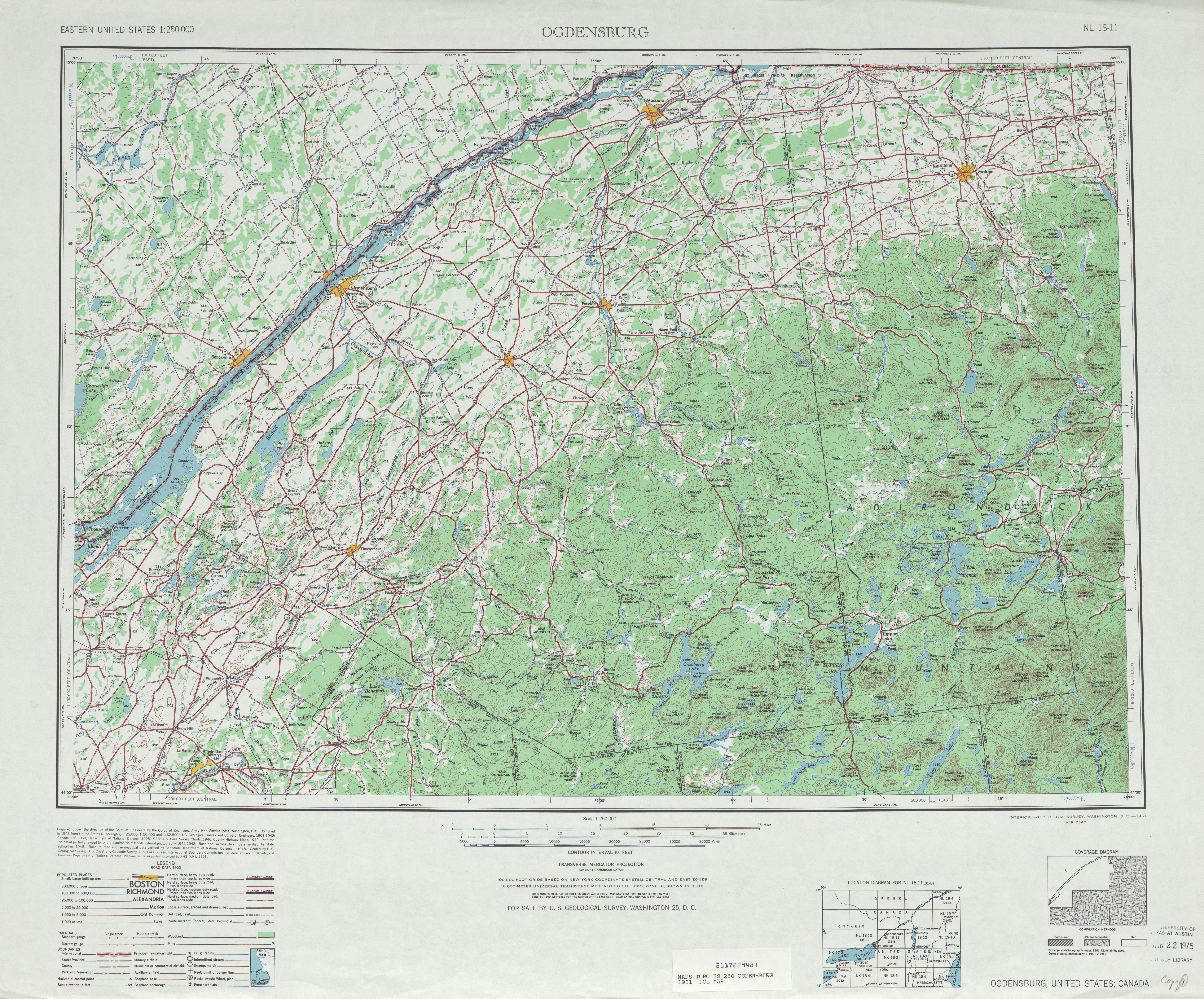
- Route 853: Now St. Lawrence County Route 55 in Lawrenceville ( Marked on 1951 USGS topo)
- Route 855: somewhere in Angelica - 855
- Route 858: Prospect Road ( Route 920V) in Remsen - 858
- Route 862: Riverside Drive ( Route 920P) in Johnsville and Glen. ( Marked on the Traffic Data Report as 862)
- Route 866: Babcock Hollow Road ( Route 960U) in Bath. ( Marked on the Traffic Data Report as 866)
- Route 897: Morning Thorpe Avenue in Southeast? - 897
- Route 898: Washington Avenue ( Route 981K) in Ulster (unconfirmed from the NYCRR)
- Route 903: Bridge Road ( then-Route 910L, now NY 185) in Crown Point - 903
- Route 904: Glen Cove Road ( Route 900B) in Oyster Bay - 904
- Route 918: Old Floyd Road in Floyd - 918
- Route 919: Burrstone Road ( Route 921B) in New Hartford (unconfirmed from the NYCRR)
- Route 920: somewhere in Deerfield (unconfirmed from the NYCRR)
- Route 921: Reference Route 921D in Barneveld (Page 334/338 of the TDC)
- Route 922: somewhere in New Hartford - 922
- Route 923: Reference Route 921F in Oneida County (Utica County line to Penn Central Railroad) (Page 334/338 of the TDC)
- Route 928: connection ( Route 921G) in Salisbury - 928
- Route 948: Mt. McGregor Road in Wilton - 948
- Route 951: Altamont Avenue ( Route 911H) in Rotterdam - 951
- Route 955: Former NY 401 in Stockport
- Route 956: Main Street ( Route 980B) in Kinderhook - 956
- Route 957: Old US 20 ( Route 980C) in New Lebanon (unconfirmed by the NYCRR)
- Route 958: Connector to MA 102 in State Line (unconfirmed by the NYCRR)
- Route 960: Old NY 22 ( Route 980F) in Copake - 960
- Route 962: NY 52 Business ( Route 980J) in Fishkill - 962
- Route 968: Old State Road ( Route 980U) in Highlands - 968
- Route 978: Reservoir Road ( Route 981L) in Olive (unconfirmed by the NYCRR)
- Route 979: Ulster Avenue ( Route 981M) in Ulster - 979
- Route 989: 9.31 mile road in Hancock - 989
- Any old reference numbers for the Park Roads of the Palisades Interstate Park System, such as those in Bear Mountain State Park and Harriman State Park? ---- DanTD ( talk) 19:26, 16 March 2008 (UTC)
- Do any of these links (excluding NE2's first link) work for anyone? All of these "westlaw" links lead me to a page that reads "You have requested a page that is not supported by this site.". -- TMF Let's Go Mets - Stats 02:07, 24 March 2008 (UTC)
- Odd, I'll fix this in the morning. Mitch 32 contribs 02:30, 24 March 2008 (UTC)
A link which appears to lead to the NYCRR links above is here. – T M F 04:37, 12 April 2009 (UTC)
- Meh, I guess not. The "free" version doesn't appear to have the portions of Title 15 that contain the route references. – T M F 04:48, 12 April 2009 (UTC)
[3] shows that Woodhaven Boulevard is 908V, but is not state maintained. [4] also shows it. -- NE2 01:23, 2 November 2007 (UTC)
910F is Fuller Road Alternate and not technically the Adirondack Northway which only starts at exit 1 when I-87 is picked up. This is confirmed by numerous references on local news channels and media such as the Times Union, examples [5] and "Officially, this Northway extension is called Fuller Road Alternate and Route 910F" as stated in [this http://archives.timesunion.com/mweb/wmsql.wm.request?oneimage&imageid=6395517] TU story. Camelbinky ( talk) 01:11, 15 February 2010 (UTC)
- It should be noted that this is far from the only article on Wikipedia that refers to NY 910F as the Northway. – T M F 08:44, 15 February 2010 (UTC)
The latest NYSDOT pavement data report shows a new route, SR 915Q in Schenectady County. There doesn't seem to be any actual data entered for it, just a "begin" line showing that it starts from US 20. Any other citations for this route? I'm guessing this must be the I-88 connector to US 20 and NY 7, which is otherwise unnumbered (reference markers show it as a ramp of I-88). ESRoads ( talk) 16:50, 10 April 2017 (UTC)
- The 2017 Highway Inventory describes it as the "I-88 Exit 24 Conn." You're right, it extends from US 20 over I-88 to NY Route 7. Sorry, I don't have time at the moment to edit the table. ( https://www.dot.ny.gov/divisions/engineering/technical-services/highway-data-services/inventory-listing) Triskele Jim 15:49, 24 April 2019 (UTC)
"Effective April first, nineteen hundred eighty,...to transfer to the county of Cattaraugus...beginning at a point on state highway five thousand two hundred fifty-nine-A, thence running generally northerly to a point on state highway one thousand eight hundred seventy-six, east of the village of Little Valley"
This is Kilburne Corners Road, and was an unsigned state highway by the 1940s (middle of sheet 2). -- NE2 01:48, 18 June 2021 (UTC)
This was state maintained until 1981, and is shown as an unsigned route on the NYSGIS topos. -- NE2 17:45, 18 June 2021 (UTC)
[6] shows CR 41 as an unnumbered state route; it was deleted as part of a big 1980 swap. -- NE2 19:34, 18 June 2021 (UTC)
[7] (sheet 3) shows Lake Shore/Big Tree/Bay View east of Athol Springs, which was deleted in a 1980 swap. Ditto for a short spur in Sardinia on Schutt Road east of Savage Road. And all those routes on Grand Island. The triangle of Ellicott Road at Duells Corner was also deleted in 1980, but I have no proof that it was a reference route. -- NE2 22:29, 18 June 2021 (UTC)
NYSGIS quad H51 shows a branch west from NY 185 just south of the bridge. -- NE2 00:34, 19 June 2021 (UTC)
Easterly Street and Phelps Street from Gloversville north and barely east was given to the county in 1980. -- NE2 03:44, 19 June 2021 (UTC)
A stub of former NY 26 south from Antwerp was deleted in 1979. -- NE2 22:31, 19 June 2021 (UTC)
The old NY 365 cut by the military had a stub on both sides (sheet 3). I don't know when the west one disappeared, but the east one lasted until 1981. -- NE2 01:57, 22 June 2021 (UTC)
At the same time was old NY 12 from Deerfield (Utica city limit) north to the interchange with NY 12 (at Glass Factory Road). -- NE2 02:01, 22 June 2021 (UTC)
State law still lists the former part of SH 500 between US 6/NY 17M at Denton and the old railroad grade to the northeast. This was an unnumbered state highway in the 1940s (sheet 2). -- NE2 18:40, 22 June 2021 (UTC)
Several pieces disappeared in 1980:
- Peekskill Road near Cold Spring (shown as an unnumbered highway in the 1940s)
- Railroad Avenue in Brewster (not labeled in 1940s, but definitely state maintained by then)
- Fair Street north of Cold Spring
-- NE2 21:45, 22 June 2021 (UTC)
1980 deletions:
- Cameron Road from Troy to NY 136 (on 1940s map)
- former NY 40A in Valley Falls (still 40A in 1940s)
- Brickyard Road from Troy to NY 40 (on 1940s map)
-- NE2 23:34, 22 June 2021 (UTC)
1980 deletions:
- former NY 7C (unnumbered state highway on 1940s map)
- Broadway in Rotterdam, NY 7 to Schenectady
- Guilderland Avenue in Rotterdam, NY 7 to Schenectady
-- NE2 04:36, 23 June 2021 (UTC)
Deleted in 1980:
- King Road, NY 96B to bridge in Buttermilk Falls State Park (unnumbered state highway in 1940s)
- NY 96 at Halseyville east to Taughannock Falls State Park (ditto)
-- NE2 19:08, 23 June 2021 (UTC)
804 became 920L and 889 became 169 (south of Little Falls). See page 78 of the Little Falls arterial plan. -- NE2 20:46, 13 July 2021 (UTC)
As of February 2022 or earlier, the wye carrying 913P no longer exists. Still waiting on an official NYSDOT source to confirm the removal, but likely to be in the next log/GIS update whenever that happens. Coasterlover 1994 00:32, 5 March 2022 (UTC)
- List-Class New York (state) articles
- Low-importance New York (state) articles
- List-Class New York road transport articles
- High-importance New York road transport articles
- List-Class Road transport articles
- High-importance Road transport articles
- New York state highway articles
- List-Class U.S. road transport articles
- High-importance U.S. road transport articles
- U.S. road transport articles