Photos • Location
| Tahuamanu River | |
|---|---|
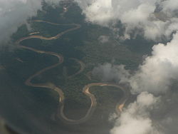
 Tahuamanu River as seen from above | |
 | |
| Location | |
| Country | Bolivia, Peru |
| Region |
Pando Department Madre de Dios Region |
| Physical characteristics | |
| Mouth | Madre de Dios River |
| Basin features | |
| River system | Amazon River |
The Tahuamanu River is a river of Bolivia and Peru. Nícolas Suárez Callau enslaved and exploited natives along the Tahuamanu during the rubber boom.
See also
References
- Rand McNally, The New International Atlas, 1993.
11°06′15″S 67°33′33″W / 11.1042°S 67.5592°W
| Tahuamanu River | |
|---|---|
 Tahuamanu River as seen from above | |
 | |
| Location | |
| Country | Bolivia, Peru |
| Region |
Pando Department Madre de Dios Region |
| Physical characteristics | |
| Mouth | Madre de Dios River |
| Basin features | |
| River system | Amazon River |
The Tahuamanu River is a river of Bolivia and Peru. Nícolas Suárez Callau enslaved and exploited natives along the Tahuamanu during the rubber boom.
See also
References
- Rand McNally, The New International Atlas, 1993.
11°06′15″S 67°33′33″W / 11.1042°S 67.5592°W