Photos • Location
Tạ An Khương Đông | |
|---|---|
Commune and village | |
| Country | |
| Province | Cà Mau |
| District | Đầm Dơi |
| Time zone | UTC+07:00 |
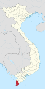
Tạ An Khương Đông is a commune (xã) and village in Đầm Dơi District, Cà Mau Province, in Vietnam.
9°03′38″N 105°16′08″E / 9.0606°N 105.2689°E
Tạ An Khương Đông | |
|---|---|
Commune and village | |
| Country | |
| Province | Cà Mau |
| District | Đầm Dơi |
| Time zone | UTC+07:00 |
Tạ An Khương Đông is a commune (xã) and village in Đầm Dơi District, Cà Mau Province, in Vietnam.
9°03′38″N 105°16′08″E / 9.0606°N 105.2689°E
