Třebeň | |
|---|---|
 Eastern part of Třebeň | |
 Flag  Coat of arms | |
 Třebeň Location in the Czech Republic | |
| Coordinates: 50°7′44″N 12°24′0″E / 50.12889°N 12.40000°E | |
| Country | |
| Region | Karlovy Vary |
| District | Cheb |
| First mentioned | 1208 |
| Area | |
| • Total | 21.70 km2 (8.38 sq mi) |
| Elevation | 439 m (1,440 ft) |
| Population (2023-01-01)
[1] | |
| • Total | 460 |
| • Density | 21/km2 (55/sq mi) |
| Time zone | UTC+1 ( CET) |
| • Summer ( DST) | UTC+2 ( CEST) |
| Postal codes | 350 02, 351 34 |
| Website |
www |
Třebeň ( German: Trebendorf) is a municipality and village in Cheb District in the Karlovy Vary Region of the Czech Republic. It has about 500 inhabitants.
Administrative parts
The villages and hamlets of Chocovice, Doubí, Dvorek, Horní Ves, Lesina, Lesinka, Nový Drahov, Povodí and Vokov are administrative parts of Třebeň.
History
The first written mention of Třebeň is from 1208. [2]
Demographics
| Year | Pop. | ±% |
|---|---|---|
| 1869 | 1,321 | — |
| 1880 | 1,533 | +16.0% |
| 1890 | 1,377 | −10.2% |
| 1900 | 1,274 | −7.5% |
| 1910 | 1,326 | +4.1% |
| 1921 | 1,285 | −3.1% |
| 1930 | 1,455 | +13.2% |
| 1950 | 513 | −64.7% |
| 1961 | 453 | −11.7% |
| 1970 | 376 | −17.0% |
| 1980 | 391 | +4.0% |
| 1991 | 321 | −17.9% |
| 2001 | 347 | +8.1% |
| 2011 | 388 | +11.8% |
| 2021 | 449 | +15.7% |
| Source: Censuses [3] [4] | ||
Gallery
-
 Church of Saint Lawrence
 -
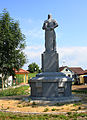 World War I memorial
 -
 Horní Ves, a part of Třebeň


.jpg)
References
- ^ "Population of Municipalities – 1 January 2023". Czech Statistical Office. 2023-05-23.
- ^ "O obci" (in Czech). Obec Třebeň. Retrieved 2022-04-20.
- ^ "Historický lexikon obcí České republiky 1869–2011 – Okres Cheb" (in Czech). Czech Statistical Office. 2015-12-21. pp. 15–16.
- ^ "Population Census 2021: Population by sex". Public Database. Czech Statistical Office. 2021-03-27.
External links
| Authority control databases: National |
|---|
|
| This Karlovy Vary Region location article is a stub. You can help Wikipedia by expanding it. |
Třebeň | |
|---|---|
|
Eastern part of Třebeň | |
|
Flag Coat of arms | |
Třebeň Location in the Czech Republic | |
| Coordinates: 50°7′44″N 12°24′0″E / 50.12889°N 12.40000°E | |
| Country | |
| Region | Karlovy Vary |
| District | Cheb |
| First mentioned | 1208 |
| Area | |
| • Total | 21.70 km2 (8.38 sq mi) |
| Elevation | 439 m (1,440 ft) |
| Population (2023-01-01)
[1] | |
| • Total | 460 |
| • Density | 21/km2 (55/sq mi) |
| Time zone | UTC+1 ( CET) |
| • Summer ( DST) | UTC+2 ( CEST) |
| Postal codes | 350 02, 351 34 |
| Website |
www |
Třebeň ( German: Trebendorf) is a municipality and village in Cheb District in the Karlovy Vary Region of the Czech Republic. It has about 500 inhabitants.
Administrative parts
The villages and hamlets of Chocovice, Doubí, Dvorek, Horní Ves, Lesina, Lesinka, Nový Drahov, Povodí and Vokov are administrative parts of Třebeň.
History
The first written mention of Třebeň is from 1208. [2]
Demographics
| Year | Pop. | ±% |
|---|---|---|
| 1869 | 1,321 | — |
| 1880 | 1,533 | +16.0% |
| 1890 | 1,377 | −10.2% |
| 1900 | 1,274 | −7.5% |
| 1910 | 1,326 | +4.1% |
| 1921 | 1,285 | −3.1% |
| 1930 | 1,455 | +13.2% |
| 1950 | 513 | −64.7% |
| 1961 | 453 | −11.7% |
| 1970 | 376 | −17.0% |
| 1980 | 391 | +4.0% |
| 1991 | 321 | −17.9% |
| 2001 | 347 | +8.1% |
| 2011 | 388 | +11.8% |
| 2021 | 449 | +15.7% |
| Source: Censuses [3] [4] | ||
Gallery
-
Church of Saint Lawrence
-
World War I memorial
-
Horní Ves, a part of Třebeň
References
- ^ "Population of Municipalities – 1 January 2023". Czech Statistical Office. 2023-05-23.
- ^ "O obci" (in Czech). Obec Třebeň. Retrieved 2022-04-20.
- ^ "Historický lexikon obcí České republiky 1869–2011 – Okres Cheb" (in Czech). Czech Statistical Office. 2015-12-21. pp. 15–16.
- ^ "Population Census 2021: Population by sex". Public Database. Czech Statistical Office. 2021-03-27.
External links
| Authority control databases: National |
|---|
|
| This Karlovy Vary Region location article is a stub. You can help Wikipedia by expanding it. |