Photos • Location
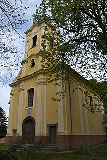
Photograph of a Roman Catholic church in Tésa, Hungary

Tésa | |
|---|---|
 Tésa Location of Tésa in Hungary | |
| Coordinates: 48°1′51.31″N 18°50′37.18″E / 48.0309194°N 18.8436611°E | |
| Country | Hungary |
| Region | Central Hungary |
| County | Pest |
| Subregion | Szobi |
| Rank | Village |
| Area | |
| • Total | 4.38 km2 (1.69 sq mi) |
| Population (1 January 2015)
[2] | |
| • Total | 82 |
| • Density | 19/km2 (48/sq mi) |
| Time zone | UTC+1 ( CET) |
| • Summer ( DST) | UTC+2 ( CEST) |
| Postal code | 2635 |
| Area code | +36 27 |
| KSH code | 19248 [1] |
| Website | http://tesa.fw.hu/ |

Tésa is a village in Pest county, Hungary.
- ^ a b Tésa at the Hungarian Central Statistical Office (Hungarian).
- ^ Tésa at the Hungarian Central Statistical Office (Hungarian). 1 January 2008
48°02′N 18°51′E / 48.033°N 18.850°E
|
| This Pest County location article is a stub. You can help Wikipedia by expanding it. |
Tésa | |
|---|---|
Tésa Location of Tésa in Hungary | |
| Coordinates: 48°1′51.31″N 18°50′37.18″E / 48.0309194°N 18.8436611°E | |
| Country | Hungary |
| Region | Central Hungary |
| County | Pest |
| Subregion | Szobi |
| Rank | Village |
| Area | |
| • Total | 4.38 km2 (1.69 sq mi) |
| Population (1 January 2015)
[2] | |
| • Total | 82 |
| • Density | 19/km2 (48/sq mi) |
| Time zone | UTC+1 ( CET) |
| • Summer ( DST) | UTC+2 ( CEST) |
| Postal code | 2635 |
| Area code | +36 27 |
| KSH code | 19248 [1] |
| Website | http://tesa.fw.hu/ |
Tésa is a village in Pest county, Hungary.
- ^ a b Tésa at the Hungarian Central Statistical Office (Hungarian).
- ^ Tésa at the Hungarian Central Statistical Office (Hungarian). 1 January 2008
48°02′N 18°51′E / 48.033°N 18.850°E
|
| This Pest County location article is a stub. You can help Wikipedia by expanding it. |