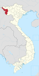
Photos • Location
Tân Thanh | |
|---|---|
| Country | |
| Province | Điện Biên |
| District | Điện Biên Phủ |
| Area | |
| • Total | 1.02 km2 (0.39 sq mi) |
| Population (18.08.2000) | |
| • Total | 8,210 |
| • Density | 8,000/km2 (21,000/sq mi) |
| Time zone | UTC+07:00 (Indochina Time) |
Tân Thanh is a ward (phường) of Điện Biên Phủ in Điện Biên Province, northwestern Vietnam.
