Photos • Location

Sylverino, Arkansas | |
|---|---|
 Silverino  Silverino | |
| Coordinates: 33°19′00″N 93°56′16″W / 33.31667°N 93.93778°W | |
| Country | United States |
| State | Arkansas |
| County | Miller |
| Elevation | 299 ft (91 m) |
| Time zone | UTC-6 ( Central (CST)) |
| • Summer ( DST) | UTC-5 (CDT) |
| Area code | 870 |
| GNIS feature ID | 63127 [1] |
Sylverino is an unincorporated community in Miller County, Arkansas, United States. Sylverino is located on U.S. Route 71, 9.6 miles (15.4 km) southeast of Texarkana. [2]
- ^ "Sylverino". Geographic Names Information System. United States Geological Survey, United States Department of the Interior.
- ^ Miller County, Arkansas General Highway Map (PDF) (Map). Arkansas State Highway and Transportation Department. 2010. Archived from the original (PDF) on April 23, 2012. Retrieved June 13, 2012.
Municipalities and communities of
Miller County, Arkansas, United States | ||
|---|---|---|
| Cities | 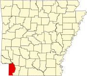 | |
| Town | ||
| CDP | ||
|
Other unincorporated communities | ||
|
| This article about a location in Miller County, Arkansas is a stub. You can help Wikipedia by expanding it. |
Sylverino, Arkansas | |
|---|---|
Silverino Silverino | |
| Coordinates: 33°19′00″N 93°56′16″W / 33.31667°N 93.93778°W | |
| Country | United States |
| State | Arkansas |
| County | Miller |
| Elevation | 299 ft (91 m) |
| Time zone | UTC-6 ( Central (CST)) |
| • Summer ( DST) | UTC-5 (CDT) |
| Area code | 870 |
| GNIS feature ID | 63127 [1] |
Sylverino is an unincorporated community in Miller County, Arkansas, United States. Sylverino is located on U.S. Route 71, 9.6 miles (15.4 km) southeast of Texarkana. [2]
- ^ "Sylverino". Geographic Names Information System. United States Geological Survey, United States Department of the Interior.
- ^ Miller County, Arkansas General Highway Map (PDF) (Map). Arkansas State Highway and Transportation Department. 2010. Archived from the original (PDF) on April 23, 2012. Retrieved June 13, 2012.
Municipalities and communities of
Miller County, Arkansas, United States | ||
|---|---|---|
| Cities | | |
| Town | ||
| CDP | ||
|
Other unincorporated communities | ||
|
| This article about a location in Miller County, Arkansas is a stub. You can help Wikipedia by expanding it. |