| Stanley R. Mickelsen Safeguard Complex | |
|---|---|
| Near Langdon, North Dakota in United States | |
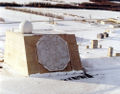
 Safeguard Complex Missile Site Radar | |
 Stanley R. Mickelsen Safeguard Complex | |
| Coordinates | 48°35′21.91″N 98°21′24.26″W / 48.5894194°N 98.3567389°W |
| Site history | |
| Built | October 1975 |
| In use | April 1976 |
| Fate | Decommissioned |
The Stanley R. Mickelsen Safeguard Complex (SRMSC) was a cluster of military facilities near Langdon, North Dakota, that supported the United States Army's Safeguard anti-ballistic missile program. [1] The complex provided launch and control for 30 LIM-49 Spartan anti-ballistic missiles, and 70 shorter-range Sprint anti-ballistic missiles.
The deployment area of the complex covered the Minuteman launchers of the 321st Strategic Missile Wing, based at Grand Forks Air Force Base, North Dakota. Under the terms of the 1972 Anti-Ballistic Missile Treaty, the US was permitted to deploy a single ABM system protecting an area containing ICBM launchers. The total of 100 launchers and 100 missiles was the maximum permitted under the treaty.
The site achieved initial operating capability on 1 April 1975, and full operational capability on 1 October 1975 costing $6 billion (equivalent to $33.97 billion in 2023). However, on 2 October 1975, the House of Representatives voted to decommission the project, after they deemed it ineffective. The complex was deactivated in April 1976, after only six months of full operational capacity. In December 2012, it was purchased by the Spring Creek Hutterite Colony of Forbes, North Dakota, at auction for $530,000 (equivalent to $703,389 in 2023). [2] [3] In 2020, portions of the property including the Pyramid were sold to the Cavalier County Job Development Authority (CCJDA) for $462,900. [4] The CCJDA intends to build an interpretive historical center, restore the property, and sell or lease the pyramid to a datacenter or similar business. In July 2022, data center developer Bitzero Blockchain Inc. acquired the pyramid from the CCJDA to restore and renovate the complex and convert it into a data center, with a slated $500 million going into the project. Bitzero also plans to create an interpretive center for the complex. [5] The Hutterite colony retains ownership of the remaining property.
The site was named for Stanley R. Mickelsen, a former commanding general of the U.S. Army Air Defense Command.
Facilities
The complex was centered on the Missile Site Radar (MSR) site, near Nekoma, North Dakota, home of the Missile Site Radar, and 30 Spartan missiles and 16 shorter-range Sprints. All missiles were held in underground launch silos.
The remaining Sprint missiles were distributed at four Remote Sprint Launchers at distances of 10 to 20 miles (16 to 32 km) from the Missile Site Radar. These were located at:
- RSL 1 48°32′00.24″N 98°34′58.81″W / 48.5334000°N 98.5830028°W
- RSL 2 48°50′58.03″N 98°25′55.84″W / 48.8494528°N 98.4321778°W
- RSL 3 48°45′52.63″N 97°59′9.92″W / 48.7646194°N 97.9860889°W
- RSL 4 48°28′30.91″N 98°15′23.02″W / 48.4752528°N 98.2563944°W
The Perimeter Acquisition Radar (PAR) was a separately sited phased array radar to detect incoming targets. The radar and site are currently in service as the Perimeter Acquisition Radar Characterization System (PARCS), located at Cavalier Air Force Station.
The MSR and PSR sites are listed in the Historic American Engineering Record, a Heritage Documentation Program. [6]
Images gallery
-
 Aerial image of the MSR site
 -
 Aerial image of Remote Sprint Launch Site No. 2.
 -
 The PAR, now known as EPARCS, is still in operation


See also
References
-
^
James Walker, Lewis Bernstein (2003).
Seize the High Ground: The Army in Space and Missile Defense. Defense Department, Army, History Office, Space and Missile Defense Command.
ISBN
0-16-072308-6.
On 21 June 1974, Army officially designated the SAFEGUARD tactical facilities in North Dakota the Stanley R. Mickelsen SAFEGUARD Complex
- ^ "Stanley R. Mickelsen Safeguard Complex: A Strange Pyramid Built in the Middle of Nowhere". Weather.com.
- ^ Burba, Bryan. "Anti-Ballistic Missiles and the Hutterites". Peaceful Societies.
- ^ "Stanley R. Mickelsen Safeguard Missile Site Radar (MSR) Complex".
- ^ "Nekoma, North Dakota, pyramid played key role in U.S. Cold War strategy". Grand Forks Herald. 2022-09-06. Retrieved 2023-02-17.
- ^ Historic American Engineering Record HAER ND-9-B HAER ND-9-P
External links
- srmsc.org - unofficial site dedicated to the Stanley R. Mickelsen Safeguard Complex
- [1] - Google Earth Image of Complex
-
Historic American Engineering Record documentation, all filed under Nekoma, Cavalier County, ND:
- HAER No. ND-9, " Stanley R. Mickelsen Safeguard Complex", 3 measured drawings, 93 data pages
- HAER No. ND-9-A, " Stanley R. Mickelsen Safeguard Complex, Limited Area Sentry Station", 1 photo, 1 data page, 1 photo caption page
- HAER No. ND-9-B, " Stanley R. Mickelsen Safeguard Complex, Missile Site Control Building", 30 photos, 30 data pages, 3 photo caption pages
- HAER No. ND-9-C, " Stanley R. Mickelsen Safeguard Complex, Universal Missile Building", 4 photos, 2 data pages, 1 photo caption page
- HAER No. ND-9-D, " Stanley R. Mickelsen Safeguard Complex, Exclusion Area Sentry Station", 1 photo, 1 data page, 1 photo caption page
- HAER No. ND-9-E, " Stanley R. Mickelsen Safeguard Complex, Warhead Handling Building", 1 photo, 2 data pages, 1 photo caption page
- HAER No. ND-9-F, " Stanley R. Mickelsen Safeguard Complex, Missile Launch Area", 13 photos, 2 data pages, 2 photo caption pages
- HAER No. ND-9-G, " Stanley R. Mickelsen Safeguard Complex, Fresh Waterpump House", 1 photo, 1 photo caption page
- HAER No. ND-9-H, " Stanley R. Mickelsen Safeguard Complex, Installation Headquarters Building", 2 photos, 1 photo caption page
- HAER No. ND-9-I, " Stanley R. Mickelsen Safeguard Complex, Area Engineer-Administration Building", 1 photo, 1 photo caption page
- HAER No. ND-9-J, " Stanley R. Mickelsen Safeguard Complex, Industrial Building", 1 photo, 1 photo caption page
- HAER No. ND-9-K, " Stanley R. Mickelsen Safeguard Complex, Family Housing Units", 2 photos, 1 photo caption page
- HAER No. ND-9-L, " Stanley R. Mickelsen Safeguard Complex, Post Chapel", 1 photo, 1 photo caption page
- HAER No. ND-9-M, " Stanley R. Mickelsen Safeguard Complex, Gymnasium", 1 photo, 1 photo caption page
- HAER No. ND-9-N, " Stanley R. Mickelsen Safeguard Complex, Community Center", 1 photo, 1 photo caption page
- HAER No. ND-9-O, " Stanley R. Mickelsen Safeguard Complex, Limited Area Sentry Station", 2 photos, 2 data pages, 1 photo caption page
- HAER No. ND-9-P, " Stanley R. Mickelsen Safeguard Complex, Perimeter Acquisition Radar Building", 58 photos, 29 data pages, 5 photo caption pages
- HAER No. ND-9-Q, " Stanley R. Mickelsen Safeguard Complex, Utility Tunnel", 2 photos, 2 data pages, 1 photo caption page
- HAER No. ND-9-R, " Stanley R. Mickelsen Safeguard Complex, Perimeter Acquisition Radar Power Plant", 13 photos, 2 data pages, 2 photo caption pages
- HAER No. ND-9-S, " Stanley R. Mickelsen Safeguard Complex, Cooling Tower", 1 photo, 1 data page, 1 photo caption page
- HAER No. ND-9-T, " Stanley R. Mickelsen Safeguard Complex, Remote Sprint Launch Site No. 1", 2 photos, 6 data pages, 1 photo caption page
- HAER No. ND-9-U, " Stanley R. Mickelsen Safeguard Complex, Limited Area Sentry Station", 3 photos, 1 data page, 1 photo caption page
- HAER No. ND-9-V, " Stanley R. Mickelsen Safeguard Complex, Remote Launch Operations Buildings", 1 photo, 15 data pages, 1 photo caption page
- HAER No. ND-9-W, " Stanley R. Mickelsen Safeguard Complex, Exclusion Area Sentry Station", 1 photo, 1 data page, 1 photo caption page
- HAER No. ND-9-X, " Stanley R. Mickelsen Safeguard Complex, Remote Sprint Launch Site No. 2", 3 photos, 1 photo caption page
- HAER No. ND-9-Y, " Stanley R. Mickelsen Safeguard Complex, Limited Area Sentry Station", 1 photo, 1 data page, 1 photo caption page
- HAER No. ND-9-Z, " Stanley R. Mickelsen Safeguard Complex, Remote Launch Operations Building", 1 photo, 15 data pages, 1 photo caption page
- HAER No. ND-9-AA, " Stanley R. Mickelsen Safeguard Complex, Exclusion Area Sentry Station", 1 photo, 1 data page, 1 photo caption page
- HAER No. ND-9-AB, " Stanley R. Mickelsen Safeguard Complex, Remote Sprint Launch Site No. 3", 1 photo, 1 photo caption page
- HAER No. ND-9-AC, " Stanley R. Mickelsen Safeguard Complex, Limited Area Sentry Station", 1 photo, 1 data page, 1 photo caption page
- HAER No. ND-9-AD, " Stanley R. Mickelsen Safeguard Complex, Remote Launch Operations Building", 9 photos, 14 data pages, 1 photo caption page
- HAER No. ND-9-AE, " Stanley R. Mickelsen Safeguard Complex, Exclusion Area Sentry Station", 2 photos, 1 data page, 1 photo caption page
- HAER No. ND-9-AF, " Stanley R. Mickelsen Safeguard Complex, Remote Sprint Launch Site No. 4", 2 photos, 1 photo caption page
- HAER No. ND-9-AG, " Stanley R. Mickelsen Safeguard Complex, Limited Area Sentry Station", 1 photo, 2 data pages, 1 photo caption page
- HAER No. ND-9-AH, " Stanley R. Mickelsen Safeguard Complex, Remote Launch Operations Building", 1 photo, 15 data pages, 1 photo caption page
- HAER No. ND-9-AI, " Stanley R. Mickelsen Safeguard Complex, Exclusion Area Sentry Station", 1 photo, 1 data page, 1 photo caption page
- HAER No. ND-9-AJ, " Stanley R. Mickelsen Safeguard Complex, Resident Engineers Office Building", 1 photo, 1 photo caption page
- HAER No. ND-9-AK, " Stanley R. Mickelsen Safeguard Complex, Community Center", 1 photo, 1 photo caption page
- HAER No. ND-9-AL, " Stanley R. Mickelsen Safeguard Complex, Bachelor Officers' Quarters", 1 photo, 1 photo caption page
- HAER No. ND-9-AM, " Stanley R. Mickelsen Safeguard Complex, Storage Building", 1 photo, 1 photo caption page
- HAER No. ND-9-AN, " Stanley R. Mickelsen Safeguard Complex, Sentry Station", 1 photo, 1 photo caption page
- HAER No. ND-9-AO, " Stanley R. Mickelsen Safeguard Complex, Controlled Area Sentry Station", 1 photo, 1 photo caption page
- HAER No. ND-9-AP, " Stanley R. Mickelsen Safeguard Complex, Industrial Building", 1 photo, 1 photo caption page
- HAER No. ND-9-AQ, " Stanley R. Mickelsen Safeguard Complex, Fresh Water Pump House", 1 photo, 1 photo caption page
- HAER No. ND-9-AR, " Stanley R. Mickelsen Safeguard Complex, Fuel Oil Pump Station", 1 photo, 2 data pages, 1 photo caption page
- HAER No. ND-9-AS, " Stanley R. Mickelsen Safeguard Complex, Administrative Headquarters Building", 1 photo, 1 photo caption page
- HAER No. ND-9-AT, " Stanley R. Mickelsen Safeguard Complex, Polar Telephone Building", 1 photo, 1 photo caption page
- HAER No. ND-9-AU, " Stanly R. Mickelsen Safeguard Complex, Missile Site Radar Power Plant", 2 photos, 1 photo caption page
| Stanley R. Mickelsen Safeguard Complex | |
|---|---|
| Near Langdon, North Dakota in United States | |
|
Safeguard Complex Missile Site Radar | |
Stanley R. Mickelsen Safeguard Complex | |
| Coordinates | 48°35′21.91″N 98°21′24.26″W / 48.5894194°N 98.3567389°W |
| Site history | |
| Built | October 1975 |
| In use | April 1976 |
| Fate | Decommissioned |
The Stanley R. Mickelsen Safeguard Complex (SRMSC) was a cluster of military facilities near Langdon, North Dakota, that supported the United States Army's Safeguard anti-ballistic missile program. [1] The complex provided launch and control for 30 LIM-49 Spartan anti-ballistic missiles, and 70 shorter-range Sprint anti-ballistic missiles.
The deployment area of the complex covered the Minuteman launchers of the 321st Strategic Missile Wing, based at Grand Forks Air Force Base, North Dakota. Under the terms of the 1972 Anti-Ballistic Missile Treaty, the US was permitted to deploy a single ABM system protecting an area containing ICBM launchers. The total of 100 launchers and 100 missiles was the maximum permitted under the treaty.
The site achieved initial operating capability on 1 April 1975, and full operational capability on 1 October 1975 costing $6 billion (equivalent to $33.97 billion in 2023). However, on 2 October 1975, the House of Representatives voted to decommission the project, after they deemed it ineffective. The complex was deactivated in April 1976, after only six months of full operational capacity. In December 2012, it was purchased by the Spring Creek Hutterite Colony of Forbes, North Dakota, at auction for $530,000 (equivalent to $703,389 in 2023). [2] [3] In 2020, portions of the property including the Pyramid were sold to the Cavalier County Job Development Authority (CCJDA) for $462,900. [4] The CCJDA intends to build an interpretive historical center, restore the property, and sell or lease the pyramid to a datacenter or similar business. In July 2022, data center developer Bitzero Blockchain Inc. acquired the pyramid from the CCJDA to restore and renovate the complex and convert it into a data center, with a slated $500 million going into the project. Bitzero also plans to create an interpretive center for the complex. [5] The Hutterite colony retains ownership of the remaining property.
The site was named for Stanley R. Mickelsen, a former commanding general of the U.S. Army Air Defense Command.
Facilities
The complex was centered on the Missile Site Radar (MSR) site, near Nekoma, North Dakota, home of the Missile Site Radar, and 30 Spartan missiles and 16 shorter-range Sprints. All missiles were held in underground launch silos.
The remaining Sprint missiles were distributed at four Remote Sprint Launchers at distances of 10 to 20 miles (16 to 32 km) from the Missile Site Radar. These were located at:
- RSL 1 48°32′00.24″N 98°34′58.81″W / 48.5334000°N 98.5830028°W
- RSL 2 48°50′58.03″N 98°25′55.84″W / 48.8494528°N 98.4321778°W
- RSL 3 48°45′52.63″N 97°59′9.92″W / 48.7646194°N 97.9860889°W
- RSL 4 48°28′30.91″N 98°15′23.02″W / 48.4752528°N 98.2563944°W
The Perimeter Acquisition Radar (PAR) was a separately sited phased array radar to detect incoming targets. The radar and site are currently in service as the Perimeter Acquisition Radar Characterization System (PARCS), located at Cavalier Air Force Station.
The MSR and PSR sites are listed in the Historic American Engineering Record, a Heritage Documentation Program. [6]
Images gallery
-
Aerial image of the MSR site
-
Aerial image of Remote Sprint Launch Site No. 2.
-
The PAR, now known as EPARCS, is still in operation
See also
References
-
^
James Walker, Lewis Bernstein (2003).
Seize the High Ground: The Army in Space and Missile Defense. Defense Department, Army, History Office, Space and Missile Defense Command.
ISBN
0-16-072308-6.
On 21 June 1974, Army officially designated the SAFEGUARD tactical facilities in North Dakota the Stanley R. Mickelsen SAFEGUARD Complex
- ^ "Stanley R. Mickelsen Safeguard Complex: A Strange Pyramid Built in the Middle of Nowhere". Weather.com.
- ^ Burba, Bryan. "Anti-Ballistic Missiles and the Hutterites". Peaceful Societies.
- ^ "Stanley R. Mickelsen Safeguard Missile Site Radar (MSR) Complex".
- ^ "Nekoma, North Dakota, pyramid played key role in U.S. Cold War strategy". Grand Forks Herald. 2022-09-06. Retrieved 2023-02-17.
- ^ Historic American Engineering Record HAER ND-9-B HAER ND-9-P
External links
- srmsc.org - unofficial site dedicated to the Stanley R. Mickelsen Safeguard Complex
- [1] - Google Earth Image of Complex
-
Historic American Engineering Record documentation, all filed under Nekoma, Cavalier County, ND:
- HAER No. ND-9, " Stanley R. Mickelsen Safeguard Complex", 3 measured drawings, 93 data pages
- HAER No. ND-9-A, " Stanley R. Mickelsen Safeguard Complex, Limited Area Sentry Station", 1 photo, 1 data page, 1 photo caption page
- HAER No. ND-9-B, " Stanley R. Mickelsen Safeguard Complex, Missile Site Control Building", 30 photos, 30 data pages, 3 photo caption pages
- HAER No. ND-9-C, " Stanley R. Mickelsen Safeguard Complex, Universal Missile Building", 4 photos, 2 data pages, 1 photo caption page
- HAER No. ND-9-D, " Stanley R. Mickelsen Safeguard Complex, Exclusion Area Sentry Station", 1 photo, 1 data page, 1 photo caption page
- HAER No. ND-9-E, " Stanley R. Mickelsen Safeguard Complex, Warhead Handling Building", 1 photo, 2 data pages, 1 photo caption page
- HAER No. ND-9-F, " Stanley R. Mickelsen Safeguard Complex, Missile Launch Area", 13 photos, 2 data pages, 2 photo caption pages
- HAER No. ND-9-G, " Stanley R. Mickelsen Safeguard Complex, Fresh Waterpump House", 1 photo, 1 photo caption page
- HAER No. ND-9-H, " Stanley R. Mickelsen Safeguard Complex, Installation Headquarters Building", 2 photos, 1 photo caption page
- HAER No. ND-9-I, " Stanley R. Mickelsen Safeguard Complex, Area Engineer-Administration Building", 1 photo, 1 photo caption page
- HAER No. ND-9-J, " Stanley R. Mickelsen Safeguard Complex, Industrial Building", 1 photo, 1 photo caption page
- HAER No. ND-9-K, " Stanley R. Mickelsen Safeguard Complex, Family Housing Units", 2 photos, 1 photo caption page
- HAER No. ND-9-L, " Stanley R. Mickelsen Safeguard Complex, Post Chapel", 1 photo, 1 photo caption page
- HAER No. ND-9-M, " Stanley R. Mickelsen Safeguard Complex, Gymnasium", 1 photo, 1 photo caption page
- HAER No. ND-9-N, " Stanley R. Mickelsen Safeguard Complex, Community Center", 1 photo, 1 photo caption page
- HAER No. ND-9-O, " Stanley R. Mickelsen Safeguard Complex, Limited Area Sentry Station", 2 photos, 2 data pages, 1 photo caption page
- HAER No. ND-9-P, " Stanley R. Mickelsen Safeguard Complex, Perimeter Acquisition Radar Building", 58 photos, 29 data pages, 5 photo caption pages
- HAER No. ND-9-Q, " Stanley R. Mickelsen Safeguard Complex, Utility Tunnel", 2 photos, 2 data pages, 1 photo caption page
- HAER No. ND-9-R, " Stanley R. Mickelsen Safeguard Complex, Perimeter Acquisition Radar Power Plant", 13 photos, 2 data pages, 2 photo caption pages
- HAER No. ND-9-S, " Stanley R. Mickelsen Safeguard Complex, Cooling Tower", 1 photo, 1 data page, 1 photo caption page
- HAER No. ND-9-T, " Stanley R. Mickelsen Safeguard Complex, Remote Sprint Launch Site No. 1", 2 photos, 6 data pages, 1 photo caption page
- HAER No. ND-9-U, " Stanley R. Mickelsen Safeguard Complex, Limited Area Sentry Station", 3 photos, 1 data page, 1 photo caption page
- HAER No. ND-9-V, " Stanley R. Mickelsen Safeguard Complex, Remote Launch Operations Buildings", 1 photo, 15 data pages, 1 photo caption page
- HAER No. ND-9-W, " Stanley R. Mickelsen Safeguard Complex, Exclusion Area Sentry Station", 1 photo, 1 data page, 1 photo caption page
- HAER No. ND-9-X, " Stanley R. Mickelsen Safeguard Complex, Remote Sprint Launch Site No. 2", 3 photos, 1 photo caption page
- HAER No. ND-9-Y, " Stanley R. Mickelsen Safeguard Complex, Limited Area Sentry Station", 1 photo, 1 data page, 1 photo caption page
- HAER No. ND-9-Z, " Stanley R. Mickelsen Safeguard Complex, Remote Launch Operations Building", 1 photo, 15 data pages, 1 photo caption page
- HAER No. ND-9-AA, " Stanley R. Mickelsen Safeguard Complex, Exclusion Area Sentry Station", 1 photo, 1 data page, 1 photo caption page
- HAER No. ND-9-AB, " Stanley R. Mickelsen Safeguard Complex, Remote Sprint Launch Site No. 3", 1 photo, 1 photo caption page
- HAER No. ND-9-AC, " Stanley R. Mickelsen Safeguard Complex, Limited Area Sentry Station", 1 photo, 1 data page, 1 photo caption page
- HAER No. ND-9-AD, " Stanley R. Mickelsen Safeguard Complex, Remote Launch Operations Building", 9 photos, 14 data pages, 1 photo caption page
- HAER No. ND-9-AE, " Stanley R. Mickelsen Safeguard Complex, Exclusion Area Sentry Station", 2 photos, 1 data page, 1 photo caption page
- HAER No. ND-9-AF, " Stanley R. Mickelsen Safeguard Complex, Remote Sprint Launch Site No. 4", 2 photos, 1 photo caption page
- HAER No. ND-9-AG, " Stanley R. Mickelsen Safeguard Complex, Limited Area Sentry Station", 1 photo, 2 data pages, 1 photo caption page
- HAER No. ND-9-AH, " Stanley R. Mickelsen Safeguard Complex, Remote Launch Operations Building", 1 photo, 15 data pages, 1 photo caption page
- HAER No. ND-9-AI, " Stanley R. Mickelsen Safeguard Complex, Exclusion Area Sentry Station", 1 photo, 1 data page, 1 photo caption page
- HAER No. ND-9-AJ, " Stanley R. Mickelsen Safeguard Complex, Resident Engineers Office Building", 1 photo, 1 photo caption page
- HAER No. ND-9-AK, " Stanley R. Mickelsen Safeguard Complex, Community Center", 1 photo, 1 photo caption page
- HAER No. ND-9-AL, " Stanley R. Mickelsen Safeguard Complex, Bachelor Officers' Quarters", 1 photo, 1 photo caption page
- HAER No. ND-9-AM, " Stanley R. Mickelsen Safeguard Complex, Storage Building", 1 photo, 1 photo caption page
- HAER No. ND-9-AN, " Stanley R. Mickelsen Safeguard Complex, Sentry Station", 1 photo, 1 photo caption page
- HAER No. ND-9-AO, " Stanley R. Mickelsen Safeguard Complex, Controlled Area Sentry Station", 1 photo, 1 photo caption page
- HAER No. ND-9-AP, " Stanley R. Mickelsen Safeguard Complex, Industrial Building", 1 photo, 1 photo caption page
- HAER No. ND-9-AQ, " Stanley R. Mickelsen Safeguard Complex, Fresh Water Pump House", 1 photo, 1 photo caption page
- HAER No. ND-9-AR, " Stanley R. Mickelsen Safeguard Complex, Fuel Oil Pump Station", 1 photo, 2 data pages, 1 photo caption page
- HAER No. ND-9-AS, " Stanley R. Mickelsen Safeguard Complex, Administrative Headquarters Building", 1 photo, 1 photo caption page
- HAER No. ND-9-AT, " Stanley R. Mickelsen Safeguard Complex, Polar Telephone Building", 1 photo, 1 photo caption page
- HAER No. ND-9-AU, " Stanly R. Mickelsen Safeguard Complex, Missile Site Radar Power Plant", 2 photos, 1 photo caption page