Photos • Location


Panorama view from St. Anton to the valley of Rhine
| St. Anton Pass | |
|---|---|
 | |
| Elevation | 1,110 m (3,642 ft) |
| Traversed by | Road |
| Location | Switzerland |
| Range | Alps |
| Coordinates | 47°24′36″N 9°32′02″E / 47.41°N 9.534°E |
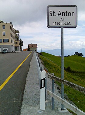
St. Anton Pass (el. 1110 m.) is a high mountain pass in the Alps between the cantons of Appenzell Innerrhoden and St. Gallen in Switzerland.
It connects Ruppen Pass (St. Gall) and Oberegg (Appenzell Inner Rhodes).
Wikimedia Commons has media related to
St. Anton AI.

| St. Anton Pass | |
|---|---|
 | |
| Elevation | 1,110 m (3,642 ft) |
| Traversed by | Road |
| Location | Switzerland |
| Range | Alps |
| Coordinates | 47°24′36″N 9°32′02″E / 47.41°N 9.534°E |
St. Anton Pass (el. 1110 m.) is a high mountain pass in the Alps between the cantons of Appenzell Innerrhoden and St. Gallen in Switzerland.
It connects Ruppen Pass (St. Gall) and Oberegg (Appenzell Inner Rhodes).
Wikimedia Commons has media related to
St. Anton AI.

