Photos • Location
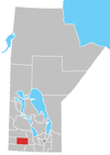
Sprucewoods is a community located at the North Gate of CFB Shilo and 20 km East of Brandon, MB on the #340 Highway. It is located in the Rural Municipality of Cornwallis.
References
49°49′14″N 99°39′06″W / 49.82056°N 99.65167°W
Sprucewoods is a community located at the North Gate of CFB Shilo and 20 km East of Brandon, MB on the #340 Highway. It is located in the Rural Municipality of Cornwallis.
References
49°49′14″N 99°39′06″W / 49.82056°N 99.65167°W
