Spring Prairie, Wisconsin | |
|---|---|
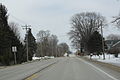
 The intersection of Highways 11 and 120 in Spring Prairie | |
 Spring Prairie, Wisconsin  Spring Prairie, Wisconsin | |
| Coordinates: 42°41′29″N 88°24′15″W / 42.69139°N 88.40417°W | |
| Country | |
| State | |
| County | Walworth |
| Elevation | 309 m (1,014 ft) |
| Time zone | UTC-6 ( Central (CST)) |
| • Summer ( DST) | UTC-5 (CDT) |
| Zip | 53177 |
| Area code | 262 |
| GNIS feature ID | 1574692 [1] |
Spring Prairie (also Franklin) is an unincorporated community located in the town of Spring Prairie, Walworth County, Wisconsin, United States. [1] Spring Prairie is located at the intersection of Wisconsin Highways 11 and 120, 7.25 miles (11.67 km) east of Elkhorn. [2]
Images
-
 Looking east at Spring Prairie
 -
 Looking east at the sign for Spring Prairie on WIS11


References
- ^ a b "Spring Prairie". Geographic Names Information System. United States Geological Survey, United States Department of the Interior.
- ^ Walworth County (PDF) (Map). Wisconsin Department of Transportation. 2013. Archived from the original (PDF) on May 16, 2011. Retrieved April 5, 2013.
External links
![]() Media related to
Spring Prairie, Wisconsin at Wikimedia Commons
Media related to
Spring Prairie, Wisconsin at Wikimedia Commons
Municipalities and communities of
Walworth County, Wisconsin, United States | ||
|---|---|---|
| Cities |  | |
| Villages | ||
| Towns | ||
| CDPs | ||
|
Other communities | ||
| Ghost towns | ||
| Footnotes | ‡This populated place also has portions in an adjacent county or counties | |
|
| This article about a location in Walworth County, Wisconsin is a stub. You can help Wikipedia by expanding it. |
Spring Prairie, Wisconsin | |
|---|---|
|
The intersection of Highways 11 and 120 in Spring Prairie | |
Spring Prairie, Wisconsin Spring Prairie, Wisconsin | |
| Coordinates: 42°41′29″N 88°24′15″W / 42.69139°N 88.40417°W | |
| Country | |
| State | |
| County | Walworth |
| Elevation | 309 m (1,014 ft) |
| Time zone | UTC-6 ( Central (CST)) |
| • Summer ( DST) | UTC-5 (CDT) |
| Zip | 53177 |
| Area code | 262 |
| GNIS feature ID | 1574692 [1] |
Spring Prairie (also Franklin) is an unincorporated community located in the town of Spring Prairie, Walworth County, Wisconsin, United States. [1] Spring Prairie is located at the intersection of Wisconsin Highways 11 and 120, 7.25 miles (11.67 km) east of Elkhorn. [2]
Images
-
Looking east at Spring Prairie
-
Looking east at the sign for Spring Prairie on WIS11
References
- ^ a b "Spring Prairie". Geographic Names Information System. United States Geological Survey, United States Department of the Interior.
- ^ Walworth County (PDF) (Map). Wisconsin Department of Transportation. 2013. Archived from the original (PDF) on May 16, 2011. Retrieved April 5, 2013.
External links
![]() Media related to
Spring Prairie, Wisconsin at Wikimedia Commons
Media related to
Spring Prairie, Wisconsin at Wikimedia Commons
Municipalities and communities of
Walworth County, Wisconsin, United States | ||
|---|---|---|
| Cities | | |
| Villages | ||
| Towns | ||
| CDPs | ||
|
Other communities | ||
| Ghost towns | ||
| Footnotes | ‡This populated place also has portions in an adjacent county or counties | |
|
| This article about a location in Walworth County, Wisconsin is a stub. You can help Wikipedia by expanding it. |